Posts From USA
Tuk 2018 preparation (Home, USA)
Journal entry for Monday 18th Jun, 2018 (day 0, miles 0)Put main content here
...click/tap to read the full postTop of the world (Tok, USA)
Journal entry for Saturday 7th Jul, 2018 (day 15, miles 2,807)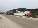
I spent a little time in the downtown area of Dawson City this morning, noting the touristification that has taken place since we were last here. Main Street is now looking pretty cute and up market but the "behind" streets are still pretty basic and unpaved.
...click/tap to read the full postWind (Fairbanks, USA)
Journal entry for Sunday 8th Jul, 2018 (day 16, miles 3,040)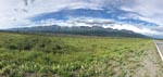
I thought today would be an easy 200 mile ride into Fairbanks. It started out warm though a bit windy and initially I spent time stopping to get some photos of The Alaskan Range. But as the day progressed the wind picked up and by late morning a howling wind (mostly a cross wind that demanded careful attention while riding), lots of dust turned the ride into a survival event.
...click/tap to read the full postNew tires (Fairbanks, USA)
Journal entry for Monday 9th Jul, 2018 (day 17, miles 3,040)I got talking to one of the owners of the B and B that I am staying at yesterday and discovered that, he is a keen motorcyclist, has bicycled and mountaineered in South America, owns a Unimog and was able to give the name of a local guy that does motorcycle maintenance and provides parts and service. The web site for this local guy is http://www.advcycleworks.com/. Today he (Dan the owner of AdvCycleWorks) fitted two new tires and gave my bike an oil change. I should note that Fairbanks has a BMW Motorrad dealer but they are closed on Mondays.
...click/tap to read the full postThe Dalton (Coldfoot, USA)
Journal entry for Tuesday 10th Jul, 2018 (day 18, miles 3,290)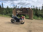
To get started on the Dalton Highway one has to drive (or in my case ride) about 80 miles along the Elliot Highway north from Fairbanks. The Elliot is reasonable quality paved country road so that 80 miles is no big deal, just a bit tedious, because one is keen to "get started" on the great adventure to Deadhorse.
...click/tap to read the full postTesing my limits (Deadhorse, USA)
Journal entry for Wednesday 11th Jul, 2018 (day 19, miles 3,525)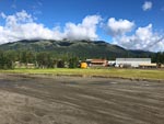
I felt very lucky this morning when I looked out on a bright sunny day. Maybe, I thought, I would have good weather all the way to Deadhorse. Yeh, right. But I was not to know the truth for a while. North from Coldfoot the road is paved for about 35 miles and one starts to get views of the Brooks Range even before the pavement ends. So note to future travelers. Go North of Coldfoot a bit as the road is paved for a while and the views are good (provided the weather is OK).
...click/tap to read the full postA relief, or good luck (Coldfoot, USA)
Journal entry for Thursday 12th Jul, 2018 (day 20, miles 3,770)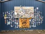
Last night at dinner I met a German guy who had flown in to Deadhorse with a bicycle in an airline box ready to start a bicycle expedition to Panama. I say ready but that is a qualified term as he did not have any food and planned on buying supplies in Deadhorse. The hotel staff did not quite laugh at him but close. I waved him on his way this morning as he was up and ready to start riding much earlier than I was ready to depart. Before getting underway I needed to get fuel and I wanted to have a look around the town. This is another one of those take a note of where you are and what you are seeing as you will probably never be back here again. I noticed a number of motorcycles around the town and took a few photos as reminders, as well as bought some "stickers" for the bike at the General Store. Then it was hit the road time.
...click/tap to read the full postDone the Dalton (Fairbanks, USA)
Journal entry for Friday 13th Jul, 2018 (day 21, miles 4,050)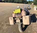
There is not much to say about today. The weather was good, the roads mostly dry and riding easy. The only record of the trials of the struggle to Deadhorse was the mud covering my motorcycle. For the first few hours this morning there were noticeably large numbers of rabbits and prairie dogs on, and beside, the road. I don't know why. But that's why the rabbit photo.
...click/tap to read the full postFirst wet night and a Tiger (Lakeview CG, USA)
Journal entry for Sunday 15th Jul, 2018 (day 23, miles 4,325)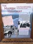
Raining this morning as I set out to retrace my earlier steps to Tok. As a result of the weather I did not take much notice of the scenery nor take any photographs. When the weather improved later in the day and I came to the new Tanana River Bridge (just before Tetlin Junction) I decided to stop and take a few photos as an acknowledgement that todays route has pretty much followed the Tanana all day.
...click/tap to read the full postBack in the USA (Winthrop, USA)
Journal entry for Thursday 26th Jul, 2018 (day 34, miles 6,825)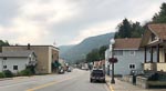
The first town on my route out of Castlegar this morning was Trail, BC. It was clearly an old mining town built in and on the sides of a steep valley with small or narrow houses. Fortunately for the town some mining and or metallurgical facilities still operates; though also clearly tourism is now a substantial income source for the area. I was intrigued by the sign at the exit to the town I did not know Italian was one of the Canadian languages.
...click/tap to read the full postHome James and don't ... (Gig Harbor, USA)
Journal entry for Friday 27th Jul, 2018 (day 35, miles 7,084)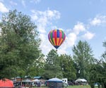
Well not quite. I did spare the horses as I am a law abiding motorcycle rider. I was pleased but surprised to see a hot air balloon in the air this morning as I was getting ready to depart. In an effort to avoid I5 and Seattle traffic my route for the day was to follow WA 20 all the way to its end point at the Port Townsend ferry terminal at Fort Casey on Whidbey Island. This strategy worked pretty well as the route through the Cascade Mountains was picturesque, with a good entertaining road, little traffic and pleasant temperature. It was not until Sedro-Woolley that I finally got caught up in the traffic appropriate for a hot summers day in the Pacific Northwest.
...click/tap to read the full postLovely State Park (Farewell Bend State Park, USA)
Journal entry for Friday 3rd Jun, 2011 (day 2, miles 521)
We got underway early afternoon yesterday and made it as far as a rest stop just east of Hood River, OR.
...click/tap to read the full postNice day - annoying engine noise! (Three Island Crossing State ark, USA)
Journal entry for Saturday 4th Jun, 2011 (day 3, miles 716)
We were greeted by another beautiful sunny day which made for pleasant driving.
...click/tap to read the full postShoshone Falls (Willard State Park, USA)
Journal entry for Sunday 5th Jun, 2011 (day 4, miles 967)
Before setting out this morning we visited the small museum attached to the Park. The displays and short video gave a good explanation of the choice of this location for the crossing.
...click/tap to read the full postFirst off-highway experience - bogged!! (Cove Mountain Road - Fishlake National Forest, USA)
Journal entry for Monday 6th Jun, 2011 (day 5, miles 1,203)Today proved to be a day of diverse experiences.
...click/tap to read the full postThe ER's first big off-highway descent (Cathedral Valley Campground - Capitol Reef NP, USA)
Journal entry for Tuesday 7th Jun, 2011 (day 6, miles 1,299)I cannot believe the weather. After a cool night with the temperature down into the high 30's we woke to another clear sunny day.
...click/tap to read the full postSight-seeing Cathedral Valley (Cedar Mesa Campground-Capitol Reef NP, USA)
Journal entry for Wednesday 8th Jun, 2011 (day 7, miles 1,437)After the morning chores, which this morning included cleaning the solar panels, we set off down Cathedral Valley in bright sunshine and nice (moderate) temperatures. As you might have guessed from the name the road traveled down a valley between eroded rocky cliffs past a number of free standing rocky features that have been given names like Temple of the Moon and Temple of the Sun. One of the interesting features we passed was a large sinkhole carved by infrequent flood waters. At the southern end of the road the flat valley floor gave way to sandstone outcroppings and the road meandered through these for a number of miles before finally joining up with SR24.
...click/tap to read the full postSome nice switchbacks (Star Spring Campground, USA)
Journal entry for Thursday 9th Jun, 2011 (day 8, miles 1,531)Continuing south along the Notom-Bullfrog road this morning we had good views of Strike Valley, a distinct north-south valley formed by sandstone ridges on the east and west sides.
...click/tap to read the full postA day unplanned (Near Natural Bridges National Monument, USA)
Journal entry for Friday 10th Jun, 2011 (day 9, miles 1,630)One of the things we really like about low-key RV travel is that days take on a life of their own without us really knowing in advance what will come.
...click/tap to read the full postNatural Bridges (Blanding, USA)
Journal entry for Saturday 11th Jun, 2011 (day 10, miles 1,690)Back in Natural Bridges National Monument this morning we walked the 0.6 miles and 500 ft up and down to view the Sipapu natural bridge. This is apparently the youngest of the three famous bridges seen from the road circuit in the park. The walk was amazingly strenuous considering its short length.
...click/tap to read the full postMeeting other ER's (Comb Wash, USA)
Journal entry for Sunday 12th Jun, 2011 (day 11, miles 1,731)We spent a lazy morning at the RV park before heading to Blanding's visitors center to meet up with the group of ERs and the guide. Along the way we discovered that only the gas stations and the visitors center are open on a Sunday.
...click/tap to read the full postRoast Pork (Elk Ridge, USA)
Journal entry for Monday 13th Jun, 2011 (day 12, miles 1,763)After exiting camp we took a short but rocky side trail into the Indian ruins at Mule Canyon. There were remains of ceremonial towers built of stones and mud as well as some remains of cliff dwellings. We spent a couple of hours there all in all climbing up and down the canyon.
...click/tap to read the full postBig and Little Notch (Elk Mountain, USA)
Journal entry for Tuesday 14th Jun, 2011 (day 13, miles 1,812)We took a 15 minute walk to the end of the ridge this morning, what a spectacular view. Though not good for photographs as the light was into our face.
...click/tap to read the full postTesting ERs - Rocky and steep (Elk Mountain, USA)
Journal entry for Wednesday 15th Jun, 2011 (day 14, miles 1,858)Today we headed down into Ruin Park and the beginning of the Needles district. From our camp the route took us along North Long Point Road to the junction with Beef Basin Road and thence a descent into the valley of ruin park. Along the way we had some fine views of Canyonland to the north and stopped at some small ruins.
...click/tap to read the full postLockhart Basin Road (Indian Creek, USA)
Journal entry for Thursday 16th Jun, 2011 (day 15, miles 1,932)By the time we were up and about this morning three of the ERs had already departed and a 4th (the one with Bill and Mike from the Earthroamer company) was about to get underway. that left only three ERs and Bill the guide.
...click/tap to read the full postRegrouping in Moab (Moab, USA)
Journal entry for Friday 17th Jun, 2011 (day 16, miles 2,085)A few miles to the blacktop of SR211, a few minutes to re-inflate our tires to highway pressures, and for a while at least our off-road adventures were over.
...click/tap to read the full postPlaying tourist (Canyonland NP, USA)
Journal entry for Saturday 18th Jun, 2011 (day 17, miles 2,191)Today we undertook the typical tourist activities around Moab. After the usual chores we headed out to Arches National Park joining a large throng of US and foreign visitors crowding the parking areas within the park to get a good look at, and walk up, close to those amazing stone structures. We have been to this park a number of times but the grandeur never fails to captivate us.
...click/tap to read the full postStuck and shoveling snow again (Paradox Valley, USA)
Journal entry for Sunday 19th Jun, 2011 (day 18, miles 2,347)Our plan for the day was an ascent into the La Sal Mountains on the east of Moab. These are in contrast to the red rock of Moab, The Arches and Canyonland. The La Sals which range up to over 12,000 ft are green and covered in pine and aspen. Our route took us south east of Moab and up a steep forest road with some impressive switchbacks. At about 9,000 ft we passed a car containing two WA tourists who were turning back as the road was too rocky for their hire car. We (unfortunately) continued. It was not long before we were passing small mounds of snow laying across the uphill edge of the road. This is a sign that you would think we would now know and take heed but no, we continued. After passing one particularly narrow section where we were squeezed between the snow on the uphill side and a steep drop and soft edge on the downhill side we came to a bank of snow completely covering the road. Progress was stopped. So we turned out attention to retracing our path. That is reversing as there was no possible chance of turning around. Our first attempt to reverse over the previously mentioned narrow section only succeeded in starting to collapse the downhill side of the trail. A new approach was called for - digging.
...click/tap to read the full postThe hanging flume and unexpected grandeur (Ruedi Resevoir White River NF, USA)
Journal entry for Monday 20th Jun, 2011 (day 19, miles 2,605)What finds and unexpected beauty and granduer we had today.
...click/tap to read the full postTowards the Denver area. Tomorrow we put the ER in for some repairs (Saint Vrain SP, USA)
Journal entry for Tuesday 21st Jun, 2011 (day 20, miles 2,831)It was cloudy this morning as we left our camp beside the dam. However within an hour the sun had burned off the cloud and we had a fine day for our trip down the western slopes of the Rockies into the Denver area. Tomorrow we drop the ER at the Earthroamer factory for some repairs at their favourite Ford dealer.
...click/tap to read the full postStart of a "mini adventure" (Rasar State Park, Hwy 20, USA)
Journal entry for Wednesday 6th Jul, 2016 (day 1, miles 138)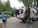
Nina and I are about start what I think of as a mini adventure. Between now and November we plan on doing some traveling in our Earthroamer. As is often the case for us the route is not well specified but will probably include a lot of time in the Western US and Western Canada. The goal of this exercise is entertainment and relaxation while my leg recovers enough to allow us to get back into the Unimog with its manual transmission and heavy clutch.
...click/tap to read the full postRe-introduction to the Cascades (Kilpchuck Forest Camp Hwy 20, USA)
Journal entry for Thursday 7th Jul, 2016 (day 2, miles 237)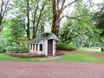
It is quit a few years since we last traveled highway 20 so today was by way of a re-introduction for us to the forests and spectacular mountains of the North Cascades, not to mention a dramatic change in climate from our recent months in Phoenix.
...click/tap to read the full postDid I mention recuperation (Jone Bay Lake Roosevelt, USA)
Journal entry for Friday 8th Jul, 2016 (day 3, miles 393)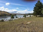
Last night camping spot (and its network of trails) gave us a chance to do a few miles of walking before we hit the road today. In case I have not mentioned it one of the goals for our mini-adventure is to see if we can maintain an exercise program while on the road. We have set this goal on previous trips but never seem to be able to stick to it. This time though there is added incentive and I need to exercise my recovering leg to re-build muscle and get some flexibility back into the damaged ankle. Thats the "recuperation" bit.
...click/tap to read the full postSpokane River Walk (Beauty Creek Camp, USA)
Journal entry for Saturday 9th Jul, 2016 (day 4, miles 524)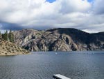
Spokane's River Walk provided the setting for todays entertainment and exercise. In addition to a nice 3 mile walk we got some sun (warn not hot), were entertained by the ducks on the river, and marveled at the competitiveness of young children as they raced stroller-bikes around a temporary track in the park beside the river. For those of you (like us) that do not know what stroller bikes are - they are bicycles without pedals that are propelled by pushing ones feet against the ground.
...click/tap to read the full postThe back blocks of Northern Idaho (Elk River Campground, USA)
Journal entry for Sunday 10th Jul, 2016 (day 6, miles 636)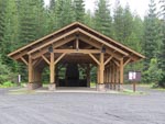
Today we were on the western side of the Clearwater National Forest south of Coeur D'Alene. Our route was south-ish and took us through interminable evergreen forests, on well made and maintained roads with little traffic. There was not much of specific note and as a result no photos for today.
...click/tap to read the full postA camp fire and hair cut (Nelson Creek Hwy 14, USA)
Journal entry for Monday 11th Jul, 2016 (day 7, miles 736)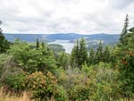
The highlight of this mornings travel was the Dent Bridge on the forest road between Elk River and Orofino, it spans the North Fork of the Clearwater River behind Dworshak dam and reservoir. Seems like this bridge is a big deal to the locals in terms of providing a shorter route from the Elk River region into Orofino, though we thought the description of the bridge(on one of the info signs) and "one of the most beautiful structures in America" was a bit excessive.
...click/tap to read the full postRoad Closed (Johnson Bar CG, USA)
Journal entry for Tuesday 12th Jul, 2016 (day 8, miles 892)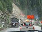
Some distance east of last nights our camp we came upon a couple of work crews fixing the road. The first of these was a small affair where a side creek had washed away the pavement. But the second was a major job. It seemed like an entire hillside had collapsed and slid over the road and there was a large crew of workmen, heavy machinery, and gravel trucks clearing the road and rebuilding the hillside. We had to wait a while at the western side of this work area for a pilot car to lead us through the workings.
...click/tap to read the full postPhotogenic little ctitters (Norton CG, USA)
Journal entry for Wednesday 13th Jul, 2016 (day 8, miles 1,060)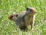
As you can see from the photos we spent a pleasant little interlude with a village of prairie dogs (I think they are prairie dogs?), we got their photos and they got bread. Seems like a reasonable trade, we guess "feeding the critters" is a common activity at this rest area (summit of Lolo Pass Hwy 12 MT).
...click/tap to read the full postA couple of big horns (Lower Seymor Lake, USA)
Journal entry for Thursday 14th Jul, 2016 (day 9, miles 1,163)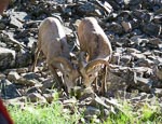
This morning we followed a picturesque, but sometimes primitive, road along the banks of Rock Creek (in the Rock Creek Recreation Area, part of Beaverhead Deer Lodge NF). Beautiful scenery, perfect weather and even a couple of big horn sheep (making the most of a 'lick' left by a local farmer).
...click/tap to read the full postWisdom and new caps (Shoup Bridge Camp, USA)
Journal entry for Friday 15th Jul, 2016 (day 11, miles 1,278)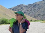
We finally got to the little town of Wisdom. MT this morning. We have in a very round about way) been heading towards this little town for the past week. Why you might ask, well in 2009 (on our Americas trip) Nina bought a purple cap covered in small mirrors in a store in this town. Later on that trip she exchanged it with a Peruvian lady for one of their local straw hats. Hence we were keen to get back to Wisdom to "get another". The store where the original hat was bought burned down 5 years ago but a new shop has been built on a nearby site and they had only two of the mirror covered caps left, both in shades of green.
...click/tap to read the full postCamp cooking (Landmark Stanley RdA Place, USA)
Journal entry for Saturday 16th Jul, 2016 (day 11, miles 1,420)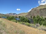
Tonight we camped beside a forest road in the Sawtooth Mountains of ID. This long and somewhat rough road connects the towns of Sunbeam and Cascade and seems to be very popular as we have seen lots of groups out camping. We deliberately sought out a forest camp tonight as we planned on cooking a "roast" dinner (pork loin, potatoes, carrots, and sweat potato) in a "dutch oven" and for this we needed a camp fire. lots of fire wood, and a place to dig a hole to partially bury the oven. Thus the informal camping spot we found for tonight was almost perfect. Except of course for the large stinging flies.
...click/tap to read the full postA day of repairs (Rainbow Point, USA)
Journal entry for Sunday 17th Jul, 2016 (day 12, miles 1,515)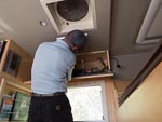
Today turned out to be a day of repairs, or is it breakages. Continuing from last nights camping spot the road into Cascade continued to be rough (lots of traffic and little maintenance of the road seems like the cause) and so we bumped over rocks and wash-boards for many hours. We visited the old mining ghost town of Deadwood, (the old hotel and a couple of other buildings are still evident),bumped into a number of groups of riders, and generally enjoyed the spectacular scenery and wonderfully sunny day.
...click/tap to read the full postA hot afternoon (Hells Canyon, USA)
Journal entry for Monday 18th Jul, 2016 (day 13, miles 1,617)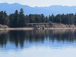
The lake (beside the campground) looked really pretty this morning with glass smooth water(the first 3 photos). The remainder of the day was a pleasant and relaxed drive to Brownlee Reservoir at the southern end of Hells Canyon. We were lucky enough to find an informal camping spot right on the shore and idled away the late afternoon and evening with a walk along the nearby road way and cooking a dinner of rice-a-riso (we are becoming quite fond of that particular meal).
...click/tap to read the full postCemetery (Hwy 5 West of Cavalier, USA)
Journal entry for Tuesday 11th Oct, 2016 (day 78, miles 8,272)It was still raining this morning when we woke in the parking lot at Winnipeg airport so we were quite keen to get going in the hope that the weather would be better farther south. That was not to be however. Once across the border into the US we left the interstate highway and followed a series of rural roads with intermittent heavy rain. It seemed to be harvesting season for some kind of root crop in this part of North Dakota and the harvesting process covered the rural roads with a nice layer of slippery mud.
...click/tap to read the full postCountry North Dakota (New Rockford, USA)
Journal entry for Wednesday 12th Oct, 2016 (day 79, miles 8,434)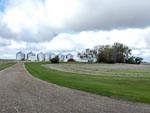
Better weather today as we continued south through ND along rural roads and flat farming country. The crops have changed a bit, more grain, and no sign of the root crops I thought we saw yesterday.
...click/tap to read the full postSunflowers (Tschedia Lake, USA)
Journal entry for Thursday 13th Oct, 2016 (day 80, miles 8,647)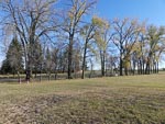
Nina started the day with a longish walk around the campground and local area (and has included a bunch of photos of last nights camping spot in todays entry). Another sunny day and again we are traveling south through ND. Today we passed many fields of sunflower that seem completely dried out and are a dark brown color. Initially when we saw the first of these fields from a distance we thought it was freshly plowed ground.
...click/tap to read the full postWall drug, the badlands (Badlands National Park, USA)
Journal entry for Friday 14th Oct, 2016 (day 81, miles 8,912)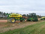
We transitioned into South Dakota today and towards the end of the day we pulled into the little town of Wall SD, which if you probably know is famous for Wall Drug, a unique style of business that started life as a real (and unsuccessful) drug store back in the 1930s. Unsuccessful that is until the owners decided to offer passing travelers free ice water. Today it is a massive complex of mismatched buildings selling all kinds of stuff from junky souvenirs to high end leather goods, ice cream and fast food. Since its first founding two nearby tourist attractions (Mount Rushmore and The Badlands National Park) have come into existence and one assumes they contribute significantly to the evident success of Wall Drug.
...click/tap to read the full postA day in Boulder (St Vrain SP, USA)
Journal entry for Sunday 16th Oct, 2016 (day 83, miles 9,493)We made an early start this morning in order to cover the distance to Boulder by lunch time. We had arranged to meet up with some friends of ours (John and Ursula) who are now living in Bolder. We last met up with these guys in Munich in early 2014. We had a nice visit and were particularly interested to hear why they chose Boulder as there retirement location.
...click/tap to read the full postA visit with the Earthroamer guys (Limon, USA)
Journal entry for Monday 17th Oct, 2016 (day 84, miles 9,749)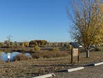
We spent most of the morning at the Earthroamer factory in Dacono CO. After the usual greetings I spent an hour or so with Spenser (ER's head of all things technical) and got a some good insight into some maintenance things I have to do on the camper (like adjust the door, and replace the town water valve). We met a few of the customers that were dropping off or picking up vehicles and at the last we had a good catch-up chat with Bill Swails including a look at the (in progress) build of an Earthroamer on a Ford 750 chassis - sorry no photos allowed - not surprisingly.
...click/tap to read the full postA visit with Rob (Rio Grande, USA)
Journal entry for Tuesday 18th Oct, 2016 (day 85, miles 9,902)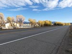
We got an early start this morning from Limon in order to make our way to La Junta CO where we had arranged to spend a few hours and have lunch with our friend Rob Pickering of Terry Lee Enterprises and renowned Unimog fixer and finder. We had a great visit catching up with developments in Rob's life and business.
...click/tap to read the full postA walk in the hoodoos (Bisti Badland, USA)
Journal entry for Wednesday 19th Oct, 2016 (day 86, miles 9,150)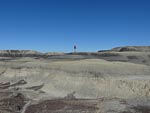
Today was another longer day of driving than we prefer but there was a goal and it was the Bisti Badlands also known as De-Na-Zin. Nina heard about this area of hoodoos and weird rock structures at this years Overland Expo West and was determined to visit and take photos. So mid afternoon we found ourselves heading south on 371, south of Farmington NM looking for the turn east that would take us to the first of the access areas. Once in the parking lot we set off on a hike of a couple of hours east into the heart of the "badlands".
...click/tap to read the full postLos Alamos, Bradbury Museum (Roadside stop near Santa Fe, USA)
Journal entry for Thursday 20th Oct, 2016 (day 87, miles 10,340)
This morning brought another hike to explore the badlands, however this time we went rugged up as the morning temperature was 32°F. We spent another couple of hours this time walking across the plateau of the badlands to a couple of lookouts. After our walk, and over breakfast, we decided to devote the remainder of the day to visiting Los Alamos and its Science Museum.
...click/tap to read the full postEl Morro (El Morro Nat Mon, USA)
Journal entry for Friday 21st Oct, 2016 (day 88, miles 10,504)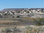
After a restful night in our roadside stop we made our way south to I40 and followed it for a while to the town of Grants where Nina took the opportunity to take a walk around the little town and captured some photos of the town's decorative water feature. From Grants we turned south along NM53 looking for a place to spend the night. As we traveled 53 we started seeing signs for The Ice Caves and since there was no way there could be ice in this hot climate started discussing what they could really be. Thus intrigued, when we finally got to the gates of Ice Caves (a privately owned and run tourist attraction) we went in to investigate and discovered that there really was ice, but more of that in tomorrows entry as for now we needed to find a camping spot for the night.
...click/tap to read the full postIce Caves ! (Concho Valley, USA)
Journal entry for Saturday 22nd Oct, 2016 (day 89, miles 10,643)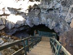
Today was a real sight-seeing day. We started by returning to those Ice Caves and discovered that there really is a cave with natural ice in it. Indeed we eventually discovered that back in the early part of the 20th century before this area had electricity and refrigerators the ice was mined to supply the iceboxes of local inhabitants. Apparently the mining ceased in the late 1940s and since that time the ice has recovered and there is more of it today then there was in those days. Is seems I may have confused some readers. Despite the heading to this entry (Concho AZ) the Ice caves are actually in New Mexico. The apparent mistake is a conflict between where we were traveling during the day and where we stayed the night. The heading to the entry gives the name of the place we spent the night.
...click/tap to read the full postA few days in Phoenix (Apache Junction, USA)
Journal entry for Sunday 23rd Oct, 2016 (day 92, miles 10,814)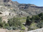
Today we were headed towards Phoenix and a couple of days of business. From Cocho Valley (on AZ61) we made our way to Show Low and picked up AZ 60 to Globe and then into the KOA at Apache Junction. We have traveled this route a number of times but even so the spectacular Snake River valley is worth a stop and a few photos.
...click/tap to read the full postNight in the desert (Quartzite, USA)
Journal entry for Wednesday 26th Oct, 2016 (day 93, miles 11,004)With our business in Phoenix complete we are on our way again on what will be the final leg of this particular adventure as we are now destined for our home in WA via the Saltan Sea. The complication for this next leg is that we are now in two vehicles as one of the reasons for passing through Phoenix was to collect my pickup-truck that was stored down here (don't ask). The goal today was simply to get under way, we made it to the desert just near Quartzite.
...click/tap to read the full postSalton Sea (Yucca Valley, USA)
Journal entry for Thursday 27th Oct, 2016 (day 94, miles 11,243)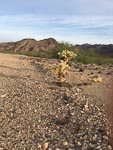
This afternoon we made a stop at the Salton Sea in Southern California. Our plan was this would be our only sight-seeing stop on this leg of the trip. After all we are on our way home and driving two vehicles so it is really two solo trips. The nature of this leg also means that there will be little or no blog updates. I will include an entry for each day, with Nina' photos (when there are some) to make sure the map tracks our route. But since we are driving-to-get-there I expect nothing of note to say. Hence, for a while this blog will be dormant.
...click/tap to read the full postNothing to say - just motoring (Independence, USA)
Journal entry for Friday 28th Oct, 2016 (day 95, miles 11,499)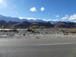
A beautiful cold morning (Beckworth Pass, USA)
Journal entry for Saturday 29th Oct, 2016 (day 96, miles 11,763)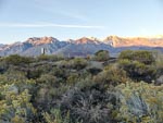
Travelin (Hwy 395, USA)
Journal entry for Sunday 30th Oct, 2016 (day 97, miles 11,987)Really nothing to say or see
...click/tap to read the full postHome today, mushrooms in our garden (Government Camp, USA)
Journal entry for Monday 31st Oct, 2016 (day 98, miles 12,255)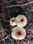
Just to remind anyone who is still reading this site. We are going to be off the air for a while as we have a couple of non adventure trips planned and will not be reporting those on the blog. So don't look for any updates until the new year.
...click/tap to read the full postGeorgia - Two food experiences (Telarvi, USA)
Journal entry for Saturday 14th Sep, 2024 (day 41, miles 0)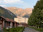
Today we said goodbye to our Azerbaijani guide and driver and ventured into Georgia; and I am pleased to report that the border experience was simple and fast - thankfully. Inside Georgia our first stop was the village of Telavi where we learned about the making of bread and a style of desert called churchkhela. The significant thing about the bread is the style of the oven in which it is baked. It is round, almost a cylinder, standing with an opening at the top and a fire at the bottom. It's a bit like a large Indian Tandoori. The dough to be backed is stuck to the internal side of the cylinder. Some of the photos will explain better than my words can.
...click/tap to read the full postA travel day (Tbilisi, USA)
Journal entry for Sunday 15th Sep, 2024 (day 42, miles 0)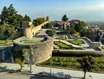
There is not much to say about today as it turned out to be simply a travel day in which we would drive from Telavi to Tbilisi. Before getting underway Nina went on a bit of a photo expedition around our hotel and captured images of the old fort across the road as well as some of the well-worn infrastructure of the city. There after the group did a quick tour of the local market before we undertook the 4-5 hour drive to Tbilisi. For reasons that I could never work out our driver took a very indirect route between Telavi and Tbilisi.
...click/tap to read the full postThe Military Road (Tbilisi, USA)
Journal entry for Monday 16th Sep, 2024 (day 43, miles 0)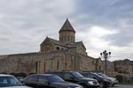
Today was always planned to be a long driving day as we were to travel the Georgian Military Road north from Tbilisi to almost the Russian border. Although the drive was under 200km in each direction, the round trip took just on 12 hours and along the way we saw
...click/tap to read the full postBlack Sea Resort (Batumi, USA)
Journal entry for Saturday 21st Sep, 2024 (day 48, miles 0)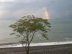
We spent most of yesterday (Sept 20th) in Yerevan with a late checkout before catching another overnight train. This one would take us back into Georgia, through Tbilisi and onto the Black Sea resort town of Batumi. The border crossing back into Georgia hapened around 22:00 and between Armenian exit processing and Georgia entry took a couple of hours and was all done either with officers boarding the train or at a small office beside the train.
...click/tap to read the full postOn the road again! (Federal Way, USA)
Journal entry for Thursday 5th Jul, 2012 (day 1, miles 20)After weeks of work preparing ourselves, the vehicle and our house for a 6 month trip we are finally underway.
...click/tap to read the full postFriendly border guards (Rest Area I-29, USA)
Journal entry for Wednesday 18th Jul, 2012 (day 14, miles 2,247)We re-entered the US via highway 59 (into Minnesota) just south of the town of Tolstoi. This crossing does not seem to get a lot of traffic as all US customs lanes were closed when we pulled up. Initially we were questioned in a gruff manner by the guards but after they worked out that we were residents and the vehicle a motorhome things improved. They of course wanted a look inside the vehicle and admitted it was just out of curiosity.
...click/tap to read the full postWe need a receipt for accommodation tonight (Summit, USA)
Journal entry for Thursday 19th Jul, 2012 (day 15, miles 2,411)Tomorrow we will apply for South Dakota drivers licenses in the town of Watertown, to meet the documentation requirements we must stay tonight in some form of South Dakota accommodation that will give us a receipt. Hence we picked a commercial campground in the town of Summit about 30 miles north of Watertown.
...click/tap to read the full postBath day (for the Yellow Beast) (Monson Lake, USA)
Journal entry for Friday 20th Jul, 2012 (day 16, miles 2,579)We got our nice new South Dakota driver licenses this morning, although as we pulled up in front of the address of the Licensing Department it was not obvious we were in the right place. Parked in the street was a National Guard convoy of Hummers and trucks, and the building that was supposed to house the licensing department had National Guard signs all over it.
...click/tap to read the full postBack roads of Wisconsin (St Croix, USA)
Journal entry for Saturday 21st Jul, 2012 (day 17, miles 2,778)I am guessing that there is (somewhere) a road building school specifically for engineers that build secondary roads in Minnesota and Wisconsin. Today we got extensive exposure to roads that displayed the signature feature of this school. The roads are laid down in 20-30 ft sections, between each section is a small gap filled with pitch. Since this inter-section gap is slightly lower than the main sections a very consistent wash-board effect is produced. I was very pleased to encounter these road sections as they provided the perfect shake test for the truck and camper. Anything that did not break on these roads is unlikely to break anywhere. Other overlanders looking to subject their vehicle to a similar trial by bumps can get the exact route by sending me a message from the contact page of this site.
...click/tap to read the full postA new hat for Nina (Bayfield, USA)
Journal entry for Sunday 22nd Jul, 2012 (day 18, miles 2,941)Today Nina bought herself a new rhine-stone cap to replace the one she traded with a Uros women when we visited the Uros people of Las Islas Flotantes in Peru.
...click/tap to read the full postThe Apostle Islands (Sturgeon River CG, USA)
Journal entry for Monday 23rd Jul, 2012 (day 19, miles 3,086)Playing tourists. Today we took a boat cruise to the Apostle Islands. These are situated in Lake Superior just off the village of Bayfield in Wisconsin. The captain of our boat explained that no one knows where the name came from and pointed out that even the number is wrong. There where (apparently, Phil can correct me on this) 12 apostles but 21 islands. Today those islands are all part of a national park; though they show the effect of the past in which many were clear cut for timber quarried for sandstone, or used as fishing bases.
...click/tap to read the full postSummer in the land of Yoopers and Trolls (Hog Island Point NF, USA)
Journal entry for Tuesday 24th Jul, 2012 (day 20, miles 3,300)For those somewhat un-schooled in the geography of Michigan (like me) I need to point out that the state of Michigan is made up of two disconnected regions. One of these regions is a peninsula that pokes out into lake Michigan and is called by the locals the upper peninsula, or UP for short. Predictably the people that live in the UP have been given a nick name by their non-UP brethren, they are called Yoopers (UP-ers get it?) - very creative. As an ineffective attempt at revenge the non Yoopers are called Trolls but probably only by yoopers.
...click/tap to read the full postThe Mackinac bridge, the Soo, power outages, flat batteries (Sault Ste Marie, USA)
Journal entry for Thursday 26th Jul, 2012 (day 22, miles 3,402)We are in the Soo - as the locals call the town of Sault Ste Marie - famous for the shipping locks between Lakes Superior and Huron. It seems to be our turn for electrical problems. We arrived here yesterday (25 July) because the batteries in the camper have low voltage and we thought a good 12 hour charge at a commercial camp ground would do the trick. Before settling in for the night we drove into the town center of Sault Ste Marie to look at the locks and find The River of History Museum. Suddenly all the shops are dark, the traffic signals are blank and within minutes police and fire officers are out directing traffic through intersections - the power is out. We learned later that the town had a power outage a few days ago also.
...click/tap to read the full postFundy coast, covered bridges (Calais, USA)
Journal entry for Saturday 25th Aug, 2012 (day 52, miles 8,037)Another glorious late summer day, blue sky warm air and bright light. A perfect day to continue our travels along the Fundy coast and to pay short visits to the three towns of St Martins, Saint John, St Stephen. We arrived in St Martins at close to low tide and spent a little while walking around the foreshore, taking a few photos, lounging on the gravel beach and seeing if we could see the water beginning to rise. St Martins sports two covered wooden bridges built in the 1930s. The signs on the bridges indicated a height limit of 4.0m - exactly what I think our height is. So we contented ourselves with walking across.
...click/tap to read the full postBar Harbor and the Pumpkin Patch (Hermon, USA)
Journal entry for Sunday 26th Aug, 2012 (day 53, miles 8,231)Today we followed the Maine coast south to the Arcadia National Park at the town of Bar Harbor. This coast line is still the western edge of the Bay of Fundy and continues the beautiful coastal scenery of the past few days. Strong tides are still evident in the muddy inlets and creeks but the tide heights are lower as we are nearer the mouth of the Fundy. We spent a couple of hours walking around Bar Harbor. A beautiful town with many quaint buildings, lot of shops and many tourists. Interesting this is one of the few tourist towns we have visited where specific parking directions have been given for RVs. We followed a series of signs right through the town to a sports field where parking was easy, and out of the way of other vehicles and the shops.
...click/tap to read the full postBad hair day (at least at the start) (Rumford, USA)
Journal entry for Monday 27th Aug, 2012 (day 54, miles 8,356)Today did not start well. The spout on the kitchen faucet came off in Nina's hand. While cooking a quiche the microwave oven (overheated I think) and the door latch stuck in the open position, so now it sports a duct-tape bandage to keep the door closed. We got repeatedly lost in Bangor looking for a Staples store, and that was with the aid of 3 GPS devices. By 12:30 I was ready to declare the day over and go back to bed. However it turned out that all was not lost and after lunch we headed towards Gorman, NH to start a route approximately south through the White Mountains. After an easy drive through rural Maine we arrived at a WalMart in the town of Rumford where we camped for the night in the company of 3 other RVs and 6-8 18 wheelers.
...click/tap to read the full postThe Kanca and White Mountain (West Lebanon, USA)
Journal entry for Tuesday 28th Aug, 2012 (day 55, miles 8,533)West of Rumford we arrived in the town of Gorham, the start of our traverse of the White Mountain State Forest. It is an obvious jumping off point for hikers on the Appalachian Trail as we saw many people with packs of varying sizes walking purposefully around the town. South out of Gorham, Highway 16 passes the turn off to Mt Washington and its Auto Road to the summit (but cars only). Farther south at Conway we picked up the Kancamagus Highway (or the Kanca as it is apparently known). This road winds west along the Swift river for some miles before starting a steep climb to Kancamagus Pass. There after it descends along the Pemigewasset River into the town of Lincoln. Here we picked up the Sawyer Highway (SR118) to complete our traverse of the White Mountain State Forest and eventually arrived in Wentworth.
...click/tap to read the full postQuechee Gorge, first signs of fall (Woodford SP, USA)
Journal entry for Wednesday 29th Aug, 2012 (day 56, miles 8,659)Continuing west along highway 4 and the Ottauquechee River we crossed into Vermont and got a chance to visit the the town of Quechee (with a very expensive looking country club), view the small but spectacular Quechee Gorge and take a stroll around Woodstock (not the famous one), a nice prosperous tourist destination. A little after Woodstock we joined highway 100, turned south and wound our way through the rural hills of Vermont through picturesque forests, patches of farm land, small quaint hamlets and over some very twisting, steep and in places rough paved roads.
...click/tap to read the full postMooses and Shakers (West Cornwall, USA)
Journal entry for Thursday 30th Aug, 2012 (day 57, miles 8,763)Wild life has been scarce on this trip. Apart from a few foxes, a few deer and a hedgehog we have seen no forest wildlife. In particular we have been disappointed not to see any moose. So when we saw some brightly painted moose statues this morning while driving through Bennington, VT we could not resist. We had to stop and take photos of the only mooses of the trip.
...click/tap to read the full postPhilly here we come (Hatfield, USA)
Journal entry for Friday 31st Aug, 2012 (day 58, miles 8,959)Today we ventured off the back roads of the North Eastern USA and onto some major freeways on our way to Oak Grove Campground in Hatfied, PA where we will stay for a few days as a base to see some of the sights of Philadelphia.
...click/tap to read the full postA day of History (Hatfield, USA)
Journal entry for Saturday 1st Sep, 2012 (day 58, miles 8,959)How do you visit and see the downtown area of a big city like Philadelphia when you travel around in a big yellow truck. This is a question that has occupied our minds a lot as we have thought about how we will travel in Europe. The answer we have arrived at is to park/camp outside the city and become foot (or more accurately public transport) tourists for the day. Today was our first opportunity to put this plan into practice. So just after 8:00am this morning we drove the beast from the campground to the local train station and boarded one of the SEPTA trains for a 50 minute journey into the center of Philly. That was easy and the day continued in that vein.
...click/tap to read the full postA wet day in camp (Hatfield, USA)
Journal entry for Sunday 2nd Sep, 2012 (day 60, miles 8,959)The latest hurricane got us today with heavy rain off and on all day. Between (and some times during) the heavy showers I spent some time crawling around and under the engine of the truck tracing wires. Why you might ask. Well we had a momentary electrical failure a few days ago that I was trying to explain. The burned wire in my hand in the picture below is the evidence and the culprit was an un-insulated connector.
...click/tap to read the full postPerplexed by the Amish (Lancaster, USA)
Journal entry for Monday 3rd Sep, 2012 (day 61, miles 9,055)Today we visited the towns of Intercourse, Paradise and Bird-In-Hand Pennsylvania to take a closer look (and learn a little) about the Amish people (no, I don't know the origin of those names but thankfully I did manage to resist making school-boy jokes about them). But to be honest we became more perplexed the more we heard about the Amish way of life. For example we saw many horse carriages with steel tired wheels running down the highway and were told that the Amish are not allowed to use motor vehicles or vehicles with rubber wheels. But when we visited an Amish farm we saw modern tractors, modern fork lifts and a variety of rubber tired trailers and trollies.
...click/tap to read the full postExhaust repair (Cherry Hill Park, USA)
Journal entry for Tuesday 4th Sep, 2012 (day 62, miles 9,163)A truck repair and travel day. We got going early and arrived at the Lancaster Freightliner dealer at 7:30. Our trucks exhaust system has sprung a small leak where the pipe exits from the muffler. Rather than just repair this leak we decided to have the exhaust system modified so that it empties under the truck chassis rather than onto the side of the camper. Hopefully this will avoid those big black marks you may have seen on the passenger's side of the camper. This task took some time so we spent the morning in the drivers lounge chatting with truckies and just twiddling our thumbs. We were done by 13:00 and thereafter joined the rushing freeway traffic bypassing Baltimore on our way to Cherry Hill Park Campground in Maryland, our base for a visit to Washington DC.
...click/tap to read the full postA day in DC (Cherry Hill Park, USA)
Journal entry for Wednesday 5th Sep, 2012 (day 63, miles 9,163)Today could have been called "hopping on and off a bus day " - because that's what we did for the day. An early start (6:55am) from Cherry Hill on a shuttle bus got us to Union Station before 8:00, thereafter the day was spent on (or waiting for) one of those open-topped double decker tour buses, or in a museum or later in the day standing in front of the Whitehouse. Since this is not our first visit to DC we missed some of the big name draws like the Air and Space Museum. We spent a good deal of time at the Ford Theater Museum (which had a very good display on Lincoln's presidency) and across the road at Peterson's House (where Lincoln died) redecorated in period furnishings. The American History Museum was a bit of a disappointment. Good displays on the transportation and the presidents and their first ladies but also some rambling displays that were hard to see the point of.
...click/tap to read the full postThe next phase of the journey (Coopers Rock, USA)
Journal entry for Thursday 6th Sep, 2012 (day 64, miles 9,369)It is interesting how a journey like this develops phases; periods with a definite focus. Today marked the start of (or transition to) what we both think of as the vehicle phase; a period where our focus will be on the truck. A week from now we will be in Nixa, MO (for about 10 days) for some upgrades and repairs to the camper and two weeks after that we will be in Colorado for a week of work (both maintenance and upgrades) on the truck. So as we drove out of the DC/Baltimore area this morning on those frantic freeways our eyes were turning west and we were thinking about how to pace ourselves for the 1000 mile leg to Nixa.
...click/tap to read the full postCountry Roads, take me ... (Grayson, USA)
Journal entry for Friday 7th Sep, 2012 (day 65, miles 9,617)John Denver's song Country Roads kept rolling through my head today as we drove I-79 and then I-64 through West Virginia (though you would hardly call these highways "country roads"). Perfect warm fall weather and beautiful rolling hills with mixed forests as far as the eye can see - I could feel why someone would want to sing about this country.
...click/tap to read the full postResting; the Nada Tunnel (Lexington, USA)
Journal entry for Saturday 8th Sep, 2012 (day 66, miles 9,734)This morning we were a bit disenchanted with truck stops. We were surrounded by refrigeration units last night and to say it was noisy would be an understatement. A poor nights sleep plus heavy rain put a hold on our plans to venture south of I-64 for some sightseeing in the Red River Gorge area (part of the Daniel Boone National Forest) and we spent much of the morning in a quiet rest area west of Grayson recuperating.
...click/tap to read the full postJust traveling (Mt Vernon, USA)
Journal entry for Sunday 9th Sep, 2012 (day 67, miles 10,010)This morning it was clear that we are now in get there mode. Hence today we simply traveled down I-64 at a leisurely pace but without any effort at sightseeing or exploring off the highway. Our talk was about cleaning the vehicle and other preparation for the GXV visit.
...click/tap to read the full postGetting ship shape (Eureka, USA)
Journal entry for Monday 10th Sep, 2012 (day 68, miles 10,132)From last nights rest area it was a short day into St Louis and a KOA camp ground. We spent the afternoon sorting through and tidying drawers and other storage areas.
...click/tap to read the full postBassPro, fix-ups, upgrades and hospitality (Nixa, USA)
Journal entry for Wednesday 19th Sep, 2012 (day 77, miles 10,132)As per our arrangement with GXV we arrived in Nixa, MO on Wed 12th for what was planned as a week of fixes, and upgrades to the camper. But before making it to the GXV factory we paid the mandatory visit to the Springfield BassPro shop. This is the original and first BassPro store and boy is it impressive. To give a sense of its popularity, the town of Springfield and surrounds has a population of about 400,000 people yet this BassPro store gets approximately 4,000,000 visitors per year. We have been to this store on previous visits but it was only on this occasion that I noticed the ceiling of the store - it has been decorated to portray the underside of the surface of a lake. So as one sits in the cafe looking up one gets a good view of the underside of some ducks, among other things.
...click/tap to read the full postA new map (Rest Area I-44, USA)
Journal entry for Thursday 20th Sep, 2012 (day 78, miles 10,473)You might have noticed, in previous photos of the truck, the world map on the right hand side of the camper box. We had this put on during the construction so that we could discuss with people where we were from, going etc. At the time we chose to have the map land masses "cut out" so that the camper yellow showed through and also to color the land masses a muted grey. As a result some of the smaller land masses got deleted (for example NewFoundland and PEI) and country boundaries were hard to see. Nina was unhappy with this so a new map was called for, and today it was installed. As you will see in future photos of the truck the new map is a traditional rectangular multi-colored map of the world.
...click/tap to read the full postLovely lake (Elk City SP, USA)
Journal entry for Friday 21st Sep, 2012 (day 79, miles 10,603)Our appointment in Colorado has been put back a day allowing us to have a lazy day. We pulled into Elk City State Park early and spent a pleasant afternoon beside the lake in summer like temperatures. Nina busied herself putting route lines on the new map while I continued the study of my new electrical device (FLEXnet) and tried to work out how our sophisticated charging equipment works.
...click/tap to read the full postVisitors, the plains (Cheney SP, USA)
Journal entry for Saturday 22nd Sep, 2012 (day 80, miles 10,757)This morning we had a rush of visitors curious about the truck. We noticed last night that a number of our fellow campers were looking at us and our yellow truck and were a little surprised that none approached us. But by this morning curiosity had overcome any reluctance and we had more than 20 people drop by over a period of an hour. It is a while since we had such a large group in one place asking us questions. As always the visitors are curious, but polite, and as always we tell our story, show the vehicle and also seek to be polite and friendly. The way we see it; if we did not want visitors we should have chosen a different truck and different color.
...click/tap to read the full postMetal art, Milo(?) crops, and a little bit of 4x4 (Hamilton County SP, USA)
Journal entry for Sunday 23rd Sep, 2012 (day 82, miles 11,000)We are beginning to feel the effects of the time of year. The sun seemed late to rise this morning and the morning air was fresh (could not call it cool/cold yet). We were on the road by 7:30am continuing west through more pretty Kansas country side; though now the land is flat and a little drier than previous days. At Mullinville, KS we passed a fence decorated with metal "art" - it seems to represent the property owners impressions of various people. Throughout the day we passed lots of fields with a low crop with brown tops (photos 4 and 5). A lady at the Wichita Visitors Center suggested it was milo, but I guess we were not convinced, so a bit of internet research revealed that the crop is sorghum and is nicknamed milo.
...click/tap to read the full postSanta Fe Trail, Old Bent Fort (La Junta, USA)
Journal entry for Monday 24th Sep, 2012 (day 86, miles 11,119)We saw off the last of Kansas this morning and entered flat dry farming land of drought plagued eastern Colorado. Signs along the road reminded us that we were, and had been since St Louis, pretty much tracing the route of the original Santa Fe Trail the southern most route by which settlers traveled into the West. This trail brought many settlers to what is today New Mexico and was then Mexican territory and eventually precipitated the Mexican-American war. In the hey day of the trail one of the few outposts of supply and security was Bent Fort, a fortified adobe trading post built by the Bent brothers and a son of a French nobleman a few miles from todays town of La Junta. The fort burned down in 1849 but was rebuilt in the mid 1970's as a historic monument and filled with historic artifacts and is today staffed by Park Rangers and volunteers in period costumes. We spent a pleasant, though hot, few hours there enthralled by the fort structure and the old tools and other implements. An interesting point of trivia was a discussion with one of the staff about the word Arkansas, which of course we all now know to pronounce as Ar-kan-saw. However it seems (or at least we were told) that when the state of Arkansas joined the Union its two Senators differed on their pronunciation of the word. One used the now accepted pronunciation of Ar-kan-saw while the other called his state Ar-kan-sas. Soon after statehood was granted the state legislature adopted the Ar-kan-saw pronunciation as the officially correct form. Just to confuse us foreigners apparently many people from Kansas still call it Ar-kan-sas.
...click/tap to read the full postRob P's shop, Hanagan's Farm and Koshare (La Junta, USA)
Journal entry for Friday 28th Sep, 2012 (day 86, miles 11,119)Our four days in La Junta were like many travel experiences; one arrives in a place with some plans but really little, if any, conception of how events will actually unfold. Our La Junta visit was that type of experience in spades.
...click/tap to read the full postThe Rockies (The Crags CG, USA)
Journal entry for Saturday 29th Sep, 2012 (day 87, miles 11,311)The early morning fog had burned off by the time we merged onto I-25 heading north to Colorado Springs. It felt strange to be back in the hustle and bustle of an interstate after so many days on the more relaxed secondary roads of Kansas and Colorado. After shopping and other chores we did a quick tour through the Garden of the Gods Park then joined highway 24 heading into the mountains looking for a place to pull over for the night. However improvised camping spots proved hard to find and before long we found ourselves at the town of Divide at 9000ft. Camping at 9000ft was certainly not part of our plan but there seemed to be no alternative. The nearby state park campground was full so we eventually turned onto a narrow gravel road towards a forest service campground called The Crags at 9600ft.
...click/tap to read the full postPikes Peak (Colorado Springs, USA)
Journal entry for Sunday 30th Sep, 2012 (day 88, miles 11,392)After a lazy start to the day we alighted from our snug camper to a sunny but cool morning (the truck computer told us it was close to freezing overnight) and spent an hour or so strolling up the road to a trail head, then along part of the trail reaching well over 10,000 ft before returning to the truck to get underway. We were both more than a little surprised how well we were reacting to the altitude. On previous occasions a sudden climb to this kind of level has had the usual side effects of head aches and shortness of breath. The truck was reluctant to start and even with the aid of the new air-intake heater coughed, spluttered and belched smoke for a few minutes before finally settling down.
...click/tap to read the full postThe Gold Belt Tour, Phantom, Victor, America Eagles (Victor, USA)
Journal entry for Monday 1st Oct, 2012 (day 89, miles 11,493)The Gold Belt Tour is a linked series of roads connecting the towns of Florence, Canon City, Victor, and Cripple Creek. We had been debating for some days whether we would attempt the Phantom Canyon Road (one of the Gold Belt Tour roads), and today decided in the affirmative. Why the debate? Well the guide book Nina has been reading points out that there are two tunnels along the road (something that is usually an issue for us) that the road is narrow, twisting and unsuitable for long vehicles (over 25ft). The road turned out to be fabulous. It is, as advertised, twisting and in places very narrow. Most of it is an old railway bed and in places where the road runs through cuts in large rocks it has not been widened since its railways days. For miles it runs along a narrow man made ledge on the side of a steep valleys; it was exhilarating.
...click/tap to read the full postThe Shelf Road (San Isabel NF, USA)
Journal entry for Tuesday 2nd Oct, 2012 (day 90, miles 11,578)We met the fox in the parking lot of the American Eagles Overlook he was very bold and followed us around while we tried to use the morning light to get some better photos of this amazing hole in the ground. I am not sure we improved on our previous efforts in regard to the open pit but we did get a better look at some of those dump trucks this morning; they make our Mog look small.
...click/tap to read the full postAutumn colors, and Sand Dunes (Sand Dune NP, USA)
Journal entry for Wednesday 3rd Oct, 2012 (day 91, miles 11,742)Although we did not know it at the start, today would be consumed by autumn colors, The Sangre de Cristo Mountains and the Great Sand Dune National Preserve. From our camp in the San Isabel NF (in the Wet Mountains) we passed through the town of Westcliffe (which seemed pretty much closed down for the season) and down highway 69 which travels north-south just east of the Sangre de Cristo Mountains. There are many minor roads heading west from 69 into the S de C and eventually we succumbed and started west towards Mosca Pass along CR-580. This country road changed names a number of times as it wound its way west and gradually deteriorated from a two lane black top into a narrow wheel track as it climbed to Mosca Pass at just short of 10,000 ft. Along the way we passed through farmland, open range and wonderful high alpine forest where the Aspens were displaying a wonderful mix of fall colors and providing a breath taking contrast to the dark spruce. We have been captivated by the yellow and orange colors of the Aspens for a number of days now and have been at great pains to capture these vivid colors with our camera, but they continue to prove elusive.
...click/tap to read the full postDunes, colors and a cook-up (Near Chama, USA)
Journal entry for Thursday 4th Oct, 2012 (day 92, miles 11,855)A few more photos of the Dunes and then a lengthy stop in Alamosa for laundry and then we were on our way through Southern Colorado towards New Mexico. The drive along 17 from Antonito towards Chama New Mexico took us through La Manga Pass and Cumbres Pass (both just over 10,000') and presented a wonderful display of Golden Aspen and other fall colors.
...click/tap to read the full postOur arrival at the Balloon Fiesta !! (Albuquerque, USA)
Journal entry for Friday 5th Oct, 2012 (day 93, miles 12,019)Heading down I-25 from Santa Fe to Albuquerque we were conscious of how little we knew about the Balloon Fiesta we were headed to. We had camping reservations but no idea where the campground was, we had an offer of a driveway camping spot but no address, and we had a contact at the Fiesta itself but no arrangements for meeting. But luck and the internet came to our aid. Some directions from the Fiesta website got us onto the main entrance to the Fiesta grounds, which immediately turned into an entrance line for the RV parking area (a campground without facilities). We had only been in the line a few minutes when the SUV in front stopped and our contact Scott got out and strolled back to chat to us.
...click/tap to read the full postBalloon Fiesta Day 1, Glow (Albuquerque, USA)
Journal entry for Saturday 6th Oct, 2012 (day 94, miles 12,019)I could say "our first day at the fiesta dawned to great excitement" - but in fact we were up and going, and excited, well before dawn. Thank to Scott's hospitality we were in one of the VIP hospitality tents having breakfast at least an hour before dawn hoping (like thousands of other people) that the wind would subside so that the first mass launch of the fiesta would take place. Unfortunately the wind remained and the launch was cancelled.
...click/tap to read the full postBalloon Fiesta Day 2 - Mass launch (Albuquerque, USA)
Journal entry for Sunday 7th Oct, 2012 (day 95, miles 12,019)This morning we knew a little more about the routine. Up just before 5:00am, onto a free shuttle bus for the 10 minute trip to the launch field, grab a seat in the hospitality tent, get some coffee and a snack and wait for the activity to start. This morning the weather gods smiled on the event and the wind was light. In waining darkness the Dawn Patrol launched (about 10 balloons that go up in advance of the mass launch to sample the flying conditions). With the Dawn patrol in the air serious action started, with many other balloons beginning the filling process, canopies inflating and their burners lighting the morning sky.
...click/tap to read the full postBalloon fiesta - Our final sessions (Chaco Canyon, USA)
Journal entry for Tuesday 9th Oct, 2012 (day 97, miles 12,019)Monday and Tuesday are typically lower key days at the festival. The only event is the morning session (no evening display) and the format is a little different. The balloons divide themselves into two groups; those that want to compete and those that don't. The non-competitors launch from the fiesta field from dawn onwards (until about 8:00am). From 8:00am on-wards the field is closed to all balloon launches, vehicles and the public and is set up with a series of targets for competition. The competitor balloons choose a launch site at least 1 mile from the field and then attempt to fly to the field and drop a marker onto one of the targets.
...click/tap to read the full postChaco (Durango, USA)
Journal entry for Wednesday 10th Oct, 2012 (day 98, miles 12,357)We started our brief exploration of Chaco Canyon and ruins with the usual visitor center film. This one was a bit disappointing; too much mysticism and not enough history. Though to be fair not much is really known about the people of Chaco. Some deductions from the ruins they left, a few artifacts and references in the oral histories of a number of South West tribes. However one look at the size, scope and nature of the ruins in Chaco canyon and it is evident that they were a prosperous, well organized and skilled people. The ruins on display in the canyon are called "great houses", they are large D shaped complexes with hundreds of rooms, built over succeeding generations but according to the original plan. Current archeological theory is that these buildings are ceremonial rather than domestic. Why and how did this thriving culture fall or depart; seems there is no answer to that question.
...click/tap to read the full postLaundry, chores and a chance to spread out (Haviland Lake, USA)
Journal entry for Thursday 11th Oct, 2012 (day 99, miles 12,392)A house with a laundry and space to spread out captivated us this morning so that we did not get going until the morning was almost done. A few more shopping chores and a chance meeting with another Unimog owner and Rosie and her friends from Texas and we were really late getting underway. As a result we got only as far as Haviland Lake Campground; only about 30 miles for the day.
...click/tap to read the full postFirst signs of winter (Lizard Head Pass, USA)
Journal entry for Friday 12th Oct, 2012 (day 100, miles 12,560)Overnight the weather turned and today we have been traveling in a mix of rain, light hail and a few snow flurries. Higher on the mountains there is a lot of fresh snow. We saw very few bright yellow Aspens today; their leaves are now mostly brown or gone. It is amazing how things have changed in a week; though of course we have moved more into the heart of the Rockies and should expect that fall/winter is more advanced here.
...click/tap to read the full postCold start, warm finish (Bushy Basin Rim, USA)
Journal entry for Saturday 13th Oct, 2012 (day 101, miles 12,711)Our first touch of winter continued overnight. This morning there was a light dusting of snow on the ground and the temperature was 27°F. As we dropped down out of the mountains to the town of Dolores (SW Colorado) the scenery confirmed the approaching winter, the remaining leaves are deep red colors, the Aspens are mostly bare, and temperature stayed in the low 30s. Along the way the countryside changed from mountains to sandstone canyons. From Dolores a short drive took us to Hovenweep National Monument were we walked around the rim of a small canyon and looked at the ruins of stone buildings from the 1200's. The people that built these are the descendants of the people of Chaco. While at Hovenweep the sun made an appearance and the temperature climbed into the 50s.
...click/tap to read the full postGooseberry Rd (Mormon Pasture, USA)
Journal entry for Sunday 14th Oct, 2012 (day 102, miles 12,784)Today was spent "trying out" the truck. Our first experiment was actually to get down off our ridge top camp. The short, steep, narrow descent to highway 95 proved to be a non event but re-enforced one of yesterdays lessons; namely - over rough roads one must travel slowly. Our first stop for the day was a valley called Comb Wash were we encountered some narrow sandy trails, and a small creek crossing. The truck handled all the small obstacles without raising a sweat.
...click/tap to read the full postBeef Basin Rd (Bushy Basin Rim, USA)
Journal entry for Monday 15th Oct, 2012 (day 103, miles 12,875)The second leg of our forest route continued North towards highway 211 and Canyonland. After a short climb out of our camp site the road traveled for a couple of hours along the rim of a number of canyons through low Juniper forests affording us great views of red sandstone cliffs, rocks valleys and Canyonland to the North.
...click/tap to read the full postMoki Dugway (Page, USA)
Journal entry for Tuesday 16th Oct, 2012 (day 104, miles 13,098)Our route from Blanding was south on 261 towards Monument Valley. Along the way we came across two spectacular but unexpected sights. The first was the (to us) oddly names Moki Dugway. This is a roadway carved into a sandstone escarpment that connects the highland plateau of the canyon land region with the lower lands of the northern Arizona Navajo Indian lands of Monument Valley. The next interesting sight was the descriptively named Gooseneck State Park. At this spot there is an overlook which gives incredible views of the twisting course of the San Jaun river before it finds its way into Lake Powell.
...click/tap to read the full postAntelope Canyon (South of Flagstaff, USA)
Journal entry for Wednesday 17th Oct, 2012 (day 105, miles 13,305)Antelope Canyon can only be visited as part of a tour. This is partly a restriction imposed by the local Navajos who I am sure want to get revenue from visitors to the Canyon. But it is also a safety precaution as the Canyons are prone to flash flooding from distant rain falls. For example in 1997 11 visitors died when the Canyon suddenly flooded.
...click/tap to read the full postOn the road again (Mobile, USA)
Journal entry for Wednesday 19th Dec, 2012 (day 168, miles 16,753)We are on the road again. As you can see from the date and miles on this entry we have spent the last 2 months and about 3,000 miles off the web visiting family and generally attending to business and chores. It has been great to spend some time with our sons, but not so great to have a bunch of chores requiring attention. However today that is over and we are back into travel mode heading for southern AZ and then CA and Mexico.
...click/tap to read the full postThe Sonora Desert, and cacti (Organ Pipes NM, USA)
Journal entry for Thursday 20th Dec, 2012 (day 169, miles 16,861)On the short drive south to Organ Pipes National Monument today we saw much evidence of our proximity to the Mexican border. The few small towns we passed through had many establishments offering Mexican auto insurance, many other signs were in Spanish, and in the space of 80 miles we passed two Border Patrol checkpoints.
...click/tap to read the full postCheckpoints and a day in the desert (Sentinel Rest Area, USA)
Journal entry for Friday 21st Dec, 2012 (day 170, miles 16,982)We might be back on the road, but there is not much to report as things are going to be a bit quiet for the next few days as we travel slowly to CA. So for example today we got a relaxed start (that is late) to the day, spent some time talking to Duane and Kim (RVers from Minnesota) and finally got moving by about 11:30.
...click/tap to read the full postRV Parks and casino-ing (Paradise Casino,Yuma, USA)
Journal entry for Saturday 22nd Dec, 2012 (day 171, miles 17,072)Another late start and warm sunny desert weather saw us heading west along I-8 towards Yuma, and boy what an eye opener Yuma turned out to be. This town must be the RV capital of the world. There are RV parks, mobile home parks, and RV sales yards everywhere. There is even a large RV salvage (wreckers) yard packed full of RVs in all stages of destruction and decay. It is also a town with a strong hispanic influence, lots of spanish signs on motels and restaurants.
...click/tap to read the full postThe Imperial Valley (La Mesa, USA)
Journal entry for Sunday 23rd Dec, 2012 (day 172, miles 17)A quiet night in the casino's gravel parking lot was followed by a bright but cool morning. A few 18-wheel trucks had joined the scattering of RV's over night but they were far enough away from us not to cause any noise disturbance; a nice change from rest areas.
...click/tap to read the full postSnow in Mexico (Calexico, USA)
Journal entry for Saturday 12th Jan, 2013 (day 192, miles 19,795)Three longish days of driving have carried us from Ciudad Constitucion in mid Baja to Calexico, California and while long driving days usually mean "nothing to say" that is not entirely the case here. If nothing else we managed to capture some photos on each of these days that are shared below, had conversations with every military checkpoint on the Baja and at the end of this period an interesting day along the US-Mexico border.
...click/tap to read the full postLeaving Mexico - again (Yuma, USA)
Journal entry for Sunday 13th Jan, 2013 (day 192, miles 19,879)The main event and/or interest feature of today was relinquishing our Mexican Tourist cards and returning the vehicle temporary import papers to the Mexican Banjercito.
...click/tap to read the full postTires rotated in freezing weather (Sentinel Rest Area, USA)
Journal entry for Monday 14th Jan, 2013 (day 195, miles 19,977)Before leaving Yuma this morning we stopped by a local tire shop and had them rotate the tires/wheels on the truck. I had also wanted them to reverse the tires on the two front wheels (that is take the tire off the rim turn it over and remount it) but the manager was not prepared to do that. He pointed out that to do as I asked he would have to disassemble the wheels (the truck has two-piece wheels and the two halves are sealed together with rubber O-rings) and without new O-rings (which he did not have) the reassembled wheel might leak. So we settled for a simply rotation. I stood in the workshop area for about an hour and a half rugged up like the workers while a freezing wind whistled past.
...click/tap to read the full postAn evening with friends near Tucson (Tucson, USA)
Journal entry for Tuesday 15th Jan, 2013 (day 195, miles 19,977)Today was simply a driving day. We were on our way to Tucson to spend an evening with some friends from Gig Harbor who were escaping the wet weather of Washington and getting in a bit of golf. Though with the current cold snap in Arizona the golf appears to have been put on hold.
...click/tap to read the full postA visit to Quartzsite - amazing!! (Quartzsite, USA)
Journal entry for Tuesday 22nd Jan, 2013 (day 202, miles 20,391)From Tucson we spent 3 nights with our son and fiance; in Phoenix and then headed west along Hwy 10 towards the town of Quartzsite. We have heard from many people over the years about the RV "get-together" that happens in Quartzsite every winter but have never really understood what it was. Sometimes the description sounds like an RV Show other times it sounds like 300,000 people "dry camping" with their RVs in the desert. So we decided to drop in to that town and have a look for ourselves.
...click/tap to read the full postThe last leg (John Wilke Rest Area, USA)
Journal entry for Wednesday 23rd Jan, 2013 (day 200, miles 20,554)The last leg - on our way back to Gig Harbor. During our stay in Phoenix and Quartzsite we worked on our applications for Russian Visas with the assistance of a visa agency. We finalized the paper work this morning and so our first stop today was the little town of Blythe, CA where we hoped to Fedex/UPS the paper work to that agency. Blythe turned into a bit of a mad-cap affair. On the door of the UPS office was a sign saying they are only open 2 hours a day - 1 in the morning and 1 in the afternoon. We found a Fedex agent but their collection had already happened for the day. Finally at ACE Hardware (who it seems do small items only) we got the days UPS pickup.
...click/tap to read the full postDeath Valley in the rain (Death Valley, USA)
Journal entry for Thursday 24th Jan, 2013 (day 204, miles 20,760)Grey sky and light rain greeted us this morning as we set out north to cross the Mojave on our way to Death Valley Junction. It felt strange to see this part of the country in the rain. Fresh mud, pools of standing water and evidence of water running over the roadway was a constant sight. There was even water running beside the road as we descended to our nights camp at Furnace Creek near the Death Valley visitors center.
...click/tap to read the full postBad Water - below the sea (Death Valley, USA)
Journal entry for Friday 25th Jan, 2013 (day 205, miles 20,869)Our day started with the almost obligatory trip to the visitors center and the orientation film; which we would both classify as one of the better ones we have seen. Bad Water - the lowest point in the valley at -260 ft was next on the agenda and where, with a smattering of other visitors, we walked out a short way onto the vast salt pan. We were somewhat surprised by the texture of the surface of the pan as we expected it to be smooth perhaps with small ridges around where water had pooled. But it was actually a chaotic pattern of small salt uplifts (protrusions less than 1 foot high) mixed with mud.
...click/tap to read the full postScotty's Castle? (Hawthorne, USA)
Journal entry for Saturday 26th Jan, 2013 (day 206, miles 21,081)The weather was improved this morning so we decided to do a little more exploring before leaving the valley. First on our agenda was the Race Track, a dried mud pan where large boulders move across the surface of the pan under the influence of some force that is not understood. However this objective was abandoned when we realized that it would require 50 miles of very rough road. We consoled ourselves with a visit to the Ubehebe Crater (formed about 2000 years ago by a steam explosion resulting from hot magma interacting with ground water) before heading onto Scotty's Castle.
...click/tap to read the full postCasino Dinner! (Reno, USA)
Journal entry for Sunday 27th Jan, 2013 (day 207, miles 21,233)The weather was clear but cold as we left Hawthorne and traveled beside Walker Lake this morning but before long we were again driving through snow covered country side and as we entered Fallon snow started to fall. On into Reno the snow persisted and we started to worry about road condition in the mountains and our chances of getting over to I-5.
...click/tap to read the full postLassen Forest - Playing in the snow (Yreka, USA)
Journal entry for Monday 28th Jan, 2013 (day 208, miles 21,489)Today was simply over the mountains to I-5. As it turned out the weather was good, with no new snow and hence no problems with chains and closed roads. The trip was through the beautiful Ponderosas of Lassen National Forest. Along the way we took the opportunity to play a bit in the snow to see whether we could get the truck bogged. I am glad to report we did not. Maybe we simply did not try hard enough.
...click/tap to read the full postA travel day (Portland, USA)
Journal entry for Tuesday 29th Jan, 2013 (day 209, miles 21,827)Nothing exciting happened today. We simply traveled along I-5 with the goal of making Portland before the day ended.
...click/tap to read the full postVehicle Service - all day (Portland, USA)
Journal entry for Wednesday 30th Jan, 2013 (day 210, miles 21,827)We were up this morning at 5:30 am in order to get to McCoy Freightliner by 6:00am in order to have the truck serviced in advance of shipping to Russia. When we called McCoy about a week ago we were told that they don't take bookings, it is first come first served and we are open from 6:00am until 11:00 pm. Since we wanted to get finished in a day we decided to try and be first. That worked out as we were indeed the first customers of the day. The bit of the story we had not anticipated was that while the office is open from 6:00am the mechanics/technicians don't arrive until 7:00am (or later). Anyway about that time activity started on the yellow truck.
...click/tap to read the full postRepairs in a parking lot (Chehalis, USA)
Journal entry for Thursday 31st Jan, 2013 (day 211, miles 20,554)So what to do with the day, that was our big question this morning, given that we were a day a head of schedule. The answer turned out to be spend almost the entire day in a Home Depot parking lot doing some repairs to the camper cabinets. Over the last week or so we have been like the walking wounded so today seemed like an opportune day to fix some things.
...click/tap to read the full postBack in the USA (Baltimore, USA)
Journal entry for Saturday 15th Feb, 2014 (day 318, miles 20,704)Today we flew back into the US, from Paris to Baltimore Washington Int airport. What can I say about that, plane travel is boring and tedious. Winter time in the US plane travel is also plagued by long delays, and we had our share of that today. We finally got to an airport hotel in Baltimore about 10:00pm tonight (4:00am Paris time). This is likely to be the last entry for a while. We hope to collect the truck in Halifax at the end of this week and then it will be business and chores for a good period before we head back to Europe. The kind of mundane stuff that does not warrant a website entry. There may be one more as our (or really the trucks) arrival in Halifax will signal the completion of an around the world journey. We and the truck were in Halifax on August, 20 2012.
...click/tap to read the full postTraveling again (Baltimore, USA)
Journal entry for Friday 30th May, 2014 (day 319, miles 0)Hello all, we are about to begin traveling again and it is not entirely coincidence that we are back in Baltimore. We are here to have our truck loaded onto a boat for Europe. We delivered it to the port on Tuesday (May 27th) and expect that it will depart Baltimore about June 5th for Antwerp. We plan on collecting it on June 23rd. We'll see how that plan goes.
...click/tap to read the full postBack in the US (Massena, USA)
Journal entry for Tuesday 6th Jun, 2017 (day 84, miles 75,234)The weather was still wet this morning and got worse as the day progressed. The poor weather has diminished our enthusiasm for exploration and now we are thinking of increasing our pace and getting back to Gig Harbor a little earlier.
...click/tap to read the full postNice weather (Fair Haven SP, USA)
Journal entry for Wednesday 7th Jun, 2017 (day 85, miles 75,430)
Today we followed minor highways generally paralleling the St Lawrence river in up-state New York. Lots of quaint little towns and small farms. Finally the weather has improved and there is a sense of summer in the air. We saw lots of evidence today of recent flooding with the water still quite high whenever we got near the waters edge.
...click/tap to read the full postNiagara! (Angola Hwy 90, USA)
Journal entry for Thursday 8th Jun, 2017 (day 86, miles 75,613)
Another fine day, so we celebrated the sun by taking a long walk around the campground and the nearby break-water before getting underway for the day. More minor highways, more quaint little towns as we followed the southern shore of Lake Ontario. But the highpoint of the day was Niagara Falls. On that subject I will let the photos do the talking.
...click/tap to read the full postHeat, horse and buggy (Findlay Walmart, USA)
Journal entry for Friday 9th Jun, 2017 (day 87, miles 75,929)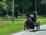
Today the nice weather turned into "hot and windy" and decidedly less pleasant. We spent the day pushing West into a strong wind with temperatures into the 90's. The disadvantage of the Mog's large windscreen is evident on days like today. On a totally different front we got a couple of photos of Armish horse and buggies. We have been seeing these sporadically for the last couple of days but this was our fist successful effort at capturing a photo. Interestingly we have seen road signs warning of such vehicles and even dedicated parking places at shopping plazas for them.
...click/tap to read the full postPeoria (Peoria, USA)
Journal entry for Saturday 10th Jun, 2017 (day 88, miles 76,272)No much to report about today. It is still hot and windy as we pushed through the farm lands of Illinois.
...click/tap to read the full postPushing on (Omaha Hwy 680, USA)
Journal entry for Sunday 11th Jun, 2017 (day 88, miles 76,662)
You will see we took a few photos of the campground before leaving this morning. The weather was a little bit gentler today. It is still windy but the temperature is a bit more moderate because of a cloud cover that also makes for a bit of a "gray-day" but also a somewhat better day for traveling. So we pushed on a bit harder than usual making use of I80 into Iowa. You will notice that this route brought us in contact with the "famous" truck stop Iowa 80 the self claimed "largest truck stop in the world".
...click/tap to read the full postMachines (Atkinson Mill Race Park, USA)
Journal entry for Monday 12th Jun, 2017 (day 89, miles 76,889)
A more pleasant day still some wind but not so hot, and sunny rather than gray. This generally put us in a better mood and a nice campground early in the afternoon gave me the opportunity to work on a problem with the truck.
...click/tap to read the full postGrassland and Museum (Angostura Reservoir, USA)
Journal entry for Tuesday 13th Jun, 2017 (day 90, miles 77,177)
More nice weather and a change of scenery today. We are now in the grasslands. The change in scenery happened quite quickly as all of a sudden we noticed that we were traveling amidst rolling grass covered hills that stretch as far as the eye can see in every direction.
...click/tap to read the full postBlack Hills (Sheridan, USA)
Journal entry for Wednesday 14th Jun, 2017 (day 91, miles 77,441)
We could not help but notice that Angostura Reservoir had a number of really nice campgrounds - spacious and well maintained. A few photos below don't really do the place justice. Once underway we headed north and west through the little town of Hot Springs SD and then into Wyoming through the town of Newcastle. This route took us through the picturesque Black Hills. I show my age by admitting that I cannot think of the name "Black Hills" without hearing Doris Day as Calamity Jane singing "The Black Hills of Dakota" in my head.
...click/tap to read the full postBear day (Custer State Forest CG, USA)
Journal entry for Thursday 15th Jun, 2017 (day 92, miles 77,671)
Today promised to be a scenic day and did not disappoint. The first leg out of Sheridan took us to Dayton and then west along Alt14 and a spectacular climb through the Big Horn National Forest before an equally spectacular descent to Lovell. There after a brief interlude following the Sidon Canal and we arrived in Powell MT. The final stretch of the day was Highway 296 also known as Chief Joseph Scenic Byway which connects with the Highway 212 (The Beartooth Highway) at the North Eastern entrance of Yellowstone National Park.
...click/tap to read the full postYellowstone (Avon, USA)
Journal entry for Friday 16th Jun, 2017 (day 93, miles 77,956)
Yellowstone National Park really is a scenic treasures. Even on a grey wet day like today the animals, the mountains and the rivers make it a feast for the soul. This morning we crossed the Northern part of the park from the junction with 212 to the Northern Entrance and while we were really only transiting on our way to Bozeman we could not help but want to stop and take photos. As you can see the animals conspired to feed our temptation.
...click/tap to read the full postFriends near Eureka (Eureka, USA)
Journal entry for Saturday 17th Jun, 2017 (day 94, miles 78,556)
We passed through a lot of interesting scenic country today as we made our way to Rexford MT (near Eureka) to visit our friends. It is pretty clear that had we not been so close to the end of this journey we would have spent more time traversing this interesting route.
...click/tap to read the full postFinished - 5 years around the world (Gig Harbor, USA)
Journal entry for Sunday 18th Jun, 2017 (day 95, miles 78,736)
After breakfast coffee and a heartfelt goodbye to out friends Ken and Ivy we hit the road towards our house Washington thinking that we would spread the 500+ miles remaining over two days. But as often happens at the end of a journey the heading for home syndrome hit us and we drove throughout the day arriving at our house just before midnight. A total of 18 hours and 500+ miles representing an exceptionally long day in our truck. The early part of our route from Eureka to Libby, Bonners Ferry to Sand Point was really pretty and we noted it for future explorations. But in truth today was a "get home" day. It was also a day of mixed emotions as it brings to an end almost 5 years of traveling around the world in our big yellow beast. And we are not sure at this point when or where our next travels will be. We were last at our house in WA with the yellow truck in January 2013 just before we shipped to Vladivostok, Russia.
...click/tap to read the full postOverland Expo West 2018 (Fort Tuthill County Park, Flagstaff, USA)
Journal entry for Saturday 19th May, 2018 (day 1043, miles 82)
We missed Overland Expo West last year and so this year we were excited to see it at the (to us) new venue of Fort Tuthill County Park. And we were not disappointed. The crowd seemed huge and there was a vast increase in the number of exhibitors. Particularly noteable for us was the number of new providers of large overland vehicles. In fact there were so many and the vehicles are so large that our yellow Unimog seemed decidedly small.
...click/tap to read the full postMount Rainier (Crow Lake Way Trailhead Hwy 12, USA)
Journal entry for Friday 28th Sep, 2018 (day 1, miles 143)
Todays goal was to try for some good photos of Mount Rainier, we were optomistic as the weather was great so we decided that Sunrie Visitor Center would be the best spot as we would not be in position until afternoon. That proved to be a less than ideal choice as by the time we got there the sun was over the top of the mountain making for poor light. Still the drive along Hwy 410 and along the Sunrise entrance road was enjoyable.
...click/tap to read the full postAn easy day on Hwy 12 (Benton City, USA)
Journal entry for Saturday 29th Sep, 2018 (day 2, miles 267)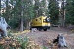
The outside temperature this morning was 37°F emphasisiing the fact that we spent the night in the mountains and at altitude. Stopped in Yakima for a while to get some supplies and communicate with family and a bit of exercise on the Yakima Green Way, a very extensive walking and bicycle trail system.
...click/tap to read the full postFarm country (Alpowa Summit Rest Area, USA)
Journal entry for Sunday 30th Sep, 2018 (day 3, miles 402)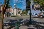
Today we got a good dose of Washington farm country. Lots of fields of straw colored growth, some just stuble having been recently harvested, some tall and swaying and about to be harvested (we assume). Quaint little towns some of which seem to be caught in a bit of a time warp, except for all the modern pickup trucks. Really a pleasant day and a salutory reminder of the scope of farming.
...click/tap to read the full postThe Clearwater (Five Mile Creek Hwy 12, USA)
Journal entry for Monday 1st Oct, 2018 (day 4, miles 482)
We stopped for a long while in Lewiston this morning. The town has a nice skate park and walking trail beside the river. We took advantage of this facility, and the fine sunny weather, to undertake our daily exercises. I am on a regime of strengthening and stretching from my physical therapist and Nina is aiming to achieve her Apple Watch goal of 10,000 steps every day.
...click/tap to read the full postExploring around Orofino (Knife Edge River Access Hwy 12, USA)
Journal entry for Tuesday 2nd Oct, 2018 (day 5, miles 596)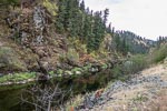
We spent the day exploring the area south of Orofino along Idaho Highways 13 and 14 before starting the trek along Highway 12 towards Lolo Pass. The day was wet with light rain and this discouraged photos and encouraged an early stop.
...click/tap to read the full postLolo Pass (KOA Missoula, USA)
Journal entry for Wednesday 3rd Oct, 2018 (day 6, miles 708)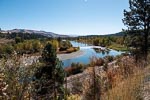
We had some business to take care of so we set off early towards Lolo pass with the goal of getting to Missoula, a campground, wifi and enough time to "take care of business". The day turned out to be sunny which made the drive up Hwy 12 to Lolo Pass quite picturesque. There were long sections of new pavement which made driving very pleasant. But this was offset by a number of delays due to single lane sections where road crews were at work.
...click/tap to read the full postA rude awakening (Suba, USA)
Journal entry for Thursday 4th Oct, 2018 (day 7, miles 799)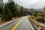
As the reader will deduce from the photos, today brought grey skies and rain. After dithering around in Missoula for a long time we eventually got a late start heading south along Hwy 93. Fall colors were out in force but the lack of nice light and water on the lens reduced the opportunity for nice photos to zero.
...click/tap to read the full postFirst snows (Near Ennis, USA)
Journal entry for Friday 5th Oct, 2018 (day 8, miles 972)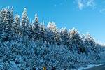
This morning was a real treat. From our overnight spot we climbed steeply to Lost Trail Pass and were delighted to find ourselves amongst fresh snow, quite a few inches of the nice fluffy white stuff. Despite having lived in the US (a place where snow is not uncommon) for 20 years we still have the typical Australian reaction to this "exotic" stuff. After Lost Trail the road towards Wisdom, MT climbed a little higher to Chief Joseph Pass before dropping out of the mountains and eventually the Big Hole Battlefield Memorial, and the cafe in Wisdom.
...click/tap to read the full postA little vehicle trouble (Suga City, USA)
Journal entry for Saturday 6th Oct, 2018 (day 9, miles 1,153)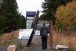
This morning our Webasto diesel heater would not start so we had to rely on the generator and a small electric heater to get our little house up to a comfortable temperature. To my surprise we also had difficulty getting the truck engine to start. Both these small problems were more than a little surprising as we were not at a particularly high altitude (only about 6,500 ft) and it was not particularly cold (33°F). Throughout the mornings travel both these problems persisted in a minor form. Both the heater and engine would start but would generate blue smoke for a while until full warmed up. Eventually in West Yellowstone I added some diesel anti-gel treatment to both tanks and we decided to bypass Yellowstone and the Tetons and head south towards Idaho Falls looking for lower altitude and slightly warmer temperatures until we were convinced the anti-gel treatment had done its job.
...click/tap to read the full postFarms, Fog and Mountains (Grand Tetons, USA)
Journal entry for Sunday 7th Oct, 2018 (day 10, miles 1,249)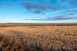
We got off to a good start this morning. The heater, generator and truck all started as they should, and the sun was out providing very good light as we drove east through farm country. Near the town of Driggs we ran into a very dense and extended patch of fog which had largely dissipated by the time we stopped for some exercise on the walking/cycle trail at Victor. Then over Teton Pass to Jackson Hole, Wyoming.
...click/tap to read the full postPerfect photo weather (East Entrance Yellowstone, USA)
Journal entry for Monday 8th Oct, 2018 (day 11, miles 1,449)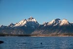
The day started bright and sunny, with no clouds, so we were up somewhat earlier than usual to take advantage of the great photo opportunities. This theme continued throughout the day and we spent more time on the road than would be usual for us as we wanted to cover our targeted areas of both the Tetons and Yellowstone while the good weather lasted.
...click/tap to read the full postShoshone Canyon (KOA Billings, USA)
Journal entry for Tuesday 9th Oct, 2018 (day 12, miles 1,619)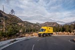
It was cold outside this morning, 24°F at 8:00 when we finally decided to get out of bed. But the diesel heater worked all night so we were comfortable inside our yellow box. And thanks to that same diesel heater I was able to warm the engine and get it started first try. I am now quite confused about the cause of the isses we have had with the truck engine and diesel heater.
...click/tap to read the full postBusiness/lazy day (KOA Billings, USA)
Journal entry for Wednesday 10th Oct, 2018 (day 13, miles 1,636)As you can see we spent an additional day in the Billings KOA. Sometimes it is just nice to hang around and do nothing. Particularly when there are nice facilities.
...click/tap to read the full postBig Horn Canyon (Fort Smith, USA)
Journal entry for Thursday 11th Oct, 2018 (day 14, miles 1,766)
As the title says, today we visited the northern end of Big Horn Canyon. Our route took us through miles of grass lands and Crow Indian Reservation before finishing in the small town of Fort Smith. At this time of year the town is gearing up for for fishing. There are many fishing lodges around the town and drift boats on trails were very common.
...click/tap to read the full postMore grass lands (Devils Tower, USA)
Journal entry for Friday 12th Oct, 2018 (day 15, miles 2,021)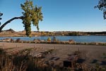
Today turned out to be a long distance day by our standards, over 200 miles. But bad weather is forecast for the next few days and we wanted to be at a campground while it (the weather) descended on us. Also the roads today were good, travel easy and the grass lands scenery interesting without being spectacular. Thus we made it to Devils Tower late in the day to find, fortunately that the KOA was open for a few more days. We also arrived just in time to get a few photos of the Tower before the sun was gone.
...click/tap to read the full postA snowy day in camp (Devils Tower, USA)
Journal entry for Saturday 13th Oct, 2018 (day 16, miles 2,021)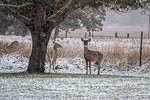
The forecast bad weather arrived over night and by mid morning the temperature was below freezing an snow was falling. That's how the day continued.
...click/tap to read the full postMail pickup (Rapid City, USA)
Journal entry for Sunday 14th Oct, 2018 (day 17, miles 2,140)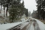
It was cold this morning, 20°F, and still snowing lightly. Overnight our diesel heater had (again) stopped working and this time I could not get it restarted. Fortunately we are in a campground with electricty so we can still heat the camper and truck engine or maybe we would be here another day. Putting aside the vehicle troubles the morning was really pretty. About an inch of snow covering most everything yet clouds high enough that we could see the Devil's Tower also with a light snow cover. We quite enjoyed our stay at Devil's Tower KOA.
...click/tap to read the full postPrairie dogs (Badlands NP, USA)
Journal entry for Monday 15th Oct, 2018 (day 18, miles 2,227)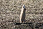
In order to give the mail service time to deliver the parcel we are waiting for, we decided to pay a visit to the Badlands National Park, spend a night there and try again for the mail tomorrow. So, after the usual round of grocery shopping chores, we headed east towards the famous town of Wall, SD and the Northern Entrance to The Badlands National Park.
...click/tap to read the full postSuccessful mail pickup (Rapid City, USA)
Journal entry for Tuesday 16th Oct, 2018 (day 19, miles 2,351)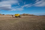
We spent this morning completing our exploration of the Badlands finally exiting the park through the town of Interior, SD before heading back to Americas Mailbox and that long awaited parcel. In case your curiousity is aroused the parcel contained a supply of mint flavoured chocolates that Nina and I use as an after dinner treat.
...click/tap to read the full postBlackhills (Hot Springs, USA)
Journal entry for Wednesday 17th Oct, 2018 (day 20, miles 2,446)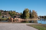
Our excursion to the Badlands a couple of days ago had the unfortunate side effect of getting our truck very muddy as the road to Sage Creek is gravel, or in our case mud, as a result of the recent snow. So this morning we had intended to visit a local Rapid City Truck Wash to cleanup. However when we pulled into the entrance we noted 3 or 4 animal carrier tractor trailers ahead of us, and in short order one of the truck attendants informed us that our wait would be at least 4 hours. So much for cleaning the truck.
...click/tap to read the full postBlackhills (Hot Springs, USA)
Journal entry for Thursday 18th Oct, 2018 (day 21, miles 2,468)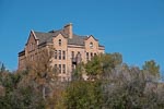
We decided to spend an extra day in the Hot Springs area. We are a little ahead of schedule for our visit next week with Rob Pickering and I am not feeling well, I have a cold. And the town of Hot Springs seems to deserve a little more attention than we have so far given it. So after a relaxed morning we spent a few hours in the town enjoying the walking paths beside the river.
...click/tap to read the full postCow country (Hawk Springs SRA, USA)
Journal entry for Friday 19th Oct, 2018 (day 22, miles 2,656)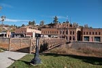
We made another visit to Hot Springs this morning before getting on our way. Nina wanted a few more photos and the town offered a good trail for her daily walk. Thereafter we spent a pleasant day driving through miles and miles of open grass lands.
...click/tap to read the full postInto Colorado (Strasburg KOA, USA)
Journal entry for Saturday 20th Oct, 2018 (day 23, miles 2,862)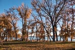
Before getting underway this morning we could not resist a few more photos of our pleasant camping spot. Then it was "onward" with the plan of getting to the Denver area so that we would be within easy driving distance of La Junta for tomorrow. Along the way we made an extended stop at the Wyoming Visitor Center just before the Colorado border. Quite an impressive building and facilities.
...click/tap to read the full postReady for a week of truck work (La Junta, USA)
Journal entry for Sunday 21st Oct, 2018 (day 24, miles 3,014)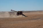
We spent the day making our way to La Junta, a long run east along I70 and then at the town of Limon south on state route 71. The run south along 71 was notable for the dryness of the country side. We would later hear that moisture (rain or snow) has been scarce in this part of the country for over a year. AS you can see from the photos we are in grain growing country.
...click/tap to read the full postA week of maintenance and repairs (La Junta, USA)
Journal entry for Friday 26th Oct, 2018 (day 29, miles 3,014)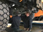
Late today, Friday, all the work was done and our "week of truck stuff" came to an end. Compared to the last time we were here in 2014 Rob's business seems much busier (which is good) with a number of other customers or at least customer vehicles requiring attention.
...click/tap to read the full postA little hiccup and feed lots (Garden City, USA)
Journal entry for Saturday 27th Oct, 2018 (day 30, miles 3,346)We had a bit of a hiccup this morning. We stayed in the parking lot at Terry Lee Ent. last night and headed east this morning. But a little way into our drive we discovered that our new exhaust system needed a bit of adjustment. So back to La Junta where Rob was waiting to spend a couple of hours of his Saturday getting us ship-shape.
...click/tap to read the full postFarm country and fall colors (Elk City SRA, USA)
Journal entry for Sunday 28th Oct, 2018 (day 31, miles 3,698)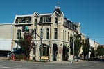
We had a little McDonalds fiasco this morning. We rarely eat at the "Golden Arches" but this morning as we approached Dodge City we decided we would take breakfast at one of those eastablishments. Thus once in Dodge we found a place to park, ordered our desired nourishmet at the new fangled electronic boards that McDonalds now have, and sat down waiting for the delivery of our food and drink. Within a few minutes a young lady came to our table to inform us that "the expresso machine was not working would standard coffee be OK rather than the expresso I had ordered". yeh, sure. A few minutes later she came back with "oh, and by the way the iceream machine is also not working so we cannot make the chocolate shake you ordered". At that point we cancelled the entire order and left. On the way out I noticed that the store advertised "mobile ordering" using your smart phone. I wondered how the McDonalds app would have handled this situation, certainly their fancy electrtonic order board was not aware that expresso coffee and icecream while on the menu were not available.
...click/tap to read the full postA visit with GXV (Springfield, USA)
Journal entry for Monday 29th Oct, 2018 (day 32, miles 3,860)
As you can see this morning we were still obsessed by the lake and the birds. Why ? We could not work out an answer to that question.
...click/tap to read the full postTyler Bend (Buffalo River NP, USA)
Journal entry for Tuesday 30th Oct, 2018 (day 33, miles 3,979)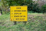
After running down the KOA checklist for departing campers we took a few "last" photos of Springfield KOA and then hit the road south. For those that have not been to this part of the world, south of Springfield there are a series of popular lakes and the town of Branson. Branson is like a small Las Vegas with a varierty of entertainment and shows and to ensure that visitors get to know the choices available to them the highway is lined with large billboards advertising the various artists that are performing in the town. However, we have been to Branson on previous visits so this time we just continued on through the town.
...click/tap to read the full postRain ! (Little Rock, USA)
Journal entry for Wednesday 31st Oct, 2018 (day 34, miles 4,081)Overnight the rain continued with some really heavy bouts and that's how the day continued as well. Thus once underway we made steady progress to the KOA on the Northern side of Little Rock, AR thinking or was it hoping that tomorrow would deliver better weather so that we could visit the President Clinton Library.
...click/tap to read the full postRain ! (Little Rock, USA)
Journal entry for Thursday 1st Nov, 2018 (day 35, miles 4,081)Rain again, is that a ryhme? In any case we spent the day lazing inside our camper out of the rain. Certainly not a day that encouraged sightseeing.
...click/tap to read the full postClinton Presidential Center (Village Creek SP, USA)
Journal entry for Friday 2nd Nov, 2018 (day 36, miles 4,196)
We spent the morning at the Clinton Presidential Center in downtown Little Rock. The approach was easy for our not-so nimble vehicle and parking was easy as the Center has a large lot adjacent to the entrance. We also noticed that there is an RV park on the northern side of the river right opposite the Center. Had we stayed there we would have been able to visit the Center via a pedestrian bridge. Something to keep in mind for next time.
...click/tap to read the full postI40 Tennessee (Natches Trace SP, USA)
Journal entry for Saturday 3rd Nov, 2018 (day 37, miles 4,382)Not long after getting underway this morning we came upon a police officer who had closed the road we wanted to take; seems there was a marathon underway and we needed to detour around the town of Wynne to avoid it. This caused us a bit of navigational confusion for a while, but eventually we found our way on to AR64 as required. By midday we were racing along the I40 northern bypass of Memphis surrounded by trucks and Saturday shopping traffic. Not our favourite style of travel.
...click/tap to read the full postOverland Expo Prep I (Crossville, USA)
Journal entry for Sunday 4th Nov, 2018 (day 38, miles 4,619)
The next few days are going to be a bit boring for you readers as it is time I started preparing for the sessions I am presenting at Overland Expo. That means we are looking for campgrounds with wifi so that we can spend a couple of days stationary while I work.
...click/tap to read the full postOverland Expo Prep II (Crossville, USA)
Journal entry for Monday 5th Nov, 2018 (day 39, miles 4,619)
Spent a second night at Crossville KOA, the Overland Expo work continues. Note the campground mascots, according to the staff there are 20-30 of these little guys living in the campground and surrounding properties
...click/tap to read the full postWithin reach of Overland Expo (Townsend, USA)
Journal entry for Tuesday 6th Nov, 2018 (day 39, miles 4,703)
Today we headed to a KOA at Townsend, TN. We wanted to spend the last couple of nights before Overland Expo at a place within easy reach of the Overland venue. Townsend seemed to fit the bill, an interesting tourist town on the north side of the Smoky Mountains.
...click/tap to read the full postTourist heaven and autumn colors (Cherokee, USA)
Journal entry for Wednesday 7th Nov, 2018 (day 40, miles 4,781)
Overnight we looked a little more carefully at the map and the location of the Overland venue and decided that we were a bit too far away from the venue and in any case we needed to collect some groceries before the event. Thus a we changed our plans and decided to move.
...click/tap to read the full postOverland Expo East 2018 (REEB Ranch, USA)
Journal entry for Friday 9th Nov, 2018 (day 41, miles 4,857)
The Overland Expo event was noticeably smaller in terms of attendies than its western sibling, however it still managed to be inspiring and we came away from the event even more enthused about our planned trip to Australia next year (more of this in a future post). The presentations (and books) by Elspeth Beard and Simon and lisa Thomas (see below for links).
...click/tap to read the full postWe are in our final week of preparation. (Inside the final week, USA)
Journal entry for Tuesday 10th Mar, 2009 (day -4, miles 0)Finally we are in the last week before departing and Nina is telling me it's time to get all that test data off the web site, so that we don't confuse friends and family.
...click/tap to read the full postWe are on our way. (Gig Harbor, USA)
Journal entry for Saturday 14th Mar, 2009 (day 1, miles 272)We are (finally) on our way.
...click/tap to read the full postThe vehicle computer gave us a bit of a fright today. (Lewiston, USA)
Journal entry for Sunday 15th Mar, 2009 (day 2, miles 511)Despite the regular noisy goods trains that punctuated the night, we slept well last night. For Nina that meant no iPods or radios were needed to induce sleep. Hope for her sake that is a portentous sign.
...click/tap to read the full postA day following the Clearwater River through Lolo Pass, with lots of snow. (Missoula, USA)
Journal entry for Monday 16th Mar, 2009 (day 3, miles 767)We took our time getting under way this morning as we decided to enjoy the amenities of the Hells Gate campground, a nice warm (?) shower, paved walking track and beautiful setting.
...click/tap to read the full postAn interlude with our son Richard in Bozeman Montana. (Bozeman, USA)
Journal entry for Tuesday 17th Mar, 2009 (day 4, miles 950)We woke to the noise of semi-trailers, they were also parked in the rest area with us, and about 4 inches of fresh snow. The storm that dropped snow on us yesterday along the Clearwater was still in force last night.
...click/tap to read the full postOn our way again after our visit in Bozeman (Red Mountain Camp Ground, USA)
Journal entry for Friday 20th Mar, 2009 (day 7, miles 1,010)A very short drive today. We spent most of the day saying our good byes to Rick and Lizzie and finishing some last minute business chores.
...click/tap to read the full postAn excursion through some Montana history along the Road Agents Trail. (Bannack, USA)
Journal entry for Saturday 21st Mar, 2009 (day 8, miles 1,134)Our day started with a stroll down the streets of Virginia City, an old gold town that is being maintained as both a historic site and a living town. Some interesting old buildings displayed a way of life that is now gone. Not far from Virginia City is the town of Nevada City an even smaller town again with a good collection of late 1800 buildings and a lot of railway relics and a workshop in which some locals maintain a train that runs from Virginia City to Nevada City. Both these towns were major centers of gold production in the late 1800's and at one point Virginia City was the capital of the Montana Territory.
...click/tap to read the full postOur journey through Montana history continued (Missoula, USA)
Journal entry for Sunday 22nd Mar, 2009 (day 9, miles 1,329)From our camp at Bannack State Park we returned to highway 278 and through Big Hole Pass and into the Big Hole River valley. Winter had not yet departed from the valley. There was a carpet of snow across all the fields and the whole valley was white, except where it was dotted with cows and hay.
...click/tap to read the full postOur first repair day (Missoula, USA)
Journal entry for Monday 23rd Mar, 2009 (day 10, miles 1,339)Well the pump repair did not work. This morning when we investigated the area under the seat, it was wet, and it seemed to be newly wet. A bit more investigation and it was clear, the pump was still leaking. A new one was in order.
...click/tap to read the full postIt's not camping without a camp fire; in that case today was our first day of real camping. (Thompson Lake, USA)
Journal entry for Tuesday 24th Mar, 2009 (day 11, miles 1,496)The saga of the leaking water system continued this morning.
...click/tap to read the full postBack into Washington on our way to Canada (Spokane-Alderwood RV Resort, USA)
Journal entry for Wednesday 25th Mar, 2009 (day 12, miles 100)We woke to a light covering of fresh snow, maybe an inch, the last traces of the fire sending up little wisps of smoke, and blue sky above the low cloud or mist that was swirling around. Back on the road everything was covered in fresh snow, and the morning light was making it all glisten. It was a very pleasant drive into Libby
...click/tap to read the full postThe first of our business days (Spokane-Wal Mart parking lot, USA)
Journal entry for Thursday 26th Mar, 2009 (day 13, miles 1,786)There is not much to say about this day. We got the vehicle to Car Toys at the scheduled time and they had fixed the issue within half an hour.
...click/tap to read the full postToday we found out about the yellow bellied marmots in Lincoln Rock Park (Lincoln Rock State Park, USA)
Journal entry for Friday 27th Mar, 2009 (day 14, miles 1,934)The Wal Mart parking lot proved to be a most adequate place to sleep. You would not call it a great camping spot. Certainly not the kind of place you would want to sit in a camp chair, next to the motor home and drink a beer, but flat, safe and relatively quiet. Also in the morning a short stroll to the store provided very clean and warm rest rooms.
...click/tap to read the full postThree mountain ranges, frost heaves, back in the USA (Tok River, USA)
Journal entry for Thursday 23rd Apr, 2009 (day 41, miles 7,100)We camped at the Tok River Campground - Tok is pronounced to sound like Coke. This is the first public campground that we have found open since central Washington. There is still some snow around the grounds and over parts of the river but the roadways are all clear.
...click/tap to read the full postFairbanks, preparing for the Dalton Highway and the drive to Deadhorse (Fairbanks, USA)
Journal entry for Friday 24th Apr, 2009 (day 42, miles 7,333)We called into the township of Tok this morning for fuel. It seems like there is only one street maybe that's why it has been designated Mainstreet Alaska.
...click/tap to read the full postWe crossed the Yukon and had omelet for dinner (Yukon River Dalton Hwy, USA)
Journal entry for Saturday 25th Apr, 2009 (day 43, miles 7,484)This morning in our motel room was a time to catch up with emails, journal entries and talk to Rick and Brendon, consequently we got a late start from Fairbanks.
...click/tap to read the full postColdfoot and the last spruce tree (The Last Spruce Tree, USA)
Journal entry for Sunday 26th Apr, 2009 (day 44, miles 7,667)Deadhorse at Latititude 70°12,119' is our most northerly point. (Deadhorse, USA)
Journal entry for Monday 27th Apr, 2009 (day 45, miles 7,853)I am sitting in our Tiger in the parking lot of the Caribou Inn, a motel, in Deadhorse Alaska and behind me a guy in a huge CAT front end loader, is clearing snow from the car park as if he is in a race, and while he is doing this workers in pickup trucks are entering and leaving the lot as if an earth moving machine is just another normal vehicle on the roadway; which come to think of it in this part of the world, it is. This seems like an entirely appropriate way to end what has been another exciting and some what surreal day.
...click/tap to read the full postSouthward bound, the Brooks Range in good weather (South of Coldfoot, USA)
Journal entry for Tuesday 28th Apr, 2009 (day 46, miles 8,115)At midnight last night even though the sun had set the twilight was bright enough to take photos. I guess we are in the land of the midnight sun.
...click/tap to read the full postOff the Dalton, summer has arrived. (Fairbanks, USA)
Journal entry for Wednesday 29th Apr, 2009 (day 47, miles 123,456)We woke to another blue sky and bright sun day, but with that same strong wind of last night.
...click/tap to read the full postAn R and R day, our first mosquitoes - summer had really arrived!! (Fairbanks, USA)
Journal entry for Thursday 30th Apr, 2009 (day 48, miles 8,394)Today is an R & R day. A chance to clean the vehicle both inside and out and to put our heavy winter clothes into the carrier on top of the Tiger - we anticipate that they will not be needed again. The temperature in Fairbanks today was 75, and this looks like it will persist for most of the next week.
...click/tap to read the full postA warm lazy day driving to Denali (Denali, USA)
Journal entry for Friday 1st May, 2009 (day 49, miles 8,534)What with more phone calls, emails, packing the Tiger, shopping, and just enjoying the warm weather we had a late start from Fairbanks.
...click/tap to read the full postA splendid view of Denali, and a drive on the park road (Denali, USA)
Journal entry for Saturday 2nd May, 2009 (day 50, miles 8,534)Nina had read that during the off season it was possible to drive the first 30 miles of the 90 mile long Denali Park road. We thought that this would be a nice treat if possible as during the summer the only access to that road, and its views of Mt McKinley, is by bus. The previous time we were here the bus ride was 2.5 hours, each way, of sweaty people and a nice view of rain and cloud.
...click/tap to read the full postMy McKinley watched over us most of the day (Montana Creek, USA)
Journal entry for Sunday 3rd May, 2009 (day 51, miles 8,773)I know it's getting boring, starting another entry with a weather report; but - it's another beautiful day with blue sky and bright sunshine.
...click/tap to read the full postBack into civilization, or at least a city (Anchorage, USA)
Journal entry for Monday 4th May, 2009 (day 52, miles 8,875)We only had about 100 miles to drive to Anchorage today so it was a short driving day. Again we were granted a clear day with bright sun and wonderful views of mountains on either side of the road.
...click/tap to read the full postA business day in Anchorage (Anchorage, USA)
Journal entry for Tuesday 5th May, 2009 (day 53, miles 8,875)We spent the day talking to the family, updating websites, and catching up on emails.
...click/tap to read the full postToday turned out to be a rainy day dedicated to the vehicle (Seward, USA)
Journal entry for Wednesday 6th May, 2009 (day 54, miles 9,039)Before leaving Anchorage this morning we were to have the Tiger serviced, an oil change and new fuel filter. The replacement of the fuel filter was something I was a little nervous about. It is a task I will probably have to do myself while we are in South America and I had read that it is difficult. It's hard to get access to it - and also that once replaced it can be difficult to get the fuel lines and pump primed with fuel. This is a well known problem with diesel vehicles.
...click/tap to read the full postA sunny day on the Kenai Peninsular (Capt Cook State Recreation Area, USA)
Journal entry for Thursday 7th May, 2009 (day 55, miles 9,191)This morning in Seward the sun was out, and the broken clouds had lifted above the tops of the surrounding mountains. A beautiful setting.
...click/tap to read the full postThe Homer Spit and our most Westerly Point (Homer, USA)
Journal entry for Friday 8th May, 2009 (day 56, miles 9,333)The campground that was closed last night was obviously going to open soon. As we went for a morning walk we found the campground gate open and a workman blowing the leaves from last fall off the camping spots.
...click/tap to read the full postLeaving the Kenai and Anchorage (Eklutna Lake Campground, USA)
Journal entry for Saturday 9th May, 2009 (day 57, miles 9,607)We woke early to a sunny but crisp day. After the usual breakfast routine of coffee and muesli we walked to the end of the spit. A vehicular ferry was unloading and we stayed to watch. Unlike most of the ferries in the Seattle area this one was not strictly a drive on drive off type. The ferry had a large lift or elevator structure that carried vehicles from the hold up to the level of the dock, where they drove off the lift onto the dock. It was interesting but a very slow way to load and unload. It was a beautiful morning, no wind, bald eagles all over the place and sports fishermen getting ready for the days adventure.
...click/tap to read the full postThe Matanuska, and Heading for Valdez (Squirrel Campground, USA)
Journal entry for Sunday 10th May, 2009 (day 58, miles 9,809)To day we spent much of the day driving, what appears to me to be, one of the iconic sections of the Alaskan Highway; namely the Glenn Highway through the valley of Matanuska River and past the Matanuska glacier to the junction with the Richardson Highway. We also passed the Musk Ox farm - which we did not visit this time.
...click/tap to read the full post10,000 miles, Valdez and the Chugach Mountains (still) (Chitina - Copper River, USA)
Journal entry for Monday 11th May, 2009 (day 59, miles 10,020)Today we racked up the 10,000th mile of our journey.
...click/tap to read the full postKennicott, Kennecott and our 9 year old tour guide. (Copper River, USA)
Journal entry for Tuesday 12th May, 2009 (day 60, miles 10,136)From our camp in the bed of the Copper River the McCarthy road climbed along the face of the valley wall over recent small rock falls to a ridge between the Copper River and the Chitina River. From this vantage point we could see east and south into the Chitina where the river meandered through a very wide valley. In the distance the valley was full of dust haze whipped up by the wind.
...click/tap to read the full postAnother cultural experience on the way to Haines (Deadman Lake, USA)
Journal entry for Wednesday 13th May, 2009 (day 61, miles 10,404)People are funny. This morning at 1:40 AM I was awakened when a pickup truck passed by our camping spot in the bed of the Copper River. The truck was towing a trailer which was loaded with a fish wheel. After passing us the truck continued upstream until it was out of sight. Now I ask you; who launches a fish wheel at 1:40 AM.
...click/tap to read the full postSome wildlife today. (Haines, USA)
Journal entry for Thursday 14th May, 2009 (day 62, miles 10,781)After I wrote the journal yesterday Nina had a special wildlife experience when she spotted a beaver swimming up and down the lake, it was visible for a long time.
...click/tap to read the full postOur Tiger meets a sibling (Skagway, USA)
Journal entry for Friday 15th May, 2009 (day 63, miles 10,830)Nina woke this morning with sore eyes so we spent a good amount of time today getting her to see the medical clinic.
...click/tap to read the full postA boat trip to Juneau (Juneau - Skagway, USA)
Journal entry for Saturday 16th May, 2009 (day 64, miles 10,833)I was restless during the night and by 5:30 am I was awake, hence by 6:00 am we were parked at the small boat harbor where we would meet the catamaran that would take us to Juneau and back. The boat turned out to be a 65' cat with a large single enclosed cabin and a small open after deck.
...click/tap to read the full postA BIG change in plans, and a push to Phoenix (Holter Lake, USA)
Journal entry for Saturday 6th Jun, 2009 (day 85, miles 14,728)A light dusting of fresh snow greeted us this morning and although we did not know it when we woke this would be a very appropriate farewell from Canada nicely bookending our time in Canada and the north; snow when we arrived - snow when we departed.
...click/tap to read the full postMontana and Utah - fast!! (Yuba Lake, USA)
Journal entry for Sunday 7th Jun, 2009 (day 86, miles 15,364)Today was one of contrast, this morning driving through Helena, MT there was fresh snow on the ground and occasional flurries and by the afternoon at Lake Yuba the temperature was nudging 90°F, people were boating and swimming and we were worrying about how to stay cool.
...click/tap to read the full postZion, Glen Canyon Dam and a lot of miles! (Phoenix (Almost), USA)
Journal entry for Monday 8th Jun, 2009 (day 87, miles 15,910)We planned on getting to Phoenix today, a drive of something like 600 miles, but Nina could not resist the temptation of Zion National Park and we had to see some of it on our way.
...click/tap to read the full postVisiting our son in Phoenix, plans for Central and South America (Phoenix, USA)
Journal entry for Tuesday 9th Jun, 2009 (day 8894, miles 16,209)We have had a hectic week in Phoenix, catching up on family matters, maintenance on the Tiger and emails/phone contact with Norm so that he could arrange insurance and shipping for the trip into central and south america.
...click/tap to read the full postOn our way again!! (El Paso, USA)
Journal entry for Tuesday 16th Jun, 2009 (day 95, miles 16,639)We are back on the road after some last minute chores and goodbyes. We are following Highway 10 so that means out of Phoenix we headed south and then eventually east.
...click/tap to read the full postA long hot drive, but surprisingly nice campground (Caverns of Sonora, USA)
Journal entry for Wednesday 17th Jun, 2009 (day 96, miles 17,044)We woke this morning to find that the rest area was next to a prison and that the truck engines had not become any quieter during the night.
...click/tap to read the full postAnother long hot day with a shopping break in San Antonio's Outdoor World (Three Forks - Tips Park, USA)
Journal entry for Thursday 18th Jun, 2009 (day 97, miles 17,339)We lingered at the camping ground this morning sheltering from the strong morning sun under the shade of the trees and enjoying the Texas country side.
...click/tap to read the full postThrough Southern Texas to Pharr, and we meet Norm (Pharr, USA)
Journal entry for Friday 19th Jun, 2009 (day 98, miles 17,531)We were quite excited on this day as we were finally going to arrive in Pharr, meet the trip organize Norm and start the final preparation for the Central and South America legs.
...click/tap to read the full postLast minute shopping and preparation in McAllen, Pharr, Alamo TX (Pharr, USA)
Journal entry for Saturday 20th Jun, 2009 (day 99, miles 17,563)There is not much to say about today. Last minute shopping.
...click/tap to read the full postLeaving Mexico - twice!! (Pharr, USA)
Journal entry for Monday 13th Sep, 2010 (day 549, miles 54,243)This morning we broke one of our long standing driving rules for Latin America - don't drive at night. We were up and on the road, in the rain and dark, at 5:15 am in the hope of making the border that day and to get through Tampico before the days traffic got into full swing. Our timing was good, as we crossed the impressive bridge on the southern edge of Tampico as the sky was just beginning to lighten.
...click/tap to read the full postChores and Dinner with Norm (Pharr, USA)
Journal entry for Tuesday 14th Sep, 2010 (day 550, miles 54,243)We spent the day on chores, mostly getting a service for the vehicle.
...click/tap to read the full postOn the road in the USA - the Gulf Coast (Rockport, USA)
Journal entry for Wednesday 15th Sep, 2010 (day 551, miles 54,512)We headed East today towards Orlando, FL. What a change/shock it is to be back traveling on US roads. It's almost boring. Good roads, 4 lanes, no crazy drivers and shops everywhere. Also camping grounds that have water, electricity, dump and propane can be bought at almost every stop.
...click/tap to read the full postHouston .. "the Eagle has landed" (Houston, USA)
Journal entry for Thursday 16th Sep, 2010 (day 552, miles 54,704)Boy is Texas flat. We traveled along the gulf coast today and much of the way the land was flat flat flat with no trees. We could see from one horizon to the other. From time to time the road got close enough to the coast for us to see the waters of the gulf. Nice beach side communities and some nice parks. Also some impressive bridges.
...click/tap to read the full postLook sharp "we are now in Piggly Wiggly country" (New Iberia, USA)
Journal entry for Friday 17th Sep, 2010 (day 553, miles 54,963)The country today was still flat but now the highway is a corridor in the forest. We spent much of the day on I-10 so that traffic was much heavier than yesterday.
...click/tap to read the full postTabasco (Gulfport, USA)
Journal entry for Saturday 18th Sep, 2010 (day 554, miles 55,186)This morning we visited the factory that makes Tabasco pepper sauce at Avery Island Louisiana. Founded in the 1860's by a member of the McIlHenny family, the company is still a family owned business. There is only one factory in the world and this is it. It produces 700,000 bottles of sauce per day (4 days a week). The sauce is made from capsicum peppers that are grown on the island and also in Central and South America and the sauce is shipped to over 100 different countries. The McIlHenny's sure seem to have a head for business and an understanding of the law of supply and demand. The first 2 oz bottles made in 1864 sold for $1 each !!. We did not think much of the pepper sauce flavored ice cream but did like their new sweet and sour sauce.
...click/tap to read the full postMan made beaches - only in America (I think) (Destin, USA)
Journal entry for Sunday 19th Sep, 2010 (day 555, miles 55,402)The day started with a drive along the coast into the city of Biloxi, Mississippi. The coast was quite beautiful, long stretches of white sand beaches that were easily accessible as there were no buildings between the road and the beach. We later discovered that this 27 miles section of beach is entirely man-made. All that lovely sand was originally trucked in - only in America!!
...click/tap to read the full postMore lovely coastal scenery (Cross City, USA)
Journal entry for Monday 20th Sep, 2010 (day 556, miles 55,646)Today was a pleasant drive through coastal scenery. More spectacular long bridges over water ways, miles of pine forests and some long stretches of road right next to the water. It really is a pretty, and affluent, part of the world.
...click/tap to read the full postHorse farms and freeways (Kissimee, USA)
Journal entry for Tuesday 21st Sep, 2010 (day 557, miles 55,839)It was an easy drive into Orlando. Initially it was a little foggy as we drove along more flat highway through oak and pine forests and then through beautiful horse farms.
...click/tap to read the full postUniversal Studios Day I (Kissimee, USA)
Journal entry for Wednesday 22nd Sep, 2010 (day 558, miles 55,839)We spent the day at Universal Studios, Islands of Adventure. This is the park that houses Harry Potter World which was our major motivation for visiting the parks in the first place.
...click/tap to read the full postUniversal Day II (Kissimee, USA)
Journal entry for Thursday 23rd Sep, 2010 (day 559, miles 55,903)We went back to Harry Potter world for a few hours this morning. Nina wanted to visit some of the other exhibits and I spent my time riding the various roller coasters.
...click/tap to read the full postDisney World (Kissimee, USA)
Journal entry for Sunday 26th Sep, 2010 (day 562, miles 55,973)I am cheating and combining three days into one entry.
...click/tap to read the full postThe oldest (continuously occupied European) town in the US (Woodbine, USA)
Journal entry for Monday 27th Sep, 2010 (day 563, miles 56,177)We left Orlando heading north today. Along the way we stopped for a brief visit to the coastal town of St Augustine. This was a bit of a surprise, or maybe it is our poor understanding of American history. Founded by the Spanish over 50 years before the pilgrims landed in the Mayflower, its original purpose was as a base from which the Spanish could attack a French settlement a little farther north. There is an old fort, some remnants of a colonial town which has been turned into a sort of mini theme park, and some older colonial churches. In all, a nice little town. For us it simply served to underscore the profound influence the Spanish had on the new world, here is yet another place in the Americas that was being visited by the Spanish as early as 1513. Simply amazing.
...click/tap to read the full postWarm (not hot) and sunny (Lexington, USA)
Journal entry for Tuesday 28th Sep, 2010 (day 564, miles 56,436)You know that when the title of a days entry is about the weather that the day was devoid of noteworthy things to talk about.
...click/tap to read the full postA Visit to the Tiger Factory (Waco, USA)
Journal entry for Wednesday 29th Sep, 2010 (day 565, miles 56,719)We had been planning this visit for months. There are a number of things on our Tiger motor home that need fixing or freshening up after our journey, so this visit was to discuss with the Tiger folks what could be done.
...click/tap to read the full postAnother weather day! (Wall Doxey SP, USA)
Journal entry for Thursday 30th Sep, 2010 (day 566, miles 57,017)More signs of fall today and at the campground tonight there were lots of leaves, though the trees are not yet looking bare.
...click/tap to read the full postGracelands! (Aux Arc Park Ozark, USA)
Journal entry for Friday 1st Oct, 2010 (day 567, miles 57,338)Today in some ways typified our entire journey, first make a plan and then do something completely different.
...click/tap to read the full postThe country is FLAT!! (Amarillo, USA)
Journal entry for Saturday 2nd Oct, 2010 (day 568, miles 57,838)All I can say is - Oklahoma and Texas sure know what it means to be flat.
...click/tap to read the full postMountains again (Water Canyon Near Socoro, USA)
Journal entry for Sunday 3rd Oct, 2010 (day 569, miles 58,247)We continued due west for much of the day to Albuquerque and then south to pickup highway 60.
...click/tap to read the full postRadio Telescopes, desert and mountains (Tempe, USA)
Journal entry for Monday 4th Oct, 2010 (day 570, miles 58,587)The light was beautiful this morning and for a while we got back into tourist mode and took some photographs of the desert, and mountains bathed in the light of the rising sun. Later in the morning as we descended onto the low lands approaching Phoenix we passed through a really impressive gorge.
...click/tap to read the full postStarting the final leg (Beatty, USA)
Journal entry for Monday 11th Oct, 2010 (day 577, miles 59,069)It seemed to take forever to get past the Phoenix metropolitan area and then we were into the deserts of western Arizona and eventually Nevada.
...click/tap to read the full postHome James (Yreka, USA)
Journal entry for Tuesday 12th Oct, 2010 (day 578, miles 59,672)Today was a long day of driving and we allowed ourselves no time for sightseeing. Our minds are now on getting home. Some of the desert mountain scenery through Nevada was alluring and reminded us a little of the mountains of SW Bolivia with dry valleys and the colors of the rock indicating thermal activity on the upper reaches of the mountains. We will come back and visit a little longer on some future trip.
...click/tap to read the full postHome (Home, USA)
Journal entry for Wednesday 13th Oct, 2010 (day 579, miles 60,029)We drove into Southern Oregon from our camp in a rest stop on the I-5 while it was still dark. The day dawned slowly, through some early fog into a spectacularly sunny North West day; a relatively rare event - it was as if fate was welcoming us home. The weather continued fine all the way to our home south of Seattle. We had spectacular views of the various mountains (Hood, St Helens, and Rainier).
...click/tap to read the full postThe Tiger reborn (Columbia, USA)
Journal entry for Thursday 17th Mar, 2011 (day 1, miles 10)We arrived (by plane) in Columbia, SC last night. The mission: to collect our Tiger motor home.
...click/tap to read the full postNew shocks at Camping World (Spartanburg, USA)
Journal entry for Friday 18th Mar, 2011 (day 2, miles 100)We were at Campingworld a little after 8:30 to have new front shocks fitted. I had organized this from home a few weeks ago in the hope of facilitating a fast turn around. It was not to be so. We were not finished until early afternoon, during the process had discovered that one of our tires was about to disintegrate, and the rear brakes both pads and rotors need to be replaced. Back on the highway we further discovered that while the shocks were improved there was still a substantial vibration. We will need to replace all 4 tires soon.
...click/tap to read the full postNew Tires, Biltmore Estate (Ashville, USA)
Journal entry for Saturday 19th Mar, 2011 (day 3, miles 100)Fortune smiled on us this morning - we got 4 new Bridgestone tires at Discount Tire. It took only 1/2 an hour and once on the highway the vibration has gone -- Yippey!!
...click/tap to read the full postBare trees and on the Blue Ridge Parkway (Smokey Mountain NP, USA)
Journal entry for Sunday 20th Mar, 2011 (day 4, miles 76,600)After a late start we spent some time exploring the area around Asheville. Included in these explorations was a drive to the town of Chimney Rock, a quaint little one street town at the foot of a spectacular granite tower called, you guessed it Chimney Rock. Unfortunately we could not tour the top of the rock as the elevator is being replaced and will be out of action for a year, and the track was closed until mid April.
...click/tap to read the full postForests and blue grass! (Louisville, USA)
Journal entry for Monday 21st Mar, 2011 (day 5, miles 76,905)The bare forests and Rhodies continued this morning as we traversed the Smokey Mountains. Exiting the tranquil forests and mountains into the excessively and garishly developed towns of Gatlinburg, Pigeon Forge (which among other things is the home of Dolly Parton, and boasts her Dollywood theme park) and Servierville was a bit of a jolt.
...click/tap to read the full postGreat Rivers (Meramec State Park, USA)
Journal entry for Tuesday 22nd Mar, 2011 (day 6, miles 77,263)We parked on the banks of the Ohio River in downtown Louisville this morning, strolled along the bank and made use of the weak wifi at a restaurant to update the journal and check emails. There had been a recent flood. Mud caked the walkways and boat docks, and there were work crews out cleaning away debris. The delight of the morning was a large beaver swimming along side the bank. Nina chased it for about 1/2 a mile trying to get some photos. We have never seen a beaver up close before and were surprised by its size.
...click/tap to read the full postGXV (Fall River SP, USA)
Journal entry for Wednesday 23rd Mar, 2011 (day 7, miles 77,646)We spent the morning driving across Missouri to Nixa a township south of Springfield. This is the home base of GlobalXVehicles.com an organization that builds high end custom expedition style motorhomes. We wanted to see some of their work up close and get an understanding of the range of vehicles they provide. We spent a very interesting hour or more with Mike Vanpelt, the owner and Dave Mezo the sales manager. We saw three vehicles under construction. One was a large two story motorhome based on a full size truck (you can see some of this on their website) - this is truly an awesome (and more than a little over the top) vehicle. There were also two Ford F550 based vehicles under construction. One of these (being built for a TV personality) has air bags and trailing arm suspension front and rear. All in all the work was very impressive. I was particularly taken by the level of the sophisticated engineering (both body and suspension) that the team has brought together in the relatively short time they have been in business.
...click/tap to read the full postFlat, cold and windy (Goodland, USA)
Journal entry for Thursday 24th Mar, 2011 (day 8, miles 87,066)It was cold last night!! To our surprise the temp this morning was 33°F. What happened to spring?
...click/tap to read the full postEarthroamer visit (Buena Vista, USA)
Journal entry for Friday 25th Mar, 2011 (day 9, miles 78,439)It was even colder this morning, 20°F, sunny and clear. We were up and going by 7:00 am in order to be at the Earthroamer factory by mid morning.
...click/tap to read the full postFresh snow (Montrose, USA)
Journal entry for Saturday 26th Mar, 2011 (day 10, miles 78,600)Boy did we get our weather predictions wrong for this trip. Another cold night with a light dusting of fresh snow this morning. However the sun was out and the sky blue. Really a pretty morning. We took advantage of the pleasant campground and lazed around until late morning before getting underway.
...click/tap to read the full postMountains and desert, all in one day (Canyon de Chelly, USA)
Journal entry for Sunday 27th Mar, 2011 (day 11, miles 78,914)Our route this morning took us through the town of Ouray and on through Red Mountain and Molas Divide passes to Silverton and Durango. We knew from previous visits that this was a spectacular drive and we were not disappointed. Though we were a bit surprised, at our selves, when we realized (and observed) that Red mountain was still winter white (not red) because of the snow.
...click/tap to read the full postThe Grand Canyon (Grand Canyon, USA)
Journal entry for Monday 28th Mar, 2011 (day 12, miles 79,190)Before starting the days travel we drove along the rim road of the Canyon de Chelly, stopping at a number of the numerous overlooks. The Canyon de Chelly is only 500-600 feet deep, but spectacular, with many impressive sandstone structures. From some of the overlooks we had glimpses of Anastasi ruins built into the canyon wall. The floor of the canyon showed signs of recent agriculture, and habitation as well as a vehicle track that we understood is used for guided jeep tours.
...click/tap to read the full postNarrow streets in Jerome (Phoenix, USA)
Journal entry for Tuesday 29th Mar, 2011 (day 13, miles 78,439)We undertook a little more sightseeing this morning before leaving the canyon and making our way south to Flagstaff, and there after along 89A through Oak Creek Canyon, Sedona, and Jerome. This is definitely a scenic route transitioning from a narrow winding canyon into spectacular red rock mountains.
...click/tap to read the full postLast stop before OX11 (Maricopa, USA)
Journal entry for Wednesday 30th Mar, 2011 (day 14, miles 79,495)We spent last night, and a very little time this morning, in Phoenix visiting with our son. It was nice to catchup as we have not seen him in some time. We will drop by again on our return journey next week. If the schedules work our we will get a chance to visit with his loverly lady Lizzie.
...click/tap to read the full postOX11 - Overland Expo 2011 (Amaro, USA)
Journal entry for Sunday 3rd Apr, 2011 (day 18, miles 79,634)So what is OX11?
...click/tap to read the full postNorthward (Mancos, USA)
Journal entry for Tuesday 5th Apr, 2011 (day 20, miles 80,209)Yesterday we left the Expo site around 8:00am. The exhibition area and campground were not quite deserted but only a few vehicles and people remained giving a bit of a forlorn look, particularly when compared to the bustle of the last few days. We arrived in Phoenix late morning to visit with our son and his girlfriend. The visit was capped off with a delightful dinner at a local brewery/restaraunt.
...click/tap to read the full postBeautiful springtime scenery in the Rockies (Colorado Springs, USA)
Journal entry for Wednesday 6th Apr, 2011 (day 21, miles 80,545)Dear reader (if there are any) - I feel like I must apologize for the current crop of journal entries. Since leaving South Carolina we have been traveling towards a destination rather than traveling for the sake of seeing and exploring. It is difficult to make interesting comments about such travels. For in reality the journey is primarily about how many miles one can travel in a day before becoming tired. I hope you find the interlude at OX11 of more interest, but I fear that the remainder of the journey back to WA will be more traveling to a destination.
...click/tap to read the full postThe Earthroamer - our new motorhome (On the way home, USA)
Journal entry for Thursday 7th Apr, 2011 (day 23, miles 80,545)Over the past few days we called at the Denver factory of Earthroamer and picked up the our new (to us) motorhome. Since OX11 we have been communicating with the guys there to purchase one of the used vehicles they have for sale.
...click/tap to read the full post