Posts From Canada
Not entirely solo (Nanaimo, Canada)
Journal entry for Saturday 23rd Jun, 2018 (day 1, miles 175)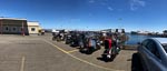
For the first two days of this adventure I am accompanied by a friend named Todd, so I have to admit that the journey is not entirely solo. But only a small cheat.
...click/tap to read the full postSea to Sky (Lillooet, Canada)
Journal entry for Sunday 24th Jun, 2018 (day 2, miles 323)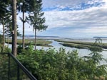
We were pleasantly surprised this morning to find that the campground had a cafe that opened at 8:00 so morning coffee was pretty easy to organize. So once fortified we packed and headed to the ferry terminal to await the loading of the vessel to Horse Shoe Bay. By the time loading started there were a large pack of bikes of all kinds most laden down with gear for an extended journey.
...click/tap to read the full postStorms shorten the day (100 Mile House, Canada)
Journal entry for Monday 25th Jun, 2018 (day 3, miles 446)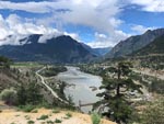
Highway 99 continued past Lillooet this morning and continued to be great riding and spectacular scenery; the weather even continued acceptable. At the intersection with Highway 12 is the town of Cache Creek and here I had breakfast before continuing north on 12. Soon the weather deteriorated with torrential rain, high wind and even hail.
...click/tap to read the full postRoadhouse philosophy (Prince George, Canada)
Journal entry for Tuesday 26th Jun, 2018 (day 4, miles 659)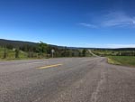
Yesterdays storm was gone this morning to be replaced by crystal clear sky and bright sun which displayed the countryside wonderfully. However without the usual expedition photographer along on this journey the job of capturing the scenery and recording events fell to me. I just hope I am up to the task.
...click/tap to read the full postForest (Smithers, Canada)
Journal entry for Wednesday 27th Jun, 2018 (day 5, miles 893)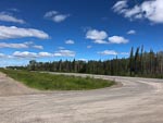
Today my route took me West along Highway 16 a somewhat less busy road than Highway 97 of the previous couple of days. The weather continued generally fine but with a strong buffeting wind that made riding a little less pleasant than normal.
...click/tap to read the full postLeaving civilization - sort of (Bell 2, Canada)
Journal entry for Thursday 28th Jun, 2018 (day 6, miles 1,118)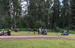
The Yukon (Boya Lake Provincial Park, Canada)
Journal entry for Friday 29th Jun, 2018 (day 7, miles 1,358)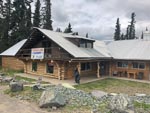
Heading North this morning from Bell 2 was more of the mountains, forests, good lonely road of yesterday. Though a little spice was added by patchy rain showers that sometimes were quite heavy. The rain slowed me down some what as I am still a bit of a novice to this motorcycle stuff and I don't want to misjudge a corner in the wet. Late morning, some what before Dease Lake I called into Tatogga Lake Resort a campground and restaurant housed in a quaint log building where I had breakfast (or as it is becoming the days main meal).
...click/tap to read the full postThe Alaska Highway (Alcan) (Squanga Lake Territorial Park, Canada)
Journal entry for Saturday 30th Jun, 2018 (day 8, miles 1,627)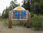
The first phase of todays journey was to complete the crossing of British Columbia and arrive at the border with the Yukon Territory. The effort required to cross BC from South to North never ceases to amaze me, and this trip is no exception. At the Yukon border sign the odometer on the bike is showing 30584 miles or 1300 miles since the ferry from port Angeles first dropped me on BC soil. A few more miles and the Cassiar Highway was done and I have arrived at the Alaska Highway.
...click/tap to read the full postCanada Day (Whitehorse, Canada)
Journal entry for Sunday 1st Jul, 2018 (day 9, miles 1,627)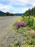
I plan on spending the next two nights in Whitehorse in a hotel. This will give me a days rest from sitting on the bike, an opportunity to do a bit of planning for the next leg to Inuvik and Tuktoyaktuk and get some food and a means of carrying some extra fuel. When Nina and I originally put this rest day in the schedule we did not really notice that today, July 1st, is Canada's national day. Hence when I arrived in Whitehorse this morning a little after 11:00 am the Canada Day Parade was ending.
...click/tap to read the full postYukon Rivers (Moose Creek, Canada)
Journal entry for Tuesday 3rd Jul, 2018 (day 11, miles 1,932)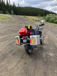
I dithered about in Whitehorse a bit this morning before getting underway. I had to buy one of those red plastic fuel containers and then figure out how to attach it to the bike. I had expected to get a 2 gallon container but of course I should have realized all containers here would be metric so the choice was 5 liters (1.25 gals) or 10 liters (2.5 gals). After way too much deliberation I went with the 10 liter variety. Strapping it to the bike required a set of 4 lime green tie-down straps 3 of which were surplus to requirements; thus my load of unnecessary items is increased.
...click/tap to read the full postGlorious Day (Eagle Plains, Canada)
Journal entry for Wednesday 4th Jul, 2018 (day 12, miles 2,278)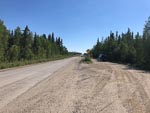
I could not get out of the campground fast enough this morning, I don't really like mosquitoes. Rather than hit the road I headed back towards Whitehorse about half a mile to Moose Creek Lodge for todays installment on the Traditional Yukon Breakfast; it also was good and too big. Thereafter I hit the road to Dawson City. The weather was glorious. Bright sun with temperatures sometimes in the high 70s. So I was keen to get to Dawson City to gas up and then head up the Dempster Highway with the hope of getting to Eagle Plains; the first fuel stop on the Dempster and about half way to Inuvik.
...click/tap to read the full postNot so Glorious (Eagle Plains, Canada)
Journal entry for Thursday 5th Jul, 2018 (day 13, miles 2,372)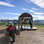
It was raining gently this morning as I pulled up to the gas pump to fill up for what I hoped would be a long day to Inuvik. I did not know it at the time but the guy that pumped the gas was prophetic as he said "you should not be going north in this weather". Yesterday was my introduction to gravel, today it was an introduction to mud. The first few miles were very tentative but within an hour the rain eased a bit and by the time I got to the rest area and monument for the Arctic Circle (25 miles from Eagle Plains) I was beginning to get hopeful.
...click/tap to read the full postRetreat (Dawson City, Canada)
Journal entry for Friday 6th Jul, 2018 (day 14, miles 2,621)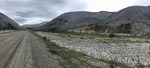
Today my retreat from Eagle Plains was mostly uneventful. There was a dense cloud cover with some mist in the valleys but fortunately no rain. The road was mostly dry so my gravel experience of two days ago was helpful. The cloud and consequence poor light rendered the scenery less of a post card and more of a bland grey mush. But as I have learned to do from other adventures I took the time to stop regularly to take a mental picture my surroundings. There is a good chance I will never be back to this place.
...click/tap to read the full postBack in Canada (Haines Junction, Canada)
Journal entry for Monday 16th Jul, 2018 (day 24, miles 4,559)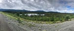
It was still somewhat wet this morning as I set off towards the Canadian Border. I was expecting to have breakfast at a place called Border City that my maps told me was just the US side of the border. I found it, but it turned out to be closed and that looked permanent. The Canadian entry station is at the town of Beaver Creek about 20 km after the actual geographic border and this town though small was definitely not closed. Three gas stations and at least two restaurants. So I chose Buckshot Betty's for one of those breakfasts I will not be allowed to have one I get home.
...click/tap to read the full postMaybe a Grizzly (Teslin, Canada)
Journal entry for Tuesday 17th Jul, 2018 (day 25, miles 4,769)
It was wet and cold pulling out of Haines Junction this morning and so the miles into Whitehorse were not about photos and sightseeing. In Whitehorse I stopped for the mandatory coffee at Starbucks, bought a few groceries and then was on my way towards Teslin.
...click/tap to read the full postBears and Bison (Laird Hot Springs, Canada)
Journal entry for Wednesday 18th Jul, 2018 (day 26, miles 3,770)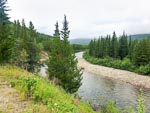
It was raining this morning so packing up my gear was a bit of a chore, trying to do everything inside the tent so as not to get all my gear wet. The rain also meant that this mornings ride was about "getting there" rather than taking in my surroundings. However after a couple of hours the rain intervals lessened and I became a little more observant of my surroundings.
...click/tap to read the full postMuncho and Stone Mountain (Fort Nelson, Canada)
Journal entry for Thursday 19th Jul, 2018 (day 27, miles 5,025)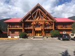
This morning as I passed Laird Hot Springs I saw that the parking lot was crammed with motorhomes and tents. Apparently a lot of people, like me, discovered the campground and lodge full last evening. However they apparently are more creative than me and simply occupied the parking lot. The crowded nature of the parking lot confirmed my decision to give the hot springs a miss. Later in the day Nina informed me that, according to the Milepost, the Laird Hot Springs is one of the most popular attractions on the ALCAN.
...click/tap to read the full postNo services for .. (Fort St John, Canada)
Journal entry for Friday 20th Jul, 2018 (day 28, miles 5,485)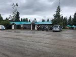
Before setting out this morning I had a conversation with a bicycle rider who had also overnighted in the campground. Turns out the guy was French and like me was headed towards Fort St John. However he expressed to me that he had a problem. Seems there is no camping ground along that route for well over 100 kilometers and that he did not want to just camp in the forest beside the road, we was nervous of bears. Well once I got under way I was immediately confronted by a sign that encapsulated the Frenchman's concern; it read Check your fuel. No services for 144 kms (thats over 110 miles). And it turned out that the sign was correct, the first fuel stop, indeed maybe even the first occupied building, was a lodge at Buckinghorse River. For me the lodge provided a welcome stop for a traditional breakfast and a place to get fuel for the next leg of the journey.
...click/tap to read the full postThe Peace (Prince George, Canada)
Journal entry for Saturday 21st Jul, 2018 (day 29, miles 5,780)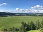
From St John this morning I back tracked a little to the start of BC Highway 29 that heads south along the Peace River to Hudson's Hope. There is obviously a political dispute surrounding the Peace River as I saw many signs arguing against the idea of a hydro power scheme on the Peace. After Hudson's Hope the route left the Peace and eventually caught up with the Pine River and followed that for miles. Today was another day of no services for ... so my French friend from Fort Nelson would have had (will have?) further camping dilemmas.
...click/tap to read the full postMt Robson (Lucerne Provincial Park, Canada)
Journal entry for Sunday 22nd Jul, 2018 (day 30, miles 6,004)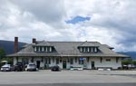
There is no doubt that today is Mount Robson day, though there were many miles between the start of day and that mountain, many miles of good road and forest (did I say forest!). Before getting to the mountain itself one drops into a valley that the locals call and signpost as Robson Valley, but which is geographically a valley of the Fraser River. In this valley I came upon the small (microscopic ?) town of McBride and stopped in at the old railway station that has been converted to a cafe and art/curio shop. Here I had a lunch of soup and toast. The cook promised me that the soup was 17 bean soup, but I could only identify two variety of beans. Never the less the soup and conversation was pleasant.
...click/tap to read the full postWaiting for weather (Jasper, Canada)
Journal entry for Monday 23rd Jul, 2018 (day 31, miles 6,041)
I followed Nina's advice and decided to stay in Jasper for tonight, thus making today a bit of a rest day. The hope (and forecast) is that tomorrows weather along the Icefield Parkway will be better than today. Spent the day relaxing around Jasper and the campground.
...click/tap to read the full postIcefield Parkway (Radium Hot Springs, Canada)
Journal entry for Tuesday 24th Jul, 2018 (day 32, miles 6,288)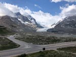
For a little while this morning the rest day gamble seemed like it might not pay off, as the mountains were all covered in cloud as I started out this morning. But by the time I got to the Columbia Icefield the cloud was broken and sun was showing through. I tried to capture a smattering of the sights along this really picturesque route. I have travelled this road a number of times but never failed to be awed by just how much spectacular mountain and lake scenery is packed into this single road.
...click/tap to read the full postRogers Pass and other things (Castlegar, Canada)
Journal entry for Wednesday 25th Jul, 2018 (day 33, miles 6,606)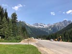
Today I was very much in the mood of "heading for home" which was remiss of me for there was a lot of great scenery along the way and I did not give it the photographic attention it deserved. From Radium this morning I made an early start and followed the Columbia River (and highway 95) north to the town of Golden a major rail head town and a watering hole on the Trans-Canada Highway (or Highway 1 as it is also called). For me it was also breakfast.
...click/tap to read the full postThe journey continues (Rest Area on Canada 1, Canada)
Journal entry for Thursday 11th Aug, 2016 (day 17, miles 2,408)
So we are on the road again and the "journey continues". Since the last entry we have been back to our house in Washington, to undertake a series of chores that deserve no discussion. In addition we had a visit from our eldest son Brendon and we accompanied him into the mountains of British Columbia where Nina and I played support team to a brief solo mountain biking expedition.
...click/tap to read the full postPicturesque camp (Nahatlatch Lake, Canada)
Journal entry for Friday 12th Aug, 2016 (day 18, miles 2,528)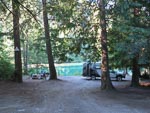
We expect today to be a bit of a model for our time in British Columbia. A relative short day in terms of mileage, but a good stretch of that mileage on rocky roads, and at the end of the day a really picturesque campsite (this time beside a glacial lake). There is not much to say about such a day that is not captured in the photos.
...click/tap to read the full postA trap for the unwary (Carpenter Lake, BC, Canada)
Journal entry for Saturday 13th Aug, 2016 (day 19, miles 2,671)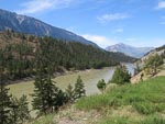
Gun Creek Camp Ground, where we camped tonight, is located in the bed of Carpenter Lake where Gun Creek enters the lake. The campground is provided and maintained by BCHydro and the lake is a source of water for a BCHydro generating plant. Just near the campground is the site of an old town that was flooded when the lake filled after the damming of Bridge River. The campground is very popular as 4x4 types can easily access the dry floor of the lake to have some fun, and make some dust, in the dry silt. However, as we discovered the dry silt might be fun but when wet the stuff makes for getting quickly and thoroughly stuck.
...click/tap to read the full postHurley Wilderness (Lilloet Fire Road, Canada)
Journal entry for Sunday 14th Aug, 2016 (day 20, miles 2,728)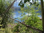
We did a bit of exploring around Gold Bridge this morning before heading down the Hurley Wilderness road, a summer only road that provides a short cut to Pemberton from Gold Bridge, it was quite rough and rocky as it seems to get a lot of traffic that is in a hurry.
...click/tap to read the full postA day in Pemberton (Twin One CG, Canada)
Journal entry for Monday 15th Aug, 2016 (day 21, miles 2,771)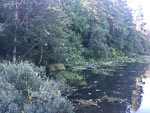
Into Pemberton this morning for the usual type of chores after a few days in the "wilderness", groceries, internet, real coffee, a visit to the Visitor Info center.
...click/tap to read the full postA few hikes (Birkenhead Lake CG, Canada)
Journal entry for Tuesday 16th Aug, 2016 (day 22, miles 2,828)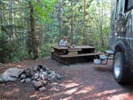
The day started with another rescue mission. One of the other campers at Twin One had managed to flatten their vehicle's battery overnight and came calling asking for a jump start; which of course we did. We like to pay it forward, we have been helped by other people many times.
...click/tap to read the full postA rest day (Birkenhead Lake, Canada)
Journal entry for Wednesday 17th Aug, 2016 (day 23, miles 2,828)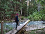
A rest day at Birkenhead Lake, a short hike, and some general relaxing in the forest and by the lake.
...click/tap to read the full postHighline Road (Gun Creek CG, Canada)
Journal entry for Thursday 18th Aug, 2016 (day 24, miles 2,913)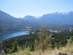
Today we traveled back to the Goldbridge area via a spectacular series of roads. The first of these was called the Highline Road, and it was well named. It followed the western shore of Anderson Lake but was cut high on the valley wall rather than on the lake front. Spectacular, with a number of really steep rough climbs. At the Northern end of Anderson Lake was a short section of flat road through Seton Portage to Seton Lake and the village of Shalalth, and then a 3000 ft climb and descent over Mission Mountain Road to Carpenter lake, Goldbridge and a return visit to Gun Creek CG.
...click/tap to read the full postWashing day (Clinton, Canada)
Journal entry for Friday 19th Aug, 2016 (day 25, miles 3,031)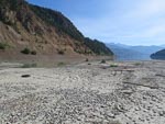
Another warm summers day and a stop in Lillooet to do some laundry before heading up highway 99 and then 97 to the town of Clinton to a real campground with showers and electricity. I felt the need to give the camper batteries some real electricity as we have been having trouble getting them fully recharged. The electrical system in the ER seems inadequate but I have not entirely worked out what the problem is. At some point I will do an entry devoted to electrical issues.
...click/tap to read the full postRoast Lamb (Little Big Bar CG, Canada)
Journal entry for Saturday 20th Aug, 2016 (day 26, miles 3,059)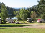
We hung around the campground this morning enjoying the nice sun and the camps wifi. In Clinton while filling up with fuel we got talking to a local guy who had ridden a motorcycle to Ushuaia, Argentina, you never can tell about people.
...click/tap to read the full postThe Mighty Fraser (Bull Canyon CG, Canada)
Journal entry for Sunday 21st Aug, 2016 (day 27, miles 3,198)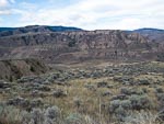
There was some cloud in the sky this morning and threat of rain (which eventually arrived) as we got onto the road for a pleasant drive through a series of valleys and eventually along an escarpment beside the Fraser River with really spectacular views. Finally the road dropped off the escarpment and down to a steel bridge across the river where to our surprise we met up with the motorcyclists from last nights camp. There after followed a discussion about our proposed route. They thought they had found the correct road but it was rough and boulder covered, so not to their liking.
...click/tap to read the full postBoring (Dugan Lake CG, Canada)
Journal entry for Monday 22nd Aug, 2016 (day 28, miles 3,287)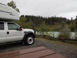
Not a very interesting day. After a fast drive from last nights camping spot (the first of the two photos below) to Williams Lake we spent over half the day in the car park of either Walmart or Canadian Tire catching up on "business".
...click/tap to read the full postDéjà Vu (Greeny Lake, Canada)
Journal entry for Tuesday 23rd Aug, 2016 (day 29, miles 3,354)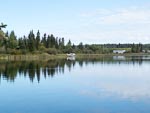
As we headed to our chosen camping spot this afternoon, Greeny Lake near Lac La Hache, it dawned on us that we stayed at this very same park on our way north in 2009. A quick look at our blog confirmed this and even gave us a date 3/31/2009. As you can see from the pictures below conditions today are a bit different from that previous visit.
...click/tap to read the full postBackroad wanderings (Howard Lake, Canada)
Journal entry for Wednesday 24th Aug, 2016 (day 30, miles 3,416)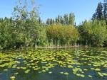
We spent the day following various backroads past a series of picturesque lakes finally arriving at Howard lake for our nights resting place.
...click/tap to read the full postMushrooms (Latremouille Lake, Canada)
Journal entry for Thursday 25th Aug, 2016 (day 31, miles 3,511)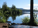
Our backroad wanderings continued today and a series of logging and other gravel roads led us past a series of lakes. The wet nature of the countryside produced a good supply and variety of fungii and the bright sunshine had us more than a bit carried away with the photography.
...click/tap to read the full postBears and Beavers (Deadman Lake, Canada)
Journal entry for Friday 26th Aug, 2016 (day 32, miles 3,610)
We continued our wanderings this morning heading south along forest roads from Bridge Lake with the plan on getting to the area around Castle Rock Hoodoos Provincial Park. But that proved a little more challenging than we had expected as we had to reconcile differences between various maps. The result of this resolution was that we ended up traveling along Brigade Creek Fire Service Road. It was clear from the start of this 12 mile section of road that it was little used as there were no tire marks in the sand, an impression that was eventually reinforced by a series of fallen trees blocking our path. So we spent some of our time either pulling trees off the road with the front winch or simply pushing them out of the way with the front bumper. The final mile of the road was a steep descent into Deadman Creek and we were nervous for a while that we would be faced with an impassable crossing of that creek; but all was well.
...click/tap to read the full postA nice lakeside camp (Leighton Lake CG, Canada)
Journal entry for Saturday 27th Aug, 2016 (day 33, miles 3,669)
It was raining this morning, and the road was now muddy, as we traveled North along Deadman Valley to Vidette Resort. We just wanted to get as far up the valley as we could to see if we could unravel some of yesterdays navigation confusion.
...click/tap to read the full postStarting the day with a short hike (Princeton, Canada)
Journal entry for Sunday 28th Aug, 2016 (day 34, miles 3,784)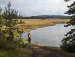
We got off to a healthy start today with a 3 mile hike around the lake, pleasant weather and nice views. Thereafter the day was about getting to Princeton. Though of course we chose not to follow the obvious highways but instead chose Kane Valley Rd, Voght Valley Rd, and Otter Lake Rd to Tulameen.
...click/tap to read the full postA visit with friends and family (Vaseux Lake, Canada)
Journal entry for Tuesday 30th Aug, 2016 (day 36, miles 3,895)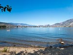
We spent a couple of nights with some of Nina's Canadian family at their house on Vaseux Lake in the Okanagan region of BC. They were kind enough to conduct us on a tour of a few of the local vineyards, show us some of the local wild life, as well as allow us to enjoy the tranquility of their loverly lakeside cottage.
...click/tap to read the full postLakeside living (Summerland, Canada)
Journal entry for Wednesday 31st Aug, 2016 (day 37, miles 3,983)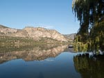
Just a short drive today to a resort town called Summerland situated on the western side of Lake Okanagan. This is a really popular vacation and retirement place. The campground we stayed seemed to be fully occupied by "permanents" and advertised itself as "affordable lakeside living". The travelers like us that wanted a nights camping got relegated to the "grass area" without facilities.
...click/tap to read the full postTrain trestles (Kelowna, Canada)
Journal entry for Friday 2nd Sep, 2016 (day 39, miles 4,027)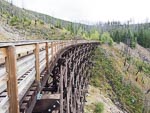
We spent the nights of September 1st and 2nd with some more of Nina's Canadian family in Kelowna. We were more than a bit spoiled by this visit, a house with fabulous views, king sized bed, great food and lots of "catching up". On Friday (2nd) our hosts took us for a tour of the area including a nice long walk along part of the old Kettle Valley Railway. This was originally a spur line from the Trans-Cancada to link towns of the Okanagan Valley into Canadian commerce rather than have then ship goods in and out through the US. The line is now a cycle and walking track, with the highlight being the many wood trestles.
...click/tap to read the full postThe last weekend (Sugar Lake, Canada)
Journal entry for Saturday 3rd Sep, 2016 (day 40, miles 4,120)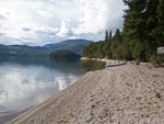
After saying our goodbyes this morning we made our way through surprisingly thick traffic into downtown Kelowna to do some shopping and then north towards Vernon before turning onto Highway 6. A little bit past Lumby we turned off the highway and headed towards Sugar Lake Recreation Area wondering whether we would be able to find a camping spot. It was, after all, the labor day weekend in a sense the last weekend of summer.
...click/tap to read the full postMore language lessons (Nakusp Hot Springs, Canada)
Journal entry for Sunday 4th Sep, 2016 (day 41, miles 4,237)
A nice relaxing day wandering along some of the lesser highways of British Columbia. We saw our first bunch of logs in a river/lake getting ready for transportation, caught a ferry and spent some time watching an Osprey (I think thats what it was) fly around its enormous nest waiting for us to depart. Late in the day we arrived at Nakusp Hot Springs. I had been keen to sample the hot water but one look at the crowd put me off, more like a stew than a spa. Having forgone the bath we decided to take a camping site at the place and thereby got another language lesson when the manager asked if we wanted a 'hydro' site we answered NO thinking a hydro site must be one with water. It was only later that we realised in British Columbia 'hydro' is a synonym for electricity as for many years BC Hydro was the only producer and distributor of electricity.
...click/tap to read the full postAnother beautiful forest walk (Crawford Bay, Canada)
Journal entry for Monday 5th Sep, 2016 (day 42, miles 4,330)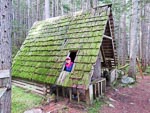
We started our day in an energetic and healthy manner taking a long walk (5 miles) along a forest track that once (before 1960) was the only access, by horse back, to the hot springs. As you can see from the photos the walk presented us with a lot of mushroom opportunities. By the time our walk was over the campground was pretty much deserted and throughout the mornings drive we saw lots of RVs and cars carrying camping gear on the road presumably heading home.
...click/tap to read the full postClosed and cold (Palmer Bar Crk, Canada)
Journal entry for Tuesday 6th Sep, 2016 (day 43, miles 4,447)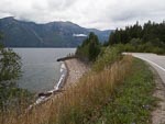
Cool and windy today with occasional rain. Already, just a few days after labor day we see campgrounds and other tourist attractions closed for the season. The wind was good for someone however. This afternoon we stopped for a break at a Provincial Park and watched while a group of sail-boarders made the most of the wind.
...click/tap to read the full postBiggest Truck (Kananaskis Trunk Road, Canada)
Journal entry for Wednesday 7th Sep, 2016 (day 44, miles 4,590)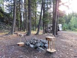
A few photos this morning of last nights camping spot and the nearby bridge with a small hole in the deck and then back on to Highway 6 toward the resort town of Fernie. Along the way we stopped to look at Th Biggest Truck in the World in the mining town of Sparwood, though from what I can see on google the Belaz 75710 (built in Belarussia) with a payload of 496 tons is a more likely candidate for the title.
...click/tap to read the full postFirst snows (Willow Rock CG, Canada)
Journal entry for Thursday 8th Sep, 2016 (day 45, miles 4,735)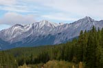
It rained a bit overnight and was overcast this morning and the road was wet and hence muddy as we continued north of 940. Late morning we connected with Highway 40 (also called the Kananaskis Trail), a spectacular drive surrounded by mountains that eventually connected with Highway 1 just east of the town of Canmore. Highway 40 provided a herd of mountain sheep for our entertainment and the first snow falls of the trip.
...click/tap to read the full postNew family members, new camera (Cochrane, Canada)
Journal entry for Friday 9th Sep, 2016 (day 46, miles 4,811)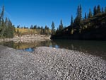
This morning was bright, clear and cool, and we started the day with a short hike along a trail from the campground. The fall colors are really in evidence now. After our exercise we headed towards Calgary with the goal of shopping for a new camera for Nina before spending the night with Yvonne and Gary, some of Nina' Canadian family.
...click/tap to read the full postVisit with friends (Calgary, Canada)
Journal entry for Saturday 10th Sep, 2016 (day 47, miles 4,841)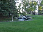
Another visit today, this time with Bernie (a friend we met in South America) and his partner Heather at their house in the south of Calgary. We spent a delightful afternoon and evening with B&H, reminiscing with Bernie about our South America experience and getting to know Heather a little better. They were kind enough to take us on a walk of the area around their house including a nice stroll through the Bow River Valley.
...click/tap to read the full postBack to the mountains (Lake Louise, Canada)
Journal entry for Monday 12th Sep, 2016 (day 49, miles 4,982)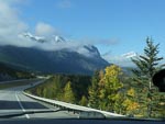
Yesterday we drove back up into the mountains and stayed at a campground in Lake Louise, but no photos as the day was a bit of a loss from the weather point of view. But today with better weather, bright sun, we backtracked a bit to visit Banff and generally absorb the spectacle of the mountains. This also gave Nina a chance to experiment with her new camera, and ask a zillion questions -- how do I &
...click/tap to read the full postThe Icefields Parkway (Jasper, Canada)
Journal entry for Tuesday 13th Sep, 2016 (day 50, miles 5,131)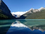
Today I am going to mostly let the photos do the talking, they are more eloquent than I can be. As you might guess from those same photos we started the day with a visit to the lake and hotel at Lake Louise and then drove the Icefield Parkway to Jasper. We were blessed with glorious weather, bright sun and not a cloud in the sky. It was an opportunity to try out Nina's new camera that we could not resist.
...click/tap to read the full postLast look (Kinky Lake, Canada)
Journal entry for Wednesday 14th Sep, 2016 (day 51, miles 5,206)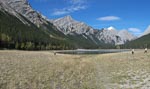
Another glorious day, though with a little cloud. We started the day with a drive on the Malign Lake Road and found a hike that took us to two lakes, Beaver Lake and Summit Lake. Again we used this as an opportunity to experiment with the new camera. This was obviously encouraged by the great light and spectacular scenery. You will note in photo 8 that with the use of the camera's panorama mode Nina was able to make 3 of me.
...click/tap to read the full postTo Edmonton (Spruce Grove CG Edmonton, Canada)
Journal entry for Thursday 15th Sep, 2016 (day 52, miles 5,390)We spent today driving the road to Edmonton. We tried in the town of Hinton to get Nina a "nail job" but all the places we tried either did not do nails anymore or were booked out. Eventually she phoned a place in Edmonton (the value of the internet) for tomorrow.
...click/tap to read the full postNina gets her nails done (Long Lake Prov. Park, Canada)
Journal entry for Friday 16th Sep, 2016 (day 53, miles 5,498)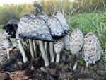
By the time the nail job was complete and we had stocked up on groceries it was after lunch. At that point we had not finally decided exactly where we would go but as the afternoon proceeded it became clear we wanted (over the coming couple of days) to go as far north as Fort McMurray.
...click/tap to read the full postBusy highway and oversized loads (Crow Lake Prov. Park, Canada)
Journal entry for Saturday 17th Sep, 2016 (day 53, miles 5,498)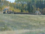
We started today with a nice long walk in the forest (and rain) near the campground and found a good example of a beaver felled tree. Once underway we made our way into the little village of Boyle for a fuel top-up before starting the stretch of road to Fort McMurray. Not far out of Boyle highway 63 turned from a rural road into a new 4 lane freeway/motorway/expressway (whatever you want to call it) clearly built to handle the demands of the energy industry, indeed we passed a number of oversized loads during the curse of the day as well as seeing many heavy transporters returning south. I was a bit captivated by the trailers and their many wheels, at one point we caught a photo of a returning combination with two prime-movers (at pulling and one pushing), 26 axles on the trailer and 8 wheels on each axle.
...click/tap to read the full postOil sands and wild fire (Engstrom Lake Prov Rec Area, Canada)
Journal entry for Sunday 18th Sep, 2016 (day 55, miles 5,614)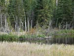
We were a bit surprised to see that there was less traffic this morning as we completed the drive into Fort McMurray. Sunday does seem to make some difference to the pace of activity in this energy boom-town area. The big interests today were oil sands and the wildfire that devastated Fort McMurray earlier in 2016.
...click/tap to read the full postBoreal forest and beaver (Winston Churchill Prov. Park, Canada)
Journal entry for Monday 19th Sep, 2016 (day 56, miles 5,895)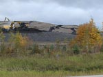
I should have mentioned the boreal forest in a earlier entry a that is what we have been traveling through the last few day. Short skinny black spruce tree, birch and aspen now turning vivid yellow and the occasional stands of larch (tamarack) that look like pine tree that are turning with the fall. Around Fort McMurray the forest was obviously burned from the wildfire earlier in the year but even in these blacked tracks there were patches of yellow and green where some trees survived and in many places under the blacked spruce new grass could be seen.
...click/tap to read the full postFarm land, boom towns, and time for laundry (Meadow Lake Prov Park, Canada)
Journal entry for Tuesday 20th Sep, 2016 (day 57, miles 6,042)
We visited the towns of Lac La Biche and Cold Lake today. A grocery resupply in La Biche and laundry in Cold Lake. They both gave the impression of being little boom towns, a small "older part of town" with lots of new shops and facilities grafted on the side. Lots of new pickup trucks and surprisingly large car dealerships.
...click/tap to read the full postShopping spree (Unnamed Campground Meadow Lake, Canada)
Journal entry for Wednesday 21st Sep, 2016 (day 58, miles 6,158)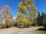
We drove all the way back to Cold Lake this morning to go on a shopping spree for some clothing. Nina needs socks and gloves and I need socks and long johns. These proved amazingly difficult to get as "the winter stuff is not in stock yet".
...click/tap to read the full postBears 4 + 1 (Lac La Plonge, Canada)
Journal entry for Thursday 22nd Sep, 2016 (day 59, miles 6,309)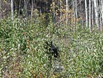
We took a few photos of the campground this morning as the light was great and the water on the lake incredibly still. Thereafter a series of minor highways (!!) before joining Hwy 155 north to a place on our map called Beauval. Along 155 we saw a number of bears, one small clearly brown bear scurrying off the road away from the traffic, one black but unfortunately dead on the side of the road and just before Beauval a mother black bear and two cubs. Unfortunately no really good photos.
...click/tap to read the full postGray sky, gravel road (Gravel Pit Hwy 2, Canada)
Journal entry for Friday 23rd Sep, 2016 (day 60, miles 6,426)The sky was gray this morning as we set out along Hwy 165 and it was not long before the rain started and proceeded to set in for the day. Thus the day turned into a long drive along a surprisingly good quality gravel road.
...click/tap to read the full postIn PA (Prince Albert, Canada)
Journal entry for Saturday 24th Sep, 2016 (day 61, miles 6,541)It was still raining this morning with a light mist so that driving south towards Prince Albert was like being in a green/grey tunnel.
...click/tap to read the full postScenic road (Baldy Lake, Canada)
Journal entry for Sunday 25th Sep, 2016 (day 62, miles 6,654)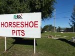
Today turned out to be sunny, as predicted by the weather app on our phones and making it a good day for us to leave Prince Alert and travel the section of Highway 120 to Candle Lake which was marked as a scenic road on one of our maps. The good light also gave Nina a chance to get a few photos of the PA Exhibition grounds and some of its more notable sights.
...click/tap to read the full postLarch trees and lakes (Hanson Lake, Canada)
Journal entry for Monday 26th Sep, 2016 (day 63, miles 6,799)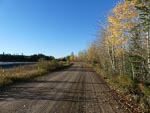
We got a bit obsessed today with both Larch trees (also called tamarack) and lakes. Why you might ask. Well the larch trees are abundant along the side of the highway, some green and others various shades of yellow. We spent a good deal of time photographing them in the hope of capturing the color and structure of these beautiful trees. Also later we discovered from google that they are the only deciduous conifer, dropping their needles in the winer after turning yellow. There was also a touch of nostalgia for us in these trees as we drove through many Larch forests in Mongolia in 2013.
...click/tap to read the full postFlin Flon, the shield, graffiti (Iskwasum Lake, Canada)
Journal entry for Tuesday 27th Sep, 2016 (day 64, miles 6,933)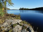
Today we were traveling over the the precambrian shield or Laurentian shield "a large area of exposed igneous and metamorphic rocks that form the ancient core of the North American continent". We probably transitioned onto this geological feature sometime yesterday but it became more evident today with frequent outcropings of rock visible in the wet lands on the side of the road. The shield is rich in minerals and was the impetus for the founding of the twin towns of Creighton and Flin Flon on the Saskatchewan - Manitoba border. These towns originated in 1914 when Tom Creighton discovered a massive copper/zinc ore body on the site of what would be these two towns. Flin Flon incorporated as a town in 1946 and granted city status in 1970.
...click/tap to read the full postWater falls, graffiti and Thompson (Thompson, Canada)
Journal entry for Wednesday 28th Sep, 2016 (day 65, miles 7,130)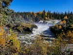
We were surprised this morning to find two side excursions to water falls (Wekusko Falls, and Pisew Falls), surprised because the land seems so flat that we had trouble imagining that anything could fall. But we should not have been surprised As these falls were not distinguished by the height of the fall but by the volume of water and power of the flow. Pisew Falls in particular was very impressive and unusually even Nina was impressed.
...click/tap to read the full postThompson museum, then backtrack south (Gravel pit South of Thompson, Canada)
Journal entry for Thursday 29th Sep, 2016 (day 66, miles 7,212)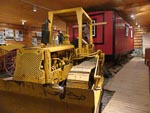
We made a short stop at the local museum on our way out of Thompson this morning and by examining some stuffed animals (a bob cat and a Lynx) confirmed that the animal we saw hunting a couple of days ago was certainly a Lynx. From the museum we retraced our steps south to a nice road side work area where we spent the night. We could not resist another visit to Pisew Falls and this time found the suspension bridge built by the Lions Club and gave access to the falls from the other side.
...click/tap to read the full postVegetarian bacon for dinner (Nth of The Pas, Canada)
Journal entry for Friday 30th Sep, 2016 (day 67, miles 7,339)
Not much to say about today. Our nice weather has gone so today is raining and misty. We stopped briefly at the town of The Pas for supplies then farther south we found another nice large gravel area just off the road for the night.
...click/tap to read the full postPhoto hickup (Lake Winnipegosis, Canada)
Journal entry for Saturday 1st Oct, 2016 (day 68, miles 7,463)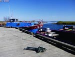
The weather improved today with sun and a mostly clear sky, which was good because our route is now taking us beside Lake Winnipeg and Lake Winnipegosis. We found a nice roadside camping for the night beside one of the rivers feeding the lakes. Unfortunately no photos as we had a bit of a hick-up today and accidentally deleted most of the days imagesspan>. Nina miraculously resurrected the days photos.
...click/tap to read the full postOld Russian/Ukrainian (?) church (Winnipegosis, Canada)
Journal entry for Sunday 2nd Oct, 2016 (day 69, miles 7,620)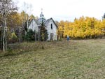
Still heading towards Winnipeg through the "lakes district". The weather was generally dreary today with lots of rain and often very heavy.
...click/tap to read the full postWinnipeg, Churchill and no polar bears (we thought!) (Churchill, Canada)
Journal entry for Sunday 9th Oct, 2016 (day 76, miles 6,158)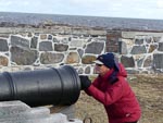
So what has been happening since Sept 30th, the date of the last entry. A couple of days after leaving Thompson the weather turned bad with really heavy rain. That prompted us to short circuit the plans we had for traveling some of the minor roads near Lake Manitoba and instead we headed pretty much directly to Winnipeg arriving there the afternoon of Tuesday 4th Oct. We took a place at a KOA camping ground on the Western side of the city and spent the remainder of the week on chores (oil change, hair do for Nina), visited some of Nina's relatives in Winnipeg and in nearby Steinbach, and preparing for our excursion to Churchill.
...click/tap to read the full postOne last look at the Badlands (Oliver Reservoir, Canada)
Journal entry for Saturday 15th Oct, 2016 (day 82, miles 9,236)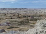
We spent sometime this morning exploring the badlands hoping for some good light and then it was "hit the road"
...click/tap to read the full postA Vancouver traffic jam (Vancouver, Canada)
Journal entry for Friday 6th Jul, 2012 (day 2, miles 220)Today was, unsurprisingly, not a very adventurous day and there is not much to write about. This will also be the case off and on over the next few weeks as we visit friends and relatives across Canada - interesting and enjoyable for Nina and I but not something that others will find of particular interest.
...click/tap to read the full postLake Buntzen (Langley, BC, Canada)
Journal entry for Saturday 7th Jul, 2012 (day 3, miles 245)We had much of the today to ourselves before a dinner date late in the afternoon. The Lonely Planet guide came to our rescue and we headed off early to Lake Buntzen, a reservoir created by the BC Hydro company.
...click/tap to read the full postGPS (SatNav) Troubles!! (Hope, Canada)
Journal entry for Sunday 8th Jul, 2012 (day 4, miles 355)Today was one of those perfect lessons in the importance of keeping your electronic devices (and their software) up to date.
...click/tap to read the full postThe Yellow Head!! (Sicamous, Canada)
Journal entry for Monday 9th Jul, 2012 (day 5, miles 573)From Hope last night we followed the Yellow Head highway (Hwy 5) to Kamloops, and then onto Sicamous.
...click/tap to read the full postTourists in the Rockies (Golden, Canada)
Journal entry for Tuesday 10th Jul, 2012 (day 6, miles 731)Another beautiful summers day started with a quick stop at the Last Spike Memorial (celebrating the completion of the Trans-Canada railway 1885) and showed the town of Revelstoke to perfection.
...click/tap to read the full postThe Zigzag Road (Field, Canada)
Journal entry for Wednesday 11th Jul, 2012 (day 7, miles 772)How would you react to a sign that tells you to reverse up to (or down to) the next turn?
...click/tap to read the full postGood bye to the Canadian Rockies (Bow Valley Provincial Park, Canada)
Journal entry for Thursday 12th Jul, 2012 (day 8, miles 881)Today we said goodbye to the Canadian Rockies with, yet one more picture of Lake Louise (it never looses its appeal or its crowds), a walk down the streets of Banff and then that drive out of the mountains.
...click/tap to read the full postBeers with Bernie (Calgary, Canada)
Journal entry for Friday 13th Jul, 2012 (day 9, miles 941)From last nights camp we had only a short drive of some 80kms into Calgary and our friend Bernie's house. We spent a hot afternoon drinking some beer and late in the afternoon finished the day off with a BBQ. Along the way Bernie took the yellow beast for a spin around the block.
...click/tap to read the full postCanola (Bow Valley Provincial Park, Canada)
Journal entry for Saturday 14th Jul, 2012 (day 10, miles 1,155)Today the prairies started for real. Oceans of green and yellow (canola crops), rolling country side and roads that go straight for miles at a time. The mix of green (wheat and other crops) and the yellow canola fields was the visual highlight of the day.
...click/tap to read the full postPrairie back roads (Climax, Canada)
Journal entry for Sunday 15th Jul, 2012 (day 11, miles 1,391)Prairie backroads, summer thunderstorms and grass as far as the eye can see, that was today.
...click/tap to read the full postGrasslands National Park (Point of interest, Canada)
Journal entry for Monday 16th Jul, 2012 (day 12, miles 1,666)We spent the morning traveling east along a mix of gravel and rough black-top backroads through picturesque farming and grass lands. Late in the morning we took a detour to Grasslands National Park an area set aside to be restored to pre-farming conditions with natural grass and indigenous animals.
...click/tap to read the full postWhat day is it ? - S@#it! (Steinbach, Canada)
Journal entry for Tuesday 17th Jul, 2012 (day 13, miles 2,049)What day is it? It is Tuesday the 17th July. S@#it we are supposed to be in Winnipeg by 3:00pm today to meet someone at the airport!
...click/tap to read the full postThree Jims and a Dave (Serpent River, Canada)
Journal entry for Friday 27th Jul, 2012 (day 23, miles 3,535)OK, so today we got our battery problem fixed (I think). Thanks to Roger and Matt at Global Expedition Vehicles we were put in touch with Welch's RV Service a local Sault Ste Marie RV sales and service business. There we met Jim the manager and big Dave the technician who worked on our camper. Early in the diagnosis and repair process a second Jim arrived. A previous owner of a Unimog 404 he was curious about our yellow monster. After a little conversation he offered to buy us coffee at the cafe next door. There we met our third Jim of the day (the owner of the cafe).
...click/tap to read the full postThe Big Nickel, an upside down Dane (Samuel de Champlain Park, Canada)
Journal entry for Saturday 28th Jul, 2012 (day 24, miles 3,738)Sudbury Ontario has been an active and important nickel (and other minerals) mining town for well over 100 years. The extent of past and present mining is easily seen from the huge piles of spoil piled up around the town, in some cases they look like mountain ridges. In more recent times Sudbury has made an effort to diversify and increase tourism and to this end has built a mining/geological exhibition called Dynamic Earth (also known as the Big Nickel) and a general science exhibition known as ScienceNorth. The Big Nickel is a bit of a pun. There was a mine here at one time called the Big Nickel but now there is in fact a large (that is a very large) replica of a Canadian Nickel on a pedestal out front of the Dynamic Earth building. While observing this wonder we met a Danish lady named Barbara standing on her head in front of the nickel (her friend, also a Dane, named, Anne Marie was taking her photo). Seems being photographed head standing in front of sights around the world is her thing.
...click/tap to read the full postWalmart+McDonalds and Quiche for dinner (Ottawa, Canada)
Journal entry for Sunday 29th Jul, 2012 (day 25, miles 3,938)Today for the first time I noticed that here in Ontario (and maybe Canada) Walmart stores have a McDonalds restaurant attached. I am sure that in the US it is a Subway. In any case that proved convenient today as McDonalds has free wifi and gave us a chance to catch up on the website. Before getting underway this morning we got into conversations with quite a group of people who were curious about our vehicle, wanted to take a photo and look inside. We sometimes feel we are getting a bit tired of telling the same story but the people are friendly, the curiosity natural and we better get used to it for it will happen in other parts of the world as well.
...click/tap to read the full postNew plan, new "country" (Trois Riviere, Canada)
Journal entry for Monday 30th Jul, 2012 (day 26, miles 4,141)This morning our plans changed (or at least solidified), the catayst was a conversation with another traveling couple (Gerry and Joy from Mississauga) who told us about the ferry from Blanc-Sablon to St Barbe, NewFoundland. This route will require us to travel the remote trans Labrador Highway (made up of highways 389, 500, and 510) and was just the trigger we needed to make a decision about how or whether to visit NewFoundland. It is approximately 2500 kms from Casselman (where we met Gerry and Joy) to the ferry at Blanc-Sablon and we are allowing 10 days for the journey.
...click/tap to read the full postRV Parking lot, Cirque du Soleil, movies on silos (Quebec City, Canada)
Journal entry for Tuesday 31st Jul, 2012 (day 27, miles 4,224)Today we wanted to make a short visit to the old part of Quebec City (founded in 1608 it is the only walled city in the US/Canada), but where to park. Fortunately Google provided a possible answer, a parking lot in downtown Quebec right on Bassin Loise that (apparently) was suitable for RVs, so off we headed. Our GPS lead us right to the place and sure enough there were a lot of RVs already parked there. Quickly we found out that the parking fee for RVs was C$65 per 24 hours and almost as quickly decided we would stay the night here and devote the remainder of the day to sightseeing. The lot is an amazingly convenient spot for a base, we are only a short walk (maybe 15 minutes) up hill to the old walled city and Chateaux Fontenac. The blue and yellow big top tents of Cirque du Soleil are just across the road, and just down the street is a big complex of grain silos that become a projection screen for outdoor movies. It seemed every RV owner in Quebec (other than us) knew about this place because by 10:00pm the place was packed with motorhomes and camping trailers, probably over 200 of them.
...click/tap to read the full postDead end on 175 and then the Chemin de fauve, (Near Malbaie, Canada)
Journal entry for Wednesday 1st Aug, 2012 (day 28, miles 4,488)Our destination today was Tadoussac along supposed scenic route 175 and then a gravel cutoff road to the coast and highway 138. The trip along 175 was scenic, through the granite hills of the Laurentian Mountains and the gravel cutoff road was a good test of the beast with some rough sections, but about 26 kms into our gravel trial road we encountered Pont ferme. That closed bridge destroyed the days plan. We had to backtrack almost to Quebec city before getting onto 138, about 6 hours to be back in QC.
...click/tap to read the full postParking rules, installing signs, and seaside camping (Baie-Comeau, Canada)
Journal entry for Thursday 2nd Aug, 2012 (day 29, miles 4,654)There was a fog in the valley of the St Lawrence this morning which sometimes spilled over onto the road way as we continued towards the ferry over the Fjord du Saguenay and the town of Tadoussac on the north shore of the fjord. For us Tadoussac was simply a stop for internet and fuel though for others it is a center for whale watching. We ran a foul of local parking ordinances but after some discussion the police lady who was threatening to give us a ticket instead lead us (on her motor scooter) to the top of town and a gravel parking lot next to a skate park (coordinates for other hapless RV drivers who get stuck in this town are N48.14757 W69.71359)
...click/tap to read the full postHydro power, big trucks and loose nuts (Road to Labrador City, Canada)
Journal entry for Friday 3rd Aug, 2012 (day 30, miles 4,941)Heading out of Baie-Comeau north to cross the 50th and 51st parallels today we got an abrupt introduction to northern roads. The first 60km was marked by one of the roughest sealed roads we have ever driven and one that twisted around small lakes with almost continuous short but steep (10-12%) climbs and descents. Fortunately the road improved after 60km. Hydro power is the other signature feature of this road. Large power line towers march beside the road as far as the 200KM where sits the 5th hydro station of the day Manic 5. These power stations get their name from the Manicouagan River which in turn is fed by the Manicouagan Reservoir a large circular lake clearly discernible on a map, this is the 5th largest meteor crater in the world.
...click/tap to read the full postMilestones, 5000 miles, 1 month, Labrador City (Gravel Pit Hwy 500, Canada)
Journal entry for Saturday 4th Aug, 2012 (day 31, miles 5,076)A day of milestones. We have been on the road one calendar month, traveled 5000 miles and reached Labrador City at the western end of the Trans-Labrador highway. It was also a day of gradually changing terrain. We started the day with a continuation of the hilly granite country with its myriad lakes where the road was forced to twist and climb around the terrain. As the day progressed the terrain flattened somewhat, the lakes were joined by large areas of wetlands (I think what they call muskeg in Alaska) so that at times the road seems to be forced through the lakes rather than around them. Interspersed between the lakes are some impressive rivers. The forest continues to be an endless carpet composed mostly of what I think are black spruce, the same kind of trees we saw on the road to Inuvik. To our surprise there has been a lot of sealed road today, some of it brand new, and even the gravel (more accurately packed earth) we have encountered has been in good condition allowing (our) highway speeds.
...click/tap to read the full postRain, road works and lunch with fellow travelers (Another Gravel Pit, Canada)
Journal entry for Sunday 5th Aug, 2012 (day 32, miles 5,271)Rain, wind and lower temperatures this morning gave us an opportunity to test the various heating systems in the vehicle. So in turn we tried the hydronic to heat water (for a shower) and then to heat the camper, next the generator and small electric heater, and finally the heating strip in the air conditioner.
...click/tap to read the full postTilts, traps and Mina Hubbard (Gravel Pit, Hwy 510, Canada)
Journal entry for Monday 6th Aug, 2012 (day 33, miles 5,484)Another wet morning, more Black Spruce tundra and more gravel road brought us to the (twin .. adjacent?) towns of Goose Bay and Happy Valley. All the shops were closed, but fortunately not the gas station and visitors center. A further 30 kms north was the Town of North West River where we spent an informative couple of hours learning about the fur trade (at the Labrador Heritage Museum) and the ethnic origins of the peoples of the region (at the Labrador Interpretation Center). It is hard to credit but settlement of Labrador and its meager population of 51,000 owes its existence to the fur trade (or more accurately a fashion craze in Europe for felt hats made from beaver pelts). Approaching from the north and the Hudson Bay was the British strategy for gaining access to the furs of Canada in the face of French domination of the Quebec City region and the St Lawrence. North West River was a key stop along the fur trading routes as it has access to the sea via Lake Melville and the narrows near Rigolet. The Museum is housed in the old Hudson Bay Company store building and contained many artifacts from a way of life that is not all that distant for the folks of this town. As recently as the 1940s trapping fur was the main livelihood of many residents. We learned about tilts, small wooden buildings about the size of a 2-man tent, The trappers built these along their trap-line at 1-day intervals. We also learned about Mina Hubbard the wife of Leonidas Hubbard who (after a failed and fatal attempt by her husband) became the first European to map the interior of Labrador in 1905.
...click/tap to read the full postThe Atlantic Ocean, and defrosting the fridge (Port Hope Simpson, Canada)
Journal entry for Tuesday 7th Aug, 2012 (day 34, miles 5,682)Today it felt like we drove through the same patch of country and road almost all day. Gravel road, tundra dotted with lakes and rivers, and outcroppings of granite (a general sensation of repetition familiar to anyone who has driven in inland Australia). However at the end of the day we were rewarded for our patience with the arrival of the Atlantic Ocean at the town of Port Hope Simpson. The real Atlantic mind you, not just a lake that is connected by a series of channels to the Atlantic like North West River but the real honest to goodness ocean. The slight let down was that we were also greeted by the worst sections of road so far in Labrador. An intimidating and discouraging start to anyone embarking on a trip across Labrador from the East via the NewFoundland ferry.
...click/tap to read the full postMore history, this time fishing (Mary's and Battle Harbors, Canada)
Journal entry for Wednesday 8th Aug, 2012 (day 35, miles 5,710)Where North West River told the story of Labrador from the perspective of the fur trade, todays visits to Battle Harbor (an island) from Mary's Harbor (mainland) showed it through the lens of fishing. From the early 1500s Europeans (English, Basque, French, Portuguese) came to the shores of Labrador to fish for Cod, Salmon, Seal and whale. Battle Harbor was one of the major venues where these catches were processed ready for sale to merchants and shipment back to Europe. At one time there were hundreds of small fishing villages along the coast of Labrador supported primarily by Cod (and other) fishing. But in the 1960s reductions in the fish stock caused the end of the Cod fishing industry and the demise of many of the fishing villages. Battle Harbor (we are told is a corruption of a Portuguese word battel or boat) has been taken over by The Battle Harbor Historical Trust partly as an exercise in saving heritage and partly as a way of injecting some tourist dollars into the local economy.
...click/tap to read the full postBasques, old boats and black flies (L'Anse aux Claire, Canada)
Journal entry for Thursday 9th Aug, 2012 (day 36, miles 5,825)This morning we saw off the last of the gravel road on our way into Red Bay, a picturesque village on a rocky barren cove. This place is famous for the discovery (in 1978) of a Basque whaling galleon that sank here in the 1500s while laden with a seasons haul of whale oil. Interestingly the search for this vessel was triggered by documentary research conducted in the Basque region of France and Spain. This research unearthed not only the existence and sinking of this ship but also shed light on the existence and extent of Basque whaling operations in the new world. Apparently at the time (early-mid 1500s) the Basques were the only European nation actively hunting whales using small boats and harpoons. The two exhibits in Red Bay (one of the galleon and the other of the smaller whaling boat called a chalupa) were quite interesting and highlight Red Bays role as a major whaling settlement during the Basque period.
...click/tap to read the full postThe Rock, veggie patches, fire wood and Vikings (Hwy 432, Canada)
Journal entry for Friday 10th Aug, 2012 (day 37, miles 5,972)Disembarking the ferry at St Barbe we headed north following Highway 430 (called the Viking Route). For 20km the road followed the coast through well manicured villages and attractive though bleak and windswept coast and then headed inland. Along the roadside we encountered two sights that required later explanation from a local. The first were many areas set aside for the storage of firewood, some areas were well organized while others less so. We learned that these are generally personal (family) firewood supplies. NewFoundlanders are allowed to cut firewood in the forests and store near where it is cut for later use as winter heating. The second sight was more perplexing. We saw small plots of vegetable gardens beside the road. Later explanation informed us that, NewFoundland is known as The Rock for good reason; real soil is almost non-existent on the island. It happens that the construction of roadways creates a small area of fertile soil in the ditch beside the road. Locals make use of this rare soil and grow root vegetables there.
...click/tap to read the full postEarliest inhabitants (Shallow Bay, Canada)
Journal entry for Saturday 11th Aug, 2012 (day 38, miles 6,160)Traveling south today eventually brought us to the town and historic site of Port aux Choix, a prominent headland on the west coast of NewFoundlands Northern Peninsula. At this site Archeologists have found evidence of human habitation dating back 4400 years and almost continuous habitation since that time by no less than 5 different groups. The original peoples were a maritime culture (meaning they lived on fish and other sea food), these were replaced as the climate grew colder by two different groups of paleo-Eskimo peoples that lived on sea mammals. These in turn were replaced, as the climate warmed, by more modern Indian peoples. The 5th group was obviously European.
...click/tap to read the full postGros Morne, fellow travelers (Lomond CG, Canada)
Journal entry for Sunday 12th Aug, 2012 (day 39, miles 6,255)Gros Morne National Park is perhaps the premier park in NewFoundland. It is a massive granite mountain range that protrudes as much as 2000 ft above the coastal plain and is cut by steep fjord like valleys. One of the pieces of this mountain complex is famous among geologist as it is up-thrusted ocean floor. Study of these rocks (apparently) helped found the theory of plate tectonics.
...click/tap to read the full postA rainy travel day (Norris Arm, Canada)
Journal entry for Monday 13th Aug, 2012 (day 40, miles 6,441)Overnight the weather turned to rain and low cloud. That is the way it persisted all day as we traveled east. At Deer lake we picked up Canada's Highway 1 (or the THC as the signs here call it - Trans-Canada-Highway, we have not seen this road since Quebec City) and followed it all day until our campsite in the forest beside a pipeline near Norris Arm.
...click/tap to read the full postGeorges tire shop (Butter Pot CG, Canada)
Journal entry for Tuesday 14th Aug, 2012 (day 41, miles 6,499)Fog and rain diverted us this morning and we abandoned our plans to visit Twillingate. We consoled ourselves with the observation that both the Iceberg and Whale seasons are already over. Instead we headed into Gander to find a truck tire shop and to have the two drivers side tires swapped or 'rotated'. After some searching we found Professional Tire Service and its owner George who quickly had the beast jacked up and the tires off and swapped around. It was interesting to watch the workmen maneuver the heavy tires on-and-off the hubs with the dexterous use of a large tire iron. I think I will have to find a place to practice.
...click/tap to read the full postMost easterly point, Signal Hill, Quidi Vidi, fish and chips (St John, Canada)
Journal entry for Wednesday 15th Aug, 2012 (day 42, miles 6,775)A packed day of sightseeing. We started with Cape Spear the most easterly point on the North American continent. The weather did not cooperate as it was wet and windy, but that did not reduce our enthusiasm. We see this as the start of our East-West journey around the world, so in that sense today was the start of the "real" trip.
...click/tap to read the full postSea birds, a night on a ferry (Argentia Ferry, Canada)
Journal entry for Thursday 16th Aug, 2012 (day 43, miles 6,942)Today we were scheduled to take the ferry from Argentia, NewFoundland to North Sydney, Nova Scotia. However yesterday Nina decided that she wanted to visit Cape St Mary's Ecological Reserve before we arrived at the ferry. This entailed an early start to the day, so by 5:30 am we were on the road. St Mary's Reserve is at the end of a very scenic coastal road that passes through a mix of open moor land and low forests that is sparcely populated. The reserve itself is on the barren headland of Cape St Mary's and is marked by a small collection of buildings and a still operational lighthouse. From the Reserve entrance it is a short walk to the bird colonies that make this place famous. Crowded onto one pinnacle of rock (and overflowing onto surrounding cliffs) are 5 different species of birds estimated to number something like 70,000 in total. The birds seem to understand that their rock tower affords them protection because our mainland cliff top, vantage point was only about 100ft from the colony but they seemed to take no notice of us.
...click/tap to read the full postCape Breton (Margaree, Canada)
Journal entry for Friday 17th Aug, 2012 (day 44, miles 7,085)The ferry arrived much earlier than we had expected and released us onto Novo Scotia at 4:00 am into the dark of a heavy rain storm seasoned with fog. We fumbled our way onto Highway 105 (which is the Trans-Canada-Highway in this part of the world) and followed it for 20 miles until a lookout gave us a place to stop and catch some of the sleep we did not get on the ferry.
...click/tap to read the full postVisitors, Shubie Park, Halifax (Dartmouth, Canada)
Journal entry for Monday 20th Aug, 2012 (day 47, miles 7,323)Saturday morning from Margaree we got a late start as we had a stream of visitors; the consequence of camping at a lookout. One visitor, a gentleman from NY with his white dog, is retired and lives in NS for part of the summer. The dog was very friendly, liked having his ears scratched, and afforded us a dose of borrowed pet.
...click/tap to read the full postKilts, sally ports and loopholes (Panmura Island, Canada)
Journal entry for Tuesday 21st Aug, 2012 (day 48, miles 7,497)An early start, a quick visit to a local Staples store to print some documents, and then a visit to the Halifax Citadel. As mentioned in the previous entry this is a large stone fort that sits atop the prominent hill around which Halifax is situated. Construction started in 1820 and it was completed in 1860, the fort's primary purpose was to protect against a land attack. The citadel was passed from the Canadian Army to the Canadian National Parks in the early 1950s to prevent the local Halifax citizens demolishing it so that the hilltop could be turned into car parking. The structure is in very good condition and today is garrisoned by volunteers who dress and act the role of the British Highland Regiment that originally garrisoned the fort. We took a short tour with one of the "soldiers". He explained the purpose of the sally port (a narrow door through which soldiers could exit the citadel center to enter the musket gallery) and loopholes (narrow vertical slits in the walls of the musket gallery through which soldiers could fire their weapons at the attacking enemy)
...click/tap to read the full postWalking, sand dunes and city tour (Stanhope CG, Canada)
Journal entry for Wednesday 22nd Aug, 2012 (day 49, miles 7,598)A glorious sunny day saw us driving through picturesque country side and small villages toward the north coast of PEI and St Peters Bay. On the east shore of the bay is the Greenwich section of PEI National Park which boast beaches, parabolic sand dunes and a floating board walk. Our initiation into this section of the park was a trip to the very large visitors center building where we learned about the action of the wind that formed the sand dunes and ended with a 10 minute novel video that was viewed from a gallery and projected onto the floor. A visit to the beaches and dunes entailed a 3 mile stroll through a lovely mix of grass lands, forests and over that floating board walk. The board walk crossed a large fresh water pond that is formed behind the first rank of dunes. All in all a pleasant walk.
...click/tap to read the full postGreen Gables and Blue Angels (Cape Jourimain, Canada)
Journal entry for Thursday 23rd Aug, 2012 (day 50, miles 7,684)Anne of Green Gables, a well know book by Louise M Montgomery, was set in a fictional house and property called Green Gables. That setting was inspired by a house in the town of Cavendish PEI owned by the authors grandparent's cousins. That site has been a major tourist destination for nearly 100 years and is now administered by the Canadian National Parks service. This morning we joined the throngs and paid homage to girl-hood fantasy. We spent a pleasant hour touring the house (decorated as described in the book) and wandering the grounds including the famous haunted woods. Like everything we have seen on PEI the setting was sunny, warm and tranquil.
...click/tap to read the full postFundy mud, big tide (Calhoun Marsh, Canada)
Journal entry for Friday 24th Aug, 2012 (day 51, miles 7,843)The Bay of Fundy (the body of water that separates New Brunswick from Nova Scotia) boasts the largest rise and fall between low and high tide of any place on earth with a record of 16.2 meters recorded at Noel, NS. These extreme tides are explained by the shape of the bay itself which causes the incoming Atlantic tide to backup within the bay. Today we got a chance to experience the tide swing of Fundy with a visit to Hopewell Rocks a Provincial Park on the western (New Brunswick) side of the bay. Hopewell is famous for its Flowerpots. Segments of forested coastal cliffs that have been separated from the mainland and stand just yards off shore like pillars of stone and rock topped with a small garden. The experience at Hopewell is that at low tide one can stroll among the flowerpots with the gardens way overhead, whereas once the tide comes in these same pillars become small forested islands. An additional attraction for the children among us (both young and old) is to walk out into the bay into the soft, fine-grained but very sticky mud that at low tide seems to go for miles.
...click/tap to read the full postPort of Halifax (Halifax, Canada)
Journal entry for Friday 2nd Jun, 2017 (day 80, miles 74,370)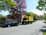
Our flight from Glasgow to Halifax on May 31st turned out to be a long drawn out affair. Initially scheduled as an early-ish flight at 9:30 am we did not actually get into the air until 3:30pm, so by the time we finally got to Halifax we were more than a little zombie like and hence we did not focus on anything except finding some food at a restaurant close to our AirBnB and sleep.
...click/tap to read the full postOn the road again (Richibucto, Canada)
Journal entry for Saturday 3rd Jun, 2017 (day 81, miles 74,581)We had planned on traveling along the Fundy coast after leaving Halifax. The Fundy is famous for its large tides with daily swings of 40 feet being common. But the weather was poor, cold, wet and gray. So we changed our minds and after leaving Nova Scotia we headed generally North along the coast of New Brunswick.
...click/tap to read the full postBackroads and a Moose (Grand Falls, Canada)
Journal entry for Sunday 4th Jun, 2017 (day 82, miles 74,756)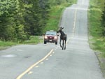
Our route today took us a little farther north (to Miramichi) and then west to Grand Falls along a series of minor and sometimes bumpy roads. It was nice to be back in "the wilderness" after Europe and we were rewarded with a brief glimpse of a young moose.
...click/tap to read the full postThe St Lawrence (Levis, Canada)
Journal entry for Monday 5th Jun, 2017 (day 83, miles 75,002)Not much to say about today. We continued generally west from Grand Falls skirting the US border, eventually arriving at the major highways that follow the south side of the St Lawrence. Then turned south to follow those highways ending the day at the town of Levis where we camped at a small gas station.
...click/tap to read the full postVancouver to visit some friends and relatives (Vancouver, Canada)
Journal entry for Saturday 28th Mar, 2009 (day 15, miles 2,189)We could not resist a walk around the town of Leavensworth, the cute always seems to win out over the kitsch. We were a bit early at 9:30 so most of the shops and businesses were closed; probably a good thing as we didn't need to find any more Washington souvenirs.
...click/tap to read the full postSome visiting and then leaving Vancouver (Along the Sea to Sky Highway, Canada)
Journal entry for Sunday 29th Mar, 2009 (day 16, miles 2,296)We had morning coffee with Brenda and a bit more catching up and then we had to leave to make our next visit.
...click/tap to read the full postA visit to Whistler and along the Duffy Lake road (Hwy 99 Near Lilloet, Canada)
Journal entry for Monday 30th Mar, 2009 (day 17, miles 2,403)We continued along Hwy 99 this morning into Whistler. The highway is much improved from a few years ago with a lot more 4 lane sections but there was still a tremendous amount of construction and road work going on. I sure hope they get it all done before the Olympics in 2010.
...click/tap to read the full postEmbarking along the Cariboo gold trail (Greeney Lake, Canada)
Journal entry for Tuesday 31st Mar, 2009 (day 18, miles 2,558)From our camp we continued north west along highway 99 following Cayoosh Creek. The river valley was really spectacular, winding river, steep sides, and rocky crags atop the mountains all covered in fresh snow. As a consequence the road was twisty and steep in places, even in this weather there was road work in progress and signs along the way identified a number of projects to start once the weather improved. We were surprised that neither of us had much memory of this part of the road.
...click/tap to read the full postToday we got laughed at by the locals (twice) (Prince George, Canada)
Journal entry for Wednesday 1st Apr, 2009 (day 19, miles 2,752)I was cold during the night and had to crank up the propane furnace. When I got out of the vehicle in the morning I understood why. The thermometer showed 25°F and the ground which was muddy the previous evening was frozen solid. The puddles of water had ice 3/8 inch thick on top. So I estimated the temperature was something like 20°F during the night.
...click/tap to read the full postA business and catch up day in Prince George (Prince George, Canada)
Journal entry for Thursday 2nd Apr, 2009 (day 20, miles 2,752)Last night seemed like a warm night so we were surprised to see about 4 inches of fresh snow in the morning.
...click/tap to read the full postCamped beside another frozen lake, this one with several fishing holes in the ice. (Co-op Lake, Canada)
Journal entry for Friday 3rd Apr, 2009 (day 21, miles 2,919)Today we traveled west on highway 16 towards Prince Rupert. The day was clear and sunny, although cold with temps around 28°F, until late in the afternoon. Last night was cold as the muddy roads in the camp ground were as hard as concrete this morning.
...click/tap to read the full postToday it's mountains and maples. (Forest Road near old Hazelton, Canada)
Journal entry for Saturday 4th Apr, 2009 (day 22, miles 3,088)The clear sky of last night pushed temperatures down to 16-17°F, but by the morning the sky was overcast signaling a, slightly, warmer day.
...click/tap to read the full postDown the Skeena River to Price Rupert and seals on ice (Prince Rupert, Canada)
Journal entry for Sunday 5th Apr, 2009 (day 23, miles 3,316)Some how I lost this entry. I cannot recreate the text, but I can put the images back.
...click/tap to read the full postNina's Alaska (Lakelse Provincial Park, Canada)
Journal entry for Monday 6th Apr, 2009 (day 24, miles 3,505)Seagulls by the thousands, eagles by the dozens along the Naas River on the way to Gingolx. (Gingolx, Canada)
Journal entry for Tuesday 7th Apr, 2009 (day 25, miles 3,629)After a late start we drove back to the town of Terrace and again headed for the Safeways cafe and their free wifi service. Terrace is now very familiar and I was beginning to feel like I was having a 3 week vacation in this town. However Terrace just happens to be at the junction of some interesting side trips and we keep coming back to Safeways because we like/need to have internet access.
...click/tap to read the full postToday I had to rescue Nina from a roadside snow heap, and the Cranberry connector road was (for us at least) impassable because of snow. (Cassiar Highway rest area, Canada)
Journal entry for Wednesday 8th Apr, 2009 (day 26, miles 3,890)From our overnight spot beside the highway we drove back up the Naas valley in low cloud and mist to the junction with the Nisga'a highway and into the town of new Aiynash. There was not a lot to see on the way because of the weather but the sea birds could be heard squawking away.
...click/tap to read the full postA pleasant day spent in Stewart,BC and Hyder, AK (Stewart, Canada)
Journal entry for Thursday 9th Apr, 2009 (day 27, miles 3,960)At Meziadin Junction we confirmed that the gas station was closed and discovered that everything was covered in several feet of snow. It was a good thing that we had not planned on staying there last night, as we had at one point discussed, as there was no where to park.
...click/tap to read the full postThe road goes ever on - and it's difficult to get off. (Kinaskan Lake, Canada)
Journal entry for Friday 10th Apr, 2009 (day 28, miles 4,130)Driving back up highway 37A today from Stewart to Meziadin Junction the same caterpillar loader was still clearing snow debris from the roadway. It must be a big and costly job keeping that road open during winter.
...click/tap to read the full postTelegraph Creek road - another unexpected gem (Telegraph Creek Road, Canada)
Journal entry for Saturday 11th Apr, 2009 (day 29, miles 4,307)Back on the treadmill this morning. The forests of small and sparse spruce trees is even more evident this morning and there is definitely less snow on the ground emphasizing the colder winters and lower precipitation of this area.
...click/tap to read the full postMoose, Caribou and we finally make it to the Yukon and the 60th parallel. (Watson Lake, Canada)
Journal entry for Sunday 12th Apr, 2009 (day 30, miles 4,518)Again the ground that was muddy last night is as hard as a rock. As we soon discovered this also meant the gravel road back to Dease Lake was frozen hard making for good driving.
...click/tap to read the full postA change of plans, and we meet a trapper. (Whitehorse, Canada)
Journal entry for Monday 13th Apr, 2009 (day 31, miles 4,790)The campground manager told us this morning that it had been 18°F minimum overnight, and again the ground was frozen this morning. But the day dawned clear, blue sky and bright sunshine.
...click/tap to read the full postA late start from Whitehorse, and then some big - frozen - rivers. The Yukon, Pelly, Stewart, and Klondike. (Dempster Junction, Canada)
Journal entry for Tuesday 14th Apr, 2009 (day 32, miles 5,108)Today we had our longest driving leg of the trip so far, from Whiethorse to Dempster Junction. As indicated in yesterdays entry the reason for this is to start the Dempster Hwy while the ice bridges to Inuvik are open.
...click/tap to read the full postA big day, the first leg of our trip to Inuvik (Eagle Lodge, Canada)
Journal entry for Wednesday 15th Apr, 2009 (day 33, miles 5,338)We were somewhat excited and apprehensive this morning. We have heard and read so many stories about the Dempster highway and its challenges and magnificent scenery.
...click/tap to read the full postInuvik - Cross the Arctic circle, two ice bridges and the Yukon to Northwest Territories border. (Inuvik, Canada)
Journal entry for Thursday 16th Apr, 2009 (day 34, miles 5,571)Overnight it snowed a few inches so this morning the world looks clean in the bright sunshine and blue sky. Unfortunately the water system froze up overnight and the pump is leaking again. So until we get to Fairbanks we will be using water from a 5 gallon plastic container.
...click/tap to read the full postTuktoyaktak, the ice road, and the the Arctic Ocean. (Tuktoyaktuk, Canada)
Journal entry for Friday 17th Apr, 2009 (day 35, miles 5,689)A tour of the Inuvik recreation center and then south to sub-arctic territory (Eagle Lodge, Canada)
Journal entry for Saturday 18th Apr, 2009 (day 36, miles 6,039)We stayed in the Capital motel in Inuvik again last night; and it is amazing just how much stuff we managed to take out of the motor home and into our room in just one night. It felt like repacking was a major project.
...click/tap to read the full postDawson City - we are the first RV of the season. (Dawson City, Canada)
Journal entry for Sunday 19th Apr, 2009 (day 37, miles 6,296)This morning it was still snowing, and now the road north was closed for sure as the big yellow boom gate was across the road and locked. Some had clearly not been as lucky as us as there were at least two trucks and one SUV parked just the wrong side of the gate.
...click/tap to read the full postA Hilltop View of Dawson (Whitehorse, Canada)
Journal entry for Monday 20th Apr, 2009 (day 38, miles 6,658)This morning before leaving Dawson City we drove up to a local lookout called Dome Hill which afforded a wonderful 360° panorama of the area and of the town sitting at the junction of the Klondike and Yukon rivers. From this vantage point the effect of mining for gold is evident, with numerous long winding mounds of river gravel and rock that are apparently the spoils of major dredging in the Klondike River.
...click/tap to read the full postA repair day (Whitehorse, Canada)
Journal entry for Tuesday 21st Apr, 2009 (day 39, miles 6,693)As luck would have it there was an RV parts and repair place almost immediately across the road from the RV park we stayed in last night. So just after 9:00am this morning we were in that establishment seeking parts.
...click/tap to read the full postThe Kluane Mountains (Kluane Lake, Canada)
Journal entry for Wednesday 22nd Apr, 2009 (day 40, miles 6,872)We are parked on a disused section of the Alaskan Highway at the northern end of Kluane Lake. To our west and south are the Kluane Mountains providing a wonderful view from this, otherwise ordinary, camp site. The day is sunny and clear with a chill breeze blowing.
...click/tap to read the full postLeaving Alaska (Whitehorse, Canada)
Journal entry for Sunday 17th May, 2009 (day 65, miles 10,951)Last night after the trip to Juneau we went to one of the local RV parks for the night. When we got there we could not find the manager so picked a site for ourselves and settled in for the night. This morning when we went to pay for our night, again we could not find the manager, indeed what we thought last night was the office, was actually the laundry. We only found the office by asking some of the other residents. Turned out to be a plywood door with a 4 inch nail as a handle - tells you something about the standard of this RV park. But still no manager, so we got a free night.
...click/tap to read the full postLong ago ... peoples place (Whitehorse, Canada)
Journal entry for Monday 18th May, 2009 (day 66, miles 11,099)In 1999 when we drove through this area we visited an exhibit of first nation lifestyle and Nina wanted to visit it again, but we could not remember where it was exactly or what it was called. When we drove through Whitehorse in April on our way north we saw a sign that looked promising but still could not find the place. On the Juneau trip two days ago we got lucky as one of the other guests knew of the place and gave us the name Long ago ... peoples place or Kwaday Dan Kenjii. So finding this place was on our agenda for today.
...click/tap to read the full postWaiting, and waiting, and waiting ..... for tires (Marsh Lake, Canada)
Journal entry for Tuesday 19th May, 2009 (day 67, miles 11,143)I decided to buy two new rear tires for the Tiger this morning. So I was up early and phoned a couple of the local tire shops, and as luck would have it one of them (KAL-TIRE) had in stock some Bridgestones compatible with the existing tires. So off we went to get them fitted. To cut a long story short we waited from 10:00 am until 4:00 pm, but eventually got our tires.
...click/tap to read the full postA visit to Atlin (Snafu Lake (Atlin Road), Canada)
Journal entry for Wednesday 20th May, 2009 (day 68, miles 11,302)Earlier in our trip we had bypassed Atlin with the thought that we should make that side trip later in the season when, we hoped, more things would be open and the lake might be blue rather than white. So at Jakes Corner, we made the turn and started the 98 km journey to Atlin. The day was clear, blue sky, and bright sun; a perfect day for this scenic road. Interestingly the lake was still partly frozen, with slushy ice covering a good proportion of the lake area.
...click/tap to read the full postAlong the Alcan to Watson Lake (Watson Lake, Canada)
Journal entry for Thursday 21st May, 2009 (day 69, miles 11,542)Today was a long drive from the Atlin Road to Watson Lake. In truth the scenery was splendid, as we passed numerous lakes and had views of mountains all day. But it is unfortunately true that after a while one gets accustomed to the scenery and its impact is lessened.
...click/tap to read the full postSoaking in the Hot Springs (Liard River Hot Springs, Canada)
Journal entry for Friday 22nd May, 2009 (day 70, miles 11,682)Our journey today followed the Liard River for much of the day from just outside Watson Lake to Liard River Hot Spring. We were surprised by the size of the river, it is wide and fast flowing.
...click/tap to read the full postDall sheep, black and brown bear (Beaver Lake, Canada)
Journal entry for Saturday 23rd May, 2009 (day 71, miles 11,901)The character of the road and terrain changed today. There were more mountains and they were closer. We were beginning to enter the northern Rocky Mountains. The road is more twisting and there are more rough spots.
...click/tap to read the full postA casserole disaster!! (Blackstone Territorial Park, Canada)
Journal entry for Sunday 24th May, 2009 (day 72, miles 12,085)We were quick to depart the clouds of mosquitos at Beaver Lake, but pulled into a clearing not far up the Liard Hwy to spend a couple of hours sorting through photos and composing some web entries.
...click/tap to read the full postA stuck D6, and breath taking water fall. (Sambaa Deh Park, Canada)
Journal entry for Monday 25th May, 2009 (day 73, miles 12,291)The Liard Highway finishes at Checkpoint, a now closed gas station and convenience store at the junction with the Mackenzie Highway. We turned west at this junction for a short side trip to the settlement of Fort Simpson, 60 km away and across the Liard River ferry - it's an ice bridge in the winter.
...click/tap to read the full postThe Mackenzie River is getting a bridge! (Yellowknife, Canada)
Journal entry for Tuesday 26th May, 2009 (day 74, miles 12,601)We pushed hard today to get to Yellowknife.
...click/tap to read the full postA day in Yellowknife (Tibbitt Lake - Ingram Trail, Canada)
Journal entry for Wednesday 27th May, 2009 (day 75, miles 12,661)We spent a considerable time this morning trying to get water to top up the Tigers water tank. At the campground we tried a number of options to fill from their water tank but there was not enough pressure to do the job. After further investigation we were directed to the town water plant that fills tankers for household water delivery, again no luck - this time they did not have a hose small enough for us. Only 2 inch diameter hoses for filling the trucks. So we eventually gave up on the water.
...click/tap to read the full postYellowknife (again) - and then south. (Kakisa - Mackenzie Highway, Canada)
Journal entry for Thursday 28th May, 2009 (day 76, miles 12,937)It was cold over night as this morning there was fresh ice at 1/4 to 1/2 inch thick on the lake. And I thought that we had escaped the cold weather. However the day is clear and bright, but chilly.
...click/tap to read the full postBelow the 60th parallel (Meander River, Canada)
Journal entry for Friday 29th May, 2009 (day 77, miles 13,162)During the morning we took a side trip to the town of Hay River, a prosperous little town near the southern end of great slave lake and on the Hay River. It is a transportation and service center particularly for the summer water traffic on Slave Lake. The town boasts the Purple High School. The town was moved to its current location when the original town located on the river flats was flooded in 1963.
...click/tap to read the full postFarmland and high wind (Winagami Lake, Canada)
Journal entry for Saturday 30th May, 2009 (day 78, miles 13,492)We stopped in the town of High Level this morning to get fuel, groceries and to see what the local visitor information center could tell us. The visitors center contained a small but interesting museum displaying relics of the past. As with a lot of these types of displays we both learned things - for example that washing day was the same day as pasta making day so that the starch from the pasta could be used to starch shirt collars - and saw things that we recognized from our own childhood - another hand operated cream separator.
...click/tap to read the full postBack into traffic, a mall, and a movie (Edmonton, Canada)
Journal entry for Sunday 31st May, 2009 (day 79, miles 13,744)Our route today followed a series of increasingly busy secondary rural roads through farm country. The wind of the past few days was still blowing strongly and occasionally small dust storms assaulted us.
...click/tap to read the full postThe Rockies, they really are something special! (Jasper (Pocahontas Campground), Canada)
Journal entry for Monday 1st Jun, 2009 (day 80, miles 13,984)We spent much of the morning and early afternoon exploring downtown Edmonton. Certainly not enough time for what appeared to be a wonderfully positioned city on the high northern banks of the Saskatchewan River. We did get a chance to walk along the river through Victoria Park. A lot of people were out walking, jogging and cycling. I guess the local citizens like to enjoy the limited sunny, warm weather when ever they can.
...click/tap to read the full postTourist for a day in Jasper (Mt Robson (Lucerne Campground), Canada)
Journal entry for Tuesday 2nd Jun, 2009 (day 81, miles 14,063)Another beautiful sunny day awaited us and we were away early, at least compared to our usual relaxed starts. After a brief stop in Jasper to make a few phone calls we found our way to the Jasper Tramway which lifted us up the side of Whistlers Mountain for a panoramic view of Jasper and its surrounds. From the upper station a trail continues a couple of kms and several hundred feet farther up the ridge to the summit of Whistlers. We spent an enjoyable hour hiking up the trail, admiring the scenery and soaking in the atmosphere. We had visited this region in 1976 and had a few adventures on the lower slopes of a couple of the local peaks, so we did more than a little reminiscing also.
...click/tap to read the full postA hike in the forest, lots of tourists with rented RVs (Jonas Creek Campground, Canada)
Journal entry for Wednesday 3rd Jun, 2009 (day 82, miles 14,118)After a leisurely start to the day we drove back into Jasper and spent some time in an internet cafe catching up on emails, our journal and various researches. Jasper was picturesque, with another bright sunny day really showing the mountains and the town at its best. It was with more than a little regret that we headed south down the Icefield Hwy out of Jasper. A little way south we stopped at a hiking trail around the five lakes and spent a couple of hours strolling through the pine forests and admiring the lakes; what a wonderful setting for some well needed exercise.
...click/tap to read the full postSmoke haze on the Icefield Hwy, visiting Ninas cousin in Calgary (Calgary, Canada)
Journal entry for Thursday 4th Jun, 2009 (day 83, miles 14,349)Our goal for today was to get to Calgary for a visit with Nina's cousin, so we got an uncharacteristically early start.
...click/tap to read the full postA day in Calgary - a FEDEX parcel problem!! (Calgary, Canada)
Journal entry for Friday 5th Jun, 2009 (day 84, miles 14,362)We spent the today in and around Calgary with Nina's cousin Yvonne. It could have been a rest day with time to do washing, catch up on emails, catch up on family doings and relax; but for Nina and Yvonne it wasn't. There was a FedEx parcel from Richard for us and it had to be cleared through Canadian customs; a task that proved surprisingly difficult and complex.
...click/tap to read the full post