Posts for category camping
On the road again - with apologies to Willie Nelsons (Sahagun, Colombia)
Journal entry for Friday 7th Aug, 2009 (day 147, miles 20,824)Checkout was 13:00 and we stayed at the hotel until almost that time doing a variety of packing, computing and shopping chores.
...click/tap to read the full postPolice checks and mountain springs (Taraza, Colombia)
Journal entry for Saturday 8th Aug, 2009 (day 148, miles 20,979)Our first night camping in Colombia was without problems; though the local roosters got active about 5:00 and ended our nights sleep earlier than we might have liked.
...click/tap to read the full postSpectacular mountain road and paragliders. (North of Bello, Colombia)
Journal entry for Sunday 9th Aug, 2009 (day 149, miles 21,125)The road started to climb almost from the start of todays travel and after we crossed the bridge over the Rio Cauca the climb was on in ernest. You might notice in the photo of the bridge the sand-bagged machine gun post at the far end of the bridge. We climbed from 500ft to over 9000 ft in less than 100 miles and got to 7000ft in about 30 miles.
...click/tap to read the full postNE from Medellin along a minor road, and intense Spanish practice (Porce, Colombia)
Journal entry for Monday 10th Aug, 2009 (day 150, miles 21,204)After a relaxed start we set about driving south through the center of Medellin. Our goal was to at least traverse the city using the main north-south road to get a little flavor of the place. As a goal we set ourselves a Texaco station on the southern side of the town that we had heard about as a potential over night stopping place. It was hectic following the traffic and trying to read the signs, but we were helped by the GPS and the free Colombia map we got on the internet. We found the Texaco and also got stopped by some transit police, they gave us the most thorough review of any police so far but in the end we were on our way with no troubles.
...click/tap to read the full postNarrow roads, truck stop chaos, and watching tire repairs (Near Lebrija, Colombia)
Journal entry for Tuesday 11th Aug, 2009 (day 151, miles 21,381)After our goodbyes this morning the road continued a winding climb. The streets in some of the villages were so narrow that home owners had erected posts made of 10 ft sections of railway track in front of their houses to protect then from passing trucks. In a couple of places there was a man with a flag to ensure that only one vehicle at a time tried to negotiate a particularly tight corner. Twice we were forced to back up to allow tanker trucks to pass. All very exciting!! And this is a toll road.
...click/tap to read the full postGoing the wrong way on cobbled streets, a cable car across Chicamocha Canyon (Chicamocha National Park, Colombia)
Journal entry for Wednesday 12th Aug, 2009 (day 152, miles 21,440)Our first destination today was the town of Giron said by our guide book to be noteworthy for its cobbled streets and white washed Spanish colonial buildings, and its beautiful central square. Our first effort to turn off the highway into Giron was less than successful, we turned into a nice cobbled one-way street the wrong way. Needless to say the street was narrow and took us about a dozen back and forward moves to get turned around while the local drivers encouraged us by sounding their horns, and squeezing around us while we tried to turn. Our second effort to turn in Giron ended in another nicely cobbled street, but a dead end. This time Nina asked a pair of moto (small motor cycles) riders where the entrance was and rather than explain one volunteered to lead us there. Well, the correct turn was a sharp 330° corner that we could only negotiate with a K turn. But the fun was not over. This town was founded in the early 1600, well before motor homes were thought of and the streets are narrow - at one point we passed between a pedestrian and a moto rider and both of them had to duck so as not to be hit in the head by our side mirrors.
...click/tap to read the full postMore Spanish Colonial (Barichara, Colombia)
Journal entry for Thursday 13th Aug, 2009 (day 153, miles 21,493)As you can see we did not travel far today.
...click/tap to read the full postCamping San Jorge, Villa De Leyva (Villa De Leyva, Colombia)
Journal entry for Friday 14th Aug, 2009 (day 154, miles 21,612)Back into San Gil this morning for a bit more internet business and to discover that yesterday we had missed the center of San Gil and its almost stationary traffic, and multitude of road works. There after we followed the highway through Barbosa towards Tunja and Bogota until early afternoon when we arrived at Arcabuco.
...click/tap to read the full postMore campers, a bike race, and luck in navigating (Embalse Del Neusa, Colombia)
Journal entry for Sunday 16th Aug, 2009 (day 156, miles 21,742)I think it would be accurate to say that today was a full day.
...click/tap to read the full postBump into old friends in a parking lot (Chia, Colombia)
Journal entry for Monday 17th Aug, 2009 (day 157, miles 21,779)The camping ground was much quieter this morning, with many of the cars of last night having departed sometime during the night. The campers that were still present were in the process of packing indicating that the holiday weekend was coming to an end. The road down out of the mountains was also much quieter with only a little bit of local traffic.
...click/tap to read the full postTrucks, trucks and more trucks up and down mountains (Armenia, Colombia)
Journal entry for Thursday 20th Aug, 2009 (day 160, miles 21,971)At the start of the day it seemed like it would be an easy 200 miles or so today, so we did not rush to depart and sat with our hosts, Gloria, Martha, Miquel chatting until well after 10:00 am.
...click/tap to read the full postAn unexpected breakfast with Deisy, driving through a banana plantation to a beautiful Hacienda (Hacienda Bambusa, Colombia)
Journal entry for Friday 21st Aug, 2009 (day 161, miles 22,006)The first task this morning was to get some minutes for my cell phone and lookup the internet for directions to Hacienda Bambusa. We found a Comcel shop on the road into Armenia and parked in a side street nearby. It took me about 20 minutes and when I returned to the vehicle Nina was nowhere to be seen. Then I heard a voice from a nearby house. Nina was inside talking to Deisy, the lady of the house, who was preparing hot chocolate and food for us.
...click/tap to read the full postParque del Cafe, Cali Sunday traffic (Cali, Colombia)
Journal entry for Sunday 23rd Aug, 2009 (day 163, miles 22,181)Leaving Bambusa was like jumping back into the fray after a nice respite.
...click/tap to read the full postMore hectic traffic, tight streets and a couple of old bridges (Popayan, Colombia)
Journal entry for Monday 24th Aug, 2009 (day 164, miles 22,274)We headed back into the Southern fringes of Cali this morning to visit Jardin Plaza on Carrera 100. An impressive modern mall with a Carrafours supermarket, a very large hardware store and many other clothing stores. Very up market. Wifi in the outdoor food areas. We stayed there much longer than expected as I was trying to buy some parts for the propane system as the time is approaching when I will have to figure out how to get our propane tank refilled or use a local gas bottle.
...click/tap to read the full postA small village market with our first experience of real indigenous dress, a very rough road. (Paletara, Colombia)
Journal entry for Tuesday 25th Aug, 2009 (day 165, miles 22,370)We headed north and then east along a minor road to the village of Silvia to see the Tuesday market. The Lonely Planet guide book suggested it. The road was another one of the now familiar twisting mountain roads that followed the side of a valley. However this road was not complete and we eventually came upon the road crew that is building the last few miles.
...click/tap to read the full postWhat a road!! (San Agustin, Colombia)
Journal entry for Wednesday 26th Aug, 2009 (day 166, miles 22,428)This morning was wet and somewhat miserable. Last night there had been some discussion about leaving both vehicles here for the day and catching a bus to San Agustin but Nina and I decided we would drive and Sandra and Bernie opted to come with us.
...click/tap to read the full postBack onto the Pan American Highway (Patia, Colombia)
Journal entry for Thursday 27th Aug, 2009 (day 167, miles 22,581)This morning we made an early start on retracing our steps along the slow road back to Paletara. The weather was better but the road was not. About 60 miles in all back to Paletara, the last 40 over dirt and the total trip took 5 1/2 hours. Lots of low range over big pot holes. There was more traffic on the road today almost all of it trucks carrying cattle or sacks of something. One truck driver stopped to warn us that there were guerillas on the road - at least that's what we think he said. But we had no problems.
...click/tap to read the full postVehicle problems (not ours), free roadside mechanics, we don't make the border!! (Pasto, Colombia)
Journal entry for Friday 28th Aug, 2009 (day 168, miles 22,679)As planned last night we were up and moving by 7:30am and made good progress south on slightly less twisting road than yesterday. The drive was simply spectacular as it passed through wide and deep valleys. There were sheer drops mere feet from the road way. As has been the case on most Colombian roads the scenery is spectacular but there are no places to pull off the road so any effort to enjoy the scenery has to be done from the moving vehicle. This does not make for good photographs.
...click/tap to read the full postOur first unassisted border crossing (Otavalo, Ecuador)
Journal entry for Saturday 29th Aug, 2009 (day 169, miles 22,856)We were out of the gas station by 8:00 am looking to get some propane and have the Tiger washed. For some reason at the 4 places we tried all said NO!. We drove a few miles north to a propane plant, they were willing to fill Bernie's portable bottle but initially said they could not fill the tank on the Tiger. However, after a while, and we think a discussion with the plant boss they story changed and I drove the Tiger into the plant. Like in Central America, at first, the plants pump could not force propane into the tank against the pressure of gas in the tank. But eventually they cranked up the pump pressure and we got topped up.
...click/tap to read the full postA spectacular camping spot, short drive, night time visitors! (Laguna de Cuicocha, Ecuador)
Journal entry for Tuesday 1st Sep, 2009 (day 172, miles 22,899)The equator (almost), down jackets, camping at 14,000 ft (almost). (Laguna Mojanda, Ecuador)
Journal entry for Wednesday 2nd Sep, 2009 (day 173, miles 22,931)We stayed at Cuicocha until late morning trying to get a good photo of the snow brushed tip of Mount Cotacachi. In the process a snow capped mountain emerged out of the clouds to our East. I guess from the map that it is Mount Cayambe at 5790 m. While at the lake we bumped into an Australian and two Swiss tourists who had come up to take the hiking trail around the lake. They gave glowing reports on their trips to the Galapagos Islands, so that is now back on Nina's agenda.
...click/tap to read the full postCross the equator into Quito (Quito, Ecuador)
Journal entry for Sunday 6th Sep, 2009 (day 177, miles 23,043)Another clear but windy morning in Otavalo. The wind is blowing dust everywhere. The last few days have been windy and dusty, so much so that I will be be pleased to get away from Otavalo's dust. Though I will miss the town.
...click/tap to read the full postSouth out of Quito and the Quilotoa Loop - Part 1 (Laguna Quilotoa, Ecuador)
Journal entry for Thursday 10th Sep, 2009 (day 181, miles 23,161)This morning we had to finally face the task of finding our way out of Quito to the south. This was always going to be somewhat of a challenge as the city is hemmed in on the east and west by mountains and hence it stretches south/north a long way. The challenge was increased by the fact that we only had a tourist map of the city and a map of the country. Nothing that showed the outer parts of the city in detail. It was around 8:30 by the time we got underway and over the course of the next hour we tried in turn each of the four main north-south trolley bus routes, starting with the eastern most and working our way to the west. Why did we do that? Not by choice. We either came to a police blockage to south bound traffic - to give north bound vehicles more lanes, or simply took the wrong turn. But in time the western route got us to the southern boundary of the city and back onto the PanAmericana. We must be becoming seasoned travelers as all of this was done without arguments or angst between driver and navigator.
...click/tap to read the full postAn extremely windy night, and another spectacular road. (Gravel Pit East of Sigchos, Ecuador)
Journal entry for Friday 11th Sep, 2009 (day 182, miles 23,202)Last night was windy, did I say it was windy last night. Not a constant steady wind but terrific gusts that shook the Tiger. At times I feared that a window might give way or the Thule luggage container on the roof would rip off and get carried away. The wind we felt in Atigun Pass on the way to Deadhorse, AK was stronger but we did not camp with that wind. This morning was cold, for the first time since leaving Canada we turned on the house heater. Outside temp was about 40°F but with the wind - at least 30 mph it felt much colder. Even the locals were rugged up.
...click/tap to read the full postBanos, a tourist town, almost non-existent roads, and a night in a hostel. (Banos, Ecuador)
Journal entry for Saturday 12th Sep, 2009 (day 183, miles 23,294)It's interesting how the days on the road vary, some are so mundane that there hardly seems to be anything to say, then others like today (and tomorrow - this is the hint that I wrote up two days at the same time) are so packed with sights, experiences and surprises that it seems impossible to capture even the basics.
...click/tap to read the full postAnd we thought we had been high before. Also starting the second 6 months on the road (Mount Chimorazo, Ecuador)
Journal entry for Sunday 13th Sep, 2009 (day 184, miles 23,369)As I hinted in yesterdays entry, today would prove to be another of those days that leaves one searching for words. Seems appropriate somehow that the start of our second 6 months on the road should be memorable - and it was.
...click/tap to read the full postBack on the PanAmericana (Alausi, Ecuador)
Journal entry for Monday 14th Sep, 2009 (day 185, miles 23,483)Neither of us slept well last night, and Nina was definitely suffering mild altitude sickness, with head ache and insomnia so we headed for lower altitude and Guaranda. We stopped just east of Guaranda on the road to Riobamba for Nina to sleep for a couple of hours, she was more her normal self after that.
...click/tap to read the full postAnd this is a major highway!! (Cuenca, Ecuador)
Journal entry for Tuesday 15th Sep, 2009 (day 186, miles 23,593)We stayed around Alausi for some time this morning doing some business on the internet. Then in bright sunshine we headed South along the main road to Cuenca. For many miles the road was in great condition with newly laid smooth pavement. And I was thinking how nice it was to be back on a major road rather than some of the rough routes we had followed in recent days.
...click/tap to read the full postFix up day (Cuenca, Ecuador)
Journal entry for Thursday 17th Sep, 2009 (day 188, miles 23,593)East and then North along the Orient Road (Mendez, Ecuador)
Journal entry for Saturday 19th Sep, 2009 (day 190, miles 23,734)We tried to get an early start this morning, but got delayed by an attempt at a last minute stop at the Mall De Rio - we are still not sure what time it opens, but its after 9:30.
...click/tap to read the full postA garden tour and lecture on Indian housing. (Puyo, Ecuador)
Journal entry for Sunday 20th Sep, 2009 (day 191, miles 23,861)The road between Macas and Puyo was on the whole new, and much better than we had anticipated, except for a small number of sections that still had to be made. Those sections were simply river gravel and rocks laid over what I assume to be the old dirt road. There were only a few sections of the unmade road and probably not more than a few miles in all. One of the more interesting bad parts of the road was the river crossing in the town of Sucua. there used to be a suspension bridge crossing the river, but that obviously collapsed some time ago as the remains are still lying on the ground and in the river. The replacement bridge is only one lane and hence impatient bus and truck drivers simply drive through the river - I presume until it is too deep.
...click/tap to read the full postBathing at Banos (Puyo, Ecuador)
Journal entry for Monday 21st Sep, 2009 (day 192, miles 23,936)Today we planned a return visit to the resort town of Banos, but this time approaching it along the Pastaza river valley from the East. It made for a leisurely day of driving as the round trip only racked up 75 miles. Starting in humid tropical conditions at 3000 ft in Puyo the road winds its way along the Northern wall of the Pastaza valley above the cliffs of the lower gorge and eventually climbs out of the tropical vegetation as it nears Banos at just under 6000 ft. It is an impressive road, a number of dripping tunnels and lots of tight turns. Also a number of places where it is taking a lot of hard work to keep the road from being swept from the mountain side by slides and rock falls. There are a number of narrow side roads that enable tourists with smaller vehicles than ours to visit local villages, water falls and other attractions. There were quite a few tourists, both young and old, riding bikes along the 12 km section of the road into Banos.
...click/tap to read the full postA tropical rain storm, cruise on the Rio Napo, and a jungle tour (Misahualli, Ecuador)
Journal entry for Tuesday 22nd Sep, 2009 (day 193, miles 23,994)Not long after leaving the Puyo area this morning we got a taste of our first tropical rain storm. The small rivers crossing the road were running full of brown water and puddles were building up in the villages and along the road side. This gave us a little sample of why the road builders are so keen on the road side drains we have seen everywhere.
...click/tap to read the full postTreating ourselves to some pampering (Papallacta, Ecuador)
Journal entry for Wednesday 23rd Sep, 2009 (day 194, miles 24,088)Today we headed for the thermal pools at Papallacta up in the mountains and on our way back to Quito, but before leaving the area we took a drive into the town of Tena to see another jungle park mentioned in our guide book. Tena is a sizable town that is becoming a significant tourist destination for those seeking a jungle experience or kayakers seeking access to the rivers and rapids of the area. It also looked like the town was trying to rebuild itself to cater to those tourists as roads were being dug up everywhere.
...click/tap to read the full postGalapagos here we come - well almost (Quito, Ecuador)
Journal entry for Thursday 24th Sep, 2009 (day 195, miles 24,134)Before leaving Papallacta this morning we treated ourselves to an hour in the baths, hot pools. While still part of the Termes De Papallacta, this was more basic. Just a series of nicely finished hot pools. It was cold (45°F) and drizzling, so one did not spend much time out of the warm water.
...click/tap to read the full postOn the way south, we see Chimborazo again (South of Riobamba, Ecuador)
Journal entry for Monday 12th Oct, 2009 (day 213, miles 24,279)We hung around the hostel most of the morning before making our way back to the Tiger at the parquedero and getting underway.
...click/tap to read the full postA BIG descent,and our first truly solo border crossing (Tumbes, Peru)
Journal entry for Tuesday 13th Oct, 2009 (day 214, miles 24,520)What a day!!.
...click/tap to read the full postPeruvian coast and a start of the desert (Desert South of Piura, Peru)
Journal entry for Wednesday 14th Oct, 2009 (day 215, miles 24,734)We had a few emotional moments in Tumbes this morning as Nina thought she had lost her ATM card, and then for a few moments feared the ATM had eaten the card she borrowed from me. While all finished up ok it was not a encouraging start to the day, but .. things improved from there.
...click/tap to read the full postA day of desert scenery, with interludes at the beach (Huanchaco, Peru)
Journal entry for Thursday 15th Oct, 2009 (day 216, miles 24,969)We had a very pleasant night, temperature in the mid 60°F's and no insects. Not what we had expected from a desert.
...click/tap to read the full postNarrow canyons and, more, amazing roads (Rio Santa, Peru)
Journal entry for Saturday 17th Oct, 2009 (day 218, miles 25,214)We were away early this morning heading for the mountain town of Caraz in the valley that lies between the Cordillera Blanco (snow covered) and the more westerly Cordillera Negro (not snow covered) mountain ranges. The route we chose travelled down the coast to Chimbote, then headed inland along "highway 12" through Huallaca, and the Canon Del Pato.
...click/tap to read the full postMore tunnels, and a quiet afternoon in Caraz (Caraz, Peru)
Journal entry for Sunday 18th Oct, 2009 (day 219, miles 25,220)We continued on the rough dirt road this morning to the village of Huallanca looking forward to the sealed road south to Caraz as described in the guide book. But alas the book lied, at least a little. After Caraz the road continued to be gravel but of a better quality as it climbed up into the Canon Del Pato. This was yet another amazing road. Built about 1913, presumably to put in the hydro power plant, it winds along the side of the canyon for maybe 6 miles and passes through 30 rough rock tunnels. At places the canyon (like the one yesterday) is less than 50 yards wide (about a 1/2 wedge shot).
...click/tap to read the full postNotario, lagunas, and a flat (Huaraz, Peru)
Journal entry for Monday 19th Oct, 2009 (day 220, miles 25,306)Before heading out of Caraz this morning we had a challenging and somewhat unusual chore to perform. Nina receives a pension from her time as a teacher in Australia. Every year the pension organization requires proof that she is still alive (I know it sounds like the Russell Crowe movie Proof of Life). She must fill in a form and get it witnessed. So this morning we set off to find a notario, the Latin equivalent of a US notary or Australian JP. That accomplished, with lots of laughs, we went to a post office to send the letter certificardo. It's amazing what a few words of Spanish, lots of miming, and some intelligent locals can accomplish.
...click/tap to read the full postGiant Puya Raimondii (Hwy 14, Peru)
Journal entry for Tuesday 20th Oct, 2009 (day 221, miles 25,413)So what are giant Puya Raimondii?
...click/tap to read the full postWhat a contrast! (Reserva De Lachay, Peru)
Journal entry for Wednesday 21st Oct, 2009 (day 222, miles 25,550)Words are going to fail me today.
...click/tap to read the full postLima - an unexpected stop (Lima, Peru)
Journal entry for Thursday 22nd Oct, 2009 (day 223, miles 25,623)When we left the camping ground at De Lachay this morning we had no intention of stopping in Lima; in fact we had spent most of the previous evening planning to get up early to try and miss the worst of Lima's notorious traffic.
...click/tap to read the full postDriving in Lima, then down the coast to Nasca (Nasca, Peru)
Journal entry for Friday 23rd Oct, 2009 (day 224, miles 25,923)This morning we decided to try and find an Acogas place we had read about where other travelers had purchased an adapter that allowed US fixed propane tanks to be filled at gas station GPL pumps (location details in the camping section below). This proved to be a challenging driving experience as it took us on some of Lima's busiest streets at rush hour. Also took us through some of the up market shopping areas. But it was successful; we got the fitting and a couple of hours later at a gas station filled our fixed tank with no trouble.
...click/tap to read the full postThose mysterious lines in the desert (Along the Cusco Road, Peru)
Journal entry for Saturday 24th Oct, 2009 (day 225, miles 26,014)There was never any doubt that we would take a scenic flight to look at those famous Nazca lines and figures, so that was the first item on the days "to do" list. I must admit that they are less impressive than I expected. The photos I have seen in places like National Geographic make them look bigger than they are in real life. Also there are lots of marks made by modern man that cut across the ancient lines and figures. But I am still pleased we took the flight, and the lines and figures are worth seeing. Even if smaller than expected you still can't help but ask yourself - why; why would a group of people make these figures ??
...click/tap to read the full postA long day, another unbelievable road, and we finally get to Cusco (Cusco, Peru)
Journal entry for Sunday 25th Oct, 2009 (day 226, miles 25,623)What an arduous day. We were on the road for over 12 hours (6:00am to 6:30pm) and covered 550kms over yet another amazing road. The scenery was simply awesome, and the road surface generally excellent. But the topography - has to be seen to be believed. The high point on the road before the town of Puquio was just on 15,000 feet, but altitude alone does not give the full picture. At least three times the road descended to 6,500 ft before climbing back to 13,-14,000 and each time both the climb and descent was achieved by what seemed like never ending switch backs. The climb out of Abancay was perhaps the most impressive of all. The town was at 6,500ft and within 30 km of road travel and no more than 10 kms of actual distance we were back at 14,000ft.
...click/tap to read the full postMachu Picchu (Aguas Calientes, Peru)
Journal entry for Wednesday 28th Oct, 2009 (day 229, miles 25,623)The day started with a bit of a mad rush. We got a taxi to Cusco's San Pedro station only to discover that our train departed from a different station 15 kms out of Cusco and that we had to be there is 20 minutes. So another taxi and a bit of hair raising driving; but we made it.
...click/tap to read the full postA change of plans (Road to Yauri, Peru)
Journal entry for Sunday 1st Nov, 2009 (day 233, miles 26,584)Today is proof that we don't plan a long way in advance.
...click/tap to read the full postA day on the antiplano (Chivay, Peru)
Journal entry for Monday 2nd Nov, 2009 (day 234, miles 26,790)The antiplano is the name for the high desolate plateaus of Peru, Bolivia and Chile; and that's pretty much where we spent the day. From our camping spot last night at a little over 13,000 feet we drove all day at altitudes between 11,000 ft and our high point of 16,000 ft. And desolate it is, dry, dusty and cold. With the temperature at times as low as 35°F and never about 60°F. But - there are small communities and even individual family groups scattered all over the antiplano making a living from a combination of agriculture and rearing llama, alpaca, and sheep. Plus all these scattered little settlements are served by buses. The bus services are all the more amazing considering the quality of the roads, they vary from good black top to terrible gravel and broken pavement. On the bad sections of roads the buses travel at speeds of 40 mph whereas the roads restrict us to 10-15 mph. Anyone interested in building a vehicle for rough roads should come talk to the Peruvian bus companies for some hints on suspension design.
...click/tap to read the full postThe Day of the Condors, Peru has a scale all its own. (Cruz Del Condor, Peru)
Journal entry for Tuesday 3rd Nov, 2009 (day 235, miles 26,845)We were on the road to Cruz del Condor by about 7:00 am as the condors, apparently, are only visible around 8:00 am and 4:30 pm, and we wanted to be there in time to see them this morning. Apparently so did every other tourist and tourist operator for 200 miles around as the road was busy. It was also rough with the traffic from tourist buses making heavy washboards in addition to the parts of the road that are simply creek beds. But to compensate for the roughness the drive was wonderful. It winds along the side of a very deep steep valley both sides of which are covered with terraced agricultural land, foot trails, and villages (with no road access). The scale of the terracing is hard to comprehend, particularly when one realizes that much of it has been done by hand over hundreds of years of farming.
...click/tap to read the full postArequipa to fix a flat (Imata Junction, Peru)
Journal entry for Wednesday 4th Nov, 2009 (day 236, miles 27,050)We had a nice quiet night at this spectacular lookout. We were more than a little curious as to how proceedings would get started this morning after discovering that there was no afternoon activity yesterday. The security guards arrived by bus about 6:00am and the first of the vendors about 6:30am but by 7:00am when we departed there were no tourists, not all the vendors, and no condors flying (presumably because the thermal air currents had not yet started). On the drive back to Chivay we passed dozens of large and small tourists buses. We concluded that Cruz Del Condor only operates from about 7:30 to 11:00 am each day.
...click/tap to read the full postPink Flamingoes, Puno, Titicaca and a parade (Near Santa Rosa, Peru)
Journal entry for Thursday 5th Nov, 2009 (day 237, miles 27,259)Last night was the coldest we have experienced since Alaska/Yukon. At 6:00 am after the sun had been on the vehicle for 45 minutes the trucks thermometer showed 22°F. The cold, and a desire to cover some distance today had us underway by 6:00am.
...click/tap to read the full postA Peruvian political protest, a bogged minibus, an old convent, and a sacrificial mummy. (Arequipa, Peru)
Journal entry for Friday 20th Nov, 2009 (day 252, miles 27,795)Throughout the night activity continued on the highway with more and more vehicles arriving and joining the line waiting for the road to be opened.
...click/tap to read the full postChile! (Arica, Chile)
Journal entry for Saturday 21st Nov, 2009 (day 253, miles 28,054)The drive out of Arequipa was stark and desolate. Big bone dry hills of sand and crumbling rock. But it set the scene for the days travel, all day we drove through variations on the theme of desert. If we had stayed on the coast in Peru we would have travelled through desert all the way from the Ecuador border and, from what we read, there is still many hundreds of miles of it to go in coastal Chile.
...click/tap to read the full postSunday in Arica, everything is closed. Relaxing on the beach! (Arica, Chile)
Journal entry for Sunday 22nd Nov, 2009 (day 254, miles 28,105)We awoke to a grey sky; sea mist in the mornings and evenings is apparently the norm in this part of the world - but eventually the sky cleared into a bright warm day.
...click/tap to read the full postThe Duty Free zone, we get a spare tire - finally! (Iquique, Chile)
Journal entry for Monday 23rd Nov, 2009 (day 255, miles 28,328)The drive to Iquique was about 200 miles and it turned out to be generally a good road through desert scenery. Just out of Arica we came to some very interesting structures called something like guardian angels, they were abstract sculptures that seemed to be made out of mud. The remainder of the drive went through a series of large dry valleys. In each valley, the road descended 2000 ft down to a small river and then climbed out again. This happened maybe 6 times. The valleys were dry, completely devoid of vegetation except on the floor where the small river flowed.
...click/tap to read the full postCoastal desert (North of Tocopilla, Chile)
Journal entry for Friday 27th Nov, 2009 (day 259, miles 28,481)We got a late start from Iquique as I wanted to hang around the flight school using their wifi to fix a problem that had developed with the software that downloads maps to our GPS. Got it fixed eventually but it left me with the feeling that maybe we have too much technology with us - you think!!
...click/tap to read the full post(El Tatio Geysers, Chile)
Journal entry for Saturday 28th Nov, 2009 (day 260, miles 28,687)Over the past couple of days we had been indecisive about our route after Tocopilla, would we or would we not head inland towards El Tatio Geysers. Well today we decided - El Tatio here we come. The downside of this decision, which we would later suffer with, was altitude. In one day this route would take us from sea level to 14,500 ft. As it turned out this was too much - but that's getting a bit ahead of the story.
...click/tap to read the full postEscape to lower altitude!! (San Pedro De Atacama, Chile)
Journal entry for Sunday 29th Nov, 2009 (day 261, miles 28,750)Well the effects of altitude did not diminish during the night. We both suffered from head aches and an in-ability to sleep - it made for a long and uncomfortable night.
...click/tap to read the full postSalt mountains, the tropic of capricorn, and a real hotel (Antofagasta, Chile)
Journal entry for Monday 30th Nov, 2009 (day 262, miles 28,961)Leaving San pedro this morning we had one of those delightful little surprises. Just outside the town was a sign pointing to a gravel side road with the sign Cordillera de la Sal. We spent about an hour negotiating our way along this track past various weird geological structures formed by salt pushing up the ground. Eventually we got stopped by deep sand and had to turn around. Our next expedition vehicle will have a better (ie higher) tire floatation in sand.
...click/tap to read the full postBureaucracy!! (Tal Tal, Chile)
Journal entry for Wednesday 2nd Dec, 2009 (day 264, miles 28,961)Last night Nina and I were talking about bureaucracy and which of the countries we have visited display the worst bureaucracy. This conversation was prompted by a conversation Nina had with her sister about the level of effort and paper work associated with moving their family back from Germany to Australia.
...click/tap to read the full postLots of beach side camping spots (Playa Flamenco, Chile)
Journal entry for Thursday 3rd Dec, 2009 (day 265, miles 28,961)Today we were simply heading south, trying to cover some miles. More desert scenery.
...click/tap to read the full postMilestones! (El Molle, Chile)
Journal entry for Friday 4th Dec, 2009 (day 266, miles 29,642)A long drive today trying to make some headway south. Today signaled the first of a few milestones, the vehicle ticked over 40,000 miles on the odometer, and we left the Atacama desert behind finally. Coming up in the next few days are 30,000 trip miles and S 30° latitude.
...click/tap to read the full postExploring the Rio Elqui Valley (E of La Serena, Chile)
Journal entry for Saturday 5th Dec, 2009 (day 267, miles 29,758)We continued up the valley this morning to the town of Vicuna. Quite a lovely place, clean and tidy with a wonderful main plaza with great old trees. We walked around for a while absorbing the atmosphere and soaking up the sun.
...click/tap to read the full postWe cross the 30th parallel. (Los Villos, Chile)
Journal entry for Sunday 6th Dec, 2009 (day 268, miles 29,940)A milestone again today - over the 30th parallel.
...click/tap to read the full postVina Del Mar, Valparaiso, and we logged our 30,000th trip mile today. (Parque Nacional de Campana, Chile)
Journal entry for Monday 7th Dec, 2009 (day 269, miles 30,122)Another milestone - 30,000 miles since Gig Harbor in just under 9 months
...click/tap to read the full postNowhere to stay in Santiago!! (Santiago, Chile)
Journal entry for Tuesday 8th Dec, 2009 (day 270, miles 30,233)Brakes, shock absorbers, and GPS map of Chile (Santiago, Chile)
Journal entry for Wednesday 9th Dec, 2009 (day 271, miles 30,267)Today was going to be another day of chores. First stop an organization named SALFA (the local Chevy dealer). We found one of their outlets near where we spent the night but it turned out only to be a sales office for very large Mack trucks. They sent us into the heart of the city to there light vehicle sales and service office. To cut a long story short, the Chevy people checked the brakes for us (did not need any work) but could not replace the shock absorbers as they did not have replacement parts. However they drove us to a local workshop that dealt in aftermarket parts and they were able to fit 4 new shocks. Mind you this took all day. But the tiger feels a lot better with the repairs.
...click/tap to read the full postAnother day on the Santiago metro (Santiago, Chile)
Journal entry for Thursday 10th Dec, 2009 (day 272, miles 30,323)This morning we discovered that we left one set of keys at the workshop that replaced the shocks. What a drag - we had to drive all the way back into central Santiago to get them.
...click/tap to read the full postResting in the sun, Nina has a cold (Islote de Gaviotes, Chile)
Journal entry for Friday 11th Dec, 2009 (day 273, miles 30,399)We did not travel far today. Nina has a cold and needs to rest in the sun. So we drove from our gas station just west of Santiago to the coast to a camp ground near Laguna Verde. We found the camp ground from a tourist brochure.
...click/tap to read the full postJust moving South (Talca, Chile)
Journal entry for Sunday 13th Dec, 2009 (day 275, miles 30,697)Today everything was closed, even the toilets at the gas station, for the presidential election. Guess this is another good excuse for a day off.
...click/tap to read the full postAnother milestone - 9 months on the road (Lautaro, Chile)
Journal entry for Monday 14th Dec, 2009 (day 276, miles 30,948)It's 9 months today since we left Gig Harbor, seems amazing that we have been living in this little vehicle for so long. When I look at the map I am a little surprised by the distance we have travelled and even more surprised when I contemplate the return journey - I think it will take another 9 months.
...click/tap to read the full postStart of the Lakes District - wonderful! (Pucon, Chile)
Journal entry for Tuesday 15th Dec, 2009 (day 277, miles 31,041)Today we left Highway 5 (the Panam) for an excursion East into a region of lakes and volcanos. The country side is now very temperate in appearance, rivers large and small, evergreen trees, lush pastures and spring flowers.
...click/tap to read the full postExploring the back country around Pucon (Lican Ray, Chile)
Journal entry for Wednesday 16th Dec, 2009 (day 278, miles 31,126)After a slow start, partly caused by me wandering off to an internet cafe without telling Nina where I was, we headed off looking for a minor road that would (we hope) circumnavigate Volcan Villarrica and lead us to Laguna Lican Ray the next lake south. The scenery was lush pastures, fine stands of evergreens and crystal clear rivers and a few minor water falls. The road turned out to be a little rough and gave us a chance to experience the positive effect of new shock absorbers. We even got to take the Tiger on some real 4x4 road - but only a little way. We could not complete the traverse to Lican Ray as the road became impassable to a vehicle as big as the Tiger. So we retraced our steps back to Villarrica and took the opportunity to do some chores, washing clothes, and washing the Tiger.
...click/tap to read the full postTermas Geometrica, and Argentine insurance (Panguipulli, Chile)
Journal entry for Thursday 17th Dec, 2009 (day 279, miles 31,186)It was a beautiful morning with the sun shining off the glassy waters of the lake, and the occasional small wavelets washing the black sand beach. This really is a lovely setting for a campground.
...click/tap to read the full postArgentina - a very easy border crossing (San Martin de Los Andes, Argentina)
Journal entry for Friday 18th Dec, 2009 (day 280, miles 31,268)We left Panguipulli about 10:00am maybe a little later than expected after the usual chores, fuel, internet, groceries and a few last photos. It is a really nice little town, not particularly touristy.
...click/tap to read the full postA day of lakes and crystal clear water (Lago Villarino, Argentina)
Journal entry for Saturday 19th Dec, 2009 (day 281, miles 31,308)Today was sunny, but with a blustery cool wind. We spent the morning in San Martin shopping and looking around and then headed south down highway 234, also called the Ruta de Los Siete Lagos (route of 7 lakes) towards San Carlos De Barioche. As the name promised we spent the remainder of the day driving past and viewing lakes, the rivers that feed/drain them, plus some spectacular mountains. Really a very pleasant day.
...click/tap to read the full postWonderful scenery!! (San Carlos De Bariloche, Argentina)
Journal entry for Sunday 20th Dec, 2009 (day 282, miles 31,428)We continued our tour of Argentine lakes, rivers and mountains today.
...click/tap to read the full postWhat an indulgence!! (Llao Llao, Argentina)
Journal entry for Monday 21st Dec, 2009 (day 283, miles 31,441)We set out from the campground today to explore west along the lake shore with the intension of eventually stopping in Bariloche to look around. Oh how plans can change. We drove past a number of scenic lakes and called into the famous hotel LLao LLao just to have a look at the place. It's really grand, with a great location on a hill with commanding views of lakes and mountains. While having coffee and chocolate in one of the restaurants we asked ourselves- why not stay here for a night?. Within 10 minutes we had a room.
...click/tap to read the full postAn excursion South of Bariloche. (El Bolson, Argentina)
Journal entry for Tuesday 22nd Dec, 2009 (day 284, miles 31,536)We used up all of our minutes at the hotel this morning leaving right on check out time of 11:30 making the most of hot showers, a sumptuous buffet breakfast, and that last click on the internet.
...click/tap to read the full postA tight squeeze into our hotel!! (Bariloche, Argentina)
Journal entry for Wednesday 23rd Dec, 2009 (day 285, miles 31,620)Today we drove back to Bariloche. The weather turned wet and miserable for the first time we can remember. As a result we checked into the Hotel Tirol a day earlier than originally planned. They had space in the back for us to park but the entrance way was really tight. We had to fold the mirrors in on the sides and I would guess there were only a couple of inches spare on top. The manager was very nice about it and tried to help us with directions.
...click/tap to read the full postTiger body damage (Entre Lago, Chile)
Journal entry for Saturday 26th Dec, 2009 (day 288, miles 31,753)We got off to a bad start today. On the exit from our hotel parking place we had to go through a narrow gate. The gate posts were about 3 inches wider than the Tiger. But the driveway was not level so part way through the gate the Tiger tilted and bumped into the left hand post causing some damage to the house body and damaging the plastic panel where we put in fuel.
...click/tap to read the full postThe Island of Chiloe. (Ancud, Chile)
Journal entry for Sunday 27th Dec, 2009 (day 289, miles 31,944)We joined up with the Panam Highway at Orsono late this morning and followed it south with a small side trip to explore the town of Fruitilla, then around a peninsula (jutting from the west into Lago LLanquihue), and back to the Panam. The drive was pleasant through nice green country side. The weather was cold, grey and wet - not really encouraging for getting out and seeing things.
...click/tap to read the full postQuaint German type churches. (Castro, Chile)
Journal entry for Monday 28th Dec, 2009 (day 290, miles 32,061)The weather had improved over night so we could explore the camping ground before leaving without getting wet. It was in a wonderful position right on a headland with fine views of the ocean. Like many camp grounds we have seen in Chile it was once an impressive facility and a substantial investment but over the last probably 10 years there has been little maintenance and now it looks run down.
...click/tap to read the full postThe end of the Panamericana - Ruta 5 (Quellon, Chile)
Journal entry for Tuesday 29th Dec, 2009 (day 292, miles 32,222)The end of today brought us to the town of Quellon and a big milestone; the end of the Panamerican Highway. It runs 29,000 miles (though different versions of the route are different lengths see - Pan American Highway) from Prudhoe Bay or Fairbanks Alaska to Quellon. Chile and is called Ruta-5 along much of its length. Now we can't claim to have driven the entire Panamerican as often we have travelled by lesser side roads, but we have certainly travelled the distance.
...click/tap to read the full postNorth bound, for a little while. (Ensenada, Chile)
Journal entry for Wednesday 30th Dec, 2009 (day 292, miles 32,425)Today we are heading north to the towns of Puerto Varas, and Ensenada to meet up with the Canadians (Sam and Bernie) that we met in Colombia and Iquique Chile.
...click/tap to read the full postAnother (uneventful) border crossing (Bariloche, Argentina)
Journal entry for Sunday 3rd Jan, 2010 (day 296, miles 32,661)We eventually got underway after saying our goodbyes to Sam and Bernie. The weather was cloudy and so we did not see anything of Volcan Orsorno as we drove along its flanks.
...click/tap to read the full postButch Cassidy and the Sundance Kid?? (Lago Rivadavia, Argentina)
Journal entry for Saturday 9th Jan, 2010 (day 302, miles 33,003)So why the reference to Butch and Sundance?
...click/tap to read the full postStarting the Carretera Austral (Villa Santa Lucia, Chile)
Journal entry for Sunday 10th Jan, 2010 (day 303, miles 33,135)The weather gods seemed to be on our side as this morning was mostly clear and sunny. We continued south through Parque Alerces past beautiful clear lakes and river, with snow capped mountains, with some fresh snow, in the background. Along the way we saw many campers and a number of RVs made from converted trucks. Argentines seem to be avid campers.
...click/tap to read the full postThis place is wonderful, but we want to come back in the summer ----- no wait, it is the summer, Darn (Ventisquero Colgante, Chile)
Journal entry for Monday 11th Jan, 2010 (day 304, miles 33,219)It was raining when we woke this morning and except for a few momentary breaks when the sun won through it was wet, overcast and not particularly pleasant all day. Though even the weather did not prevent us getting some of the wonder and awe from the never ending vistas of mountains, glaciers and lakes. But .. this must be just a stunning place when (or maybe it's if) the weather is clear.
...click/tap to read the full post(Puerto Aysen, Chile)
Journal entry for Tuesday 12th Jan, 2010 (day 305, miles 33,381)It's still raining.
...click/tap to read the full post(Reserve Nacional Cerro Castillo, Chile)
Journal entry for Wednesday 13th Jan, 2010 (day 306, miles 33,495)A day of paved roads
...click/tap to read the full postBack on the gravel, to Lago General Carrera (Puerto Rio Tranquillo, Chile)
Journal entry for Thursday 14th Jan, 2010 (day 307, miles 33,660)South from last nights camp we crossed the Cerro Castillo range of mountains heading towards the town of Cerro Castillo and the end of the paved road. However before arriving at Cerro Castillo we took a detour, still on paved road, to the port town of Puerto Ingeniero Ibanez. This town is the ferry port for the ferry across Lago General Carrera (called Lago Buenos Aires in Argentina) to Chile Chico. Along the Ibanez road we got some fine views of Cerro Castillo, plus some of the strongest winds we have experienced on this trip, sustained 40 mph I would guess. It was difficult to open doors and walk into the wind.
...click/tap to read the full postGuanaco's (Lago Esmeralda, Chile)
Journal entry for Friday 15th Jan, 2010 (day 308, miles 33,739)We continued south along the western shore of Lago Carrera this morning to the exceptionally small town of El Maiten and a road junction. Right is to Villa O'Higgins and the end of the Carretera Austral and left is to Chili Chico and the Argentine border. We are going right, but will be back as the O'Higgins road is a deadend.
...click/tap to read the full postGreat weather, a visit to Caleta Tortel (Rio Bravo, Chile)
Journal entry for Saturday 16th Jan, 2010 (day 309, miles 33,841)We were treated to fine weather today and it really did show off the country side and scenery.
...click/tap to read the full postTo O'Higgins and back (Rio Bravo, Chile)
Journal entry for Sunday 17th Jan, 2010 (day 310, miles 33,959)From our gravel pit camping spot we continued south in overcast and wet conditions on a road that was essentially a single track forest road in OK condition. The road was pretty spectacular though, as it travelled along, mostly, the steep west bank of the Rio Bravo and then the equally steep west bank of the Rio Colorado before crossing a narrow causeway to gain the east bank of the Colorado for the final few km into O'Higgins.
...click/tap to read the full postTaunted by the weather gods (South of Puerto Bertrand, Chile)
Journal entry for Monday 18th Jan, 2010 (day 311, miles 34,067)It rained hard all night and this morning the river was at least 2 feet higher.
...click/tap to read the full postA picturesque drive along Lago General Carrera (Chile Chico, Chile)
Journal entry for Tuesday 19th Jan, 2010 (day 312, miles 34,161)We were greeted this morning by a clear sky and bright sun, what a treat. We continued North to the junction of highway 7 and the road to Chile Chico (highway 256). Along the way we said goodbye to the mighty Rio Baker and its turquoise waters, and Lago Bertrand. The Carretera Austral has been, despite the rain, a wonderful experience and we are sad to leave it.
...click/tap to read the full postArgentina again! (Estacion Telken, Argentina)
Journal entry for Wednesday 20th Jan, 2010 (day 313, miles 34,229)We busied ourselves in Chile Chico until late morning with washing and internet and then continued east for a few kms on good road to the Chilean border station. No dramas on exit - the same three steps as all other Chilean crossings. A little further down the road is a nice new Chilean border station building nearing completion with a sign proudly proclaiming that it will be complete in 2009 - huh??
...click/tap to read the full postPainted hands and Choiques (Ruta 40, Argentina)
Journal entry for Thursday 21st Jan, 2010 (day 314, miles 34,309)We decided that this morning we would take a slight detour to Cueva De Las Manos a local archeological site with 9000 year old cave paintings. The turn off from Ruto 40 coincided precisely with the end of the Ruta 40 pavement and involved 22 kms of some very rough road to a wind swept parking lot on the cliff tops overlooking the valley of the Rio Pinturos. From the parking lot a very rough walking track led down into the valley and up the other side to the entrance station of the caves. To view the paintings we had to go on a free conducted tour which was fabulous. The guides English was just good enough for us to get some of the facts about the paintings, almost entirely of the human hand, and mostly left hands.
...click/tap to read the full postA day of dust and gravel roads (El Chalten, Argentina)
Journal entry for Friday 22nd Jan, 2010 (day 315, miles 34,614)We traveled 300 miles today over 200 of which was gravel and the whole day was through dusty, dry grass lands with little habitation. There were only two places we passed today where we could buy fuel and at one of those the owners for some reason just left the customers waiting without service - we gave up after waiting 30 minutes. Incidentally that was the town of Bajo Caracoles which I commented on in yesterdays camping section.
...click/tap to read the full postMoving on (El Calafate, Argentina)
Journal entry for Tuesday 26th Jan, 2010 (day 319, miles 34,886)We moved on to El Calafate today. Driving away from El Chalten the weather quickly became sunny even though the wind did not abate.
...click/tap to read the full postTaxes - phase I (El Calafate, Argentina)
Journal entry for Thursday 28th Jan, 2010 (day 321, miles 34,889)Wind swept steppes (Puerto Natales, Chile)
Journal entry for Friday 29th Jan, 2010 (day 322, miles 35,059)We moved on again today. Destination the area of Parque Nacional Torres De Payne and Puerto Natales Chile.
...click/tap to read the full postWhat a desolate wind swept country this is! (Punta Arenas, Chile)
Journal entry for Friday 5th Feb, 2010 (day 329, miles 35,522)It took a long time to say goodbye to everyone this morning. We had to chat with Bernie and Sam now that they are back from the hike, and say another set of goodbyes to Max the Aussie cyclist, and of course a last stop at the local internet cafe. But we were eventually on our way, heading to Punta Arenas one of the gateways to Tierra Del Fuego.
...click/tap to read the full postPenguins (Pinguinera) (Highway 255 East of Punta Arenas, Chile)
Journal entry for Saturday 6th Feb, 2010 (day 330, miles 35,665)Overnight we decided that we would give the boat tour a miss and drive ourselves to the Seno Otway Pinguinera a rookery on an ocean inlet west and a little north of the town. The drive was via a reasonable quality dirt road through more flat wind swept steppe country.
...click/tap to read the full postA chaotic border crossing in the middle of no-where (Tolhuin, Argentina)
Journal entry for Sunday 7th Feb, 2010 (day 331, miles 35,914)If anything the wind was even stronger this morning; there were big white caps on the waters in the straights.
...click/tap to read the full postWe made it !!! (Ushuaia, Argentina)
Journal entry for Monday 8th Feb, 2010 (day 332, miles 35,993)Today we rolled into Ushuaia, Argentina - the end of the road south. Deadhorse Alaska is 289 days and 28061 miles behind us.
...click/tap to read the full postTime to go (Ushuaia, Argentina)
Journal entry for Saturday 13th Feb, 2010 (day 337, miles 35,993)Well guess what - it rained again last night. The campground is again a muddy and puddled obstacle course.
...click/tap to read the full postTwo borders today (Rio Gallegos, Argentina)
Journal entry for Sunday 14th Feb, 2010 (day 338, miles 36,492)We could not resist a stop at the panaderia in Tolhuin for a little indulgence on our way out of town this morning.
...click/tap to read the full postBeautiful lighting and our first Argentine skunk (Parque Nacional Monte Leon, Argentina)
Journal entry for Monday 15th Feb, 2010 (day 339, miles 36,698)We spent time in Rio Gallegos this morning on business.
...click/tap to read the full postTraveling north through more flat grass lands (Puerto San Julian, Argentina)
Journal entry for Tuesday 16th Feb, 2010 (day 340, miles 36,818)We spent some time in the national park this morning - Nina walked along one of the hiking trails to see some more penguins, braving the Puma's that the signs warned about - but she did not see any.
...click/tap to read the full postThe town with no fuel!! (Puerto Deseado, Argentina)
Journal entry for Wednesday 17th Feb, 2010 (day 341, miles 37,069)Before leaving this morning we needed fuel. We tried both the stations in the town only to discover that neither of them had gasoline or diesel, we were directed to the gas station 4 kms away on the highway. We noted though that both stations still had a full roster of tank-filler assistants!
...click/tap to read the full postMore grass lands and grey skies! (Pampa Salamanca, Argentina)
Journal entry for Saturday 20th Feb, 2010 (day 344, miles 37,332)There is not much to say about today - north from Deseado along more flat grass lands with grey skies and patchy rain.
...click/tap to read the full postThe rain is gone (Puento Piramida, Argentina)
Journal entry for Sunday 21st Feb, 2010 (day 345, miles 37,621)The rain has departed, blue sky is back.
...click/tap to read the full postOn to Bueno Aires (San Antonio Oeste, Argentina)
Journal entry for Monday 22nd Feb, 2010 (day 346, miles 37,864)Overnight we decided we wanted to get to Buenos Aires expeditiously as the whale watching tours do not commence for several more weeks.. Sam and Bernie made an early start. We were a bit slower as we have business to do in the nearby town of Puerto Madryn - bank, groceries, internet and exchange our small propane tank. As a result we got a late start to the days drive - 4:30.
...click/tap to read the full postGreen fields !! (Bahia Blanca, Argentina)
Journal entry for Tuesday 23rd Feb, 2010 (day 347, miles 38,111)We are now back above the 40th parallel and the weather is warmer - low 70°F's, the sun is shining and today the landscape changed. No longer flat wide lands with poor grass and prickly shrubs. It's now flattish (but with some rolling hills), and nice green grasses both in the farm fields and beside the road. This looks like the normal state of the ground not simply a reaction to recent rains. Buenos Aires is now only 700 kms away.
...click/tap to read the full postAnother business /internet day (Bahai Blanca, Argentina)
Journal entry for Wednesday 24th Feb, 2010 (day 348, miles 38,140)We spent the day and night in Bahai Blanca. It's not that it's such a nice town, in fact in most parts it's pretty dumpy - but we had business to do and the local ACA motel and gas station had good wifi.
...click/tap to read the full postA real "American" style campground (Monte Hermoso, Argentina)
Journal entry for Thursday 25th Feb, 2010 (day 349, miles 38,213)We spent some time trying to find the Brazilian consulate in Bahai Blanca, we need a visa for Brazil, only to discover that they don't seem to open.
...click/tap to read the full postMoving on - Buenos Aires here we come (Santa Isabella, Argentina)
Journal entry for Wednesday 3rd Mar, 2010 (day 356, miles 38,484)Today we moved on from Camp Americano heading to the coast further north and east near Mar Del Plata, reputed to be the most popular beach resort in Argentina. The guide book says that at the height of summer the beaches at Mar Del Plata are so crowded that one cannot find a place to lie down. Fortunately it is past the high season so we won't have that level of a crowd.
...click/tap to read the full postThe Juan Manuel Fangio Museum (Dolores, Argentina)
Journal entry for Thursday 4th Mar, 2010 (day 357, miles 38,717)Overnight we had the most amazing thunder storm, the thunder, lightening and very heavy rain lasted all night. But surprisingly this morning the campground does not show signs of all that rain. The sandy soil sure drains well.
...click/tap to read the full postArrival Buenos Aires (Beunos Aires, Argentina)
Journal entry for Friday 5th Mar, 2010 (day 358, miles 38,853)The traffic of Buenos Aires came as a bit of a shock this morning. After all the miles of deserted highway going to and returning from Ushuaia we were once again in a large city, and on tightly packed multi-lane highways. And this time we had the added pleasure of crazy Buenos Aires drivers - they do seem a little crazier than others we have met on the trip - and in particular they don't seem to want to stay in their lane, but instead drive straddling the lane lines. I guess this gives them the option to dart into which every lane appears to be moving best when the traffic arrives at the next, and inevitable, accident or breakdown.
...click/tap to read the full postOur home for 2 weeks (Buenos Aires, Argentina)
Journal entry for Saturday 6th Mar, 2010 (day 359, miles 38,903)New batteries for the Tiger this morning. The batteries that power the Tiger's living area have been showing signs of age for some time now and need to be replaced. Fortunately I found, online, and had communicated with a company that could supply the specialist batteries that are required, a pair of 6 volt deep cycle golf cart batteries. This morning after a bit of a struggle with the Buenos Aires freeway system we arrived a VZH (Van Zandweghe Hnos.). It took Marcelo's team only about 40 minutes to replace the two batteries, and to check out the Tiger's starting batteries and alternator as well. I must say I was relieved that the VZH guys actually did the installation - I was dreading that task.
...click/tap to read the full postThe Tiger's home for 2 weeks (Buenos Aires, Argentina)
Journal entry for Sunday 7th Mar, 2010 (day 360, miles 38,903)Over the preceding couple of days we had organized with Cristian of AndianRoads to drop the Tiger off at their facility at 10:30am. Yesterdays test run and Sunday mornings lower traffic volumes made the drive to the facility easy and we arrived a little early. The facility turned out to be a combined housing and vehicle storage compound in a nicely treed neighborhood, and for the first time in its life the Tiger will get to spend some time under the roof of a garage. All in all I feel very good about the security of this place and will not be worried about for Tiger.
...click/tap to read the full postBack to the parking lot (Buenos Aires, Argentina)
Journal entry for Tuesday 23rd Mar, 2010 (day 375, miles 38,903)Its three weeks since the last entry! I will get back into the swing of things with a quick catchup.
...click/tap to read the full postBuquebus ferry (Colonia, Uruguay)
Journal entry for Wednesday 24th Mar, 2010 (day 376, miles 39,001)The ferry ride to Uruguay was a crowded and tedious exercise. The vessel had a single vehicle deck and three passenger decks. Because of the size of the Tiger we were held back until all other vehicles had loaded. I found this frustrating though it really did not matter. The crossing of the Rio de la Plata (River Plate)took 4 hours. This was slower than the usual three hours and was in part the result of high winds that, the crew said, made maneuvering difficult. The unloading process was a real riot, total chaos. For some reason, perhaps the wind, the vehicle docked in a manner that meant that all vehicles would have to reverse off, and that was a challenge that many of the drivers found was at, or beyond their skill level. Cars wobbling everywhere.
...click/tap to read the full postMoving on - a little bit. (Montevideo, Uruguay)
Journal entry for Saturday 27th Mar, 2010 (day 379, miles 39,119)This morning we drove the 170 km into Montevideo. The road was straight, mostly 4 lanes, and in places in need of repair. The country side was flat or slightly rolling hills, green with enough palm trees to give a slightly tropical feel. The towns and dwellings along the way indicated a population that was not particularly affluent. The old cars and trucks emphasized this.
...click/tap to read the full postThe up-market side of Uruguay (Punta del Este, Uruguay)
Journal entry for Wednesday 31st Mar, 2010 (day 383, miles 39,249)Driving out of Montevideo today we finally saw the more up market side of the country and the beach side communities and resorts we had heard about. We followed the Rambler (a road and promenade beside the river) north and east out of old town into what I guess is called new town with many high-rise apartment buildings, nice beaches, yacht clubs, and many many people walking, jogging, and walking animals. The weather co-operated with bright sun and warm calm weather. We were seeing Uruguay and Montevideo at its best.
...click/tap to read the full postBeach vacations Uruguay style (La Paloma, Uruguay)
Journal entry for Thursday 1st Apr, 2010 (day 384, miles 39,352)We spent the morning in Puente Del Este looking for Uruguay souvenirs and taking in the beach, Nina even got a chance to join the throngs and lay on the beach sunbaking. We also got a few more photos of the hand and a few local vacationers. Later in the afternoon we visited the very eccentric house of local artist Carlos Paez Vilaro. A white structure of 9 levels with whimsical spires that cascaded down the side of Puente Ballena.
...click/tap to read the full postMoney changing in Chuy. (Barra Del Chuy, Uruguay)
Journal entry for Saturday 3rd Apr, 2010 (day 386, miles 39,479)A leisurely start meant that we were not under way much before midday. Continuing north and east we traveled along highway 9, the road was inland from the coast and passed through rolling green country side with frequent stands of large eucalyptus trees.
...click/tap to read the full postBirds! (Melo, Uruguay)
Journal entry for Sunday 4th Apr, 2010 (day 387, miles 39,980)Today we headed inland away from the coast and probably have said goodbye to the Atlantic Ocean until we get back to Colombia to ship our vehicle north.
...click/tap to read the full postBrazil! (Tupancireta, Brasil)
Journal entry for Monday 5th Apr, 2010 (day 388, miles 39,980)Melo proved to be a bit of a navigational challenge for us, not only could we not find the campground last night but we had to ask directions again this morning even to find the way north out of town. But after a few missteps we were on our way to Aceagua the border town where we would enter Brazil.
...click/tap to read the full postFarther north. (San Jose De Cedro, Brasil)
Journal entry for Tuesday 6th Apr, 2010 (day 389, miles 40,202)Today was another travel day, so there is not a lot to report.
...click/tap to read the full postThe Foz! (Foz Do Iguaçu, Brasil)
Journal entry for Wednesday 7th Apr, 2010 (day 390, miles 40,417)We arrived in Foz Do Iguacu, the Brazilian town on the Iguazu Falls in the early afternoon. While in the process of navigating our way into the center of the town a local man selling tours at a set of traffic lights offered to take us to a camping ground. We accepted, and off we went following him on his little motorcycle. The campground turned out to be very nice, shady, with all the facilities we require (see below).
...click/tap to read the full postRio! (Rio De Janeiro, Brazil)
Journal entry for Saturday 10th Apr, 2010 (day 393, miles 40,417)We flew to Rio today. What with packing and waiting that took up the entire day.
...click/tap to read the full post(Hohenau, Paraguay)
Journal entry for Monday 19th Apr, 2010 (day 402, miles 40,665)This morning we were again at the bridge over the Rio Parana going from Brazil to Paraguay. The crowds of pedestrians carrying large shopping bags of Saturday were gone, replaced by large numbers of trucks choking the bridge and its approaches.
...click/tap to read the full postA wet start (San Ignacio Guazu, Paraguay)
Journal entry for Wednesday 21st Apr, 2010 (day 404, miles 40,861)The rain stopped threatening and became an actuality early in the night. Thereafter we had bouts of heavy rain on and off all night, it also made for a wet breakfast.
...click/tap to read the full postMap and Guide book - saturated!! (Asuncion, Paraguay)
Journal entry for Thursday 22nd Apr, 2010 (day 405, miles 41,040)It rained heavily again last night, and to our shock and horror we discovered that we had left our book of maps and the Argentina guide book outside. They were saturated.
...click/tap to read the full postOut of Paraguay (Formosa, Argentina)
Journal entry for Friday 23rd Apr, 2010 (day 406, miles 41,170)While we were having breakfast this morning we were joined by perhaps 50 park workers who mingled around us for a while before filing into the nearby building for a start of day prayer meeting, followed by their own breakfast. Certain proof that, as the guide book said, Paraguay is a catholic country.
...click/tap to read the full postA day of Police checkpoints (Calchaqui, Argentina)
Journal entry for Saturday 24th Apr, 2010 (day 407, miles 41,494)We had not traveled more than 50 yards this morning when we were directed to the side of the road at the Policia Nacional checkpoint (last night we drove through it twice without being stopped). I had quite a long conversation with the officer about the spare tire and rack on the front of the Tiger. He was telling me that this was not allowed and was an infraction. I was expecting any moment to be asked to pay a "fine". I just continued with no hablo espanol, no entende. Eventually the boss decided we were too much trouble and waved us on. That proved to set the scene for the day. We must have been waved over at least 10 times during the course of the day. Sometimes we were asked for papers, but as our we are Australians, no spanish and don't understand routine improved the stops got shorter. In fairness to the officers, they probably don't see too many tourists in foreign vehicles out here, and no-one actually asked for money.
...click/tap to read the full postCovering ground to Cordoba (Cordoba, Argentina)
Journal entry for Sunday 25th Apr, 2010 (day 408, miles 41,856)Today was a driving not a seeing day - we wanted to make it to Cordoba.
...click/tap to read the full postMountains again! (Mina Clavero, Argentina)
Journal entry for Tuesday 27th Apr, 2010 (day 410, miles 41,981)The sunny autumn weather continued this morning as we continued west out of Cordoba towards Mendoza. For the first time in weeks (maybe a couple of months) we are back into some mountains. This time a small range west of Cordoba called appropriately Cordillera del Cordoba, which tops out at about 6,500 ft.
...click/tap to read the full postA beautiful desert night (Parque Nacional Sierra de las Quijadas, Argentina)
Journal entry for Wednesday 28th Apr, 2010 (day 411, miles 42,141)Another nice sunny Autumn morning. We got through the usual chores in a relaxed manner, enjoying the sun and warmth.
...click/tap to read the full postThe Andes (Mendoza, Argentina)
Journal entry for Thursday 29th Apr, 2010 (day 412, miles 42,306)We were away early this morning in an effort to make it to Mendoza during business hours. Nina has a skin rash and we needed to see a doctor to get something for it.
...click/tap to read the full postA day in Mendoza. (Mendoza, Argentina)
Journal entry for Friday 30th Apr, 2010 (day 413, miles 42,342)We spent the day finding our way around the town. It's a bit of a difficult town to navigate, many streets change names a number of times, and on the perimeter of the city a lot of curved roads and roundabouts that are not well signposted.
...click/tap to read the full postA night with Aconcagua (Aconcagua, Argentina)
Journal entry for Sunday 2nd May, 2010 (day 415, miles 42,479)We spent a bit of time exploring some of the outer parts of Mendoza this morning looking for other campgrounds and one of the Spas that we had heard about. We will visit one of these Spas when we return to Mendoza in a few days.
...click/tap to read the full postCrossing the Andes, and back into a big city (Santiago, Chile)
Journal entry for Monday 3rd May, 2010 (day 416, miles 42,614)The weather gods were good to us. When we first woke, the morning was crystal clear affording us some good views of the mountain. This really is a big mountain, we stood at the lookout at 2900m looking upwards another 4000m to the summit - that's almost like having Mt Rainier starting at 10,000ft.
...click/tap to read the full postA day at the Chevy dealer (Santiago, Chile)
Journal entry for Tuesday 4th May, 2010 (day 417, miles 42,644)There is not much to say about today, we spent it at the dealers waiting for the work to be completed. Boring but no problem.
...click/tap to read the full postHelpful border guards (The Andes, Argentina)
Journal entry for Wednesday 5th May, 2010 (day 418, miles 42,762)We woke to an overcast sky and mist, the weather forecast I had seen yesterday turned out to be correct, today was not as warm as yesterday.
...click/tap to read the full postGum tree and mountains (Dique Avalo, Argentina)
Journal entry for Sunday 9th May, 2010 (day 422, miles 43,115)Before leaving Mendoza we thought we would make one last visit to some of the inner city parks, but police had closed off many of the roads so we eventually gave up.
...click/tap to read the full postA shrine that grew into a town! (Difunta Correa, Argentina)
Journal entry for Monday 10th May, 2010 (day 423, miles 43,285)The highlight of the day was the town and shrine of Difunta Correa. You may have noticed from time to time I have include in this journal pictures of road side shrines that are composed of hundreds, sometimes thousands of plastic drink bottles. As I think I have explained before these are shrines to a women who followed her husband to war and dies of privation along the way - the legend is that her body was found with her child still alive suckling at her breast. The shrines are to her. Well today we found the ultimate example of such a shrine, close to the site of her death. It started out as a cross on a hill but today it is a full blown town, with post office, school, gas station and of course lots of souvenir shops. The shrine is composed of numerous crosses, a large fire pit for burning candles, thousands of plaques, thousands of license plates and hundreds of small doll sized houses, plus the inevitable bottles of water. All these left as offerings at the shrine.
...click/tap to read the full postA desert caravan (Ischigualasto, Argentina)
Journal entry for Tuesday 11th May, 2010 (day 424, miles 43,464)The beautiful sunset of last night was complemented with a similarly beautiful sunrise this morning.
...click/tap to read the full postFoxes and red cayons (Talampaya, Argentina)
Journal entry for Wednesday 12th May, 2010 (day 425, miles 43,514)Our next stop was Parque Nacional Talampaya north through more arid country from last nights camp. This park can only be visited as part of a tour, so we joined a group of about 20 in the small bus and headed up the paved road into the park. The road did not last long and then we were in the bed of the Rio Talampaya bouncing along through sand and boulders. We spent the next 3 hours in a gorge with 150 m vertical red sandstone sides, looking at the rock formations, petroglyphs, condors, and nandu's (large flightless birds). It was a spectacular place one of the best gorges we have visited.
...click/tap to read the full postRed rock roads and a very long cable way (Londres, Argentina)
Journal entry for Thursday 13th May, 2010 (day 426, miles 43,749)A cold night and early start got us underway before 9:00. Not far north we rejoined the famous Ruta 40 and for many miles traveled on nice wide paved road. However this eventually ceased and we found ourselves on a narrow gravel road winding through a small but spectacular mountain range of red sandstone and red granite. Unfortunately the photos don't do the scenery justice but I have included them anyway.
...click/tap to read the full postInca ruins and dust storms (Amaicha Del Valle, Argentina)
Journal entry for Friday 14th May, 2010 (day 427, miles 43,893)Before leaving the Londres area we visited the ruins at El Shincal. There are only a few walls and some stairways up to two lookouts remaining. The stone work is much rougher than the usual Inca stone work we have seen. Climbing up onto the lookouts gave very good views of the valley south and east, and perhaps that is why the village was built here - good protection.
...click/tap to read the full postSummer and winter - all in one day (Amaicha Del Valle, Argentina)
Journal entry for Saturday 15th May, 2010 (day 428, miles 43,987)From Amaicha we turned southish to visit the town of Tafi Del Valle an apparent summer retreat for the residents of the nearby city of Tucuman. This was a quite surprising excursion. From Amaicha in the desert with day time temperatures around 80 ° F we climbed into the mountains and mist to temperatures that got as low as 34 ° F. Even in Tafi, which is at the same latitude and elevation as Amaicha the temperature was only 40° F.
...click/tap to read the full postRepairs, Canon de Cafayate (Cafayate, Argentina)
Journal entry for Monday 17th May, 2010 (day 430, miles 44,121)No rain today - it dawned bright, clear and still. There was fresh snow on the surrounding mountains.
...click/tap to read the full postA fabulous day - the Rio Calchaqui valley (Cachi, Argentina)
Journal entry for Tuesday 18th May, 2010 (day 431, miles 44,225)Today we followed Ruta 40 nearly 100 miles north along the valley of the Rio Calchaqui. Though Ruta 40 returned to its tradition of a dusty gravel, and at times rough surface, that sometimes was barely wide enough for a single vehicle, it was a fabulous day. The scenery was magnificent, a green and mostly cultivated wide river flat surrounded by high desert mountains that had been carved into all kinds of shapes by wind and rain.
...click/tap to read the full postRuta 33 and the Cuseta del Obispo (Salta, Argentina)
Journal entry for Wednesday 19th May, 2010 (day 432, miles 44,320)I was excited about the scenery from yesterday when we headed east along Ruta 33 from Cachi towards Salta, thinking that today would be a bit of let down. How wrong I was. Ruta 33 climbed steadily into a range of mountains called Cumbre De Obispo - these appeared insignificant on our map - but turned out to be quite something. The road topped out at 3400 m before beginning a hair raising descent into Cueste del Obispo along a gravel road with many many tight hairpins - 1st gear most of the way.
...click/tap to read the full postFollowing the Tren a las Nubes (Salta, Argentina)
Journal entry for Saturday 22nd May, 2010 (day 435, miles 44,504)Overnight we got a taste of the bicentennial celebrations. A local disco played loud music until 5:00 am. We could not so much hear it as feel it. The bass tones actually made parts of the Tiger resonate in sympathy with the music. It would be an understatement to say that the entertainment made sleeping a little difficult.
...click/tap to read the full postSalinas Grande (Tilcara, Argentina)
Journal entry for Sunday 23rd May, 2010 (day 436, miles 44,608)Last night was cold, well below freezing, the wind eventually dropped and we were treated to a bright moonlit night with star filled skies. Not that we saw much of it, we stayed inside staying warm.
...click/tap to read the full postA change of plan - to Chile again (Salar De Olaroz, Argentina)
Journal entry for Thursday 27th May, 2010 (day 440, miles 44,817)Time to move on, but our plans have changed - and they probably will again before long.
...click/tap to read the full postSpectacular Andean highlands (San Pedro De Atacama, Chile)
Journal entry for Friday 28th May, 2010 (day 441, miles 44,978)Our journey today continued across the Andean highlands to San Pedro de Atacama. It's hard to capture the beauty, barrenness and spectacle of the scenery. We travelled at between 4000 and almost 5000 metres (13,000-16,000ft) most of the day, surrounded by higher barren multicolored mountains, the occasional salt pan and little habitation.
...click/tap to read the full postFirst tentative steps onto Bolivian roads (Laguna Colorado, Bolivia)
Journal entry for Saturday 29th May, 2010 (day 442, miles 45,081)We were up and away early this morning to give ourselves plenty of daylight for our first foray onto Bolivian roads. We have heard so many horror stories about these roads and this is apparently one of the worst areas of the country.
...click/tap to read the full postTaking the plunge (San Christobel, Bolivia)
Journal entry for Sunday 30th May, 2010 (day 443, miles 45,260)Another change of plans - today we decided to take the plunge and follow the trail north rather than return to Chile as was our original plan - why did this feel like a plunge. We had no GPS way points, poor maps and no idea how far to the next fuel source. But there are many tour company Toyotas so we did not feel too bad about the prospects.
...click/tap to read the full postA short drive and then a rest day (Uyuni, Bolivia)
Journal entry for Monday 31st May, 2010 (day 444, miles 45,320)We were up and away early this morning looking forward to a shower in Uyuni - we hoped.
...click/tap to read the full postCoincidence and Road work (West of Potosi, Bolivia)
Journal entry for Thursday 3rd Jun, 2010 (day 447, miles 45,551)We experienced a strange coincidence this morning. At breakfast I noticed a group of guys wearing identical jackets each sporting the emblem of the Coyhaique 4x4 club - Coyhaique is a town in Southern Chile that we passed through while traveling the Carretera Austral to Villa O'Higgens. At the gas station later in the morning we bumped into them again, this time they were in their vehicles. A bunch of old FJ Toyotas. One of the guys came up to me and in Spanish told me that we had met on the Fiordo Mitchell ferry crossing (on Jan 16th - half a continent and almost half a year away). Once pointed out I recognized him - he was driving a late model Dodge Ram pickup truck and at the time we chatted in broken Spanish and English about our vehicles.
...click/tap to read the full postA day of souvenir hunting (Potosi, Bolivia)
Journal entry for Friday 4th Jun, 2010 (day 448, miles 45,573)Not withstanding an early start the town of Potosi was alive and bustling when we arrived. And so we had the pleasure of trying to navigate through dense vehicle and foot traffic to the hotel we hoped to stay at but for which we had only GPS coordinates and no address. As it turned out an address would not have helped as there were no signs naming the streets. Sharp observing by Nina who spotted the hotels sign, finally got us parked in a cobbled courtyard.
...click/tap to read the full postA tight squeeze (Sucre, Bolivia)
Journal entry for Saturday 5th Jun, 2010 (day 449, miles 45,673)Getting out of Potosi proved to be a bit of a challenge. On entry to the town yesterday we saw no signs towards Sucre, our next destination, and throughout the day we saw nothing that gave a clue as to where we might find the road to Sucre. Late yesterday we got some directions from a tourist office but the lady that gave them did not seem very confident. So this morning we headed into the throng of buses, taxis and pedestrians with some nervousness. We did eventually find the correct road. The directions helped a bit, but following the buses (now a standard navigation strategy) proved to be the key ingredient.
...click/tap to read the full postMore souvenirs in Potosi (North of Potosi, Bolivia)
Journal entry for Tuesday 8th Jun, 2010 (day 452, miles 45,815)We thought the big challenge of the day would be getting the Tiger out of the area in which it was parked. But as luck would have it another vehicle was parked near the gate and this forced us to consider a different approach - turn up hill not down. This was a stroke of luck as it made the whole exercise much easier. It did not stop all the locals from the nearby souvenir stands from coming over and offering advise.
...click/tap to read the full postLa Paz - our first glimpses are breath taking (La Paz, Bolivia)
Journal entry for Wednesday 9th Jun, 2010 (day 453, miles 46,116)We had not intended to get as far as la Paz today but the road was good and we made better time than we had anticipated. After about an hours driving the mountainous topography gave way to flatter more open territory facilitating faster travel.
...click/tap to read the full postTitikaka and Illampu, a day of unexpected grandeur. (Sorata, Bolivia)
Journal entry for Saturday 19th Jun, 2010 (day 463, miles 46,251)Getting out of La Paz this morning and onto the road to Sorata was an interesting challenge that afforded us an up-close look at markets and traffic. The direct road from our hotel in Mallasa to highway 1 on the plateau in El Alto was closed for repairs so we had to resort to going directly through the San Francisco area of downtown La Paz. The traffic was perhaps the densest we have encountered. From there we climbed up to the plateau via a freeway and onto the road to the airport. Unfortunately we missed a turn and found ourselves on the southern side of the airport so spent sometime trying to correct this error. In the process we traveled through some miles of poor outer La Paz suburbs. A few more navigational adventures got us onto the road North to Sorata. Leaving the La Paz area we passed through a series of small communities. It was market day, and it seemed that in this part of the world markets are situated in the middle of the highway; which was packed with buses, trucks unloading people and goods and pedestrians darting across from one group of sellers to another. Quite exciting.
...click/tap to read the full postAyamara new year and winter solstice celebrations (Copacabana, Bolivia)
Journal entry for Monday 21st Jun, 2010 (day 465, miles 46,349)Today was a public holiday for the celebration of the Ayamaran New Year and the winter solstice. Throughout the day we saw vehicles decorated with colored ribbons and flowers and in the town of Achacachi we had a chance to witness a colorful parade. We did not get up early enough to see any of the welcoming of the sun that we later heard about from other tourists. But I am getting ahead of the story.
...click/tap to read the full postSheep (or llamas) on top (Puno, Peru)
Journal entry for Wednesday 23rd Jun, 2010 (day 467, miles 46,444)Back into Peru today. Before leaving Copacabana we tried to get fuel but the local gas station would only sell us 100bs worth. So be warned; don't arrive here needing fuel.
...click/tap to read the full post(Cusco, Peru)
Journal entry for Friday 25th Jun, 2010 (day 469, miles 46,674)Entering Cusco this morning was familiar ground. The roads are still rough, and the traffic frantic. Fortunately we had not forgotten the route to the camp ground so that after some grocery shopping we arrived at the gate to be greeted by Heimie (the guy that runs the campground). The place was well stoked with vehicles, though we were told less so than the previous day.
...click/tap to read the full postTraffic jam in the sacred valley (Ollantaytambo, Peru)
Journal entry for Saturday 26th Jun, 2010 (day 470, miles 46,769)Today we traveled up the sacred valley to the town of Ollantaytambo - or Ollanta (pronounced like Oi-yanta) to meet up with an Australian guy named Max that we have met a few times on the trip.
...click/tap to read the full postWe are re-introduced to Peru's steep valleys (Ayacucho Road, Peru)
Journal entry for Wednesday 30th Jun, 2010 (day 474, miles 47,009)We got our washing back - quite a relief really. I was not looking forward to searching all over Cusco for replacement underwear for Nina.
...click/tap to read the full postRoad work and mountains (Ayacucho Road, Peru)
Journal entry for Thursday 1st Jul, 2010 (day 475, miles 47,102)There was mist around the mountains as we started driving this morning and for a few hours we had mixed visibility with the light wind sometimes blowing the mist over the roadway. This added some additional spice to driving the narrow, twisting, mountain track.
...click/tap to read the full postI cannot capture today in a single phrase!! (Ayacucho, Peru)
Journal entry for Friday 2nd Jul, 2010 (day 476, miles 47,226)We were woken early by the mini-buses taking workmen back up the hill for another day of road building.
...click/tap to read the full postDown from the Andean Plateau! (Pisco, Peru)
Journal entry for Saturday 3rd Jul, 2010 (day 477, miles 47,427)Today we left the Andean Plateau and descended to the coastal town of Pisco (a region that makes that famous drink). The mountains gave us an appropriate send off. From our camping spot gas station we climbed into the Cordillera Occidental the mountain range that is the western border of the plateau. These mountains are similar to those we saw in south west Bolivia being composed of the bright colored minerals indicating thermal activity. From the high point of this climb at Alta Apacheta at 4750m the road descended to sea level in less than 100 miles. As you could guess, more switch backs. Initially the descent was through mountain grass lands with scattered habitation and then into a steep valley with numerous small villages and almost continuous cultivation. The final stage into Pisco brought us into the grey sea cloud that is apparently common this time of year.
...click/tap to read the full postThe coastal desert (Huachaco, Peru)
Journal entry for Monday 5th Jul, 2010 (day 479, miles 47,929)More coastal desert today. But fortunately we saw the sun for a while.
...click/tap to read the full postAnother Adobe Temple (Sipan, Peru)
Journal entry for Thursday 8th Jul, 2010 (day 482, miles 48,122)This morning after a late start we continued north through more coastal desert towards the city of Chiclayo. The sun was trying to come out from behind the clouds and the temperatures made it as far as the mid 70°F.
...click/tap to read the full postDesiertio Sechura (Lobitos, Peru)
Journal entry for Friday 9th Jul, 2010 (day 483, miles 48,357)Today after leaving Chiclayo we crossed the Sechura desert of Northern Peru. This is a 100 mile section of road that passed through a vast expanse of flat sandy nothingness approaching the city of Piura.
...click/tap to read the full postSuddenly we are in the jungle again. (Huizho, Ecuador)
Journal entry for Saturday 10th Jul, 2010 (day 484, miles 48,537)Not far north of Lobitos is the township of Cabo Blanco. This town is the southern end of a nice section of coast with clear sunny skies (rather than the normal Peruvian grey), white sand beaches and lots of hotels, restaurants, and surf shops. The Panamericana runs along side this nice stretch of beach until just south of Tumbes, the northern gateway to the Peruvian coast. Thirty km north of Tumbes is the border with Ecuador.
...click/tap to read the full postIngapirca (Alausi, Ecuador)
Journal entry for Thursday 15th Jul, 2010 (day 489, miles 48,766)The road North from Cuenca seemed generally to be in better condition than we recalled from last year. There were lengthy section of new concrete that last year were under construction. Just to keep us alert, though, there were still the occasional patches where the concrete was missing and the road surface dropped 6 inches into gravel and rock.
...click/tap to read the full post4 wheeling on the Baños road (Baños, Ecuador)
Journal entry for Friday 16th Jul, 2010 (day 490, miles 48,935)This morning we stopped at the town of Colta for a break. We had been looking for a place to stop for some miles when we came upon a road sign indicating a picnic area ahead. The sign was quite a surprise, signs are not common and official picnic areas even less so. But the place was even more of a surprise. A large very elaborate park with gardens, decorative bridges, children's play equipment and rest rooms was set beside a nice lake. The surprise continued. The place was swarming with people, adults and toddlers in traditional dress and children in school uniforms. After a while it became obvious that some kind of parade was going to take place and we stayed around long enough to see everyone line up and start marching east into the town center that was a little way removed from the highway and park. The banners being carried by the marchers indicated that the 28th anniversary of something was being celebrated.
...click/tap to read the full postA bridge too small (Narupa, Ecuador)
Journal entry for Saturday 17th Jul, 2010 (day 491, miles 49,048)We left Baños late in the morning heading East. The road traveled along the side of a steep spectacular valley, dropping down into the jungle of Eastern Ecuador. It was raining and misting, but even so the scenery was spectacular.
...click/tap to read the full postTulcan’s Topiary trees (Tulcan, Ecuador)
Journal entry for Sunday 25th Jul, 2010 (day 499, miles 49,363)Tulcan, the Ecuadorian town just south of the Colombian border, was our destination for today. From here we could get an early start on tomorrows border crossing (and search for Colombian vehicle insurance). Also, the guide book told us, the town cemetery was worth a look - and it was right. The cemetery was enormous, covering many acres of ground. The cemetery had normal graves, large and ostentatious mausoleums, and multi-tiered walls with small alcoves in which remains where placed - it was hard to conceive that this small city could need a cemetery this large . However the most amazing feature of the cemetery were the many large (up to 20 feet high) topiary trees carved into animal shapes. There were dozens of them. Maintenance of these trees must have kept a small army of workers busy. Also we happened to be there on a Sunday and the place was teeming with people paying their respects, placing flowers and generally enjoying a day out.
...click/tap to read the full postDay 500. Closing the South American Loop - we are back in Colombia (Patia, Colombia)
Journal entry for Monday 26th Jul, 2010 (day 500, miles 49,520)The border crossing was straight forward. The young Colombian lady that took the vehicle details was new at her job and was a bit slow and we needed to correct some of the details after her first efforts. One of the money changers had a calculator that produced the following calculation when I asked to change US$100.
...click/tap to read the full postSilvia market day - a return visit. (Buga, Colombia)
Journal entry for Tuesday 27th Jul, 2010 (day 501, miles 49,729)As we passed Popayan today we took a detour and made a return visit to the market town of Silvia and its Tuesday market. We were pleased that the timing was such that we could again visit this town and market.
...click/tap to read the full postA day that was hard to believe? (Ibaque (near), Colombia)
Journal entry for Friday 30th Jul, 2010 (day 504, miles 49,863)The simple statistics of todays road journey are impressive, if more than a little frustrating.
...click/tap to read the full postThe last leg of South America (Rio Chicamucha, Colombia)
Journal entry for Monday 2nd Aug, 2010 (day 507, miles 50,327)Today we headed north from Villa de Leyva starting the last leg of our South American travels. By this time next week we will be in Cartagena and starting the paper work to ship the Tiger to Panama.
...click/tap to read the full postDriving through the jungle (Aguachica, Colombia)
Journal entry for Tuesday 3rd Aug, 2010 (day 508, miles 50,456)Much of the morning was spent winding through jungle covered mountains on a narrow two lane black top. The 40 km from our gas station stopping place into Bucaramanga passed through the gorge of the Rio Chicamucha and then up and over a small mountain range. It was slow as there was a lot of heavy vehicle traffic. From Bucaramanga the mountains continued for 100 km before the country opened up into wet jungle lowland with rolling hills.
...click/tap to read the full postThe Caribbean - almost (NP Tayrona, Colombia)
Journal entry for Wednesday 4th Aug, 2010 (day 509, miles 50,690)Our plans changed again during the day. We did not find anywhere that we liked to stop for the night along the highway so we pushed on to Santa Marta and Parque Nacional Tayrona.
...click/tap to read the full postBeach camping (NP Tayrona, Colombia)
Journal entry for Thursday 5th Aug, 2010 (day 510, miles 50,698)As soon as the park gate was open at 8:00 we travelled the few miles to Gayraca beach. The road was in even worse condition than the one we traveled last night and at the rate it is deteriorating it will be non-existent in a few years.
...click/tap to read the full postCartagena - our South American journey is over (Cartagena, Colombia)
Journal entry for Friday 6th Aug, 2010 (day 511, miles 50,853)Today we drove to Cartagena, the port from where we will ship back to Panama, and checked into a hotel. Our South American journey is over.
...click/tap to read the full postThe Tiger is on the boat to Panama (Cartagena, Colombia)
Journal entry for Sunday 22nd Aug, 2010 (day 534, miles 50,853)After a somewhat tedious wait in Cartagena the ship has finally arrived and we have completed the necessary formalities. We dropped the Tiger at the port on Saturday and today(Sunday) returned to the port so that Nina could attend (and unlock the house part of the vehicle for) a narcotics inspection. That took a couple of hours and Nina had to take all of our stuff out of the vehicle while inspectors searched through it and the vehicle looking for drug hiding places. Nina said that the police where polite, and helpful, but thorough.
...click/tap to read the full postPanama (Canal Inn, Central America)
Journal entry for Tuesday 24th Aug, 2010 (day 536, miles 50,912)It is amazing how a one hour plane ride can take up the entire day!!
...click/tap to read the full postOn the road again! (Santa Clara, Central America)
Journal entry for Friday 27th Aug, 2010 (day 532, miles 50,987)Last night I downloaded renditions of the song On the Road Again by - Willie Nelson, The Loving Spoonful, Canned Heat, Bob Dylan and Tom Rush. We had them playing this morning as we drove across the Bridge of the Americas and out of Panama City. It is good to be back in the Tiger and moving again. Three weeks waiting in hotels is too much.
...click/tap to read the full postWest across Panama (Dolega, Central America)
Journal entry for Sunday 29th Aug, 2010 (day 534, miles 50,987)It seems strange to me that one crosses Panama by traveling west. The US is supposed to be North!!
...click/tap to read the full postThe Panama - Costa Rica border (San Jose, Central America)
Journal entry for Tuesday 31st Aug, 2010 (day 536, miles 51,642)The border crossing turned out to be quite straightforward though a little slow - details are given below in the camping section. Once into Costa Rica the road deteriorated into winding two lane black top with frequent large deep pot holes. The key task of drivers on this road is to avoid these holes - they would do serious damage.
...click/tap to read the full postMedication resupply (Liberia, Central America)
Journal entry for Wednesday 1st Sep, 2010 (day 537, miles 51,774)We spent some time at a mall this morning getting another months supply of our various medications. All without prescription and for about the same price to us as in the USA - but with no insurance company contribution!!
...click/tap to read the full postThe Nicoya Penisular (Samara, Central America)
Journal entry for Thursday 2nd Sep, 2010 (day 538, miles 51,916)Our goal today was to see some of the Pacific coast beaches of Costa Rica and see if we could understand what makes this country such a tourist attraction. Hence we headed south west from Liberia towards the Nicoya Peninsula. In turn we visited the beach towns of El Coco, Junquillal, and Samara. Along the way we had some navigational adventures and got to try the Tiger's 4x4 capabilities. One thing we discovered was that Costa Rican coastal minor roads become a quite interesting challenge during the wet season. The weather was grey and raining off and on all day so the beaches were not shown at their best. Even so we could see their attraction. The beach towns were humble, and a bit funky - or some would say with character - with generally low to mid budget accommodation. We did see some up market hotels and gated communities but these were away from the traditional towns on their own land.
...click/tap to read the full post(San Jorge, Central America)
Journal entry for Friday 3rd Sep, 2010 (day 539, miles 52,063)This morning it was raining and the heavy clouds convinced us that it would rain all day so there seemed no point hanging around the coast. So we headed for the border. This turned out to be a good decision as heavy rain persisted almost all the way to the Costa Rica/Nicaraguan border.
...click/tap to read the full postRecovery (Managua, Central America)
Journal entry for Saturday 4th Sep, 2010 (day 540, miles 52,128)We were on the road by 7:30 this morning pleased to leave our curbside camping spot and have the vehicle air conditioner going.
...click/tap to read the full postOvernight with a flock of Blue Birds (buses that is) (Danli, Central America)
Journal entry for Monday 6th Sep, 2010 (day 542, miles 52,312)Our drive got off to a rocky start today as we were pulled over by a police officer who insisted that we had committed an infringement by not driving in the curb side lane of a multi lane road. We spent perhaps 20 minutes debating this with him - he in Spanish and we in English insisting that we understood no Spanish. Eventually we (should I say Nina) proved more dogged and he gave up and waved us on.
...click/tap to read the full post(La Entrada, Central America)
Journal entry for Tuesday 7th Sep, 2010 (day 543, miles 52,603)The morning was a pleasant drive through hilly country with small pine forests dotting the hill sides. We took a short side excursion to the small village of Yuscaran noted in the guide book as a good example of a colonial mining town. It was perched on the side of a hill and had narrow cobblestone streets that made driving into the central square a bouncy affair.
...click/tap to read the full postThrough Guatemala City ! (Amatitlan, Central America)
Journal entry for Wednesday 8th Sep, 2010 (day 544, miles 52,816)The 70 km drive into Copan this morning showed lots of evidence of the impact of recent rains on the roads. We passed many landslides and there were many places where the road surface had been torn up by water.
...click/tap to read the full postTo Mexico!!! (Esquintla, Mexico)
Journal entry for Friday 10th Sep, 2010 (day 546, miles 53,134)This morning, on the road west (CA-2) towards the Mexican border, we got some great views of the volcanoes for which Guatemala is famous. The sky was clear and the mountains mostly free of mist.
...click/tap to read the full postAcross the Isthmus (Catemaco, Mexico)
Journal entry for Saturday 11th Sep, 2010 (day 547, miles 53,488)We had a long drive today, along highway 200 on good 4 lane road to La Ventosa, and then on highway 185 a generally bad pot-holed road with lots of topes, to Acayucan and finally to Catmaco through a heavy rain storm.
...click/tap to read the full postAlong the Emerald Coast (Uzuluama, Mexico)
Journal entry for Sunday 12th Sep, 2010 (day 548, miles 53,838)It rained heavily over night adding to the rain that this area has already experienced. We traveled coastal highway 180 this morning to the Vera Cruz bypass. For some of its length this road runs along a narrow sliver of land between the gulf on one side and lakes and wetlands on the other. Signs of recent flooding were everywhere with debris on the road surface, in places water from the lakes still lapping over the road and many houses still partly under water. Initially we were not sure that the road was open so we kept track of a number of Vera Crus bound buses and when they did not take the turnoff that bypassed the suspect section of road we knew we were ok.
...click/tap to read the full postLeaving Mexico - twice!! (Pharr, USA)
Journal entry for Monday 13th Sep, 2010 (day 549, miles 54,243)This morning we broke one of our long standing driving rules for Latin America - don't drive at night. We were up and on the road, in the rain and dark, at 5:15 am in the hope of making the border that day and to get through Tampico before the days traffic got into full swing. Our timing was good, as we crossed the impressive bridge on the southern edge of Tampico as the sky was just beginning to lighten.
...click/tap to read the full postOn the road in the USA - the Gulf Coast (Rockport, USA)
Journal entry for Wednesday 15th Sep, 2010 (day 551, miles 54,512)We headed East today towards Orlando, FL. What a change/shock it is to be back traveling on US roads. It's almost boring. Good roads, 4 lanes, no crazy drivers and shops everywhere. Also camping grounds that have water, electricity, dump and propane can be bought at almost every stop.
...click/tap to read the full postHouston .. "the Eagle has landed" (Houston, USA)
Journal entry for Thursday 16th Sep, 2010 (day 552, miles 54,704)Boy is Texas flat. We traveled along the gulf coast today and much of the way the land was flat flat flat with no trees. We could see from one horizon to the other. From time to time the road got close enough to the coast for us to see the waters of the gulf. Nice beach side communities and some nice parks. Also some impressive bridges.
...click/tap to read the full postLook sharp "we are now in Piggly Wiggly country" (New Iberia, USA)
Journal entry for Friday 17th Sep, 2010 (day 553, miles 54,963)The country today was still flat but now the highway is a corridor in the forest. We spent much of the day on I-10 so that traffic was much heavier than yesterday.
...click/tap to read the full postTabasco (Gulfport, USA)
Journal entry for Saturday 18th Sep, 2010 (day 554, miles 55,186)This morning we visited the factory that makes Tabasco pepper sauce at Avery Island Louisiana. Founded in the 1860's by a member of the McIlHenny family, the company is still a family owned business. There is only one factory in the world and this is it. It produces 700,000 bottles of sauce per day (4 days a week). The sauce is made from capsicum peppers that are grown on the island and also in Central and South America and the sauce is shipped to over 100 different countries. The McIlHenny's sure seem to have a head for business and an understanding of the law of supply and demand. The first 2 oz bottles made in 1864 sold for $1 each !!. We did not think much of the pepper sauce flavored ice cream but did like their new sweet and sour sauce.
...click/tap to read the full postMan made beaches - only in America (I think) (Destin, USA)
Journal entry for Sunday 19th Sep, 2010 (day 555, miles 55,402)The day started with a drive along the coast into the city of Biloxi, Mississippi. The coast was quite beautiful, long stretches of white sand beaches that were easily accessible as there were no buildings between the road and the beach. We later discovered that this 27 miles section of beach is entirely man-made. All that lovely sand was originally trucked in - only in America!!
...click/tap to read the full postMore lovely coastal scenery (Cross City, USA)
Journal entry for Monday 20th Sep, 2010 (day 556, miles 55,646)Today was a pleasant drive through coastal scenery. More spectacular long bridges over water ways, miles of pine forests and some long stretches of road right next to the water. It really is a pretty, and affluent, part of the world.
...click/tap to read the full postHorse farms and freeways (Kissimee, USA)
Journal entry for Tuesday 21st Sep, 2010 (day 557, miles 55,839)It was an easy drive into Orlando. Initially it was a little foggy as we drove along more flat highway through oak and pine forests and then through beautiful horse farms.
...click/tap to read the full postUniversal Day II (Kissimee, USA)
Journal entry for Thursday 23rd Sep, 2010 (day 559, miles 55,903)We went back to Harry Potter world for a few hours this morning. Nina wanted to visit some of the other exhibits and I spent my time riding the various roller coasters.
...click/tap to read the full postThe oldest (continuously occupied European) town in the US (Woodbine, USA)
Journal entry for Monday 27th Sep, 2010 (day 563, miles 56,177)We left Orlando heading north today. Along the way we stopped for a brief visit to the coastal town of St Augustine. This was a bit of a surprise, or maybe it is our poor understanding of American history. Founded by the Spanish over 50 years before the pilgrims landed in the Mayflower, its original purpose was as a base from which the Spanish could attack a French settlement a little farther north. There is an old fort, some remnants of a colonial town which has been turned into a sort of mini theme park, and some older colonial churches. In all, a nice little town. For us it simply served to underscore the profound influence the Spanish had on the new world, here is yet another place in the Americas that was being visited by the Spanish as early as 1513. Simply amazing.
...click/tap to read the full postWarm (not hot) and sunny (Lexington, USA)
Journal entry for Tuesday 28th Sep, 2010 (day 564, miles 56,436)You know that when the title of a days entry is about the weather that the day was devoid of noteworthy things to talk about.
...click/tap to read the full postA Visit to the Tiger Factory (Waco, USA)
Journal entry for Wednesday 29th Sep, 2010 (day 565, miles 56,719)We had been planning this visit for months. There are a number of things on our Tiger motor home that need fixing or freshening up after our journey, so this visit was to discuss with the Tiger folks what could be done.
...click/tap to read the full postAnother weather day! (Wall Doxey SP, USA)
Journal entry for Thursday 30th Sep, 2010 (day 566, miles 57,017)More signs of fall today and at the campground tonight there were lots of leaves, though the trees are not yet looking bare.
...click/tap to read the full postMountains again (Water Canyon Near Socoro, USA)
Journal entry for Sunday 3rd Oct, 2010 (day 569, miles 58,247)We continued due west for much of the day to Albuquerque and then south to pickup highway 60.
...click/tap to read the full postStarting the final leg (Beatty, USA)
Journal entry for Monday 11th Oct, 2010 (day 577, miles 59,069)It seemed to take forever to get past the Phoenix metropolitan area and then we were into the deserts of western Arizona and eventually Nevada.
...click/tap to read the full post(Yreka, USA)
Journal entry for Tuesday 12th Oct, 2010 (day 578, miles 59,672)Today was a long day of driving and we allowed ourselves no time for sightseeing. Our minds are now on getting home. Some of the desert mountain scenery through Nevada was alluring and reminded us a little of the mountains of SW Bolivia with dry valleys and the colors of the rock indicating thermal activity on the upper reaches of the mountains. We will come back and visit a little longer on some future trip.
...click/tap to read the full postThe Tiger reborn (Columbia, USA)
Journal entry for Thursday 17th Mar, 2011 (day 1, miles 10)We arrived (by plane) in Columbia, SC last night. The mission: to collect our Tiger motor home.
...click/tap to read the full postNew shocks at Camping World (Spartanburg, USA)
Journal entry for Friday 18th Mar, 2011 (day 2, miles 100)We were at Campingworld a little after 8:30 to have new front shocks fitted. I had organized this from home a few weeks ago in the hope of facilitating a fast turn around. It was not to be so. We were not finished until early afternoon, during the process had discovered that one of our tires was about to disintegrate, and the rear brakes both pads and rotors need to be replaced. Back on the highway we further discovered that while the shocks were improved there was still a substantial vibration. We will need to replace all 4 tires soon.
...click/tap to read the full postNew Tires, Biltmore Estate (Ashville, USA)
Journal entry for Saturday 19th Mar, 2011 (day 3, miles 100)Fortune smiled on us this morning - we got 4 new Bridgestone tires at Discount Tire. It took only 1/2 an hour and once on the highway the vibration has gone -- Yippey!!
...click/tap to read the full postBare trees and on the Blue Ridge Parkway (Smokey Mountain NP, USA)
Journal entry for Sunday 20th Mar, 2011 (day 4, miles 76,600)After a late start we spent some time exploring the area around Asheville. Included in these explorations was a drive to the town of Chimney Rock, a quaint little one street town at the foot of a spectacular granite tower called, you guessed it Chimney Rock. Unfortunately we could not tour the top of the rock as the elevator is being replaced and will be out of action for a year, and the track was closed until mid April.
...click/tap to read the full postForests and blue grass! (Louisville, USA)
Journal entry for Monday 21st Mar, 2011 (day 5, miles 76,905)The bare forests and Rhodies continued this morning as we traversed the Smokey Mountains. Exiting the tranquil forests and mountains into the excessively and garishly developed towns of Gatlinburg, Pigeon Forge (which among other things is the home of Dolly Parton, and boasts her Dollywood theme park) and Servierville was a bit of a jolt.
...click/tap to read the full postGreat Rivers (Meramec State Park, USA)
Journal entry for Tuesday 22nd Mar, 2011 (day 6, miles 77,263)We parked on the banks of the Ohio River in downtown Louisville this morning, strolled along the bank and made use of the weak wifi at a restaurant to update the journal and check emails. There had been a recent flood. Mud caked the walkways and boat docks, and there were work crews out cleaning away debris. The delight of the morning was a large beaver swimming along side the bank. Nina chased it for about 1/2 a mile trying to get some photos. We have never seen a beaver up close before and were surprised by its size.
...click/tap to read the full postGXV (Fall River SP, USA)
Journal entry for Wednesday 23rd Mar, 2011 (day 7, miles 77,646)We spent the morning driving across Missouri to Nixa a township south of Springfield. This is the home base of GlobalXVehicles.com an organization that builds high end custom expedition style motorhomes. We wanted to see some of their work up close and get an understanding of the range of vehicles they provide. We spent a very interesting hour or more with Mike Vanpelt, the owner and Dave Mezo the sales manager. We saw three vehicles under construction. One was a large two story motorhome based on a full size truck (you can see some of this on their website) - this is truly an awesome (and more than a little over the top) vehicle. There were also two Ford F550 based vehicles under construction. One of these (being built for a TV personality) has air bags and trailing arm suspension front and rear. All in all the work was very impressive. I was particularly taken by the level of the sophisticated engineering (both body and suspension) that the team has brought together in the relatively short time they have been in business.
...click/tap to read the full postFlat, cold and windy (Goodland, USA)
Journal entry for Thursday 24th Mar, 2011 (day 8, miles 87,066)It was cold last night!! To our surprise the temp this morning was 33°F. What happened to spring?
...click/tap to read the full postEarthroamer visit (Buena Vista, USA)
Journal entry for Friday 25th Mar, 2011 (day 9, miles 78,439)It was even colder this morning, 20°F, sunny and clear. We were up and going by 7:00 am in order to be at the Earthroamer factory by mid morning.
...click/tap to read the full postFresh snow (Montrose, USA)
Journal entry for Saturday 26th Mar, 2011 (day 10, miles 78,600)Boy did we get our weather predictions wrong for this trip. Another cold night with a light dusting of fresh snow this morning. However the sun was out and the sky blue. Really a pretty morning. We took advantage of the pleasant campground and lazed around until late morning before getting underway.
...click/tap to read the full postMountains and desert, all in one day (Canyon de Chelly, USA)
Journal entry for Sunday 27th Mar, 2011 (day 11, miles 78,914)Our route this morning took us through the town of Ouray and on through Red Mountain and Molas Divide passes to Silverton and Durango. We knew from previous visits that this was a spectacular drive and we were not disappointed. Though we were a bit surprised, at our selves, when we realized (and observed) that Red mountain was still winter white (not red) because of the snow.
...click/tap to read the full postThe Grand Canyon (Grand Canyon, USA)
Journal entry for Monday 28th Mar, 2011 (day 12, miles 79,190)Before starting the days travel we drove along the rim road of the Canyon de Chelly, stopping at a number of the numerous overlooks. The Canyon de Chelly is only 500-600 feet deep, but spectacular, with many impressive sandstone structures. From some of the overlooks we had glimpses of Anastasi ruins built into the canyon wall. The floor of the canyon showed signs of recent agriculture, and habitation as well as a vehicle track that we understood is used for guided jeep tours.
...click/tap to read the full postLast stop before OX11 (Maricopa, USA)
Journal entry for Wednesday 30th Mar, 2011 (day 14, miles 79,495)We spent last night, and a very little time this morning, in Phoenix visiting with our son. It was nice to catchup as we have not seen him in some time. We will drop by again on our return journey next week. If the schedules work our we will get a chance to visit with his loverly lady Lizzie.
...click/tap to read the full postOX11 - Overland Expo 2011 (Amaro, USA)
Journal entry for Sunday 3rd Apr, 2011 (day 18, miles 79,634)So what is OX11?
...click/tap to read the full postNorthward (Mancos, USA)
Journal entry for Tuesday 5th Apr, 2011 (day 20, miles 80,209)Yesterday we left the Expo site around 8:00am. The exhibition area and campground were not quite deserted but only a few vehicles and people remained giving a bit of a forlorn look, particularly when compared to the bustle of the last few days. We arrived in Phoenix late morning to visit with our son and his girlfriend. The visit was capped off with a delightful dinner at a local brewery/restaraunt.
...click/tap to read the full postBeautiful springtime scenery in the Rockies (Colorado Springs, USA)
Journal entry for Wednesday 6th Apr, 2011 (day 21, miles 80,545)Dear reader (if there are any) - I feel like I must apologize for the current crop of journal entries. Since leaving South Carolina we have been traveling towards a destination rather than traveling for the sake of seeing and exploring. It is difficult to make interesting comments about such travels. For in reality the journey is primarily about how many miles one can travel in a day before becoming tired. I hope you find the interlude at OX11 of more interest, but I fear that the remainder of the journey back to WA will be more traveling to a destination.
...click/tap to read the full postLake Buntzen (Langley, BC, Canada)
Journal entry for Saturday 7th Jul, 2012 (day 3, miles 245)We had much of the today to ourselves before a dinner date late in the afternoon. The Lonely Planet guide came to our rescue and we headed off early to Lake Buntzen, a reservoir created by the BC Hydro company.
...click/tap to read the full postAcross the border (Baja Seasons, Mexico)
Journal entry for Monday 24th Dec, 2012 (day 173, miles 17,367)We were both pretty relaxed as we headed south east towards the border town of Tecate for our long planned entry into Mexico. What a contrast to the nerves we experienced back in June 2009 when with Norm (our guide) we entered via McAllen, TX for the first time.
...click/tap to read the full postMerry Christmas from Nina and Rob (Estero Beach, Mexico)
Journal entry for Tuesday 25th Dec, 2012 (day 174, miles 17,400)We had agreed many months ago that Santa would not be leaving any stockings for us this year (as we had already spent many years christmas allowances on our yellow vehicle) so there were none of the usual Christmas rituals this morning. Instead we spent the morning strolling on the deserted beach, exploring and photographing the Baja Seasons establishment and catching up on chores.
...click/tap to read the full postBeaches, birds and narrow roads (Fidel's El Pabellon Palapas Alvinos, Mexico)
Journal entry for Wednesday 26th Dec, 2012 (day 175, miles 17,533)We made the most of our morning at the Estero Beach Resort, taking a walk, photographing the birds in the estuary, topping up the water tanks and dumping. Thereafter was a short stop at Costco, Walmart, and Starbucks for a touch of Americana and a few provisions. Then onto Mex 1 headed for San Quintin about 200km away.
...click/tap to read the full postBolder fields, Boojum trees and Onyx (Rancho Sanata Inez, Mexico)
Journal entry for Thursday 27th Dec, 2012 (day 176, miles 17,659)Our route today took us away from the Pacific coast and into the desert (and deserted) mountains that comprise the spine of the peninsular to the small town of Catavina; sparce traffic, few towns, and narrow roads were the order of the day. The scenery was not unlike the Sonora desert of southern Arizona except for the appearance of a form of plant we had not seen before - it was the Cirios or Boojum tree - a notceably tapering column structure all covered in spines with a flower on top.
...click/tap to read the full postWhat a road (San Francisquito (almost), Mexico)
Journal entry for Saturday 29th Dec, 2012 (day 178, miles 17,838)We initially expected todays journey to be a gentle side excursion from Bahia De Los Angeles (south 80 miles to San Francisquito, thence 45 miles west to El Arco and then 26 miles back to Mex 1) for at least the first leg to San Francisquito was described in our guide book as "suitable for small RVs and even pickups with small boat trailers". We modified our expectation somewhat when we heard yesterday from some of the other tourists that the recent Baja 200 (or Baja 1000 depending on which particular tourist) had recently run through that road and it may be a little chopped up. The reality was, however, altogether different to any expectation. In over 8 hours of driving we had traveled only 65 miles, not even reaching San Francisquito before the day started to fade. Not only had we shaken the truck unmercifully for those 8 hours but we had also climbed our way over and around numerous wash aways in the road that in some cases reduced the road width to less than our truck and in the process gave Nina a bad case of the shakes. At the end of the day we could confidently tell any other travelers that asked that; The Baja race had indeed chopped up the road. But so had many years without maintenance. And this road certainly was not suitable for small RVs.
...click/tap to read the full postEscape from rough roads (Ojo De Liebre, Mexico)
Journal entry for Sunday 30th Dec, 2012 (day 179, miles 17,973)Anxiety got us going early this morning. There was still a little doubt in our minds as to whether there was a road from San Francisquito to El Arco and even if there was we figured we might need the entire day to cover the distance what we estimated to be another 80 miles back to Mex 1. About an hour on, our anxiety was somewhat reduced as we found an intersection and some signs. Left to San Francisquito and right to El Arco. At this point also the nature of the roads changed (or more accurately the nature of the roughness changed). Yesterday the road did not really have washboards, but rather large "whoops" (like washboards but about 3 feet between high points - we assumed caused by high speed vehicles). At this intersection the washboards arrived and they arrived in force.
...click/tap to read the full postThe Sierra Gigante (Ciudad Constitucion,, Mexico)
Journal entry for Tuesday 1st Jan, 2013 (day 181, miles 18,332)A happy new year to you all from Nina and Rob. We were excited this morning to think that this is the year we plan to travel across the Eurasian continent. We have been saying 'next year' for so long that it has become a reflex. Right on the heels of that thought was the realization that based on our tentative plan we will actually ship the truck out of US west coast in 11 weeks. Yiks; thats not far off; and boy do we have a lot to do between now and then. Nina immediately started making a list. These thoughts have irretrievably turned our mind towards preparation for Russia and the things we have to do after Mexico.
...click/tap to read the full postA travel day - nothing to report (La Paz, Mexico)
Journal entry for Wednesday 2nd Jan, 2013 (day 182, miles 18,465)Sorry - I added this entry simply to have the camping and location details.
...click/tap to read the full postOther overlanders and a car wash (Cabo San Lucas, Mexico)
Journal entry for Thursday 3rd Jan, 2013 (day 183, miles 18,577)This morning we spent some time talking to a group (of two vehicles each with two people) from Swiztland. We had a pleasant hour or so comparing notes about vehicles, talking about our respective past travels. It was interesting to Nina and I that one of the couples had recently completed a crossing of Russia and Mongolia.
...click/tap to read the full postCabo, cousins and some time at the beach (Los Barriles, Mexico)
Journal entry for Friday 4th Jan, 2013 (day 184, miles 18,656)We had arranged to meet a cousin of Nina's this afternoon so we had time for a relaxed morning. We started the day with a drive through downtown Cabo which required some careful maneuvering through narrow streets and under low hanging trees, before heading west towards San Jose del Cabo. Along the way we stopped at Chileno beach for an hour or so to catch some sun. The beach was well looked after, the area was clean and tidy and well maintained restrooms were provided. There was a policeman in the parking lot presumably to ensure that things stayed orderly.
...click/tap to read the full postAir trouble (Ciudad Constitucion, Mexico)
Journal entry for Monday 7th Jan, 2013 (day 187, miles 18,868)From La Ventana it was only 35 miles to the city of La Paz up over a modest mountain range. In La Paz we resupplied in the very extensive Walmart store, and a Pemex gas station before undertaking the relatively uninteresting drive to Ciudad Constitucion. Throughout the day the wind strengthened and blowing dust became more wide spread so that by the time we got to Constitucion we selected a campground that we hoped would give us some shelter from the wind and dust.
...click/tap to read the full postSand, sun and other Aussies (El Requeson, Mexico)
Journal entry for Wednesday 9th Jan, 2013 (day 189, miles 19,020)We had a few hiccups and repairs before hitting the road this morning. In preparation for getting under way I checked the trucks tires for correct pressure. In the process one of the valves stuck open and released a good quantity of air before resealing itself. In addition all tires were a little low so I broke out the air hose. When I inserted the hose-end connector into the connector on the air tank the internals of the tank connector dislodged and released all the air in the tank. With the air tank empty and the connector stuck open the truck could not build any air pressure and hence we were not going anywhere until I could fix it. Thankfully after ratting around in my mess of spare parts I found a new connector. With that installed and the tires re-inflated we were on our way. Or at least on our way to the local Ley supermarket.
...click/tap to read the full postA few firsts (Ussurisk, Russia)
Journal entry for Wednesday 10th Apr, 2013 (day 7, miles 60)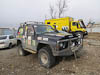
A few "firsts" today. Elena met us at the hotel this morning and offered to guide us out of the city. Assistance we were more than willing to accept as Vladivostok is not exactly a city that is easy to navigate. We stopped for a visit with Yuriy (Tatiana's father) and a breakfast of Russian crab (one "first") and a top up of our water tank before hitting the road (called the M60 or M58) north.
...click/tap to read the full postBuddha and The Emerald Valley (Spassk, Russia)
Journal entry for Thursday 11th Apr, 2013 (day 8, miles 131)
This morning Sergei took us on a tour of some of the local sights in his off-road equipped Nissan Patrol. We were accompanied on this exercise by the lady teacher from last night (Ludmilla) and a man named Shasha First stop on this tour somewhat surprisingly was a large statue of a Buddha in a small village near Ussurisk. It seems that the area around the Buddha was inhabited 10,000 years ago by an ancient race and also occupied by the army of Genghis Khan. Equally interesting to us was the forest, all the trees were coated in ice condensed out of the moist air by the overnight chill (haw frost).
...click/tap to read the full postA little problem, first night unaided (Lushegorsk, Russia)
Journal entry for Friday 12th Apr, 2013 (day 9, miles 160)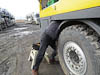
Last night among the trucks was surprisingly quiet, we heard a few come and go in the night but we did not (like often in the US) have refrigeration trucks to assault our ears.
...click/tap to read the full postA partial fix, and a night in a rest stop (M60 km 151, Russia)
Journal entry for Saturday 13th Apr, 2013 (day 10, miles 74)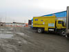
This morning we felt a little conspicuous with our bright (though now dust covered) yellow truck parked among the more dower working trucks so we decided to get out onto the road a little earlier. Besides with the water system not working I cannot use the coffee maker (what a hardship). A little way down the road we came upon one of the now familiar roadside parking spots. These are peculiar facilities. They are muddy patches of ground, sometimes with remnants of pavement, and covered in abandoned litter of kinds one does not even want to imagine. But that is not the peculiar bit. They each (of them we have seen anyway) have a large ramp made from slabs of concrete. It is like a low table with an on and off ramp. Even the roadside sign that designates the parking place has a picture of a car on the ramp. When we work out what the ramp is for we will let you all know.
...click/tap to read the full postA dumb mistake (Khabarovsk, Russia)
Journal entry for Sunday 14th Apr, 2013 (day 11, miles 102)
Today we discovered that we had made a really dumb mistake when we left our hotel in Vladivostok, but I will tell you about that below. We also found and fixed another apparent problem with the camper. Best of all with the aid of our digital map from the Open Street Map project we navigated our way through the city of Khabarovsk to a hotel.
...click/tap to read the full postGuardian angels (Khabarovsk, Russia)
Journal entry for Wednesday 17th Apr, 2013 (day 12, miles 0)
This morning our guardian angels Elena (in Vladivostok) and Irina (in Khabarovsk) succeeded in getting that document from the hotel into our hot little hands. The back story to the document's delivery is interesting. Last night around 9:00pm a train called the Ocean departed from Vladivostok headed for Khabarovsk. Aboard the train was Irina's doctor (friend or family doctor we never did work out). Elena gave him the document and he carried it for the overnight train journey. Irina met the train, took delivery of the document and then dropped by our hotel to give it to us.
...click/tap to read the full postMoving on (Birobidzhan, Russia)
Journal entry for Thursday 18th Apr, 2013 (day 15, miles 150)
It seemed to take forever to get on the move today. What with making the last use of our hotel room, catching up on emails, talking (Skype) to family it was midday before we started moving; and then only to a local super market to top up our larder.
...click/tap to read the full postContrasts (Near Novobureyskiy, Russia)
Journal entry for Friday 19th Apr, 2013 (day 16, miles 203)
Today was a day of (mild) contrasts. We started the day with a light covering of snow and once under way we traveled through a fairyland of snow and frost covered forests with a light fog. It was really beautiful. As the day progressed the fog lifted and the sun occasionally appeared, For the remainder of the day we were treated to periods of snow and sunshine; sometimes both at the same time.
...click/tap to read the full postGood news (Blagoveshchensk, Russia)
Journal entry for Saturday 20th Apr, 2013 (day 17, miles 165)
The town (city?) of Blagoveshchensk (Бпаговешенск) was our destination today. The towns name means "good news" and was named for the peace agreement signed in 1858 between the Chinese and Russians that set the Amur River as the border between the two countries in this region. Blagoveshchensk sits on the river bank only a "stones throw" from China.
...click/tap to read the full postBBQ Russin style (Svobodni, Russia)
Journal entry for Sunday 21st Apr, 2013 (day 18, miles 96)
After breakfast our hosts from last night called by to continue guiding us. First off was some shopping at a local mall; and a very up market affair it was too. It also demonstrated the universal appeal of modern electronics. In a single story mall with maybe 10 shops there were 3 cell phone stores and one computer store. For us of more interest was the well stocked supermarket.
...click/tap to read the full postBroadband chip and nice road (Ushumun, Russia)
Journal entry for Monday 22nd Apr, 2013 (day 19, miles 147)At 8:30 Alexander knocked on the camper door to get us up and moving. I accepted his offer of coffee and we spent an interesting period consuming the coffee, looking at off road pictures on his computer, and talking to each other via Google Translate. One of the pictures he showed me was of an off road event in China and two H1 Hummers with Chinese plates. He also offered to give me one of his USB-Wireless Broadband chips and to help us buy a month-by-month data plan for it. So Alexander, two sons (one teenage and one pre school) piled into the truck and we made the short drive into the center of town.
...click/tap to read the full postFirst full day on the Lena Hwy (Near Chul'man, Russia)
Journal entry for Wednesday 24th Apr, 2013 (day 21, miles 251)
All the mud was frozen solid this morning; the truck showed an outside temperature of 25°F (-3°C). We got under way with some trepidation this morning as we have a long way to go to Yakutsk and everything we have heard suggests this will be a rough road. After driving only a short way we got it officially 1075 km to go.
...click/tap to read the full postRussian spring !! (Nth of Aldan, M56, Russia)
Journal entry for Thursday 25th Apr, 2013 (day 22, miles 200)
This morning, from the comfort of our warm bed and camper we looked outside to bright sunshine and frozen puddles; so we guessed it was cold. But we were still a little surprised when the truck's outside temperature display registered 16°F (-8°C). I thought this was supposed to be spring!
...click/tap to read the full postA quick update (Yakutsk, Russia)
Journal entry for Saturday 27th Apr, 2013 (day 24, miles 51)
There has been no internet along the M56 to Yakutsk so I am some days behind in my regular journal posts. So I decided to do a quick update to let friends and family know where we are and what is happening and I will come back and fill in with a more complete record over the next few days. We are in Yakutsk, we are safe and sound but we have a significant mechanical issue with the vehicle and for the moment we are unable to travel. Over the next few days we will assess the options available to us for fixing the vehicle and do some sightseeing things as well.
...click/tap to read the full postFixing the truck (and other interesting observations) (M56 - km 130, Russia)
Journal entry for Friday 10th May, 2013 (day 37, miles 76)
Today was the big day. Would all those parts and tools be sufficient and enable us to fix our truck. Of course before we could even start the repairs we had to get to the truck and as previously this required a trip across the Lena River on a hovercraft and a couple of taxis. It was quite surprising to see how much the river had changed in the last week. It was still filled with ice, thus preventing navigation by traditional boats, but now the ice was mushy with large sections of open water. It seemed that the current condition was harder for the hovercraft as the price was 50% higher than last time we traveled.
...click/tap to read the full postBack on the M58 - a chance to cleanup and install the new water pump (M56 – 1340km, Russia)
Journal entry for Tuesday 14th May, 2013 (day 41, miles 2,905)
Today we escaped from the pot holes of the M56 and to our relief the first few hundred kilometers of the M58 west towards Chita were paved and smooth. The last 45km of the M56 took us about 1.5 hours (which was consistent with our average speed over the previous 3 days) and then with relief we arrived at the large and elaborate intersection between the M56 and the M58, turned right (west) and commenced to eat away at the 990 km between us and Chita.
...click/tap to read the full postNow the refrigerator! (M56 – 1738km, Russia)
Journal entry for Wednesday 15th May, 2013 (day 42, miles 3,103)
Late last night Nina noticed that the refrigerator seemed not to be working; and sure enough after a little investigation it was clear that the control panel lights were operating but the compressor was not running. Hence nothing was being cooled down. We could not believe it; yet another thing in this camper that had stopped working. We spent a little while discussing where we could get a new refrigerator and how we would cope without one. Then since it was late (like 22:00) we knew that Roger at GXV would be awake and at work so we called him (actually sent him an SMS to call us). His reaction mirrored ours, "you have got to be kidding".
...click/tap to read the full postChita (M55 Road Side Parking, Russia)
Journal entry for Friday 17th May, 2013 (day 44, miles 3,462)
The highlight of today was a drive into, and a look around, the city of Chita (Чита). Though our visit was not without its challenges. First amongst these was that the entry road from the east was closed, though we only worked this out after we tried it and came to a dead end. The entry from the north was open but the road was in what you might call a rough condition. In places it was simply mud and gravel and was presenting a 4x4 challenge to some of the smaller vehicles.
...click/tap to read the full postBaikal, still iced over (Lake Baikal, Russia)
Journal entry for Sunday 19th May, 2013 (day 46, miles 3,889)
The M55 enters the city of Ulan Ude (Улан Удэ) from the south along the Selenge River, and this morning in bright sunshine it was a pleasant, even pretty, drive. At first glance the city appears modern but with a different feel to the other Russian cities we have so far visited. A lot more timber fences around the outer suburban houses, some Buddhist shrines and generally a more "Mongolian" feel (though I should probably say Buhrat, as that is the name of the dominant local indigenous peoples).
...click/tap to read the full postA crappy weather day (Angosolka, Russia)
Journal entry for Wednesday 22nd May, 2013 (day 49, miles 4,323)
There is not much to say about today. The weather was crappy, windy and dusty when we woke, and during the day rain arrived and made for a miserable day of driving. For most of the day we followed the southern shore of Lake Baikal but did not really see much of the lake as the railway occupies the prime real estate next to the lake shore for the entire length of the coast. Also today the road was crappy. Most of the length was paved road that has been patched over and over again but with some sections that have simply fallen apart and it is now a combination of gravel and broken pavement. Our new strategy for bad roads is simply go slow enough that it is not too tough on the vehicle and its occupants.
...click/tap to read the full postMongolian Visa (Irkutsk, Russia)
Journal entry for Thursday 23rd May, 2013 (day 50, miles 4,381)
What a difference a day makes. This morning we were greeted by bright sunshine and as the day wore on it became warm. An early start got us into Irkutsk by about 10:00 and we easily found a parking place on Gagarin Boulevard right next to the Inturist Hotel and right beside the Angara River from where we walked about 1 km to the Mongolian Consulate and within 10 minutes had submitted our visa application; pick up passports with visas 3:00pm Friday.
...click/tap to read the full postThe Baikal road (Listvyanka, Russia)
Journal entry for Friday 24th May, 2013 (day 51, miles 4,423)
We occupied ourselves this morning doing some chores in the truck and then some grocery shopping at the famous Irkutsk market while waiting for 3:00pm and our Mongolian visas to roll around. This is the third time I have been to the markets in Irkutsk and it still facinates me. There is a large indoor food market selling all kinds of vegetables, meats, fish, nuts and almost what ever you could think of as well as a wide range of prepared food ready to eat. Now that the weather is warm there is an outside extension selling vegetables and plants.
...click/tap to read the full postA morning in Listvyanka (Sludyanka, Russia)
Journal entry for Saturday 25th May, 2013 (day 52, miles 4,531)
After admiring the view from our overnight spot we headed down the road to Listvyanka and found a spot in the lakeside parking lot. It was still early for the Russians, the parking lot was sparcely occupied and all the souvenir stalls and food stalls were just being set up.
...click/tap to read the full postGood bye Baikal (Cafe M55, Russia)
Journal entry for Sunday 26th May, 2013 (day 53, miles 4,713)
Today we simply retraced our steps on the M55 as it traversed the southern shores of Lake Baikal. The weather added to the sense of "having been here before" as the day started with low cloud and rain (same as last time on this section of road). But as the day wore on the sun appeared and we got the benefit of a more spring like day
...click/tap to read the full postSouth to Mongolia (Road to Kyakhta, Russia)
Journal entry for Monday 27th May, 2013 (day 54, miles 4,849)
Today we turned south towards Mongolia and the next chapter in our journey. The weather was cold and windy as we continued to retrace our route to Ulan Ude and then onto the A165 south towards the border town of Kyakhta (Кяхта). Not far down the A165 we stopped for morning tea and bumped into another overland vehicle. A couple of Austrian guys in a expedition truck that they built themselves(on an ex-Austrian army Steyr chassis). They have been on the road since March and started in Turkey, through Iran, Georgia, Azebijan and Russia and like us are on their way to Mongolia. Their truck is larger and heavier than ours, 17,000 KG versus 11,000. We had a chat about their experiences in Iran while sharing our morning tea of Russian cream cake.
...click/tap to read the full postBorder crossing (Darkhan, Mongolia)
Journal entry for Tuesday 28th May, 2013 (day 55, miles 4,997)
Ok, so today was all about the border crossing. In the body of this post is more information about the experience and process.
...click/tap to read the full postTranquility and Chaos (Ulaanbaatar, Mongolia)
Journal entry for Wednesday 29th May, 2013 (day 56, miles 5,113)
What a contrast today was. The first part of the day we traveled south towards Ulaanbaatar through beautiful grass lands with remnants of winter snows to offset the bright blue sky. It was spectacular, and tranquil. Then we hit UB and it was total chaos.
...click/tap to read the full postMike (from GXV) arrives, and we have an argument with a bus (Ulanbaatar, Mongolia)
Journal entry for Tuesday 4th Jun, 2013 (day 62, miles 5,113)
This morning we learned by email that Mike from GXV had arrived in UB during the night and that once he had caught up on some sleep, and checked out the mechanical facility he had organized, he would come visit us. The purpose of Mike's visit was to add some stronger components to the camper mounts that we had replaced near Yakutsk.
...click/tap to read the full postFarewell (Lun, Mongolia)
Journal entry for Monday 10th Jun, 2013 (day 68, miles 5,213)
Today we said farewell (and thanks) to Ulanbaatar, Chuka's Guest House (Chinzo, Turuu and Chuka), and especially thanks to the guys Tony, Todd and Barnsey at TWB (The Mongolian Drilling Company). We will (and already are) reflecting on our time in UB as enjoyable and interesting and are pleased that we spent enough time in the city to feel we got to know it a little.
...click/tap to read the full postWestward ho! (Somewhere, Mongolia)
Journal entry for Tuesday 11th Jun, 2013 (day 69, miles 5,423)
We traveled west all day on mainly good roads continuing our gentle introduction to Mongolian country roads. However there was just enough broken pavement and big pot holes to keep us on our toes. Early afternoon we turned from the A0301 (the main road to the city of Arvaikheer) onto the A601 towards the old Mongol capital of Kharkhorin and the road story changed. The A601 used to be paved, we could see the old paved road but now much of that was now closed, and in its place was a dusty track that had been carved from the grass land.
...click/tap to read the full postKharkhorin (ХААРХОРИН) ((Near) Tsenkher Hot Springs, Mongolia)
Journal entry for Wednesday 12th Jun, 2013 (day 70, miles 5,423)
The Monastry of Erdene Zuu Khiid is one of the highlighs of a tour of Mongolia. Situated in the old city of Kharkhorin (once for a short period the capital of the Mongol Empire) the Monastry was started in the late 1500's and eventually housed up to 1000 monks and 60-100 individual temple buildings. The monastry was closed and largely destroyed in 1937 as a result of a Stalin purge, the monks were either killed or imprisoned. We tooks a tour of the main remaining temples with a delightful young lady who tried to bring us up to speed on the 500 gods of the Budhist religion; but unfortunately we only grasped a little. Still the monastry is impressive.
...click/tap to read the full postDriving on unpaved road (Tsetseleg, Mongolia)
Journal entry for Thursday 13th Jun, 2013 (day 71, miles 5,481)
Before getting underway this morning we were passed by a number of mini-vans returning from the hot springs with their load of tourists. We waved a good morning greeting. Once underway we traveled at our now customery 10-15 mph over the steppes trying to find the flatest track as the truck (and Nina) do not seem to like steep side-hills.
...click/tap to read the full postChuluut Gorge (Tariat, Mongolia)
Journal entry for Friday 14th Jun, 2013 (day 72, miles 5,593)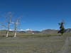
After a pleasant night near the river (despite the group of Mongolian campers nearby who sang until after midnight) we headed back into town to the FAIRfield Guesthouse, for some coffee, pastries, and wifi. Then it was off west. At the western border of the town there was a toll gate and the paved road gave way to gravel and a short steep climb over some rocky hills. We were not surprised by the appearance of gravel road as we had been told by many people that the road "may be sealed as far as Tsetseleg". What we were surprised by was that within 10 km good sealed road appeared again and continued for almost 100km until the bridge over the Chuluut River.
...click/tap to read the full postThe best laid plans (Chulutt Gorge, Mongolia)
Journal entry for Saturday 15th Jun, 2013 (day 73, miles 5,630)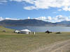
Our plan was to complete the drive to White Lake and spend a coupe of nights there resting in the sun and enjoying the Lake. So this morning we set off west. Quickly we were forced back onto that roadbed as the valley narrowed towards the start of the lake and so we jostled along for about an hour before we came to the end of the roadbed; after this point the highway was nothing more than a bunch of tracks in thre grass and a few broken down bridges. It quickly became evident that we were not going to drive miles on this "road" to the western end of the lake simply to drive back again in a few days. So we turned off the road and headed directly towards the lake shore making our own road.
...click/tap to read the full postThe Steppes (Khanui River, Mongolia)
Journal entry for Sunday 16th Jun, 2013 (day 74, miles 5,711)
We explored the Larch forest a little this morning noting that there were some really big Ovoo (places that the Mongolians adorn with blue ribbons. From the LonelyPlanet Guide "sharmanist collection of stones, wood or other offerings to the gods usually found in high places"). The cool morning, light overnight rain, sandy soil and beautiful old Larch trees made for a very pleasant environment.
...click/tap to read the full postWhat an amazing day (Selenge River, Mongolia)
Journal entry for Monday 17th Jun, 2013 (day 75, miles 5,787)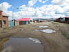
Sitting around camp, still buzzed from the days adventures (and maybe a little from beer and vodka), Nina and I agreed, today was one of those special travel days, a day that we will remember forever, and one of those days that will keep us thinking up new adventures.
...click/tap to read the full postThe "main" road (Atsimag Nuur, Mongolia)
Journal entry for Tuesday 18th Jun, 2013 (day 76, miles 5,840)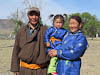
This morning we had a visit from a local family, father, mother and daughter in traditional clothing and one of the young workmen from yesterdays ferry ride. The little girl was curious but a bit unsure of us and clung to mother. The mother was very curious about the photographs we took of the group and particularly photos of her daughter. Before the visit was over a couple of additional young men in traditional gear arrived on their small Japanese motor cycles and had a quick look over the truck.
...click/tap to read the full postA little bit of civilization (Moron, Mongolia)
Journal entry for Wednesday 19th Jun, 2013 (day 77, miles 5,858)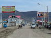
Moron, with a population of about 36,000, is the only major town in this part of Mongolia and it was our destination for the day. So after an hour or so bumping along the highway we entered the town along a 13 km stretch of ok paved road to find that we were in the midst of frantic activity.
...click/tap to read the full postNo cheese!! (Khovsgol Nuur, Mongolia)
Journal entry for Thursday 20th Jun, 2013 (day 78, miles 5,928)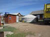
Before leaving Moron this morning we spent a deal of time checking out the local super markets topping up our larder for the coming 10 day trip west during which we don't expect to find much in the way of supplies. Believe it or not we could not find any form of cheese. We concluded that Mongolians must get their dairy products in other forms.
...click/tap to read the full postBirthday and oil seal (Moron, MOngolia)
Journal entry for Saturday 22nd Jun, 2013 (day 80, miles 5,995)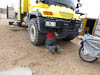
Yesterday we returned from Khvosgol Nuur to Moron with the plan of topping up with fuel and then proceeding west towards Ulaangom. But at the gas station I noticed that the right hand front wheel hub was leaking oil so we checked back into Bata's Guesthouse and I spent some time under the truck investigating the oil leak. Conlusion, an oil seal had started leaking; the seal where the axle shaft enters the outboard hub assembly. Later in the evening I called Rob Pickering (our ever helpful U500 expert) in Colorado and discussed the issue with him. His advice was "… you can probably drive it provided to check the oil level and top it up frequently". So that became the next days (todays) task, assemble the pieces needed to remove the fill plug and add oil to the hub. It also happened that today was Nina's birthday. She got a wonderful present - all day walking around this dusty town trying to find tools, oil and a means of putting the oil into the hub - very romantic.
...click/tap to read the full postGreat Camping Spot (Delgermoron River, Mongolia)
Journal entry for Sunday 23rd Jun, 2013 (day 81, miles 6,037)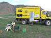
After all the chores were done we finally headed out of Moron to start our journey west. Initially the road headed south before a bridge carried us over the Delgermoron River and then for the next 60 km we followed those now familiar wheel ruts in the grass steppes (and also the followed the Delgermoron River). This section of "road" was, however, a little different. There were a few sections of graded road where the terrain narrowed beside the river or over a small saddle, and also this section of road had km posts; very civilized.
...click/tap to read the full postThe Northern Route - Day 2 (KM 153, Mongolia)
Journal entry for Monday 24th Jun, 2013 (day 82, miles 6,092)
If you are taking any notice of the mileage number you will notice that we only traveled about 50 miles today. There are two reasons for this. The first is the condition of the road - or should I say track, which keeps our average speed down to below 20 km/h. The second reason is visa timing. We cannot enter Kazakhstan until July 17th, and we don't want to spend a lot of time in the Altai region of Russia (again visa considerations) so we plan on exiting Mongolia around July 10th. Hence are deliberately traveling slowly.
...click/tap to read the full postThe Northern Route - Day 3 (KM 245, Mongolia)
Journal entry for Tuesday 25th Jun, 2013 (day 83, miles 6,143)
It was raining steadily this morning as we got underway and continued that way for most of the day. The route this morning headed towards a town called Tsetseleg (same name as a previous town, but not the same town). At one point we seemed to be off course but a spur road took us back to the main track. A highlight of the morning was the appearance of 3 SUVs heading the other way. Also, at our morning tea stop we were visited by a couple of local guys on a small motorcycle, we invited them in to the camper to share our morning tea.
...click/tap to read the full postNorthern Route - Day 4 (KM 317, Mongolia)
Journal entry for Wednesday 26th Jun, 2013 (day 84, miles 6,188)
Bright sun and warmer weather. Our route today took us back to the valley of the Tesiin River and for much of the day we traveled through that valley only occasionally leaving it to bypass narrow stretches of the valley. The Tesiin is a large river and seems to support a good size population of herders as we passed many Ger camps and herds of animals through out the day.
...click/tap to read the full postNorthern Route - Day 5 (KM 428, Mongolia)
Journal entry for Thursday 27th Jun, 2013 (day 85, miles 6,258)
After an easy 15 km run into the town of Bayantes the road split into two routes, a northerly and a southerly. As it turned out the more direct northerly route (the one we chose) followed the power lines and was a bit of a pain for us as we had to keep checking that we could pass under the lines without hitting them. Also this route passed over a series of small mountain passes that became narrow with steep side hills that certainly had a high "pucker" factor. The power lines and steep passes combined at one point to completely block our passage; a power pole had fallen over dragging the wires way to low for us to pass and as (bad) luck would have it this happened in a narrow valley. We examined the situation for quite some time before decicing that we had to by pass the entire area by driving the truck up onto a nearby hillside and around the obstacle.
...click/tap to read the full postNorthern Route - Day 6 (KM 549, Mongolia)
Journal entry for Friday 28th Jun, 2013 (day 86, miles 6,334)
There is not a lot to say about today. It was overcast and raining when we woke and it continued that way all day. The grey sky hid any of the distant mountains left us feeling like we were driving on an endless plain. As the day wore on the rain soaked into the ground and the vehicle tracks became muddy. It was then that we learned that even a 26,000 lb Unimog can get sideways once the ground is slippery enough. Thus we spent the afternoon "slip-sliding in the mud"
...click/tap to read the full postNorthern Route - Day 7 (Uvs Nuur, Mongolia)
Journal entry for Saturday 29th Jun, 2013 (day 87, miles 6,382)
The sun was out today when we woke and as we set out on the 8th day of our journey along Mongolia's Northern Route. Today we were headed for a a salt lake named Uvs Nuur, the biggest lake in Mongolia with an area of approximately 3000 square km. To get to the lake we traveled across a huge dry valley that seemed to go on for ever. THe valley was dotted with th occassional ger and for the first time we saw some camels. As we traveled west we got the first glimpse of some snow capped peaks to the west - we guessed this is our first view of the Altai Mountains (a mountain range that sits at the borders of China, Russia, Kazakhstan and Mongolia).
...click/tap to read the full postUlaangom (South of Ulaangom, Mongolia)
Journal entry for Sunday 30th Jun, 2013 (day 88, miles 6,444)
It took us a few hours this morning to wind our way across the steppes back to the "main road" and then into the town of Ulaangom. To our surprise the last 13 km into the town was good paved road and it was a pleasure (even though a short lived one) to drive on a real road for a while. Mind you on this road we came across a gang of workers painting cener lines by hand with brushes and a stencil.
...click/tap to read the full postAn afternoon visitor (Khar-Us Nuur, Mongolia)
Journal entry for Monday 1st Jul, 2013 (day 89, miles 6,484)
We had a somewhat shorter day today as we travelled only about 70 km to a lake called variously Khar-Us Nuur or Olgly Nuur. Arriving just after noon we occupied ourselves for a while doing some modifications to the latch on one of the cabinet drawers. After the chores we moved the vehicle to the lake shore and started to settle in, paddled in the lake, got out the camp chairs and started our afternoon cocktails. About this time a middle aged local man appeared on his horse and promptly sat in one of our camp chairs and started drinking the beer I had opened for myself. During the course of the next hour or so we had a very limited conversation, served him a few more beers and other assorted refreshments, and took a few photos of him.
...click/tap to read the full postLooking for vegetables (Khovd, Mongolia)
Journal entry for Tuesday 2nd Jul, 2013 (day 90, miles 6,582)
Our route south today (for the first 100 km) was on a road that continued to be nothing more than vehicle ruts in the steppes. The scenery was spectacular with colorful mountains all around, and those to the west were set off wonderfully by the morning light. About lunch time we saw a large body of water to the south and slightly east, our map named it Khar-Us Nuur (hang on wasn't that the same name as last nights lake ?? - we have noticed that many place names get used over and over again in Mongolia - very confusing for tourists).
...click/tap to read the full postVegetables and wash day (again) (Churgin Guur, Mongolia)
Journal entry for Wednesday 3rd Jul, 2013 (day 91, miles 6,624)
This morning we went back into Khovd spent some time on the internet and once again tried the market for vegetables. This time we went armed with Mongolian words for a range of vegetables. Eventually we were shown the way to the right section of the market and it immediately became obvious why we had so much trouble yesterday. Not only was it way out in the back blocks of the market area but also there were only a few stalls selling any type of vegetables, and they had only the most lmited supply. very small totatoes, one or two onions, and some long thin green things that looked a bit like cucumbers. This was proof to us that Mongolians do not eat a lot of vegetables.
...click/tap to read the full postMountains and bikers (Tolbo Nuur, Mongolia)
Journal entry for Thursday 4th Jul, 2013 (day 92, miles 6,692)
From last nights camping spot the road climbed through a series of river valleys over increasingly rough road or tracks to the highest point so far on this trip, 8660'. Along the way we passed through a couple of small villages and saw the inevitable herds of cows, sheep, goats, and camels. Late in the morning we were waved down by a pair of young boys who were out patrolling their herds on horse back. We were a little surprised that one of them spoke reasonably good English. Among other things he told us that he was "Kazak not Mongolian". We gave them some treats we carry for just such an occassion - immediately he asked (via sign language) if we had something to drink. We gave him a carton of fruit juice to which his response was - "one for my friend". He will be a successful animal trader some day.
...click/tap to read the full postA few days break (Olgii, Mongolia)
Journal entry for Friday 5th Jul, 2013 (day 93, miles 6,732)
The 60km into Olgii today was slow as the road was rough (again) with many different tracks to choose from and lots of road work (a new road is being built but so far it is not ready for use). About 10 km out from the town we came upon a large group of vehicles and people walking and riding horses, some of the horses where covered in bright rugs and some of the children were dressed as jockies, we could only guess that it was some kind of informal race.
...click/tap to read the full postTo the border (Olgii, Mongolia)
Journal entry for Monday 8th Jul, 2013 (day 96, miles 6,790)
We (actually me) spent the morning procrastinating about our departure. Showers, email updates, talking to all the other travelers at the guesthouse. But eventually I accepted Nina's argument that we needed to start towards the Russian-Mongolian border so that we were in a position to cross into Russia tomorrow as the Mongolian side of the border might be closed Wednesday for the national Naadam festival. So eventually we manouvered our way out through the guesthouse gate, changed most of our Mongolian money into Russia roubles at one of the towns bank and then hit the road towards the town of Tsagaanuur.
...click/tap to read the full postInto Russia (Altai region, Russia)
Journal entry for Tuesday 9th Jul, 2013 (day 97, miles 6,890)
Bright sunshine had us up before 8:00 am looking around the main and only street in the village to see what was happening and when we should start lining up for the border. I took the opportunity to exchange most of our remaining Mongolia money for Russian roubles and Nina got the chance to take some photos of a lady milking a yak.
...click/tap to read the full postViews, rivers, camping spots everywhere (Kurata, Russia)
Journal entry for Wednesday 10th Jul, 2013 (day 98, miles 7,012)
Today we had great weather, good road and just fabulous scenery. The route pretty much traversed the Altai Mountains by following a series of river valley's with one substantial climb over a pass to add variety. The rivers we followed were generally big and fast flowing, sometimes with steep gorges, and sometimes with grass banks. We frequently passed through nice little villages, that although clearly of modest means were well maintained and tidy. We have not seen any of the wide spread trash/garbage that we saw in Siberia. We saw many places catering to tourists (though we assume Russian tourists), rafing outfits on the fast rivers, hotels, and places that looked like camp grounds. We also saw a lot of cars and small SUVs with their roofs loaded with luggae - we assumed they were the tourists enjoying this fabulous mountain playground. There were miles of delightful (possible) camping spots along the banks of the rivers and we were a little sad that we needed to keep moving rather than enjoy these spots.
...click/tap to read the full postRussians on vacation (Katun River near Manzherok, Russia)
Journal entry for Thursday 11th Jul, 2013 (day 99, miles 7,105)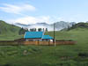
We started our travels today in, and after, some heavy rain falls but quickly the clouds cleared away and another nice summers day appeared. The road (we are traveling is the M52 which for the past two days was also called the Chuisky Trakt) continued to follow river valleys and wind between rounded mountains. As the day progressed we saw more signs of Russian tourism and Russians with vacation toys or camping gear on the tops of their cars.
...click/tap to read the full postFarm land, first world, more vacationers (A Field M52, Russia)
Journal entry for Friday 12th Jul, 2013 (day 100, miles 7,202)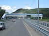
Today we left behnd the last of the Altai mountains. From our riverside camp our route continued for much of the day beside the ever widening expanse of the Katun River, passng througn many small townships catering to holiday makers (we even found some good super markets). The road was excellent making it easy and the traffic increasingly dense and frantic. If we ever needed proof that Russia is a first world country with a large fun-loving middle class today was that proof.
...click/tap to read the full postWeddings, and a Rock Concert (Barbaul, Russia)
Journal entry for Saturday 13th Jul, 2013 (day 101, miles 7,291)
Today we were intent on finding some internet as we needed to catch up on emails related to visas for those Central Asian Countries. So our goal was the city of Barnaul where we hoped we might find an internet cafe or get good reception for our cellular modems. So throughout the morning we motored along with moderate traffic on good roads through lush farmland
...click/tap to read the full postLast days in Russia (A349, Russia)
Journal entry for Tuesday 16th Jul, 2013 (day 104, miles 7,493)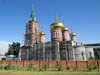
We have spent the past 3 days (14th,15th, 16th) on the A340 from Barnaul to Rubtsovsk and the border into Kazakhstan. We have been forced to travel slowly because our Kazak Visa does not start until July 17th. Had we given a little more thought to our situation last week, and had a little more knowledge about the country side south of Barnaul we could easily have spent some extra time in the Altai Mountains, that would have been more interesting and more comfortable than the hot, flat farm land we have been in the past 3 days.
...click/tap to read the full postA visit to Semey (Karpovka, Kazakhstan)
Journal entry for Wednesday 17th Jul, 2013 (day 105, miles 7,622)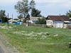
We were awake and moving early today, keen to get to the border and also a little anxious. We had read that the border crossing on the A349 was very busy and had even read on one website a recommendation that travelers should consider using another crossing about 100km east which was supposed to be quieter and hence easier. So we were relieved to find only about 8 vehicles ahead of us when we got to the Russian border post and pulled in at the end of the line waiting to be allowed through the control gate.
...click/tap to read the full postCemetries, bees and American cyclists (Kurata, Kazakhstan)
Journal entry for Thursday 18th Jul, 2013 (day 106, miles 7,786)
Today we (or at least I) felt the full weight of trying to cover the 1100km from Semey to Almaty in 4 days. Now our Australian and US readers may be surprised by this comment as 1100km would be an easy 2 day drive in either country, but in Kazakhstan, in our truck with the rough paved and unpaved roads today made it clear that our goal would be tiring and tedious. So for much of the day we bounced along, mostly on rough paved roads, at less than 50 km/h covering a little over 300km in almost 7 driving hours.
...click/tap to read the full postAnother motorhome (A350, Kazakhstan)
Journal entry for Friday 19th Jul, 2013 (day 107, miles 7,999)
Before we were out of bed this morning we heard a vehicle sounding its horn and then heard the sound of a diesel engine coming towards our camping spot. To our surprise we looked out of our window to see another motorhome coming towards us. Sue and Chris, from the UK, were on their way to Mongolia. Just to prove beyond a shadow of a doubt that people do all kinds of things and travel for all kinds of reasons we learned that they (Chris and Sue) were going to Mongolia to fly the hot air balloon they were carryiing in the big storage box mounted on the back of their vehicle. We spent some tiime together (after we got hurridly dressed) talking about the state of the roads, where to stay in various cities and the strength and weaknesses of our respective vehicles.
...click/tap to read the full postA Title (A350, Kazakhstan)
Journal entry for Saturday 20th Jul, 2013 (day 108, miles 8,205)
Today we saw a bit more activity beside the road. There were more villages, and in those villages there was more produce for sale in roadside stalls, and the main street through many of the villages had very extensive and long established groves of trees beside the street. We saw men out cutting grass with scythes and even saw one man painting the trunks of trees with white paint.
...click/tap to read the full postAlmaty - where to stay?? (Almaty, Kazakhstan)
Journal entry for Sunday 21st Jul, 2013 (day 109, miles 8,288)
Last night our big question/decision was "where do we head to once in Almaty?". We talked about it for a long time and came up with all kinds of plans. This morning we chickened out and decided to head to the Holiday Inn according to the LonelyPlanet guide it had parking; the downside - it was expensive.
...click/tap to read the full postBusiness (Almaty, Kazakhstan)
Journal entry for Monday 22nd Jul, 2013 (day 110, miles 8,291)
Today was a business day. We tried many times this morning to call the local FEDEX franchise to find out what we had to do to liberate a package from the customs process here in Almaty but everytime the receptionist tried to connect us the phone hung-up. So after failing to get anywhere over the phone we decided to add a visit to FEDEX to our days agenda.
...click/tap to read the full postBad camping choice (Almaty, Kazakhstan)
Journal entry for Tuesday 23rd Jul, 2013 (day 111, miles 8,304)We left the Holiday Inn early this morning and made our way to the Mercedes dealer. We were there early so had to find a place to park and hang-out for about an hour before their opening time of 9:00am.
...click/tap to read the full postCity traffic and tree lined streets (Charyn Canyon, Kazakhstan)
Journal entry for Wednesday 24th Jul, 2013 (day 112, miles 8,453)
Despite what we thought was an early start this morning, traffic was already fast and furious by the time we got underway heading to the southern part of the city of Almaty to visit Stantours. This is a well known Central Asian tourist company that helps travelers get visas and arranges tours and accomodation. We have been in contact with them for some months regarding our arrangements for Uzbekistan and Turkmenistan. Also this is where our package (the one we visited FEDEX about on Monday) was/had been delivered.
...click/tap to read the full postA walk into the Canyon (Almaty, Kazakhstan)
Journal entry for Friday 26th Jul, 2013 (day 114, miles 8,578)
This morning before heading back towards Almaty Nina got up early to walk down the Jeep road to the bottom of Charyn Canyon to the informal camping ground at the river. Like a slug I stayed in bed for a while but eventually I felt guilty enough that I got up and followed. The round trip took Nina 1 and 1/2 hours and I only caught up to her 100m from the truck. Either Nina is getting faster, or I am getting slower. It was a pleasant walk as the valley through which the track passes was in shade for most of the time. We also discovered why the rangers warned us not to drive this track; at one point the track passes under a couple of big bolders and has no more the 7-8 feet of clearance.
...click/tap to read the full postThe Border, Police and other hassles (Bishkek, Kyrgyzstan)
Journal entry for Sunday 28th Jul, 2013 (day 116, miles 8,751)
The past two days we have traveled from Almaty to Bishkek crossing the Kazakhstan-Kyrgyzstan border in the process. I think it would be reasonable to describe these two days as very representative of the hassles and discomfort of traveling in Central Asia.
...click/tap to read the full postLake Issyk Kul, saved from the police (Issyk Kul, Kyrgyzstan)
Journal entry for Saturday 3rd Aug, 2013 (day 122, miles 8,904)
We got an early start this morning in order to avoid the the traffic and the police as we headed east out of Bishkek towards famous Lake Issy Kul. The plan largely worked and within 40 minutes from the hotel we were out of the city and on highway A365. We did not entirely avoid the police as we passed a number of radar traps and random stop but today we did not seem to be on anyones menu.
...click/tap to read the full postAfter effect of something; maybe the corn (Issyk Kul, Kyrgyzstan)
Journal entry for Sunday 4th Aug, 2013 (day 123, miles 8,974)
Today was a bit of a bust. I woke with a moderate tummy upset and headache that persisted all day. I put it down to the corn we bought yesterday from a roadside vendor. It was either simply too much corn (2 large cobs) or maybe the corn spiced with some local micro-organisms; though Nina suffered no bad effects.
...click/tap to read the full postAn explorer, torpedoes, and Polish travelers (Issyk Kul, Kyrgyzstan)
Journal entry for Monday 5th Aug, 2013 (day 124, miles 9,102)
Much to Nina's relief I was back on deck this morning so we set off early for a full day of experiencing the delights and the unexpected of traveling.
...click/tap to read the full postKyrgys at play in a salt lake (Beside the A367, Kyrgyzstan)
Journal entry for Tuesday 6th Aug, 2013 (day 125, miles 9,238)
A hair cut and a quick swim in our small lake started the day and then we took our leave from our new Polish friends and were on our way. A little way down the road we passed 3 convoys of Mack trucks carrying fuel and led by Ford F series pickup trucks heading to a local gold mine operated by a Canadian company. At about the same time we passed a complex of walls and buildings that were amazingly decorated. The main wall seemed to have immitation yurts embedded at regular intervals, an eleborate gate and other amazing features. Noone seemed to be at home in the structure and we could not for the life of us work out what it might be.
...click/tap to read the full postGetting closer, other travelers (Kyzyl Suu, Kyrgyzstan)
Journal entry for Wednesday 7th Aug, 2013 (day 126, miles 9,318)
This morning not long after getting under way we passed through Kyzart Pass (at a modest 2650 meters), a picturesque spot situated among grass covered mountains. At the pass there were some primitive dwellings providing cafe services and a group of young children that greeted us warmly. On the descent we passed many herder camps most of which comprised both yurts and a soviet style caravan (for Aussies) or travel trailer (for our American friends); we even saw a yellow one.
...click/tap to read the full postA bit more altitude (Somewhere on the M41, Kyrgyzstan)
Journal entry for Thursday 8th Aug, 2013 (day 127, miles 9,408)
We continued for some distance this morning along the Kekemeren Gorge with more spectacular mountain views before emerging into a wide valley with a couple of small villages and wide spread cultivation. Once into the wider valley we could see in the distance the highway M41 (the main Bishkek to Osh road) as it descended from the 3500 meter Too Ashuu Pass. Our route to Osh would take us left/south at the M41 but initially we chose to go North and climb to the pass, partly out of curiousity and partly to start our altitude acclimatization - or at least to see how we would react to some serious altitude.
...click/tap to read the full postDown .. down into the Fergana (Kockkor-Ata, Kyrgyzstan)
Journal entry for Friday 9th Aug, 2013 (day 128, miles 9,606)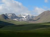
The road continued to climb for a little while this morning before eventually topping out at over 10,500 ft and then we descended, and descended and descended eventually (by the end of the day) getting down to 2,500 ft in the upper end of the Fergana Valley.
...click/tap to read the full postOther overlanders in Osh (Gul'Cha, Kyrgyzstan)
Journal entry for Saturday 10th Aug, 2013 (day 129, miles 9,740)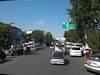
We were up and going early this morning hoping to cover the 135km to the city of Osh by lunch time in order to have sufficient time to do some extensive grocery shopping. The drive this morning continued like yesterday afternoon. Cultivated fields everywhere, people selling all kinds of vegetables and fruits at roadside stalls. In many of the stalls people were still in bed as we passed; thats right they actually had beds in the stalls and we saw people still asleep in some of them.
...click/tap to read the full postOur highest point (Before Murghab, Tajikistan)
Journal entry for Monday 12th Aug, 2013 (day 131, miles 9,949)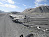
Today we crossed what we believe will be our highest point on this years journey, Ak-Baital Pass at 4655 meters (15,272 feet). But equally we spent almost the entire day traveling at over 4000 meters (13,125 ft). Only at the end of the day as we neared the town of Murghab did our GPS register an elevation below 4000 m. Todays scenery was stark and spectacular. For most of our way the road ran through one river valley or another. Typically the valleys were very wide and filled with grey gravel, and surrounded by barren mountains of many colors, and then the bigger mountains topped off with snow and glaciers. The road was a mix of old pavement and stretches of gravel, but really surprisingly good considering where we were. Though like yesterday there were periodic signs that nature was fighting back and from time to time we encountered road sections that had washed away or were being eaten away by river flow. There were also signs of recent road works so we guessed some effort is made to keep this road open.
...click/tap to read the full postA day at Yashilkul (Wakhan Road, Tajikistan)
Journal entry for Wednesday 14th Aug, 2013 (day 133, miles 10,090)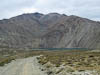
We spent most of today exploring the road out to, and beside, Lake Yashilkul. The gravel road that ran along the southern side of the lake gave good views and some interesting driving. Much of the day was overcast so we also spent a good deal of time simply sitting looking at the lake waiting for the sun to come out to provide better photo ops. It did sort-of.
...click/tap to read the full postThe Wakhan Valley Road - Day 1 (Zong, Tajikistan)
Journal entry for Thursday 15th Aug, 2013 (day 134, miles 10,158)
From our campsite near the junction with the Pamir Highway our route followed a heavliy washboarded road up a narrow valley, past a couple of very pretty lakes to Khargush Pass at 4255 meters before descending to the town of Khargush, a military checkpoint and the Parmir River and across the river - Afghanistan.
...click/tap to read the full postWakhan Valley Road -Day 2 (Ishkashim, Tajikistan)
Journal entry for Friday 16th Aug, 2013 (day 135, miles 10,223)
The title for todays entry is a bit boring but it keeps to yesterdays naming convention. I could have called todays post something like "Panj River Villages" because we seemed to spend the entire day passing through the most amazing quaint, picturesque villages. Any patch of even approximately flat ground along the southern side of the Panj River has been turned into a village and each village has extensive fields of grain, potatoes and apricot trees. The villages themselves have generally only one main street that is always lined with hugh amazing trees that often arch over the road to form a green tunnel. The houses are made from white washed mud-brick and surrounded by stone fences.The only time villages and cultivation ceases is when the river bank merges into a steep escarpment and there is no flat land.
...click/tap to read the full postWakhan Valley - Day 3 (Khorog, Tajikistan)
Journal entry for Sunday 18th Aug, 2013 (day 137, miles 10,223)
After leaving Hanis guest house and Vali its friendly and helpful manager we set out down the Panj River valley towards Khorog. The scenery today was a bit like a combination of the previous two days driving. The Panj River valley narrowed and steepened and instead of a wide valley floor and a meandering river we had a narrow gorge (sometimes less than 100 meters wide), a raging river and steep valley sides with the road often cut into those steep sides as a shelf. Interestingly though even in this much steeper country the locals had managed to find patches of soil that could be cultivated and turned into house compounds or small villages. With the river much narrower we got some closer views of people and farms on the Afghan side.
...click/tap to read the full postA pleasant meeting (Gunt River, Tajikistan)
Journal entry for Monday 19th Aug, 2013 (day 138, miles 10,223)
We had the usual chores to do today, get money, get groceries and try and buy a SIM card for my phone. So after breakfast and the usual morning crap we walked down the hill into the main part of the town. Our initial efforts to get some money were unsucessul as the ATM we tried swallowed our card, but thankfully a bank official was able to retrieve it for us - the problem, contrary to the signs on the ATM the machine only accepted Visa cards and we had tried a master card. Groceries also proved difficult as in this part of the world there are no large super markets and the local stores that sell grocery items are simply buildings with a normal domestic front door, so we wandered around asking directions from anyone that looked handy. We eventually got a limited supply.
...click/tap to read the full postThe Gunt River Valley (Wakhan Road, Tajikistan)
Journal entry for Tuesday 20th Aug, 2013 (day 139, miles 10,406)
It was overcast this morning and throughout the day we had periods of light rain, so it was hardly the ideal day to try and see the supposedly spectacular peaks that stand each side of the Gunt river valley. But regardless of the weather the first part of the day was a pleasant drive, on reasonably good road, through a spectacular steep sided valley. We passed through many villages and like those of previous days, harvest was in full swing with people working in the fields, piles of cut grain sheaves in evidence and people and donkeys carrying cut hay.
...click/tap to read the full postBack again (Gunt river, Tajikistan)
Journal entry for Wednesday 21st Aug, 2013 (day 140, miles 10,491)
It is interesting how perception works. Returning over the section of bad road this morning it did not seem as long as it did yesterday afternoon. Also as the morning progressed the weather improved so that by the time we were descending from Koy-Tezek pass the clouds were breaking up and some blue sky and sun were shining through.
...click/tap to read the full postAn outfit for Nina (Khorog, Tajikistan)
Journal entry for Thursday 22nd Aug, 2013 (day 141, miles 10,529)
We had made arrangements to meet a young lady named Mehrafruz in Khorog today, so after a relaxed start to the day in beautiful sunshine we covered the last few kilometers into Khorog and parked in the main street. Along the way we passed, and were passed by, a car decked out for a wedding - in the photos below note the wedding car getting gas from a roadside vendor.
...click/tap to read the full postAmazing road (M41, Tajikistan)
Journal entry for Friday 23rd Aug, 2013 (day 142, miles 10,618)
We were a bit slow getting underway this morning as we had to wait until our fellow campers moved their vehicles out of the way before we could manouver our monster out of the tight parking place.
...click/tap to read the full postThe road - again (Kalaikhum, Tajikistan)
Journal entry for Saturday 24th Aug, 2013 (day 143, miles 10,689)
Today was about the road, views of people and activity on the Afghan side of the border and other travelers. But before getting underway this morning we had a number of curious truckers who wanted to know who we were, what we were doing and about the truck, of course.
...click/tap to read the full postGood road finally (Kalaikhum, Tajikistan)
Journal entry for Sunday 25th Aug, 2013 (day 144, miles 10,851)
We got an early start this morning, after saying goodbye to our Swiss friends. We were on the road by 7:00am. According to our map we would follow the Panj River for another 100 km and then finaly head away from the river cross country towards Dushanbe. It is hard to believe that we have been following this same river (except for our side trip up the Gunt) since the town of Langar and our first day on the Wakhan. In other words we have driven beside the Panj river for 4 1/2 days, and to give some indication of the state of the road we have averaged less than 20 km/h on each of those days.
...click/tap to read the full postThe Anzob Tunnel (Yanghnob River, Tajikistan)
Journal entry for Thursday 29th Aug, 2013 (day 148, miles 10,972)
This morning it felt like we were starting a new chapter of this trip. The mountains of Tajikistan are (almost) all behind us, and we are headed into the heat, lowlands, and bureaucracy of Uzbekistan, Turkmenistan and Iran. Once we enter Uzbekistan our days of relaxed travel and pulling off to camp whereever we feel like it will be over, at least and maybe until Iran. As in Both Uzbekstan and Turmenistan we have to nominate where we will be almost every night and in most cases have to have a hotel booked.
...click/tap to read the full postMore river canyons (Urmetan, Tajikistan)
Journal entry for Friday 30th Aug, 2013 (day 149, miles 11,019)
Our route North this morning along the M34 was more spectacular canyon, and thankfully good road. We noticed electrical transmission towers situated high up on the steep walls of the valley and we spent some time discussing how they would have been erected.
...click/tap to read the full postFinding the border (Buston, Tajikistan)
Journal entry for Sunday 1st Sep, 2013 (day 151, miles 11,151)
Our mission today was to find "the" border crossing into Uzebekistan. Even when we were back in Gig Harbor planning this trip with all the resources of google available to us we had trouble understanding the convoluted border line between Uzbekistan and its neighbours and now that we are "on-site" it is no clearer; infact maybe even less so as the 4 maps we have of this region (3 paper and 1 electronic) show quite different road networks across the border between Tajikistan and Uzebekistan. So todays mission was to sort this out and by the end of the day know our way to a border crossing.
...click/tap to read the full postThe Uzbek border crossing (Buka, Uzbekistan)
Journal entry for Monday 2nd Sep, 2013 (day 152, miles 11,198)
Crossing the border from Tajikistan into Uzbekistan was a long drawn out affair, so dear reader please bare with me it is going to take a while to tell this story.
...click/tap to read the full postEscape the heat (Zarmin dam, Uzbekistan)
Journal entry for Tuesday 3rd Sep, 2013 (day 153, miles 11,300)
This morning when we woke all our hosts of last night had departed and the place was silent, cool, and deserted. We took advantage of the morning peace and cool to prepare for the day with the usual myriad of chores.
...click/tap to read the full postFinding our hotel (Samarkand, Uzbekistan)
Journal entry for Wednesday 4th Sep, 2013 (day 154, miles 11,400)
Todays task or challenge was to find our hotel in Samarkand and organize to park the truck there. But of course the first step was to get out of our river valley, back to Zomin and from there find the main road to Samarkand. Now we seemed to have accomplished this and were following a rural road (which had passed through a number of desert villages and their conjested markets) and were just about to rejoin a main road when we came upon a narrow low railway underpass - no more than 10 feet high. While I was sitting there contemplating a 60 km retracement and detour Nina noticed that a local farmer was pointing us down a dusty goat track. With no really good options she convinced me to follow this advice and after about 5 miles of the dustiest trail we have yet traveled we eventually found ourselves on the main Tashkent-Samarkand road.
...click/tap to read the full postBukhara here we come (Navoiy, Uzbekistan)
Journal entry for Saturday 7th Sep, 2013 (day 157, miles 11,537)
This morning we packed, said our goodbyes and were in the truck trying to navigate our way along the rough and busy Penjikent road towards the Samarkand ring route by 8:30. The first of our "on the road" chores was to try and find some diesel fuel. Fuel of any description is scarce in Uzbekistan as they have no oil supplies of their own and diesel and petrol/gasoline/benzene is all imported. Most local vehicles are running on compressed gas of some form which is much cheaper and more readily available as Uz has ample domestic supplies of natural gas. Fuel stations are an interesting sight, there are many derelict stations along the highway and also many new stations under construction. Of the ones that are established and appear working, many are actually closed as they either have no fuel to sell or are only selling it to locals. Thus we felt very fortunate this morning when we managed to buy 50 liters of diesel at 2800 soms per litre (US$1.07 per litre or just a little over $4 / gal).
...click/tap to read the full postThe desert (Kyzylkum, Uzbekistan)
Journal entry for Wednesday 11th Sep, 2013 (day 161, miles 11,717)
Now we are headed for Khiva and we have 2 nights on the road. Not far out of Bukhara the country side changed to low brush and sand to signal that we are truely in the Kyzylkum desert. We are both pleased to see that the weather forecasts we have been reading for the past couple of days are accurate and that the temperatures have moderated. Thus even though we are in the desert with no shade in sight the day is pleasant and the temperatures peaked at 85°F. The past few days in Bukhara the maximum temperature was well over 100°F.
...click/tap to read the full postMTV (Ayaz qala, Uzbekistan)
Journal entry for Thursday 12th Sep, 2013 (day 162, miles 11,870)
We had a rare treat today; really good road. Not long after getting underway this morning the road transformed from broken down tarmac to nice new concrete and more over it continued for much of the days drive. Apparently a German company has been contracted to build a modern concrete 4-lane divided roadway. So far only 2 of the 4 lanes are open but never the less those two lanes were drivers heaven. Just to remind ourseves that it is possible we had a brief burst of travel at 110 km/h (70 mph).
...click/tap to read the full postLow wires and the walled city (Khiva, Uzbekistan)
Journal entry for Friday 13th Sep, 2013 (day 163, miles 11,932)
Today we got another lesson regarding the disadvantages of tall vehicles. The good German road of yesterday was no where to be seen as we wound our way over rural roads back to the main E40 highway, and then along a very rough road to Urgench the largest city in the area. Fortunately Urgench has a ring route that was evident on our GPS map and so we were saved the struggle of navigating the center of the city. From Urgench to Khiva the road was very good except for the fact that an electric trolley bus service operates on that road and the overhead wires that provide power to the buses vary in height from 5+ meters (which is plenty high enough for our truck to clear) to under 3 meters (which is defintely NOT high enough for our truck). So we had an interesting 20 km drive into Khiva trying to avoid low electrical wires and other traffic.
...click/tap to read the full postKhiva sightseeing (Khiva, Uzbekistan)
Journal entry for Saturday 14th Sep, 2013 (day 165, miles 11,932)
Yesterday afternoon at a local super market we met a local English speaking guide (he helped us figure out the check out procedure). During the course of this morning we arranged with him by phone and sms to have a tour of the highlights of the old city.
...click/tap to read the full postA drive to Nukkus (Nokis) (Nukkus, Uzbekistan)
Journal entry for Monday 16th Sep, 2013 (day 166, miles 12,062)Today was mostly an uneventful day of traveling to the town of Nukkus (or Nokis) from which we will (tomorrow) take a 2 day 1 night tour to the rapidly vanishing Aral Sea. We left Khiva before 9:00 am hoping to avoid some of the traffic on the road back to Urgench with its low trolley-bus wires; a strategy that was somewhat successful. There after our route took us through some more flat cotton farming areas and then into the desert for the bulk of the trip to Nukkus.
...click/tap to read the full postAral Sea - Part 1 (Aral Sea, Uzbekistan)
Journal entry for Tuesday 17th Sep, 2013 (day 167, miles 12,062)
I am sure that most people know of the Aral Sea, a large body of previously fresh water that has been steadily disapearing since the 1960s. It is famous (or maybe infamous) as a stark example of environmental mismanagement resulting from the introduction of large scale cotton farming and associated massive irrigation on Uzbekistan territory during Soviet times. We were here to see this "wonder of the world" and to do so "while it is still there" - as the Lonely Planet guide book suggests.
...click/tap to read the full postFrench Fries in Dashogus (Dashogus, Turkmenistan)
Journal entry for Friday 20th Sep, 2013 (day 170, miles 12,152)
Tonight in Dashogus we had dinner at a local hotel and french fries were on the menu so I could not help but order some as we have not had, nor even seen, french fries since we left the USA nearly 6 months ago. They were not great, but still a treat. So now I should go back and start at the beginning of the day.
...click/tap to read the full postTraffic Police and the Devil's Gate (Devils Gate, Turkmenistan)
Journal entry for Saturday 21st Sep, 2013 (day 171, miles 12,337)
Our guide turned up at the agreed time, with a GSM chip for my phone as promised and we set off towards the no-longer existing town of Davaza (Derweze) about half way to Ashgabat. According to our guide book the town no loner exists because the previous president decided he did not like it and had it "removed". So if it does not exist, why go there? Well it is famous for a man made wonder called Devils gate, but we will get to that.
...click/tap to read the full postThe Mog in sand and more craters (Ashgabat, Turkmenistan)
Journal entry for Sunday 22nd Sep, 2013 (day 172, miles 12,515)
During the course of yesterday afternoon I started to think (fear?) that the sandy track we had traversed on the way in to view the crater yesterday afternoon may not be as easy to get over on the way back. There was one good sized sand dune along the track, and on the way in the track up to the top of that dune had a hard base but the track down was very soft. On the way out the soft part of the track would be up hill and I was concerned it would give our mighty-mog some trouble. As it turned out I was correct and I struggled for some time trying to climb the dune in the soft sand. My struggle was amplified by a few locals who insisted on reversing down the same hill I was trying to climb at the time I was trying to climb it and forcing me to avoid them. Eventually a more judicious selection of route overcame the problem and we were back on the highway.
...click/tap to read the full postWe found a real campground (Mashhad, Iran)
Journal entry for Wednesday 25th Sep, 2013 (day 176, miles 12,702)
I will get to the campground a bit later. Once underway this morning Nina started reading from the short Iran language primer that is at the end of the Lonely Planet guide book for Iran. So as we drove along we started trying to read the license plates on the vehicles that were passing us. This seemed like an achievable goal as the plates seem to contain mostly numerals. For the interested here are the numerals zero through nine - ۰ ۱ ۲ ۳ ۴ ۵ ۶ ۷ ۸ ۹. Unfortunately it is not quite that easy as there are two alternative symbols for the numeral 4 and also for 6, but I cannot find a way of putting in the alternatives.
...click/tap to read the full postHot desert (Kermen, Iran)
Journal entry for Saturday 28th Sep, 2013 (day 178, miles 13,209)
We got going early this morning in the hope of getting close to Kerman by the end of the day, and also in hope of covering a good distance before the days heat was upon us. As it turned out we covered a lot of distance and finished the day within 80 km of Kerman but we did not really escape the heat as during the middle of the day we crossed some really spectacular desert country (called the Dasht-e Lut) complete with heat haze, drifting sands and temperatures of 100°F. Again we lamented the demise of our trucks air conditioning system.
...click/tap to read the full postThe Kaluts (Dasht-e Lut, Iran)
Journal entry for Sunday 29th Sep, 2013 (day 179, miles 13,376)
The first leg of the days travel was a pleasant mountain descent that brought us to the main highway into, and about 35 km from, Kerman. There we were confronted by another no-truck sign and an indication that we should take a western ring road around the town. We were a bit perplexed by this as none of our maps, even the GPS map, indicated that this ring road existed. We followed this for some time as it made a very wide detour and eventually linked up with another major highway running west out of Kerman towards the city of Yazd. Again no-truck signs seemed to bar our entry to (or even bypass of) the town.
...click/tap to read the full postMahan, a quick visit (South of Rafsanjan, Iran)
Journal entry for Monday 30th Sep, 2013 (day 180, miles 13,566)
After a few more photos we started early on our return trip from the Kalut in the hope of covering some of those kilometers before the sun got hot. The climb back over that mountain range seemed longer on the return and as on yesterdays drive the altitude moderated the temperature. So we stopped for a break at the summit and spent a while simply enjoying the cool air.
...click/tap to read the full postTroglodites (South of Yadz, Iran)
Journal entry for Tuesday 1st Oct, 2013 (day 181, miles 13,803)
This morning we spent an hour or more searching for the town of Maymand. The group of Iranians we spoke to two nights ago at the Kaluts told us that this town was a must see, so there we were, or maybe there we were not. The town was not mentioned on any of our maps, that was a good start. From the Lonely Planet Guide we found that it was north east from the town of Shahr-e Babak. So here we were this morning driving through the Shahr-e Babak with no sign (or signs to) Maymand.
...click/tap to read the full postOur Shiraz Odessey - Episode 1 (Shiraz, Iran)
Journal entry for Tuesday 8th Oct, 2013 (day 188, miles 14,122)
My previous post at Iran Update gave a mere notification that we had some vehicle problems. It is about time I tried to bring everyone up to date on our Shiraz Odessey.
...click/tap to read the full postOn the road again (Road To Esfahan, Iran)
Journal entry for Sunday 27th Oct, 2013 (day 207, miles 14,468)Our truck is fixed (we hope) and it is time to get back on the road. Today we headed towards Esfahan about 450 km away. We maintained a moderate pace and checked the wheel hubs a number of times to make sure that the newly repaired hub was not getting hot. The good news - it seemed OK.
...click/tap to read the full postJewel of Iran (Esfahan, Iran)
Journal entry for Monday 28th Oct, 2013 (day 208, miles 14,531)
Once having completed checkin formailities and parked ourselves I set about draining the oil from the newly repaired hub. Every one in Shiraz told me I had to do this and in truth I wanted to see how much metal had accumulated on the magnetic drain plug. A large accumulation would indicate a likely problem with the most recent repair. The outcome was a modest amount of metal debris on the magnetic plug. So we are probably OK, but I will check again in a few days.
...click/tap to read the full postFirst snow (Hamedan, Iran)
Journal entry for Wednesday 30th Oct, 2013 (day 210, miles 14,819)
Today really brought home to us that winter is just around the corner. Some how the change in weather just snuck up on us as only 3 weeks ago we were trying to stay cool and complaining about the truck airconditioner not working. Whereas this morning as we prepared to depart Esfahan the sun was not up until 7:00am and the morning was cold, temps in the low 40°F. Later in the day as we drove north and a little west into the edge of the Zagros mountains we saw a dusting of fresh snow on the peaks and the temperatures in the valleys were sometimes only in the 30°Fs.
...click/tap to read the full postTakht-e Soleiman (Takht-e Soleiman, Iran)
Journal entry for Thursday 31st Oct, 2013 (day 211, miles 15,036)
We tried for an even earlier start this morning being on the road and moving even before the sun had poked its face over the horizon. An effort on our part to get past/through the town of Hamedan before the traffic got really crazy.
...click/tap to read the full postA driving day (Near Gilvan, Iran)
Journal entry for Friday 1st Nov, 2013 (day 212, miles 15,149)
The next, and penultimate, leg of our Iran journey is to the village of Astara at the very northern end of Irans Caspian Sea coast. Our guide Hossein R (the one who oranized the vehicle entry to Iran) lives there and he has invited us to spend a night with him before we make the trek together to Bazargan and the Turkish border. We are to meet Hossein at Astara on Sunday night so we have two days to get to and explore a bit of the Caspian Sea coast.
...click/tap to read the full postRain! (Masule, Iran)
Journal entry for Saturday 2nd Nov, 2013 (day 213, miles 15,272)
When we woke this morning the mountains around us were shrouded in cloud and by the time we got underway that had turned into a light rain forshadowing the rest of the day. This (the rain) was such an unusual occurrance that Nina and I spent some time discussing the question of "when was the last time we had rain" - our conclusion was Almaty, Kazakstan.
...click/tap to read the full postA visit with Hossein (Canrood, Iran)
Journal entry for Sunday 3rd Nov, 2013 (day 214, miles 15,382)
After retracing yesterdays sidetrip into Museuleh we got back onto the main coastal road heading north towards Astara and the border with Azerbaijan. This road was not memorable for any good reason, pretty much the Iranian version of strip developement being small villages with crowded mains streets every couple of kilometers, continuing rain and no view of the Caspian see. What we did see apart from lots of trucks and crazy drivers were lots of rice fields. This area is famous (in Iran) for the rice it grows.
...click/tap to read the full postIran, the final leg (Tabriz, Iran)
Journal entry for Monday 4th Nov, 2013 (day 215, miles 15,571)
Today began the final leg of our visit to Iran which was to be a circuitous route to the border at Bazargan with the prospect of some interesting sights along the way. To our pleasure and relief the rain was gone when we woke and we got under way in bright early morning sunshine. From Hossein's place at (or just below) sea level we climbed into the coastal mountains through some spectacular forests and switchbacks to over 7000ft before arriving on the outskirts of the town of Ardabil.
...click/tap to read the full postA bit of a shambles (Khoy, Iran)
Journal entry for Tuesday 5th Nov, 2013 (day 216, miles 15,774)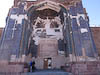
Before getting underway today we took a taxi ride into the city of Tabriz to see the famous blue mosque and the city's bazaar. The blue mosque is no longer blue, it gets its name from the fact that when it was built in 1464 it was decorated inside and out with tiles in various shades of blue. The mosque was destroyed by an earthquake in 1773 and the ruins remained untouched until a recontruction effort started in 1953. Today there are only some small patches of the orginal decoration. One of the interesting features of the mosques reconstruction is the way some of the tile decoration has been extended. Gaps left by missing original tile decoration has been filled in with plaster and the plaster painted to replicate the orginal pattern but in a slightly lighter color. This means that visitors can get the effect of the full sized original decoration but can see clearly where the original finishes and reconstrution starts.
...click/tap to read the full postThe border (Dogubayazit, Turkey)
Journal entry for Wednesday 6th Nov, 2013 (day 217, miles 15,907)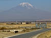
After a very early start we met Hossein at the entrance to Bazargan about 9:45am and the chaos of the Iran side of the Turkey-Iran border got underway. The first issue to be faced was actually getting into the border post. In typical Iranian fashion the entrance gate was competely blocked by taxis and other vehicles that were applying the standard practice of "park anywhere regardless of the trouble it causes". In addition the officers at the entrance wanted us to use the truck entrance and took a little bit of convincing that we infact were not a truck.
...click/tap to read the full postInernet and cheese finally (Lake Van, Turkey)
Journal entry for Friday 8th Nov, 2013 (day 219, miles 15,982)We spent all of yesterday at Larelzar Campground just catching up on chores and generaly vegin-out. Today we spent some time in the town of Dogubayazit mostly looking for an internet cfe that had wifi so that we could connect with our own computer. There must be a dozen internet cafes in a 2 block area of this town however all but one of them has no wifi, they cannot connect a laptop via their wiring and their computers all work in Turkish. Eventually we observed that the customers of these establishments are almost exclusively local boys.
...click/tap to read the full postCappadocia (Goreme, Turkey)
Journal entry for Monday 11th Nov, 2013 (day 222, miles 16,629)
We started the day in mountain mist but that soon lifted and we were treated to a nice sunny day. It is always a little surprising how bright sunshine lifts the mood a bit. However, as you can see from the photos we had, in addition to the sunshine, a little work to do on the truck today. I discovered this morning while doing by irregular inspection that some bolts were loose and needed tightening. Fortunately we found an abandoned gas station which had a nice concrete driveway with a cover in which to work.
...click/tap to read the full postMountains and forest (Ibradi, Turkey)
Journal entry for Thursday 21st Nov, 2013 (day 232, miles 16,930)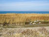
We woke this morning to bright sunshine and a picturesque lake right in front of us. For a while we lay in bed watching the more energetic locals out getting their morning exercise and then eventually stirred ourselves out of bed. The sun and scenery did not encourage a rapid departure so we did some chores, went for a walk into the town center for a little shoppping and just plain looking. It was lunch time before we finally got ourselves underway.
...click/tap to read the full postThe Mediterranean (Tasagil, Turkey)
Journal entry for Friday 22nd Nov, 2013 (day 233, miles 16,979)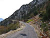
This morning we continued south towards the coast along more twisting narrow mountain roads descending towards the Mediterraean. The morning was overcast so we got very indistinct views of the Mediterranean in the distance, infact one could argue that we needed a good deal of imagination to see the sea.
...click/tap to read the full postKoprulu Kanyon (Antalya, Turkey)
Journal entry for Saturday 23rd Nov, 2013 (day 234, miles 17,072)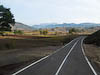
This morning we were heading north again back into the Taurus Mountains in order to visit Koprulu Kanyon a scenic attraction and National Park and the nearby town of Selge with the ruins of a large Roman theater. After crossing the coastal belt the road wound its way up a river valley through picturesque forests, along side crystal clear water and past a number of villages with many restaurants and rafting businesses seemingly closed for the winter season.
...click/tap to read the full post(Kas, Turkey)
Journal entry for Sunday 24th Nov, 2013 (day 235, miles 17,189)
There was still a bit of last nights rain and sour weather around this morning as we set off west from Antalya. Magnificent roads and magnificent scenery was the order of the day as we wound along the coast squeezed between the escapments of the Olympos Mountains on one side and the Mediterranean on the other.
...click/tap to read the full postLunch date (Kas, Turkey)
Journal entry for Sunday 1st Dec, 2013 (day 242, miles 17,190)
We had planned to get on the road today but a last minute invitation to a Thanksgiving lunch from some fellow travelers put paid to that. We spent the morning preparing and packing and then took the yellow beast about a kilometer up the hill to our luncheon appointment. Our hosts were Brett and Sandy a Californian couple who have been traveling in Europe in their pickup and camper and have decided to stay a while in Kaş and have rented an apartment up on the hillside a little out of the main street. At lunch with us were Barbara and Peter the Swiss couple we met in Tajikistan and who are staying in the campground we just departed.
...click/tap to read the full postBack into the mountains (Pamukkale, Turkey)
Journal entry for Monday 2nd Dec, 2013 (day 243, miles 17,371)
So today we did get underway again. For a while the road followed the coast and we got some great views of the Mediterranean and the numerous tourists and other sea side residential developments. As you might be able to tell we are finding the Med coast very pleasant and still marvel at how blue and clean the water looks.
...click/tap to read the full postTravertine marvel (Somewhere along the road, Turkey)
Journal entry for Tuesday 3rd Dec, 2013 (day 244, miles 17,440)
We were up and going promptly this morning as we were keen to explore. However our first problem was bare feet. The main entrance to the thermal area and ruins from the town of Pamukkale starts in the village main area and ascends across the travertines (mineral deposits) on the hill side. To protect those deposits from the hordes of visitors one is required to walk across the travetine in bare feet. Now us old guys are beginning to feel the effects of age and skeletal deterioration and hence bare feet are not our forte. So after some negotiation with the entrance staff we were allowed onto an alternate path that took us to the top of the hill. However as you will see later this did not entirely get past the bare feet topic.
...click/tap to read the full postThe ruins of Ephesus (Ozdere, Turkey)
Journal entry for Wednesday 4th Dec, 2013 (day 245, miles 17,511)
After our night with the trucks we set out in overcast and rain to find our way to the town of Selcuk and the famous nearby ruins of Ephesus. The roads were good the scenery pleasant and we eventually found our way into the main street of Selcuk.
...click/tap to read the full postA travel day (Bergama, Turkey)
Journal entry for Thursday 5th Dec, 2013 (day 246, miles 17,616)
Today was a travel day. We spent a deal of time winding our way along the coastal road and then through the city of Izmir (according to the Lonely Planet the 3rd largest city in Turkey). The route through Izmir took us along the water front; it looked really inviting with the bright sun, blue water, promenade and gardens but with no obvious places to stop we only admired it from the truck cab. The city seemed to stretch for miles as the road passed through one community after another. This gave us an opportunity to admire the way the Turks have put modern roads through old towns. As it passes through a congested shopping or market area inside a town the road is made up of three pieces, the center lanes are for through traffic and there is a lane on each side for local traffic. At intersections the through-road simply goes under the intersection with a well signed 4.8m clearance.
...click/tap to read the full postBergama and the Ruins of Pergamum (Burhaniye, Turkey)
Journal entry for Sunday 8th Dec, 2013 (day 249, miles 17,686)
As you can see from the date on this entry we have skipped a few days. We spent those days hold up in the caravan ground at Bergama. There is not much to say about those days except perhaps that the weather varied between bright winter sun and howling wind and rain. Night time temperatures below freezing as indicated by the ice on the ground in the morning. Today we are on our way again with a visit to Pergamum, the local Acropolis (fort on a hill) and the center of the old city of Bergama
...click/tap to read the full postCountry villages and narrow roads (Burhaniye, Turkey)
Journal entry for Monday 9th Dec, 2013 (day 249, miles 17,686)
Today we are headed for the old city of Troy and since the days route seemed to be relatively short we chose to follow the coastal road as much as possible. As a result we spent most of the day traveling along winding roads that pretended to be wide enough for two vehicles but in many places would not have fitted two of us side by side. We passed through small country villages with narrow streets, lots of tractors, herds of goats and olive trees and olive trees.
...click/tap to read the full postA visit to old Troy (Troia) (Burhaniye, Turkey)
Journal entry for Wednesday 11th Dec, 2013 (day 252, miles 17,805)
We have now been in the caravan camp at Troy for a couple of days and over that time the weather has been bright and sunny as well as wild and wet. This morning it is clear and very cold. There is some solid ice on the ground this morning and snow is being predicted for the Gallipoli Penninsula just a few miles away. Never the less today is the day we will visit the historic sight of Troy. But we will do it dressed in all the cold weather gear we have.
...click/tap to read the full postEurope! (Eceabat, Turkey)
Journal entry for Thursday 12th Dec, 2013 (day 253, miles 17,826)
Today is/was a big milestone for our journey, we crossed the Dardanelles (Hellespont) to the Gallipoli Peninsula and into Europe. In all other ways the day was quite un-remarkable. This morning as we prepared to depart our camp at Troia there was light snow falling (though none was accumulating). There after a shortish hop took us to the town of Çanakkale (which we would learn is pronounced Chanakarley) and the ferry to Eceabat on the Gallipoli Peninsula.
...click/tap to read the full postExploring the Gallipoli Peninsula (Kilitbahir, Turkey)
Journal entry for Friday 13th Dec, 2013 (day 254, miles 17,896)
The weather was a little better this morning, though still not great, overcast with occassional showers. But we could not let the weather prevent us exploring the peninsula. From Eceabat we headed to the western shore which is where most of the sites of interest to Australians lie. First stop was a somewat run down information center which despite its need for some repairs effectively told the story on the background to and course of the Gallipoli campaign.
...click/tap to read the full postTo Istanbul (Selımpaşa, Turkey)
Journal entry for Saturday 14th Dec, 2013 (day 255, miles 18,093)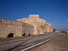
We were welcomed this morning by bright sunshine and blue sky. Before getting underway we spent some time walking along the water front enjoying the fabulous scenery before making a quick tour of the gun battery.
...click/tap to read the full postIstanbul - sort of! (Istanbul, Turkey)
Journal entry for Sunday 15th Dec, 2013 (day 256, miles 18,150)Well today was an adventure of back streets and low underpasses. Early on in the day we were feeling good, we left last nights camp in bright sunshine and got onto one of the many freeways heading into Istanbul and all seemed to be going well. Then we made a small navigation mistake by missing a fork in the freeway. But initially that did not seem too bad as our GPS quickly re-routed us and we started following the corrected route. But quite quickly this new route dropped off the freeway, into a crowded intersection and we found ourselves confronted with a 3.6M clearance sign. Fortunately we found our way past that one only to be confronted by one that read 3.8M and at this one there was no way out other than a long reverse through heavy traffic. Now remember our truck is actually 4.0M high. But I noticed that there was a slope on the road and that the clearance was greater on the left hand side of the road. Against Nina's protests I gingerly tried that higher side and squeezed through with no damage.
...click/tap to read the full postIstanbul (Istanbul, Turkey)
Journal entry for Monday 16th Dec, 2013 (day 257, miles 18,093)
We pretty much got going with the sun this morning with the forlorn hope that an early start would help us avoid some of the heavier traffic. It did not seem to.
...click/tap to read the full postThe Tumulus and Phillip II's Tomb (Vergina, Greece)
Journal entry for Monday 30th Dec, 2013 (day 271, miles 18,587)
This morning we needed to find fuel and money so we used our trusty OSM map to pick a group of banks in the city of Thessoliniki and headed that way. Unfortunately the road system defeated us and we passed by our targeted banks on a limited access road with no way to get to our targets. A further check of the map identified a Shell station at the entrance to a small town called Chalastra so that was our next hope, and indeed it worked. Diesel for 1.355 Euro per liter (about $6.80/gallon). Also the owner would accept credit cards, spoke English and has a brother that lives in Canberra. We suspect we will meet a lot of people in Greece with relatives in Australia.
...click/tap to read the full postSome Greek country roads (Near Delhpi, Greece)
Journal entry for Tuesday 31st Dec, 2013 (day 272, miles 17,896)We departed our parking lot this morning in the rain and for a while continued south on the motorway paying tolls at regular intervals. But eventually our route and inclination took us onto some country roads and through rolling farm land. All in all an unremarkable day.
...click/tap to read the full postDelphi was closed (Delphi, Greece)
Journal entry for Wednesday 1st Jan, 2014 (day 273, miles 18,823)
As we drove those 40 km to Delphi this morning the road became increasingly narrow and twisting as we climbed into the mountains and had us wondering whether we would in fact be able to enter the town and get to the archaeological site and museum for which the town is now famous. With that concern in mind we parked right at the entrance to the town's main street and went exploring on foot. As it turned out modern Delphi's main street is actually two streets, one in each direction. They are both quite narrow and made even more so by the habit of locals and visitors parking down each side of the street. But never the less it seemed likely we could get through; if tour buses can do it so can we. So after a tense 10 mintes passing by parked cars with literally inches to spare on each side we were on the other side of the town and parked in front of the Archaeological Museum. There, together with a smattering of other tourists we discovered that the museum was closed (it was after all New Years day).
...click/tap to read the full postDelphi this time open and sunny (Athens, Greece)
Journal entry for Thursday 2nd Jan, 2014 (day 274, miles 18,939)
This morning the sun was out making a perfect morning for our visit to the ruins of ancient Delphi. There were only a handful of other tourists around as we climbed up through the ruins admiring the various buidings and other artifacts. Despite being a tourists mecca, and a bit of a cliche, the place was really quite impressive. Many of the more delicate statues recovered from the ancient site are now housed in the nearby museum and after our visit to the ruins we spent some time there admiring the masterful statuary (both stone and bronze). One could not help but wonder how much of our civilization will be visible in 3000 years.
...click/tap to read the full postFerry to Santorini (Athens, Greece)
Journal entry for Monday 6th Jan, 2014 (day 278, miles 18,939)
This morning we were awake at 4:45am in order to get to and catch our 7:30 ferry to the Greek Island of Santorini. The ferry ride took all day as the vessel made stops at a number of Islands as well as Santorini. The journey was uneventful, though a bit boring. But fortunately the sea was calm even though the weather was overcast.
...click/tap to read the full postPeloponnese (Xiropigado, Greece)
Journal entry for Friday 10th Jan, 2014 (day 281, miles 19,024)
We spent yesterday recovering from our overnight ferry ride and doing a bit of "getting underway" preparation so that this morning we could depart our friendly camp ground for the next stage of our Tour of Greece. Navigating was easy as we traveled out of Athens towards Corinth and the Island of Peloponnese.
...click/tap to read the full postA glorious day (Monemvasia, Greece)
Journal entry for Saturday 11th Jan, 2014 (day 282, miles 19,118)
Today was a glorious day, warm (60°F), sunny and with the bright blue Mediterranean and many picturesque villages to admire. We spent the morning simply enjoying the coastal scenery.
...click/tap to read the full postDiros Caves (Lobkadika, Greece)
Journal entry for Sunday 12th Jan, 2014 (day 283, miles 19,218)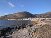
We lazed around Monemvasia this morning enjoying the sun and doing a little exploring of the nearby village. But eventually it was time to get going so we continued our adventures on mountain roads and narrow village streets towards the west coast of Peloponnese to Areopoli and then a little south to the Dimos Caves.
...click/tap to read the full postA cute village (Near Sparti, Greece)
Journal entry for Monday 13th Jan, 2014 (day 284, miles 19,318)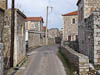
A prompter start this morning as the weather was not so inviting and we had more on our agenda today. First off we crossed back over to the west coast of Peloponnese, past Areopoli again and then north along the coast to the little village of Kardamyli. Nina had read/heard about this place from one of Rick Steve's tapes/books/shows. The people of the village apparently have worked hard to prevent over development. So after a lot more narrow roads and even narrower villages we arrived at Kardamyli.
...click/tap to read the full postNew friends and expedition trucks (Near Olympia, Greece)
Journal entry for Tuesday 14th Jan, 2014 (day 285, miles 19,477)This morning we continued east towards the town of Nafplio. Now anyone following our antics on Peloponnese will have noticed that this route takes us back almost to the start of our Peloponnese journey so the natural question is why?
...click/tap to read the full postAn unexpected meeting (Ancona, Italy)
Journal entry for Friday 17th Jan, 2014 (day 288, miles 19,568)Before getting on to todays report I want you to look at the photo of the green truck in yesterdays photos and note the seating position of the driver. We thought our Unimog was pretty smart with its variopilot which allows the steering wheel and pedals to be moved to the other side of the cab to make the truck right hand drive. Well the tug trucks that move trailers around the port of Patra go one better; they can actually turn the driving position around so that they don't have to reverse with mirrors.
...click/tap to read the full postFirst taste of European roads (Faenza, Italy)
Journal entry for Saturday 18th Jan, 2014 (day 289, miles 19,702)
Once awake this morning we moved our vehicle back into the ferry waiting area and the catching up with Gary and Monika continued. In addition now in the light of day we could take a few photos of the twoadventure vehicles parked side by side. However eventualy it was time for the Wescotts to checkin for their ferry and for us to get on our way.
...click/tap to read the full postVenice across the water (Fusina, Italy)
Journal entry for Sunday 19th Jan, 2014 (day 290, miles 18,939)
We had a rude awakening and a few sick moments this morning. Lying in bed half asleep I could hear the engine of a nearby semi-trailer and deduced from the noise that the driver was manouvering around some kind of obstacle. After a few moments I realized that the gray mass just outside the window over our bed was not fog but the side of a truck and then that is was only 2 inches from the window. Yikes; the driver was manouvering around US. I bounded out of bed with the intent of either sounding our horn of moving our truck. I got the engine started, bare foot down on the clutch pedal to engage the gear, and my left calf muscle screamed in anger with a cramp. You see I was too quick; the truck had not built enough air pressure to provide power assistance to the clutch and my still sleepy legs did not want the stress of pushing the un-assisted clutch.
...click/tap to read the full postThe alps, expensive roads (Muhlbachl, Austria)
Journal entry for Tuesday 21st Jan, 2014 (day 292, miles 20,063)
Today we planned to simply drive as far as we could in the hope of clearing the alps during a window of relatively good weather - you see we don't have snow chains for our trucks and hence we did not want to be in the alps during a storm. So we headed out towards Verona along the A4 and then north along the A22 towards the Brenna Pass and Austria.
...click/tap to read the full postFinding a camping ground near Munich (Munich (Langwieder See), Germany)
Journal entry for Wednesday 22nd Jan, 2014 (day 293, miles 20,198)Today we were looking for a camping ground on the outside of Munich. We wanted a place to park for two nights so that we could visit some Gig Harbor friends who are spending a year living in and experiencing the German lifestyle in Munich.
...click/tap to read the full postIt's 2:00pm, must be the Netherlands (Kasterlee, Belgium)
Journal entry for Saturday 1st Feb, 2014 (day 304, miles 20,704)Today we just drove, with the intent/hope of getting to a camping ground within easy reach of Antwerp by the end of the day. At one point during the day the road crossed a 20 km section of the Netherlands, we joked with each other that if it is 2:00pm - it must be the Netherlands. At this rate we could drive across the whole of Europe in a coupLe of days and see nothing except motorways.
...click/tap to read the full postDelivery and a lucky escape (Antwerp, Belgium)
Journal entry for Monday 3rd Feb, 2014 (day 306, miles 20,704)
We spent yesterday preparing the truck for shipping. This mostly involved packing things away inside the vehicle out of sight and cleaning. We had been warned by the shipping agents ( Seabridge For Motorhomes) that Canadian customs will be fussy about dirt on the outside of the vehicle. So at Merex we had the outside thoroughly cleaned with steam and pressure washer but the drive since then (through the rain) had covered the vehicle with road dirt. So we both spent a few hours with broom and bucket cleaning said road dirt off.
...click/tap to read the full postCollecting the truck (E313 (near Beringen), Belgium)
Journal entry for Monday 23rd Jun, 2014 (day 343, miles 0)
Today was the big day, we were reunited with the truck. We hung out at the apartment until about 11:00 am and then headed to the office of the freight forwarding agent that was going to help us with the port formalities. At the office we did some more waiting, had some documents copied, and did some more waiting. Eventually Karl (the driver) turned up and there after things moved at a brisk pace. A drive to the port, a lightning quick visit to the customs office, a signature on some papers at the entry to the holding yard and we were at the truck all cleared for departure. From the time we got into Karl's car the whole process took less than an hour; and most of that was driving time.
...click/tap to read the full postFriends (Thilhove, Germany)
Journal entry for Tuesday 24th Jun, 2014 (day 344, miles 94)
Today we were headed for the home of some travelers we met back in 2010 in South America. According to the instructions we had, their house was in a small village called Thilhove east of Cologne. We feared that it would require some squeezing through tight streets and a bit of careful navigation. So after waking up to a nice sunny day, getting some fuel (Euro 1.47/liter) we headed east along the A313/A4/E40 (all the same road, A313 is the Belgium designation, A4 the German and E40 the European - and I forgot what its called in the Netherlands. But we only spent 20 minutes in that country today.)
...click/tap to read the full postA visit to Köln (A3 (near Krauthauser), Germany)
Journal entry for Wednesday 25th Jun, 2014 (day 345, miles 293)
Wolfgang had offered to drive us into Koln this morning so that we could at least get a taste of the city and see its famous cathedral. So after a pleasant breakfast outside in the morning sun we piled into his Landrover 110 and got going.
...click/tap to read the full postAn introduction to Poland (Piotrowice, Poland)
Journal entry for Friday 27th Jun, 2014 (day 347, miles 360)We said an early thanks and goodbye to our hosts and then negotiated our way back onto the A4 via a Lidl supermarket and a BP gas station. There after most of the day was pretty uneventful, just purring along a European motorway.
...click/tap to read the full postCamping in Warsaw, or not (Warsaw, Poland)
Journal entry for Saturday 28th Jun, 2014 (day 348, miles 424)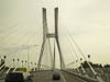
Our overnight spot might have been relatively empty yesterday afternoon, but this morning it was a hive of activity. Trucks pulling in and out and families stopping to snack. We got an early start hoping to make it all the way to Warsaw.
...click/tap to read the full postWarsaw, an early morning visit (Białystok, Poland)
Journal entry for Sunday 29th Jun, 2014 (day 349, miles 1,068)
After yesterdays unsuccessful effort to find a campground in Warsaw, this morning we were determiend to give the city another go. At least to the extent of finding some place to park so that we could spend a little time exploring the old city.
...click/tap to read the full postFinally, some luck with camping grounds (Vilnius, Lithuania)
Journal entry for Monday 30th Jun, 2014 (day 350, miles 1,273)
More trucks, forest and farm land today; and it rained most of the day. Crossing into Lithuania we noticed that the villages seem a little more run down, the cars and trucks seem a little more beaten up and we see more incidents of people parked on the side of the road fixing their vehicles. All together more "ex-soviet" in nature. Also the driving styles have become more "eastern". All roads now have three lanes, mine, the one coming towards me, and the one that someone is trying to make between those two. Something that is totally unheard of in Germany. Maybe the driving style explains the many small shrines we noticed on the road side.
...click/tap to read the full postFirst Christmas Tree (Riga, Latvia)
Journal entry for Wednesday 2nd Jul, 2014 (day 352, miles 1,459)
Today we got to Riga, the capital of Latvia, and after parking at the campground we walked into the old city for a look around. While it was another of those old cities decked out with wall to wall bars and restaurants for tourists it was still interesting and impressive. More churches was the order of the day.
...click/tap to read the full postLittle Cabins in the woods (Pärnu, Estonia)
Journal entry for Thursday 3rd Jul, 2014 (day 353, miles 1,584)
Leaving Riga this morning we managed to take ourselves (or should I say our SatNav took us) through the very center of the city, followed a cobbled street and tramline for 12km or more before finally getting onto a more regular highway. Now just so you understand the Yellow Mog does not particularly like cobblestones as they tend to be a bit like those 1950s weight reducing vibration machines. It certainly dislikes tram lines as steering becomes somewhat optional once the tires find the groove. But the big bug are the tram wires. When erected during the soviet era the tram wires were often lower than the 4m height of our truck, as we discovered in Central Asia. Fortunately Vilnius seems to have upgraded their tram wires to European standards but it was quite a few kilometers before we were completely convinced.
...click/tap to read the full postShopping spree and then a ferry (Helsinki, Finland)
Journal entry for Friday 4th Jul, 2014 (day 354, miles 1,693)
On our way out of Pärnu we had a real shopping spree as we found a huge supermarket (actually a couple of them but we only needed one) and stocked up for our pending journey into the remoteem> Scandinavian North. Now it is not that we have not seen supermarkets anywhere else on this journey. But finding one with a very large selection and with a car park that allowed us easy access has been quite rare. So we reveled in the opportunity.
...click/tap to read the full postWhich way Russia (Lappeenranta, Finland)
Journal entry for Sunday 6th Jul, 2014 (day 356, miles 1,835)
A curious episode on our departure from Helsinki. As we approached the entry ramp to the E13 (the main road to the North East) we pulled up beside a large white truck pulling a large white enclosed trailer. The driver signaled me to wind down our window and promptly asked (in a language I did not recognize) something about St Petersburg. I pointed right onto the E13 and tried to also signal that we should stop together and look at our map. That seemed to work a few miles down the motorway we both pulled into a rest area. The truck was a mobile television production facility and the two guys in it were taking it to Moscow via St Petersburg. After some discussion over our iPad map they seemed satisfied and got underway. At this point in our journey St Petersburg is about 400 km east.
...click/tap to read the full postMedieval Castle (Lappeenranta, Finland)
Journal entry for Monday 7th Jul, 2014 (day 357, miles 1,930)
Well Russia got a lot closer today. At our mid morning rest stop near the town of Simpele we were within 600 yards/meters of the Russian border. Not surprisingly we had noted during the mornings drive that more signs where in Russian.
...click/tap to read the full postA hill (Koli, Finland)
Journal entry for Tuesday 8th Jul, 2014 (day 358, miles 2,077)
So we continued north today, more good highway and of course more trees. But the weather is good and life seems stress free - except for the water leak. I spent a little time trying to diagnose that issue during the drive but got no where. I really need to be able to pull the entire fresh water system apart but don't have the facilities, tools or parts to do that. The good news on the water front is that the isolation valves that were installed by GXV while we were back in the US have proven very useful. I have been able to isolate the hot water tank from the coolant system. That means I don't have to deal with hot components while I examine the area of the leak.
...click/tap to read the full postA lazy day (The road, Finland)
Journal entry for Wednesday 9th Jul, 2014 (day 359, miles 2,225)Today was a bit of a lazy day, we traveled just under 150 miles. Considering that we are now far enough north that it does not get dark that represents a very lazy day. In addition to driving we had another shopping opportunity. In the town of Kajaani we found a number of large well stocked supermarkets.
...click/tap to read the full postAnother summers day (Juuma, Finland)
Journal entry for Thursday 10th Jul, 2014 (day 359, miles 2,225)
We spent some time this morning at last nights camp site, and also at stops along the days route, looking further at our water leak. It may be hard for those that don't own motorhomes to appreciate the frustration of having a problem like this and not being able to diagnose or fix it; but believe me it is (in our case) high. Thus we were delighted that today we believe we found the source of the water and it is nowhere near as big a deal as I had been fearing. I will say more on this topic in an upcoming post on Plumbing, but for the moment let me just note that the leak was from the second stage fine grained water filter we have installed for our drinking fountain. Now mind you we have not proven this beyond a shadow of doubt just yet but feel confident.
...click/tap to read the full postThe Arctic Circle (and reindeer) (Rovaniemi, Finland)
Journal entry for Saturday 12th Jul, 2014 (day 362, miles 2,509)
Today we hit The Arctic Circle. This happened on our way to the city of Rovaniemi which is the capital city of Lapland, the home of the Sami people. Along the way we got our first sightings of reindeer and one very obscured moose. As an aside we have been looking for moose since Poland. There have been signs warning of moose every 5 km since we entered Finland, but his is first real sighting.
...click/tap to read the full postSanta Claus (Vuotso, Finland)
Journal entry for Sunday 13th Jul, 2014 (day 363, miles 2,622)
Just a little north of Rovaniemi there is a place called Santa Claus Village. It has lots of souvenir shops, cafes and a number of different Santa Claus's that you can visit and talk to. This is the place where children's letters to Santa are sent (at least if you are not from the US). We spent a while here walking around looking at the place, the people and giving Nina an opportunity to buy some of those souvenirs. Interestingly the place had a number of Russian tourists and hence many signs in Russian.
...click/tap to read the full postReindeer day (Inari, Finland)
Journal entry for Monday 14th Jul, 2014 (day 364, miles 2,725)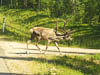
What can I say. Finland provided yet another glorious summers day and we enjoyed it. We stopped frequently to photograph the industrious reindeer (they are occupied eating to the extent that they seem not even to notice people), had a swim in one of the very pretty and beckoning lakes (just to find that despite the sun they are pretty bracing).
...click/tap to read the full postNorway (Kirkenes, Norway)
Journal entry for Tuesday 15th Jul, 2014 (day 365, miles 2,855)
This morning we headed towards the border with Norway and what started out as another great Finish summers day slowly turned into a cool overcast 50°F (10°C). The forest of evergreens gave way to stunted birch and the roads suddenly were quite bumpy.
...click/tap to read the full postAnother Mog! (Utsjoki, Norway)
Journal entry for Wednesday 16th Jul, 2014 (day 366, miles 3,012)
Today we spent a good period following a section of Norway's rugged coast. What a difference between this scenery and Finland's forests. The weather continued cool, with a strong breeze that added to the sense of ruggedness. Low scrubby birch trees continued to be the main vegetation but with large areas of moor land as well, reminding us of the maritime provinces of Canada - not surprisingly.
...click/tap to read the full postSapmi Theme Park (North of Lakselv, Norway)
Journal entry for Thursday 17th Jul, 2014 (day 367, miles 3,110)
The highlight of today was a visit to Sapmi in the town of Karasjok. In our guide book the place was described as a Theme Park and on the basis of that we almost did not go there but it actually turned out to be more like an historical village. There were many re-creations of dwellings and various other artifacts used by the Sampi peoples in their traditional way of life. It really was quite interesting. Not surprisingly there were lots of things related to reindeers.
...click/tap to read the full postMost Northerly Point (Knivskjellodden, Norway)
Journal entry for Friday 18th Jul, 2014 (day 368, miles 3,224)
This morning we drove the road to Nordkapp, and what as spectacular road it was. Narrow, clinging to the side of one mountain after another that bounded Fjord after Fjord, Some 14 km of tunnels, the longest of which at 7 km actually went under the ocean to join the mainland to the island of Mageroya (where the town of Nordkapp is located).
...click/tap to read the full postReindeer day (North of Alta, Norway)
Journal entry for Sunday 20th Jul, 2014 (day 370, miles 3,335)
This morning there was no sign of the cold and mist of yesterday, indeed everyone was out and about wearing summer clothing rather than the down jackets of yesterday. We paid the various lookouts a final visit and then we were on our way south bound. What a difference the bright sun made as we retraced the narrow coastal road, and tunnels, back to the town of Olderfjord where our southerly route departed from the route we had taken going north. At one of the nameless villages north of Olderfjord the local Reindeer population decided to give the tourists a show and we sat stopped on the side of the road for perhaps 30 minutes while a small herd of the animals busied themselves going this way and then that. It seemed like a random coming together and parting of the group only for them to rejoin in a few minutes. At one point the entire heard got together and headed for and entered an old derelict building.
...click/tap to read the full postRock carvings and slate mines (South of Alta, Norway)
Journal entry for Monday 21st Jul, 2014 (day 371, miles 3,427)
It was a short drive into Alta this morning where our first item of business was groceries, one of those never ending chores even when one is on a vacation/adventure. With the necessities done we headed for the local museum, a nicely situated building with a rather strange assortment of displays. The one that captured my attention was a short video on the local slate mining industry and small display of related tools. It was fascinating to see the miners split large slabs of slate into thinner sheets with just a hammer and chisel.
...click/tap to read the full postTurned up toes (Finland Border, Norway)
Journal entry for Tuesday 22nd Jul, 2014 (day 372, miles 3,525)
Our route this morning carried us along side a series of connected lakes through country that was covered in low birch trees towards the town of Kautokieno and its small museum. Our guide book informed us that this town is predominantly inland Sami people and traditionally was the winter camping place for the Sami.
...click/tap to read the full postJust a driving day (Near border with Finland, Sweden)
Journal entry for Wednesday 23rd Jul, 2014 (day 373, miles 3,632)Not much to report for today, as it was pretty much just drive to cover some miles. We spent a pleasant few hours parked in the little town of Enontekio while we got some groceries and did some online business and then into Sweden through the small Swedish border town of Karesuando.
...click/tap to read the full postKiruna Mine (Jukkasjarvi, Sweden)
Journal entry for Thursday 24th Jul, 2014 (day 374, miles 3,728)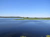
Our route this morning took us through Vittangi and Svappavarra on our way to Kiruna and the nearby village of Jukkasjaavi, which are famous for the worlds largest underground iron ore mine and the Ice Hotel respectively.
...click/tap to read the full postThe Ice Hotel (Narvik, Norway)
Journal entry for Friday 25th Jul, 2014 (day 375, miles 3,841)
After a comfortable night in the hostel parking lot and the luxury of long hot showers we were ready for our Ice Hotel tour. So at 10:00 am we strolled down to the large TeePee near the rivers edge to meet our guide. He was inside making coffee for the group over an open fire. The group turned out to be just Nina and I so we basically got a private tour.
...click/tap to read the full post(Innhavet, Norway)
Journal entry for Saturday 26th Jul, 2014 (day 376, miles 3,962)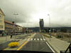
The weather was overcast this morning with the local mountain tops covered in mist. The weather somewhat detracted from the splendor of the view as we wound our way along the coast through inlet/fjord after fjord. Around lunch time the road took us to a ferry dock where we waited with an assortment of motorhomes, cars and trucks for the ferry crew to decide it was time to load up and get going. The ferry was carrying the traffic across a rather large expanse of water that had not yet been subdued with a long under water tunnel. I guess that will happen in time. Incidentally the ferry cost us approximately US$50 proving that motoring in this part of the world is not cheap.
...click/tap to read the full postLeaving the Arctic (Bjerka, Norway)
Journal entry for Sunday 27th Jul, 2014 (day 376, miles 3,962)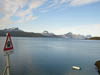
The big event of today was that we are finally dropping below the Arctic Circle. It seems amazing that we have been traveling North of that imaginary line for so long. In North America there are only a few roads that actually go north of the circle but here we have traveled a whole complex of roads, towns and even countries above the Circle.
...click/tap to read the full postJust driving along (Grong, Norway)
Journal entry for Monday 28th Jul, 2014 (day 378, miles 4,299)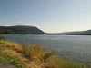
Our journey today was away from the coast and the scenery was more mountainous interspersed with many small farming villages, farm houses, lakes, rivers and the ever present trees. The volume of clean clear fresh water is hard to comprehend. When we first got to the US the abundance of water was one of the aspects of the country that surprised us, well the Scandinavian countries have surprised us again. Water seems to be endless. Today it was in the form of picturesque lakes and crystal clear mountain streams and rivers, some of them meandering and some of them roaring.
...click/tap to read the full postChips and hitch hikers (Roros, Norway)
Journal entry for Tuesday 29th Jul, 2014 (day 379, miles 4,501)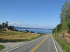
This morning after a little while traveling the road brought us to a long thin lake called Snasavatnet and there after followed the shore for its entire length. Along the lake there were a number of villages and many farms. The area had a general sense of being less remote with the buildings being even more well cared for and more traffic on the road. By the time we reached the city of Steinkjer a little while later the density of traffic, sections of 4 lane highway, and bustling businesses confirm that we are no longer in the remote north of Norway but heading towards more populated areas.
...click/tap to read the full postMushroom picking (Kroken, Norway)
Journal entry for Wednesday 30th Jul, 2014 (day 380, miles 3,228)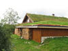
This morning we traveled the final leg to meet our German friends. Once through Roros the road was varied with some good sections and some really quite bumpy sections. Also, in places, the local sheep decided to make driving more challenging by sitting down in the middle of the road. We guessed that the roadway was warmer than the nearby grass.
...click/tap to read the full postLooking for a camping spot (Kvam, Norway)
Journal entry for Thursday 31st Jul, 2014 (day 381, miles 4,719)
Last night we all decided that today we would travel together (in convoy) and try and find a camping spot together since it seemed that both parties were traveling in the same direction for at least a few days; headed towards the coastal fjords and mountains around Bergen.
...click/tap to read the full postGlaciers (Sognfjell, Norway)
Journal entry for Friday 1st Aug, 2014 (day 382, miles 4,807)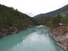
We decided that the two vehicles would travel separately today but that if possible we would meet up for the night. Romy and Wolfgang were on the road first and so would probably find a spot first. If so they would text us their GPS coordinates.
...click/tap to read the full postDescent (Sogndal, Norway)
Journal entry for Saturday 2nd Aug, 2014 (day 383, miles 4,868)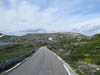
Our two groups parted ways this morning. Wolfgang, Romy and the children need to start south tomorrow whereas we (Nina and I) are headed towards a town called Flam in the hope of being able to find a base for exploring the area. So we said our goodbyes and then the VW van was off leaving Nina and I to slowly get ourselves organized for the days travel.
...click/tap to read the full postNo messy pants on the snow road (Flam, Norway)
Journal entry for Sunday 3rd Aug, 2014 (day 384, miles 4,953)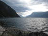
First let me explain the title of todays post. Between the towns of Laerdal and Aurland there is a famous tunnel. It is the longest road tunnel in the world at 15.23 miles (24.51km) in length. The tunnel opened in 2000 and made obsolete the original road between these two town that traveled over the mountains reaching over 4000'. That original road still exists and is called locally the snow road (I don't under stand why it is called that as when it is snowing is the very last time one would want to use that road). But never the less it has become a tourist attraction in its own right. We read some weeks back in our LonelyPlanet guide book the following statement about driving the snow road "the drive was worth the messy pants" Giving us the hint that the road would be steep, narrow and probably a little scary. Well this morning we got to the town of Laerdal and it was time for us to try the Snow road.
...click/tap to read the full postUnderground roundabouts (Nesflaten, Norway)
Journal entry for Thursday 7th Aug, 2014 (day 388, miles 5,091)
During this trip we have been often quietly amused by the enthusiasm Europeans exhibit in their efforts to take some sun. We often see travelers pulled up at some little way side stop, with their deck chairs out, sitting faces up catching the summer sun. Mostly the men (regardless of age or physical condition) have their shirts off to maximize their solar dose. Well yesterday evening we saw what might be the ultimate example of solar craving. In the parking lot of the Flam train station we observed a well conditioned young man repacking his car wearing only the briefest of swim suits (or maybe undies - we did not ask).
...click/tap to read the full postPulpit rock (Netflaten, Norway)
Journal entry for Friday 8th Aug, 2014 (day 389, miles 5,195)
Today our goal was the famous Pulpit Rock (Prekestolen) it took us a while, and more interesting roads and nice scenery to get there, but eventually we pulled into the parking lot and were confronted by hundreds of cars and motorhomes all packed together. We had read in our guide book that this was the most visited tourist attraction in Norway and the number of vehicles in the parking lot gave credence to that claim.
...click/tap to read the full postGrass tops (Gvammen, Norway)
Journal entry for Saturday 9th Aug, 2014 (day 390, miles 5,366)
Today was pretty much simply a travel day. We headed approximately east all day (approximately because road directions in this country are dictated by valleys not the destinations) passing through a number of winter skiing areas and areas with what looked like lots of holiday cottages. We got captivated by the grass roofs and the little raised log constructions - see the final picture. We would be interested if anyone could tell us the function of these little structures, we speculated that they are some form of storage.
...click/tap to read the full postSweden here we come (Byalven River, Sweden)
Journal entry for Sunday 10th Aug, 2014 (day 391, miles 5,558)We are now on a bit of a mission to get to Stockholm. There are a number of reasons for this not the least including that it seems like a good place to do some preparation for our upcoming trip to Africa (without the truck). So today we set off from our camping spot with the plan of getting to and crossing the "border". There was a noticeable change in scenery as we passed by Oslo (on the southern side). Up until then Norway had been characterized by very steep, mountainous, rocky terrain and consequently with roads that wound between the terrain. Not far east of Oslo we were suddenly in flatter more open country and by the time we got to the Swedish border the country was flat and either forested or farmed. What a difference.
...click/tap to read the full postWater water everywhere (Stockholm, Sweden)
Journal entry for Monday 11th Aug, 2014 (day 392, miles 5,774)Had I known what the day was going to bring I may have stayed in bed, but I guess thats not how things work. This morning it was raining, a really wild storm with heavy driving rain, which was (as it turned out) the perfect weather to expose a leak in our trucks roof-top air conditioning system. Only a few miles down the road we noticed a wet patch on the ceiling of the truck's head liner. As we drove the wet patch expanded until almost the entire drivers side ceiling was wet. A few miles later and it was now raining inside the truck. Fortunately we found a convenient truck parking area and stopped. However the rain did not stop and neither did the the water leaking into the truck. Eventually I got out a tarp and covered the roof of the truck. That eventually worked but by then the entire head liner was soaked and we had containers catching water all over the inside of the truck cab.
...click/tap to read the full postOops! (Granna, Sweden)
Journal entry for Sunday 17th Aug, 2014 (day 398, miles 5,946)This morning I discovered that during yesterdays removal of the hot water tank I committed a rather embarrassing oversight. After packing up and doing all the other "leaving-camp" chores this morning I decided that I would start the truck and warm up the engine while Nina went and paid the bill. So I was sitting in the cab letting the engine idle when suddenly the truck computer started making it's unmistakeable something is wrong noise, a high pitched siren; to be helpful the computer also displayed a sign on the instrument panel that indicated low coolant. Shutting down the engine I rushed to the side of the truck to check the valves that close off coolant flow to the (now removed) hot water tank only to discover that those valves were open and that coolant had been pumping into the space under the kitchen sink where the hot water tank resides. That commenced a good hour or so of soaking up red coolant with paper toweling and topping up the cooling system with water. What a stupid mistake, but fortunately with no significant consequences.
...click/tap to read the full postDCU (Copenhagen, Denmark)
Journal entry for Monday 18th Aug, 2014 (day 399, miles 6,162)
The final leg of the drive into Copenhagen was good, 4 lane motorway and weather that was the same as yesterday a mix of sun and heavy rain, but all in all an easy days driving.
...click/tap to read the full postThat water tank (Copenhagen, Denmark)
Journal entry for Wednesday 20th Aug, 2014 (day 401, miles 5,774)
It would to accurate to say that I have long been nervous about the job of re-installing the hot water tank. That is one of the reasons I did not remove it to check it for leaks much sooner. I have been concerned that I would not be able to reconnect the engine coolant supply well enough to prevent leaks. That concern was based on the difficulty I foresaw of working in the tight confines under the kitchen sink, and because even the original installation had some very minor leaks - suggesting that it was difficult to make good connections.
...click/tap to read the full postAfrica!! (Niarobi, Kenya)
Journal entry for Saturday 30th Aug, 2014 (day 411, miles 6,764)
Yesterday, Friday, the big day finally arrived and we were off to Africa. This trip has been in the planning since last year in Iran and Nina and I are both quite excited. But unfortunately as often happens with exciting vacations they start with a long spell of waiting in airports and sitting squished up in modern planes. Our Africa vacation started the same way. Hours at Berlin Airport waiting for a delayed plane, a packed plane of Egyptian families and their spoiled sons. More waiting in Cairo, a reasonably comfortable flight to Nairobi and finally a 4:00am landing and the inevitable paper work. But never the less we were in bed at our hotel by 5:00am and got some welcome catchup sleep.
...click/tap to read the full postTraveling to Arusha (Arusha, Tanzania)
Journal entry for Tuesday 2nd Sep, 2014 (day 414, miles 6,764)
Today was a traveling day, from Nairobi to Arusha (Tanzania), so no animal watching. The day was not without some points of interest however. To start with the hotel recommended we book our taxi for 5:45 to travel the 15 km to the airport for an 8:30 flight; seemed like a lot of time to us. Once we were on the plane we could understand their suggestion. Even at 6:00am in the morning Nairobi traffic was thick and not moving very fast. At the airport there was a long line of people trying to get into the terminal as all bags and passengers had to pass through a security screen before entering the terminal. And then the gate staff commenced boarding the plane an hour before takeoff. The good news about the early boarding was that the cabin staff could serve the "meal" while we were still on the ground as the 35 minute flight time really did not give them enough time to push their service trolley up and down the aisle more than once. The other good news was the relatively new and apparently well maintained plane.
...click/tap to read the full postTarangire I (Oliver's Camp, Tanzania)
Journal entry for Friday 5th Sep, 2014 (day 417, miles 6,764)
The president's presence was still being felt in the hotel this morning. A lot more people, a red carpet out in the main foyer, and a higher level of security. In amongst all this organized chaos we got breakfast, checked out and started out safari. First stop was the downtown area of Arusha, provisioning up for the journey and a briefing on the details of our safari at the office of Easy Travel. Following that, there was a drive of about 2 hours to the entrance to Tarangire National Park. After lunch and park entry formalities we started our afternoon game drive, and it proved to be very successful. By the time the afternoon was over we had seen herds of zebra, giraffe, wilder beasts, antelope, elephant, water buck, small groups of wart hogs, and a number of ostriches. A very successful first afternoon of animal watching. For Nina the day had garnered approximately 850 photos that she had to edit and cull during the evening.
...click/tap to read the full postMaasai Village (Four Seasons Serengeti, Tanzania)
Journal entry for Tuesday 9th Sep, 2014 (day 421, miles 6,764)
Today we drove north to the Serengeti. The name means "endless plains" and it sure lived up to its name, we drove all day (with various sightseeing stops) and at the end of the day we are still not at the end of the Serengeti. Now I do not mean to give the impression that the day was just driving. Early in our day we stopped at a Maasai village for a tour. The villagers organize the tour themselves and appear to provide no "kick back" to the tour company. We were met outside the village by one of the chief's sons who collected our entrance fee. Then there was a welcome dance by a large troupe of men and women, the four of us tourists got to participate in the dancing (not a pretty sight) and then we toured the village, a Maasai house and their school. We could never entirely be sure of this but it seemed like the entire village of 138 people were descendants or wives of the chief.
...click/tap to read the full postBack under canvas (Lemala Lodge, Tanzania)
Journal entry for Wednesday 10th Sep, 2014 (day 422, miles 6,764)
This morning we decided to take advantage of the luxury of the Four Seasons and delay our departure until after lunch. So we spent the morning variously catching up and or lazing around. A few souvenirs from the hotel shop, then lunch was done and we were on our way. Swai, our driver/guide, told us that it was 150 km or about 5 hours to our next camp and that our route would take us out of the Park/Conservation area in order to shorten the drive. So the day was largely just a drive to get there. Once out of the Park the roads deteriorated at times being nothing more than the marks of previous vehicles. Swai explained to us that the route we were taking was not used during the rainy season, and we could see why. Long stretches of clay soil that would turn into a quagmire with even a small amount of water.
...click/tap to read the full postLast game drive (Mountain View Lodge, Rwanda)
Journal entry for Sunday 14th Sep, 2014 (day 426, miles 6,764)
This morning we got under way about 9:00 we only had a moderate drive to the local bush airstrip for a flight to Nairobi and connection onto Kigali. But even a simple drive to the airstrip resulted in some exciting game spotting. To my delight only a few minutes out of camp we came upon a Cheetah lying in the grass recovering from a failed effort to run down a gazelle. Amazingly we drove up to within 2 meters of the animal and it hardly gave us a second look. It seemed much more focused on the herd of gazelles 200 meters away. Continuing on our way to the airport we encountered Jackals, Bat Eared Fox (really cute), Elan (the largest of the gazelle family weighing up to 900 kg), Thompson Gazelle and Grant Gazelle.
...click/tap to read the full postAn afternoon with Giraffes (Giraffe Manor, Kenya)
Journal entry for Tuesday 16th Sep, 2014 (day 428, miles 6,764)
Way back in Arusha when we were briefed by Easy Travel about our trip there was a problem with one of our flights, namely todays; from Kigali to Nairobi. Somewhere along the line the booking got changed (we think by the airline) from a morning flight to an afternoon/evening flight which would have been entirely unsuitable for us as we had tonight booked at a very special place and wanted to get there early to get the full experience, you will see why below. Anyway eventually, and thankfully, we got put back on the morning flight having discussed among ourselves that we could even charter a plane if necessary. Well it seemed this morning that Kenya Airlines almost chartered one for us as our flight (in a Ebraier 190, which holds over 100 people) there were only 12 passengers, and we were 4 of them.
...click/tap to read the full postZambia/Zimbabwe (Elephant Camp, Zimbabwe)
Journal entry for Wednesday 17th Sep, 2014 (day 429, miles 6,764)
We got a prized extra hour with the giraffes this morning as our flight (to the next stage of this adventure) was delayed. We had quite a long and smoggy drive to Nairobi airport as traffic was thick and barely crawled along. We understand from our couple of short visits to this city, and from locals, that this is the usual situation. Too many people, too many vehicles and infrastructure that lags the city. A very common story. Anyway after a pleasant 3 hour flight we dropped down onto the airfield at Livingstone, Zambia to be met by a blast of hot air and 34°C. What a change from the mild temperatures of Kenya and Tanzania. Immigration was quick and efficient and we were soon in a small bus on our way to the Zambian/Zimbabwe border and our next stop Elephant Camp, near Victoria Falls, Zimbabwe.
...click/tap to read the full postThe falls, swings, elephants, and lions. (Elephant Camp, Zimbabwe)
Journal entry for Thursday 18th Sep, 2014 (day 430, miles 6,764)
Our day started with a blood red sunrise and an introduction to the camps Cheetah named Sylvester over breakfast (I will say more about Sylvester in tomorrows entry). Then it was off on our days activities. Not surprisingly the first event of the day was a visit to the famous Victoria Falls, US$30 entry for foreigners. The falls themselves were hard to photograph as the falling water creates a large mist cloud that partially obscures the entire area. That same mist creates an entirely different micro climate within 20 meters of the falls. Close to the falls the vegetation is almost tropical yet outside that zone the place is very dry, talcum power dust, yellow dry grass and bare soil.
...click/tap to read the full postSo about Sylvester (Zambezi Queen, Namibia)
Journal entry for Friday 19th Sep, 2014 (day 431, miles 6,764)
Sylvester is a very famous Cheetah, he even has his own Facebook Page. The non profit organization associated with Elephant Camp acquired Sylvester from the Zimbabwe Nation Park Service via a tender process. They won that tender because their proposal was to have Sylvester join an education program that already included the camp elephant families. The good news for us was that, as guests of the camp, we got to spend some time with him.
...click/tap to read the full postZagreb! (Zagreb, Croatia)
Journal entry for Sunday 12th Oct, 2014 (day 454, miles 7,392)In case you have been wondering what has happened to us, Nina and I just want you to know that we are in Zagreb, we have been here since the 30th of September and we look like being here until at least the end of the coming week (17th October). Why I hear you ask? Zagreb is a nice enough city but that seems like a long time in one place. Well you will have to read the rest of the entry to find out.
...click/tap to read the full postA nice fall day in Croatia (Plitvička Jezera, Croatia)
Journal entry for Saturday 18th Oct, 2014 (day 460, miles 7,472)
First stop on this mornings drive was Zagreb Arena Mall. We had passed by this place each time we caught the bus into the city but it was only late in our stay that we decided to get off and investigate; we should have done that much earlier. The mall (as distinct from the Arena) was a really good up-market modern shopping mall but even more importantly it had a really great super market. That supermarket was this mornings goal, we wanted to stock up.
...click/tap to read the full postA short detour to Slunj (Split, Croatia)
Journal entry for Monday 20th Oct, 2014 (day 461, miles 7,481)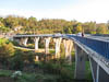
This morning we retraced our route back along the D1 towards Zagreb as far as the little town of Slunj. We passed through, and noted this town, on our way from Zagreb two days ago as the place seemed to be built in the middle of a river with water flowing in, around and under the houses and buildings. So this morning we went back for a look. Sure enough the towns geology was similar to the Plitvice park with the river widening into a series of pools and cascades and thats where the town was built. Certainly picturesque, but also difficult to build and maintain and also noisy.
...click/tap to read the full postInto Bosnia Hercegovina (Sarajevo, Bosnia)
Journal entry for Tuesday 21st Oct, 2014 (day 463, miles 7,864)
Todays route to Sarajevo was approximately 300km in length and for the first 100km we continued south on the excellent Croatian motorway through a picturesque landscape of wide valleys and distant mountains. To our surprise (and the surprise of our GPS) the motorway continued all the way to and across the border into BIH (Bosnia Hercegovina).
...click/tap to read the full postRendezvous and sun in Dubrovnik (Dubrovnik, Croatia)
Journal entry for Saturday 25th Oct, 2014 (day 467, miles 8,024)
You can see from the gaps between blog entries that the relaxed pace of travel, and somewhat quiet uneventful days are having its effect on us. Some days it just feels like there is not much to say. On the other hand our travels through Croatia and Bosnia (and now Montenegro and Albania) are interesting in a quiet sort of way. Croatia is proving to be a much more first world country than we had expected with great roads and clean towns and cities. So, going back to the gaps in the blog - this entry will bring you up to date since the last entry in Sarajevo.
...click/tap to read the full postTwo countries in one day (Lake Shkodar, Albania)
Journal entry for Sunday 26th Oct, 2014 (day 468, miles 8,156)
We left Dubrovnik this morning heading south towards Montenegro and Albania. The mornings drive was along the coast, firstly through Croatia and them into Montenegro. It was a really pretty drive with bright sunshine and the blue waters of the Adriatic. Again generally good roads with light traffic. Very pleasant.
...click/tap to read the full postImpressions of Albania (Tirana, Albania)
Journal entry for Wednesday 29th Oct, 2014 (day 471, miles 8,209)
Another gap in the blog, I must be getting old and or lazy. Well we hung around the camp ground on Shkodra Lake for a few days, did a few chores and I worked on the software project that I am trying to do with Brendon (the campground had good wifi, that was the incentive to stay). While we were there a smattering of other travelers dropped in. A German guy on motor cycle and sidecar, a couple of European motorhomes and two Landrovers with slide-in campers. But this morning it was time to move again. So today we headed for the capital city of Albania - Tirana.
...click/tap to read the full postBerat, World Heritage (Berat, Albania)
Journal entry for Thursday 30th Oct, 2014 (day 472, miles 8,276)
We had planned for today to be another short day and for it to end at the Albanian coast just south of the port and resort town of Duress. Via the internet we had located a beach front hotel and campground and thought that if it was "OK" we might spend a day or two there. Well as it turned out we never did get to it. The problem was exiting from the coastal multi-lane highway. Every time our GPS showed us an intersection at which we should turn/exit we were confronted by a highway edge with no way off. After this happened a few times we gave up on our beach side camp and headed to the next destination on Nina's list the town of Berat, a UNESCO world heritage site.
...click/tap to read the full postCorn harvesting (Ohrid, Macedonia)
Journal entry for Friday 31st Oct, 2014 (day 473, miles 8,356)
Today we headed towards the Macedonian town of Ohrid situated on a lake of the same name. As it turned out the route we chose followed a series of narrow country roads through active farming areas. There may have been a more major road to our destination but it would have required us backtracking almost all the way to Tirana.
...click/tap to read the full postA Best Western parking lot (Skopje, Macedonia)
Journal entry for Sunday 2nd Nov, 2014 (day 475, miles 8,477)
Today we made our way to Skopje, the capital of Macedonia. An unremarkable drive except perhaps for the bright autumn sunshine that eventually appeared to push away a morning mist. As we approached Skopje the highway turned into a motorway (or at least a toll-way) though in no way was it European standard. After a few toll stations and lots of pot holes we began to think that the road was more of an employment system for locals. There seemed to be a toll booth every 5 km or so.
...click/tap to read the full postA visit to Skopje (Near border, Bulgaria)
Journal entry for Monday 3rd Nov, 2014 (day 476, miles 8,647)
Around 8:30 we got the hotel reception to order us a taxi to take us into downtown Skopje for a quick look around. The taxi deposited us right near a big open square in the center of Skopje. We soon discovered that it was called Alexander the Great Square and had a whole series of extravagant statues of Alexander and other historical figures. Indeed as the morning progressed we noted that Skopje had a real taste for super sized statues of various figures.
...click/tap to read the full postCastle, cobbles and English rock climber (Veliko Tarnovo, Bulgaria)
Journal entry for Wednesday 5th Nov, 2014 (day 478, miles 8,759)
Yesterday morning we left our disused gas station camping spot in a blanketing mist and spent much of the morning driving through a grey haze. It was quite late into the day before the sun finally made its appearance.
...click/tap to read the full postThe Black Sea (North of Varna, Bulgaria)
Journal entry for Thursday 6th Nov, 2014 (day 479, miles 8,917)
One of my goals for our Balkans Adventure was to get to the Black Sea and today was the day we headed for a town called Varna a largish coastal town and apparently a Bulgarian sea side resort. Because we are running out of time on this trip the exercise was symbolic rather than substantive as we only planned to stay there long enough to touch the sea and then move on, but, it seems to me a lot of travel is symbolic.
...click/tap to read the full postBorder crossing and ring route (Bucharest, Romania)
Journal entry for Friday 7th Nov, 2014 (day 480, miles 9,113)Today was "just a driving day", from Varna to Bucharest and for much of the morning this required back-tracking over yesterdays route generally through farming country. The day did not really get interesting until the Bulgarian-Romanian border.
...click/tap to read the full postDracula Country (Bran (Castle), Romania)
Journal entry for Sunday 9th Nov, 2014 (day 482, miles 9,214)
We got an early start today headed north towards the region of Romania called Transylvania and maybe a look at one of the "Dracula" Castles. It did not take long to notice two things. The first was the signs, indicating that trucks should not be driving on the roads on Sundays (today) and secondly the large number of cars and the high level of activity in some of the smaller villages.
...click/tap to read the full postJust driving along (West of Deva, Romania)
Journal entry for Monday 10th Nov, 2014 (day 483, miles 9,419)There is not much to say about today, we drove, making our way towards Serbia and the capital Belgrad. But we did not get that far today.
...click/tap to read the full postThe Danube (Belgrad, Romania)
Journal entry for Tuesday 11th Nov, 2014 (day 484, miles 9,606)As we approached the Romanian-Serbian border this morning we had the usual discussion as to whether we would join the line for cars/buses or the line for trucks and how would the border staff respond to us being in the car lane.
...click/tap to read the full postBack home - sort of (Zagreb, Croatia)
Journal entry for Thursday 13th Nov, 2014 (day 486, miles 9,863)After yesterdays realization that we are in "get there mode" today was simply a driving day. Navigation from the campground to the main highway west towards Croatia was pretty easy and then the remainder of the day was on good European highways all the way to the Zagreb ring route.
...click/tap to read the full postA Black Forest Campground (Badenweiler, Germany)
Journal entry for Monday 17th Nov, 2014 (day 490, miles 10,514)
In the past few days we have put on a lot of miles, traveling from Zagreb all the way across Slovenia, Austria and Germany to the Black Forest area in the South West corner of Germany. We will spend a few days in this area, catch up with our son Brendon and prepare the truck for 6 months in storage while we go do some other things outside Europe.
...click/tap to read the full postFirst sighting of the Himalayas (Katmandu, Nepal)
Journal entry for Wednesday 26th Nov, 2014 (day 499, miles 10,514)
Today we are off to Katmandu for 3 nights. Pickup at 8:00 by our tour bus and an 11:00am flight from Delhi airport. We did not really take much notice of the airport on our arrival. I guess we were too sleepy and got out of the place too fast to take much in. But it is a very large and modern airport. We soon discovered that the Indian security services have added their own touches to those familiar airport checkin, immigration and security screening process. Our boarding passes were checked at least 6 times between checkin and the end of security screening, and at the security screening posts a young uniformed official dutifully recorded the details from the boarding pass of every passenger into a hand written ledger (where of course the information is totally useless). After security we were confronted by a massive array of duty free shops.
...click/tap to read the full postThe Travelin-Tortuga (Patreksfjordur, Iceland)
Journal entry for Saturday 11th Jul, 2015 (day 537, miles 13,099)
This morning we finally caught up with Kathy and Rick of travelin-tortuga.com. We met them for the first time back in May at Overland Expo, but we have been following their website since 2009 on our North/South America adventure where it (their website) was an invaluable aid to finding camping places. Back in May we had discovered that both they and we planned to be in Iceland at the same time and hence made an agreement to try and "meet up". Well this morning it happened. So we spent until early afternoon together exchanging Iceland info and talking about things "travel". It was fun and the talk of future travel plans may have inspired Nina and I to some new adventures.
...click/tap to read the full postA morning with the Puffins (Pingeyri, Iceland)
Journal entry for Sunday 12th Jul, 2015 (day 538, miles 13,254)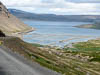
From our camping spot we had a 50 km drive to a place called Latrabjarg a top scenic spot in Iceland renowned for its high cliffs and the thousands of sea birds that nest in those cliffs. The drive was another of the now familiar spectacular Iceland roads.
...click/tap to read the full postThe wild west (Drangsnes, Iceland)
Journal entry for Monday 13th Jul, 2015 (day 539, miles 13,424)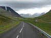
The town of Isafjordur was an early stop on todays travels. It was quite a sizeable, and neat place. The local tourist information place informed us that some of the F roads are now open and that, may have the effect of changing our plans. We got a pamphlet giving the location of RV dumps around the country, useful info for us mobile house dwellers, and we got a few groceries and fuel. A small aside about buying fuel might be in order. Many fuel stations in Iceland (and more generally in northern Europe) are un-attended and to buy fuel at these one requires a credit card that operates with a PIN not a signature. But of course none of our US cards will work in these places (the US banking system is slowly coming into the 21 century, and we are told that 'next year' we will be able to get such cards from US issuers), but fortunately we have an Aussie card that will work. The other problem with these places is one must specify the monetary value of the fuel to be bought. Hence at these places we "top up" but don't fill-up. At this stop we could pay inside the convenience store and hence we could fill our tank completely.
...click/tap to read the full postA Little Mud (Kollafjordur, Iceland)
Journal entry for Tuesday 14th Jul, 2015 (day 540, miles 107,884)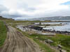
Todays adventure took us up road 643 on the Eastern side of Drangajokull Peninsula to a town called Djupavik. True to the claims of our guide book this was a remote and wild place, steep mountains on the west, the Atlantic Ocean on the east, drift wood from Siberia on the beaches, very occasional buildings, a scattering of tourist vehicles, and eventually muddy roads as the weather turned wet as we progressed north. The village of Djupavik turned out to be only three or four buildings, an abandoned herring processing factory and a lot of derelict vehicles.
...click/tap to read the full postHerring (Akureyri, Icland)
Journal entry for Thursday 16th Jul, 2015 (day 542, miles 13,789)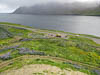
Today we headed for Iceland's second largest city, Akureyri, though to be honest the word 'city' should be used with some care as the place only has a population of 17,000 and hence almost any where else would be a "large town". Along the way we passed through the small town of Siglufjordur and to our surprise ended up spending a couple of hours there.
...click/tap to read the full postAstronaut training (Tjornes Peninsula, Iceland)
Journal entry for Friday 17th Jul, 2015 (day 543, miles 13,868)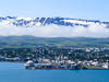
Chores kept us around the campground this morning so by the time we got underway the weather had stabilized and guess what - its a sunny day. Our first stop today was one of the big tourist draw cards in Iceland Godafoss (water fall of the gods) a quite impressive waterfall. The name derives from (as legend has it) that one of the early kings was required to make a decision at the annual parliament about whether Iceland would become Christian and after much deliberation he decided in favor of the "yes" case. On his journey home after the parliament he threw all his idols of the Norse Gods into this waterfall.
...click/tap to read the full postDettifoss (South of Dettifoss, Iceland)
Journal entry for Saturday 18th Jul, 2015 (day 544, miles 13,931)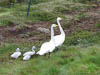
The weather changed for the worse overnight so this morning we were greeted by rain and howling winds. Not a good start to a day of sight seeing. A bit east of last nights camp we came to Aybyrgi, a gas station, visitors center and campground at the northern end of a spectacular gorge. The significant thing about this gorge is that (scientists believe) it was carve in a matter of days by a huge flood as a result of a volcanic eruption under a glacier. Despite the rain we took a short walk to some of the viewing sites.
...click/tap to read the full postOvernight ferry (Torshaven, Faroe Islands)
Journal entry for Friday 24th Jul, 2015 (day 549, miles 13,789)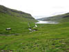
It seems that the owners of the ferry that transport tourists between Denmark and Iceland are from the Faroe Islands (a small patch of land about midway between the two end points of the route) and in order to boost tourism for their little patch of paradise they force travelers like us to stop at the Faroe Islands on one leg of the journey. Hence our return to Denmark was to be a two stage affair. The first leg was from Iceland to Torshaven (the capital of the Faroe Islands), then a 2.5 day wait and opportunity to explore the islands and then the second leg back to Denmark.
...click/tap to read the full postIceland and Faroe, Finis! (Ustrup, Denmark)
Journal entry for Tuesday 28th Jul, 2015 (day 554, miles 14,565)
We idled away our last day on the Faroe Islands at the campground and then in the ferry line. In the process of returning to the ferry we managed to rack up our most expensive toll payment to date - Euro 50 for a return trip through a 3 km tunnel. Somehow that summarized the Faroe Islands for us.
...click/tap to read the full postAmsterdam I (Beesd, Netherlands)
Journal entry for Sunday 16th Aug, 2015 (day 573, miles 15,789)
Yesterday (Sat 15th) we made the trek into Amsterdam for some sightseeing. The travel was a bit of a chore as we had a 1 mile walk to a bus stop and a 40 minute bus ride to get to Amsterdam central station. We have not visited this city since 1976/77 and unfortunately in that time memories have faded a bit so today was a bit like visiting a new city.
...click/tap to read the full postVario steering, wrong side of the road (Rugby Truck Stop, England)
Journal entry for Thursday 20th Aug, 2015 (day 577, miles 16,054)
We were shocked this morning. Having been conditioned by the Iceland ferry's practice of please vacate your cabins two hours before docking we were shocked and more than a little disoriented. Not only did the ferry staff NOT ask us to leave our cabin before docking, but they also unload all commercial trucks before asking drivers of private vehicles to attend their vehicles. This means that we could have slept until almost the official private vehicle schedule docking time of 6:30am.
...click/tap to read the full postSun (Priors Hardwick, England)
Journal entry for Saturday 22nd Aug, 2015 (day 579, miles 16,054)
Our first full day dawned fine, but cool. As we prepared breakfast we were visited by a large white swan who was very insistent, and persistent. We quickly deduced that feeding the canal water birds was a common pass-time of boaters and that the birds had come to expect this. Hence the swan was quite determined that we should provide food.
...click/tap to read the full postReturning the boat (Blackmore Campground, England)
Journal entry for Friday 28th Aug, 2015 (day 585, miles 16,124)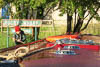
We were underway before 7:00am this morning in order to cover the remaining few kilometers to the depot at Rugby Wharf before the deadline of 9:00am. We wanted to give ourselves plenty of time as this last little bit of the route required us to perform two major turns. The first of these was at the junction of the side channel to the depot where we had to do a full U-turn in order to approach from the correct direction, and the second was just before reaching the depot were we had to turn 180 degrees in order to reverse the boat into its dock. As I have noted earlier turning these boats is not easy as the boat is at least twice as long as the canal is wide and as such turns can only be undertaken at specific turning points.
...click/tap to read the full postPeat, crofting and Bonnie Prince Charles (Sligachan (Ilse of Skye), Scotland)
Journal entry for Friday 18th Sep, 2015 (day 606, miles 17,172)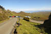
Today was a fabulous day, one of the most visually stunning days of our travels. We spent it circumnavigating the Trotternish Peninsula on the Ilse of Skye and while the scenery was picturesque the light (for some reason) had a special quality that made every view stunning.
...click/tap to read the full postAnother trail through the wilderness (Little Assynt - Leitir Easaidh, Scotland)
Journal entry for Sunday 20th Sep, 2015 (day 608, miles 17,364)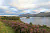
The center point of todays travel was to be a "backroad" from Ullapool to Lochinver that we learned about at the SRMN meeting in Blackmore. It was described to us as "picturesque". And indeed it was. Like the single track roads of the past few days it was quite outside our experience elsewhere in the world. Usually wilderness roads are gravel and dirt, and often with pot holes, washboards and dust or mud. But this wilderness road was paved, though narrow - usually only 8-9 feet wide, except for the regular passing places. The reason for the pavement though is pretty obvious as the surrounding country side is mostly moor or peat bog so without the pavement the road would probably not survive.
...click/tap to read the full postEnd of the earth (Thurso, Scotland)
Journal entry for Tuesday 22nd Sep, 2015 (day 610, miles 17,491)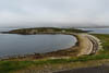
We made it to the little town of Thurso on the north coast of Scotland this afternoon, quite a cute little town, but not so cute weather. We had expected to catch a ferry from this place to Orkney tomorrow morning and spend a day or so there seeing some of the archeological sites. But on finding out that the ferry ride would cost us something like $400 we decided on a one day bus tour (from the town of John O'Groats) as a better alternative.
...click/tap to read the full postMost northerly point (John O'Groats, Scotland)
Journal entry for Wednesday 23rd Sep, 2015 (day 611, miles 17,523)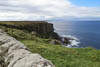
This morning after checking out the tourist information center, a display on the local nuclear power station, getting some money and other such chores we headed along the north coast towards the town of John O'Groats.
...click/tap to read the full postWe did not see Nessie (Nairn, Scotland)
Journal entry for Sunday 27th Sep, 2015 (day 615, miles 17,792)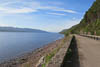
We spent today driving along the road beside Loch Ness. We had been told that the best view of the loch was to be had by driving the road North to South and so thats what we did, from Inverness to Fort Augustus and then back again. However in truth the view was not great in either direction as trees block the view from the road for almost all of the drive.
...click/tap to read the full postA battle field and stone cairns (Nairn, Scotland)
Journal entry for Monday 28th Sep, 2015 (day 616, miles 17,792)
We did a bit of sightseeing today. The battle field of Culloden is close to Nairn so that is where we went first. I had already mentioned the events associated with this place when we were on the Isle of Skye as this is where the battle took place that Bonnie Prince Charlie had to escape from.
...click/tap to read the full postYet, another beautiful day (Aboyne, Scotland)
Journal entry for Wednesday 30th Sep, 2015 (day 618, miles 17,992)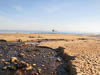
Before getting underway today there was a little chore to do, replacing the water filter in the campers water system. I have not done this in a long time and it is well over due. The process requires emptying all the "stuff" we have stored in the locker under the bed. Thus the exercise turned in to a bit of a spring clean, even though it is autumn.
...click/tap to read the full postOur 50th (Aran Island, Ireland)
Journal entry for Thursday 5th Nov, 2015 (day 654, miles 18,684)
Today is a big day for us, it is 50 years today since we first met. Now if I was being really pedantic about it we are actually a day late since when we met we were (obviously) in Australia and it is now the 6th of November in Australia - but that seems a bit too precise. But anyway 50 years seems like a significant milestone and we had planned to spend it on Aran Islands , so early this morning we were in the car headed towards Rossaveel (in heavy rain) where we were scheduled to catch a ferry to the town of Kilronan on Inishmore the largest of the three Aran Islands.
...click/tap to read the full postAnother early start and more rain (Westport, Ireland)
Journal entry for Friday 6th Nov, 2015 (day 655, miles 18,684)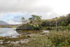
As per the title, we were up early (for us), saying goodbye to Alice and then off to the ferry for the return to the mainland, no dramas there, although we were surprised by how many people appeared apparently from nowhere to catch the ferry. Back at the ferry dock in Rossaveel a man miraculously appeared to collect the 5 euros we owed for our days parking and then we were on the road heading towards Westport.
...click/tap to read the full postStart of a "mini adventure" (Rasar State Park, Hwy 20, USA)
Journal entry for Wednesday 6th Jul, 2016 (day 1, miles 138)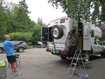
Nina and I are about start what I think of as a mini adventure. Between now and November we plan on doing some traveling in our Earthroamer. As is often the case for us the route is not well specified but will probably include a lot of time in the Western US and Western Canada. The goal of this exercise is entertainment and relaxation while my leg recovers enough to allow us to get back into the Unimog with its manual transmission and heavy clutch.
...click/tap to read the full postRe-introduction to the Cascades (Kilpchuck Forest Camp Hwy 20, USA)
Journal entry for Thursday 7th Jul, 2016 (day 2, miles 237)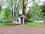
It is quit a few years since we last traveled highway 20 so today was by way of a re-introduction for us to the forests and spectacular mountains of the North Cascades, not to mention a dramatic change in climate from our recent months in Phoenix.
...click/tap to read the full postDid I mention recuperation (Jone Bay Lake Roosevelt, USA)
Journal entry for Friday 8th Jul, 2016 (day 3, miles 393)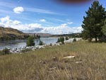
Last night camping spot (and its network of trails) gave us a chance to do a few miles of walking before we hit the road today. In case I have not mentioned it one of the goals for our mini-adventure is to see if we can maintain an exercise program while on the road. We have set this goal on previous trips but never seem to be able to stick to it. This time though there is added incentive and I need to exercise my recovering leg to re-build muscle and get some flexibility back into the damaged ankle. Thats the "recuperation" bit.
...click/tap to read the full postSpokane River Walk (Beauty Creek Camp, USA)
Journal entry for Saturday 9th Jul, 2016 (day 4, miles 524)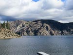
Spokane's River Walk provided the setting for todays entertainment and exercise. In addition to a nice 3 mile walk we got some sun (warn not hot), were entertained by the ducks on the river, and marveled at the competitiveness of young children as they raced stroller-bikes around a temporary track in the park beside the river. For those of you (like us) that do not know what stroller bikes are - they are bicycles without pedals that are propelled by pushing ones feet against the ground.
...click/tap to read the full postThe back blocks of Northern Idaho (Elk River Campground, USA)
Journal entry for Sunday 10th Jul, 2016 (day 6, miles 636)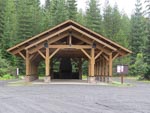
Today we were on the western side of the Clearwater National Forest south of Coeur D'Alene. Our route was south-ish and took us through interminable evergreen forests, on well made and maintained roads with little traffic. There was not much of specific note and as a result no photos for today.
...click/tap to read the full postA camp fire and hair cut (Nelson Creek Hwy 14, USA)
Journal entry for Monday 11th Jul, 2016 (day 7, miles 736)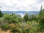
The highlight of this mornings travel was the Dent Bridge on the forest road between Elk River and Orofino, it spans the North Fork of the Clearwater River behind Dworshak dam and reservoir. Seems like this bridge is a big deal to the locals in terms of providing a shorter route from the Elk River region into Orofino, though we thought the description of the bridge(on one of the info signs) and "one of the most beautiful structures in America" was a bit excessive.
...click/tap to read the full postRoad Closed (Johnson Bar CG, USA)
Journal entry for Tuesday 12th Jul, 2016 (day 8, miles 892)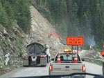
Some distance east of last nights our camp we came upon a couple of work crews fixing the road. The first of these was a small affair where a side creek had washed away the pavement. But the second was a major job. It seemed like an entire hillside had collapsed and slid over the road and there was a large crew of workmen, heavy machinery, and gravel trucks clearing the road and rebuilding the hillside. We had to wait a while at the western side of this work area for a pilot car to lead us through the workings.
...click/tap to read the full postPhotogenic little ctitters (Norton CG, USA)
Journal entry for Wednesday 13th Jul, 2016 (day 8, miles 1,060)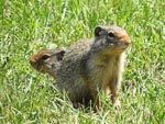
As you can see from the photos we spent a pleasant little interlude with a village of prairie dogs (I think they are prairie dogs?), we got their photos and they got bread. Seems like a reasonable trade, we guess "feeding the critters" is a common activity at this rest area (summit of Lolo Pass Hwy 12 MT).
...click/tap to read the full postA couple of big horns (Lower Seymor Lake, USA)
Journal entry for Thursday 14th Jul, 2016 (day 9, miles 1,163)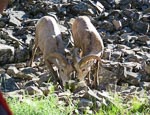
This morning we followed a picturesque, but sometimes primitive, road along the banks of Rock Creek (in the Rock Creek Recreation Area, part of Beaverhead Deer Lodge NF). Beautiful scenery, perfect weather and even a couple of big horn sheep (making the most of a 'lick' left by a local farmer).
...click/tap to read the full postWisdom and new caps (Shoup Bridge Camp, USA)
Journal entry for Friday 15th Jul, 2016 (day 11, miles 1,278)
We finally got to the little town of Wisdom. MT this morning. We have in a very round about way) been heading towards this little town for the past week. Why you might ask, well in 2009 (on our Americas trip) Nina bought a purple cap covered in small mirrors in a store in this town. Later on that trip she exchanged it with a Peruvian lady for one of their local straw hats. Hence we were keen to get back to Wisdom to "get another". The store where the original hat was bought burned down 5 years ago but a new shop has been built on a nearby site and they had only two of the mirror covered caps left, both in shades of green.
...click/tap to read the full postA day of repairs (Rainbow Point, USA)
Journal entry for Sunday 17th Jul, 2016 (day 12, miles 1,515)
Today turned out to be a day of repairs, or is it breakages. Continuing from last nights camping spot the road into Cascade continued to be rough (lots of traffic and little maintenance of the road seems like the cause) and so we bumped over rocks and wash-boards for many hours. We visited the old mining ghost town of Deadwood, (the old hotel and a couple of other buildings are still evident),bumped into a number of groups of riders, and generally enjoyed the spectacular scenery and wonderfully sunny day.
...click/tap to read the full postThe journey continues (Rest Area on Canada 1, Canada)
Journal entry for Thursday 11th Aug, 2016 (day 17, miles 2,408)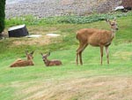
So we are on the road again and the "journey continues". Since the last entry we have been back to our house in Washington, to undertake a series of chores that deserve no discussion. In addition we had a visit from our eldest son Brendon and we accompanied him into the mountains of British Columbia where Nina and I played support team to a brief solo mountain biking expedition.
...click/tap to read the full postHurley Wilderness (Lilloet Fire Road, Canada)
Journal entry for Sunday 14th Aug, 2016 (day 20, miles 2,728)
We did a bit of exploring around Gold Bridge this morning before heading down the Hurley Wilderness road, a summer only road that provides a short cut to Pemberton from Gold Bridge, it was quite rough and rocky as it seems to get a lot of traffic that is in a hurry.
...click/tap to read the full postA day in Pemberton (Twin One CG, Canada)
Journal entry for Monday 15th Aug, 2016 (day 21, miles 2,771)
Into Pemberton this morning for the usual type of chores after a few days in the "wilderness", groceries, internet, real coffee, a visit to the Visitor Info center.
...click/tap to read the full postA few hikes (Birkenhead Lake CG, Canada)
Journal entry for Tuesday 16th Aug, 2016 (day 22, miles 2,828)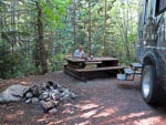
The day started with another rescue mission. One of the other campers at Twin One had managed to flatten their vehicle's battery overnight and came calling asking for a jump start; which of course we did. We like to pay it forward, we have been helped by other people many times.
...click/tap to read the full postRoast Lamb (Little Big Bar CG, Canada)
Journal entry for Saturday 20th Aug, 2016 (day 26, miles 3,059)
We hung around the campground this morning enjoying the nice sun and the camps wifi. In Clinton while filling up with fuel we got talking to a local guy who had ridden a motorcycle to Ushuaia, Argentina, you never can tell about people.
...click/tap to read the full postThe Mighty Fraser (Bull Canyon CG, Canada)
Journal entry for Sunday 21st Aug, 2016 (day 27, miles 3,198)
There was some cloud in the sky this morning and threat of rain (which eventually arrived) as we got onto the road for a pleasant drive through a series of valleys and eventually along an escarpment beside the Fraser River with really spectacular views. Finally the road dropped off the escarpment and down to a steel bridge across the river where to our surprise we met up with the motorcyclists from last nights camp. There after followed a discussion about our proposed route. They thought they had found the correct road but it was rough and boulder covered, so not to their liking.
...click/tap to read the full postBoring (Dugan Lake CG, Canada)
Journal entry for Monday 22nd Aug, 2016 (day 28, miles 3,287)
Not a very interesting day. After a fast drive from last nights camping spot (the first of the two photos below) to Williams Lake we spent over half the day in the car park of either Walmart or Canadian Tire catching up on "business".
...click/tap to read the full postMushrooms (Latremouille Lake, Canada)
Journal entry for Thursday 25th Aug, 2016 (day 31, miles 3,511)
Our backroad wanderings continued today and a series of logging and other gravel roads led us past a series of lakes. The wet nature of the countryside produced a good supply and variety of fungii and the bright sunshine had us more than a bit carried away with the photography.
...click/tap to read the full postBears and Beavers (Deadman Lake, Canada)
Journal entry for Friday 26th Aug, 2016 (day 32, miles 3,610)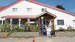
We continued our wanderings this morning heading south along forest roads from Bridge Lake with the plan on getting to the area around Castle Rock Hoodoos Provincial Park. But that proved a little more challenging than we had expected as we had to reconcile differences between various maps. The result of this resolution was that we ended up traveling along Brigade Creek Fire Service Road. It was clear from the start of this 12 mile section of road that it was little used as there were no tire marks in the sand, an impression that was eventually reinforced by a series of fallen trees blocking our path. So we spent some of our time either pulling trees off the road with the front winch or simply pushing them out of the way with the front bumper. The final mile of the road was a steep descent into Deadman Creek and we were nervous for a while that we would be faced with an impassable crossing of that creek; but all was well.
...click/tap to read the full postA nice lakeside camp (Leighton Lake CG, Canada)
Journal entry for Saturday 27th Aug, 2016 (day 33, miles 3,669)
It was raining this morning, and the road was now muddy, as we traveled North along Deadman Valley to Vidette Resort. We just wanted to get as far up the valley as we could to see if we could unravel some of yesterdays navigation confusion.
...click/tap to read the full postStarting the day with a short hike (Princeton, Canada)
Journal entry for Sunday 28th Aug, 2016 (day 34, miles 3,784)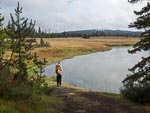
We got off to a healthy start today with a 3 mile hike around the lake, pleasant weather and nice views. Thereafter the day was about getting to Princeton. Though of course we chose not to follow the obvious highways but instead chose Kane Valley Rd, Voght Valley Rd, and Otter Lake Rd to Tulameen.
...click/tap to read the full postThe last weekend (Sugar Lake, Canada)
Journal entry for Saturday 3rd Sep, 2016 (day 40, miles 4,120)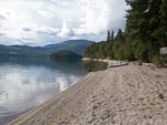
After saying our goodbyes this morning we made our way through surprisingly thick traffic into downtown Kelowna to do some shopping and then north towards Vernon before turning onto Highway 6. A little bit past Lumby we turned off the highway and headed towards Sugar Lake Recreation Area wondering whether we would be able to find a camping spot. It was, after all, the labor day weekend in a sense the last weekend of summer.
...click/tap to read the full postAnother beautiful forest walk (Crawford Bay, Canada)
Journal entry for Monday 5th Sep, 2016 (day 42, miles 4,330)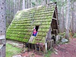
We started our day in an energetic and healthy manner taking a long walk (5 miles) along a forest track that once (before 1960) was the only access, by horse back, to the hot springs. As you can see from the photos the walk presented us with a lot of mushroom opportunities. By the time our walk was over the campground was pretty much deserted and throughout the mornings drive we saw lots of RVs and cars carrying camping gear on the road presumably heading home.
...click/tap to read the full postFirst snows (Willow Rock CG, Canada)
Journal entry for Thursday 8th Sep, 2016 (day 45, miles 4,735)
It rained a bit overnight and was overcast this morning and the road was wet and hence muddy as we continued north of 940. Late morning we connected with Highway 40 (also called the Kananaskis Trail), a spectacular drive surrounded by mountains that eventually connected with Highway 1 just east of the town of Canmore. Highway 40 provided a herd of mountain sheep for our entertainment and the first snow falls of the trip.
...click/tap to read the full postBack to the mountains (Lake Louise, Canada)
Journal entry for Monday 12th Sep, 2016 (day 49, miles 4,982)
Yesterday we drove back up into the mountains and stayed at a campground in Lake Louise, but no photos as the day was a bit of a loss from the weather point of view. But today with better weather, bright sun, we backtracked a bit to visit Banff and generally absorb the spectacle of the mountains. This also gave Nina a chance to experiment with her new camera, and ask a zillion questions -- how do I &
...click/tap to read the full postThe Icefields Parkway (Jasper, Canada)
Journal entry for Tuesday 13th Sep, 2016 (day 50, miles 5,131)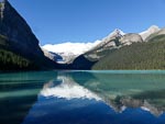
Today I am going to mostly let the photos do the talking, they are more eloquent than I can be. As you might guess from those same photos we started the day with a visit to the lake and hotel at Lake Louise and then drove the Icefield Parkway to Jasper. We were blessed with glorious weather, bright sun and not a cloud in the sky. It was an opportunity to try out Nina's new camera that we could not resist.
...click/tap to read the full postLast look (Kinky Lake, Canada)
Journal entry for Wednesday 14th Sep, 2016 (day 51, miles 5,206)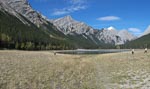
Another glorious day, though with a little cloud. We started the day with a drive on the Malign Lake Road and found a hike that took us to two lakes, Beaver Lake and Summit Lake. Again we used this as an opportunity to experiment with the new camera. This was obviously encouraged by the great light and spectacular scenery. You will note in photo 8 that with the use of the camera's panorama mode Nina was able to make 3 of me.
...click/tap to read the full postTo Edmonton (Spruce Grove CG Edmonton, Canada)
Journal entry for Thursday 15th Sep, 2016 (day 52, miles 5,390)We spent today driving the road to Edmonton. We tried in the town of Hinton to get Nina a "nail job" but all the places we tried either did not do nails anymore or were booked out. Eventually she phoned a place in Edmonton (the value of the internet) for tomorrow.
...click/tap to read the full postNina gets her nails done (Long Lake Prov. Park, Canada)
Journal entry for Friday 16th Sep, 2016 (day 53, miles 5,498)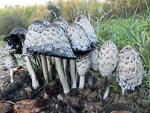
By the time the nail job was complete and we had stocked up on groceries it was after lunch. At that point we had not finally decided exactly where we would go but as the afternoon proceeded it became clear we wanted (over the coming couple of days) to go as far north as Fort McMurray.
...click/tap to read the full postBusy highway and oversized loads (Crow Lake Prov. Park, Canada)
Journal entry for Saturday 17th Sep, 2016 (day 53, miles 5,498)
We started today with a nice long walk in the forest (and rain) near the campground and found a good example of a beaver felled tree. Once underway we made our way into the little village of Boyle for a fuel top-up before starting the stretch of road to Fort McMurray. Not far out of Boyle highway 63 turned from a rural road into a new 4 lane freeway/motorway/expressway (whatever you want to call it) clearly built to handle the demands of the energy industry, indeed we passed a number of oversized loads during the curse of the day as well as seeing many heavy transporters returning south. I was a bit captivated by the trailers and their many wheels, at one point we caught a photo of a returning combination with two prime-movers (at pulling and one pushing), 26 axles on the trailer and 8 wheels on each axle.
...click/tap to read the full postOil sands and wild fire (Engstrom Lake Prov Rec Area, Canada)
Journal entry for Sunday 18th Sep, 2016 (day 55, miles 5,614)
We were a bit surprised to see that there was less traffic this morning as we completed the drive into Fort McMurray. Sunday does seem to make some difference to the pace of activity in this energy boom-town area. The big interests today were oil sands and the wildfire that devastated Fort McMurray earlier in 2016.
...click/tap to read the full postBoreal forest and beaver (Winston Churchill Prov. Park, Canada)
Journal entry for Monday 19th Sep, 2016 (day 56, miles 5,895)
I should have mentioned the boreal forest in a earlier entry a that is what we have been traveling through the last few day. Short skinny black spruce tree, birch and aspen now turning vivid yellow and the occasional stands of larch (tamarack) that look like pine tree that are turning with the fall. Around Fort McMurray the forest was obviously burned from the wildfire earlier in the year but even in these blacked tracks there were patches of yellow and green where some trees survived and in many places under the blacked spruce new grass could be seen.
...click/tap to read the full postFarm land, boom towns, and time for laundry (Meadow Lake Prov Park, Saskatchewan)
Journal entry for Tuesday 20th Sep, 2016 (day 57, miles 6,042)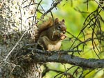
We visited the towns of Lac La Biche and Cold Lake today. A grocery resupply in La Biche and laundry in Cold Lake. They both gave the impression of being little boom towns, a small "older part of town" with lots of new shops and facilities grafted on the side. Lots of new pickup trucks and surprisingly large car dealerships.
...click/tap to read the full postShopping spree (Unnamed Campground Meadow Lake, Saskatchewan)
Journal entry for Wednesday 21st Sep, 2016 (day 58, miles 6,158)
We drove all the way back to Cold Lake this morning to go on a shopping spree for some clothing. Nina needs socks and gloves and I need socks and long johns. These proved amazingly difficult to get as "the winter stuff is not in stock yet".
...click/tap to read the full postBears 4 + 1 (Lac La Plonge, Saskatchewan)
Journal entry for Thursday 22nd Sep, 2016 (day 59, miles 6,309)
We took a few photos of the campground this morning as the light was great and the water on the lake incredibly still. Thereafter a series of minor highways (!!) before joining Hwy 155 north to a place on our map called Beauval. Along 155 we saw a number of bears, one small clearly brown bear scurrying off the road away from the traffic, one black but unfortunately dead on the side of the road and just before Beauval a mother black bear and two cubs. Unfortunately no really good photos.
...click/tap to read the full postGray sky, gravel road (Gravel Pit Hwy 2, Saskatchewan)
Journal entry for Friday 23rd Sep, 2016 (day 60, miles 6,426)The sky was gray this morning as we set out along Hwy 165 and it was not long before the rain started and proceeded to set in for the day. Thus the day turned into a long drive along a surprisingly good quality gravel road.
...click/tap to read the full postIn PA (Prince Albert, Saskatchewan)
Journal entry for Saturday 24th Sep, 2016 (day 61, miles 6,541)It was still raining this morning with a light mist so that driving south towards Prince Albert was like being in a green/grey tunnel.
...click/tap to read the full postScenic road (Baldy Lake, Saskatchewan)
Journal entry for Sunday 25th Sep, 2016 (day 62, miles 6,654)
Today turned out to be sunny, as predicted by the weather app on our phones and making it a good day for us to leave Prince Alert and travel the section of Highway 120 to Candle Lake which was marked as a scenic road on one of our maps. The good light also gave Nina a chance to get a few photos of the PA Exhibition grounds and some of its more notable sights.
...click/tap to read the full postLarch trees and lakes (Hanson Lake, Saskatchewan)
Journal entry for Monday 26th Sep, 2016 (day 63, miles 6,799)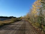
We got a bit obsessed today with both Larch trees (also called tamarack) and lakes. Why you might ask. Well the larch trees are abundant along the side of the highway, some green and others various shades of yellow. We spent a good deal of time photographing them in the hope of capturing the color and structure of these beautiful trees. Also later we discovered from google that they are the only deciduous conifer, dropping their needles in the winer after turning yellow. There was also a touch of nostalgia for us in these trees as we drove through many Larch forests in Mongolia in 2013.
...click/tap to read the full postWater falls, graffiti and Thompson (Thompson, Manitoba)
Journal entry for Wednesday 28th Sep, 2016 (day 65, miles 7,130)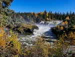
We were surprised this morning to find two side excursions to water falls (Wekusko Falls, and Pisew Falls), surprised because the land seems so flat that we had trouble imagining that anything could fall. But we should not have been surprised As these falls were not distinguished by the height of the fall but by the volume of water and power of the flow. Pisew Falls in particular was very impressive and unusually even Nina was impressed.
...click/tap to read the full postOld Russian/Ukrainian (?) church (Winnipegosis, Manitoba)
Journal entry for Sunday 2nd Oct, 2016 (day 69, miles 7,620)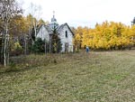
Still heading towards Winnipeg through the "lakes district". The weather was generally dreary today with lots of rain and often very heavy.
...click/tap to read the full postCemetery (Hwy 5 West of Cavalier, USA)
Journal entry for Tuesday 11th Oct, 2016 (day 78, miles 8,272)It was still raining this morning when we woke in the parking lot at Winnipeg airport so we were quite keen to get going in the hope that the weather would be better farther south. That was not to be however. Once across the border into the US we left the interstate highway and followed a series of rural roads with intermittent heavy rain. It seemed to be harvesting season for some kind of root crop in this part of North Dakota and the harvesting process covered the rural roads with a nice layer of slippery mud.
...click/tap to read the full postCountry North Dakota (New Rockford, USA)
Journal entry for Wednesday 12th Oct, 2016 (day 79, miles 8,434)
Better weather today as we continued south through ND along rural roads and flat farming country. The crops have changed a bit, more grain, and no sign of the root crops I thought we saw yesterday.
...click/tap to read the full postSunflowers (Tschedia Lake, USA)
Journal entry for Thursday 13th Oct, 2016 (day 80, miles 8,647)
Nina started the day with a longish walk around the campground and local area (and has included a bunch of photos of last nights camping spot in todays entry). Another sunny day and again we are traveling south through ND. Today we passed many fields of sunflower that seem completely dried out and are a dark brown color. Initially when we saw the first of these fields from a distance we thought it was freshly plowed ground.
...click/tap to read the full postWall drug, the badlands (Badlands National Park, USA)
Journal entry for Friday 14th Oct, 2016 (day 81, miles 8,912)
We transitioned into South Dakota today and towards the end of the day we pulled into the little town of Wall SD, which if you probably know is famous for Wall Drug, a unique style of business that started life as a real (and unsuccessful) drug store back in the 1930s. Unsuccessful that is until the owners decided to offer passing travelers free ice water. Today it is a massive complex of mismatched buildings selling all kinds of stuff from junky souvenirs to high end leather goods, ice cream and fast food. Since its first founding two nearby tourist attractions (Mount Rushmore and The Badlands National Park) have come into existence and one assumes they contribute significantly to the evident success of Wall Drug.
...click/tap to read the full postOne last look at the Badlands (Oliver Reservoir, Canada)
Journal entry for Saturday 15th Oct, 2016 (day 82, miles 9,236)
We spent sometime this morning exploring the badlands hoping for some good light and then it was "hit the road"
...click/tap to read the full postA day in Boulder (St Vrain SP, Colombia)
Journal entry for Sunday 16th Oct, 2016 (day 83, miles 9,493)We made an early start this morning in order to cover the distance to Boulder by lunch time. We had arranged to meet up with some friends of ours (John and Ursula) who are now living in Bolder. We last met up with these guys in Munich in early 2014. We had a nice visit and were particularly interested to hear why they chose Boulder as there retirement location.
...click/tap to read the full postA visit with Rob (Rio Grande, Colombia)
Journal entry for Tuesday 18th Oct, 2016 (day 85, miles 9,902)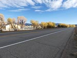
We got an early start this morning from Limon in order to make our way to La Junta CO where we had arranged to spend a few hours and have lunch with our friend Rob Pickering of Terry Lee Enterprises and renowned Unimog fixer and finder. We had a great visit catching up with developments in Rob's life and business.
...click/tap to read the full postA walk in the hoodoos (Bisti Badland, Colombia)
Journal entry for Wednesday 19th Oct, 2016 (day 86, miles 9,150)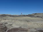
Today was another longer day of driving than we prefer but there was a goal and it was the Bisti Badlands also known as De-Na-Zin. Nina heard about this area of hoodoos and weird rock structures at this years Overland Expo West and was determined to visit and take photos. So mid afternoon we found ourselves heading south on 371, south of Farmington NM looking for the turn east that would take us to the first of the access areas. Once in the parking lot we set off on a hike of a couple of hours east into the heart of the "badlands".
...click/tap to read the full postLos Alamos, Bradbury Museum (Roadside stop near Santa Fe, Colombia)
Journal entry for Thursday 20th Oct, 2016 (day 87, miles 10,340)
This morning brought another hike to explore the badlands, however this time we went rugged up as the morning temperature was 32°F. We spent another couple of hours this time walking across the plateau of the badlands to a couple of lookouts. After our walk, and over breakfast, we decided to devote the remainder of the day to visiting Los Alamos and its Science Museum.
...click/tap to read the full postEl Morro (El Morro Nat Mon, USA)
Journal entry for Friday 21st Oct, 2016 (day 88, miles 10,504)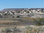
After a restful night in our roadside stop we made our way south to I40 and followed it for a while to the town of Grants where Nina took the opportunity to take a walk around the little town and captured some photos of the town's decorative water feature. From Grants we turned south along NM53 looking for a place to spend the night. As we traveled 53 we started seeing signs for The Ice Caves and since there was no way there could be ice in this hot climate started discussing what they could really be. Thus intrigued, when we finally got to the gates of Ice Caves (a privately owned and run tourist attraction) we went in to investigate and discovered that there really was ice, but more of that in tomorrows entry as for now we needed to find a camping spot for the night.
...click/tap to read the full postIce Caves ! (Concho Valley, USA)
Journal entry for Saturday 22nd Oct, 2016 (day 89, miles 10,643)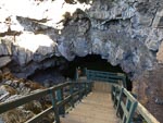
Today was a real sight-seeing day. We started by returning to those Ice Caves and discovered that there really is a cave with natural ice in it. Indeed we eventually discovered that back in the early part of the 20th century before this area had electricity and refrigerators the ice was mined to supply the iceboxes of local inhabitants. Apparently the mining ceased in the late 1940s and since that time the ice has recovered and there is more of it today then there was in those days. Is seems I may have confused some readers. Despite the heading to this entry (Concho AZ) the Ice caves are actually in New Mexico. The apparent mistake is a conflict between where we were traveling during the day and where we stayed the night. The heading to the entry gives the name of the place we spent the night.
...click/tap to read the full postA few days in Phoenix (Apache Junction, USA)
Journal entry for Sunday 23rd Oct, 2016 (day 92, miles 10,814)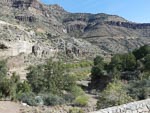
Today we were headed towards Phoenix and a couple of days of business. From Cocho Valley (on AZ61) we made our way to Show Low and picked up AZ 60 to Globe and then into the KOA at Apache Junction. We have traveled this route a number of times but even so the spectacular Snake River valley is worth a stop and a few photos.
...click/tap to read the full postA brief visit down-under (Sydney, Australia)
Journal entry for Sunday 20th Nov, 2016 (day 99, miles 0)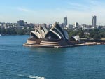
Just a brief update to let you know that we spent most of November on a visit down-under, or at least to Sydney. It was a catchup with family and a chance to do some personal business. As always Sydney harbor was picturesque and impressive with some really lovely walks around the foreshore. On the other hand Sydney traffic dense, slow and frustrating. It was great to catchup with family and meet the new members that have arrived since our last visit.
...click/tap to read the full postBack in Europe (Venlo, Netherlands)
Journal entry for Wednesday 15th Mar, 2017 (day 1, miles 69,610)We flew into Amsterdam last night and stayed in an airport hotel to allow some of the jet-lag to wash away and then this morning took a train to Eindhoven and taxi to our friend Erik's place (the power behind adventure-trucks.com) in the little village of Sint-Michielsgestel where our yellow GXV has been stored for more than a year.
...click/tap to read the full postBack in Europe II (Kettenheim, Germany)
Journal entry for Thursday 16th Mar, 2017 (day 2, miles 69,782)Looking over the map last night we discovered that our overnight spot was close to another jumbo supermarket and so once underway this morning that was our first stop.
...click/tap to read the full postFamily visit (Badenweiler, Germany)
Journal entry for Friday 17th Mar, 2017 (day 3, miles 69,782)
Today we had a specific destination, the village of Badenweiler, which is located in the Black Forest and is known for its thermal spa. There is a nice campground in the town (that we have stayed in previously) and it is close to where our son and fiancee live (when not in Berlin). We plan on staying in Badenweiler 5 days or so for a "family catchup".
...click/tap to read the full postAires and Alternators (Chalon sur Saone, France)
Journal entry for Wednesday 22nd Mar, 2017 (day 8, miles 70,163)We have been hearing about Aires for years from people and publications about motorhome travel in Europe (but more specifically France). We have been told, and read widely, that these are like overnight parking places for RVs that typically are not suitable for trucks, are specifically set aside for RVs in or on the edge of towns, and usually provide a sani-dump, fresh water (and even sometimes) electrical facilities. But in truth in our last two seasons in Europe we have not actually used one. We have often had conversations with non Europeans about the word Aires and its meaning. Google translate will tell you it means something like area, or zone. But that does not really explain the terminology Aires
...click/tap to read the full postJust plain alternators, and a Volvo dealer (Aire de Portes Les Valence, France)
Journal entry for Thursday 23rd Mar, 2017 (day 9, miles 70,322)
As I mentioned in yesterdays entry I was somewhat nervous that today we would find that the guys in Eindhoven had replaced the previously faulty alternator with some European part that was not up to the job. This concern was driven in part by the understanding that in Europe the U500 Unimog is a full 24 volt truck whereas the US version has a 12 volt alternator and 12-24 volt dc-dc converter to boost the voltage for all the control units.
...click/tap to read the full postThe rain in (almost) Spain (Le Boulou, France)
Journal entry for Friday 24th Mar, 2017 (day 10, miles 70,550)
It rained heavily throughout the day as we travelled down the A7 and then the A9 motorways towards the Spanish border. These sections of motorway seem to be managed by a different company and in general the road, and facilities were in poorer condition than those of the first few days.
...click/tap to read the full postSalvador Dali Part I (Figueres, Spain)
Journal entry for Saturday 25th Mar, 2017 (day 11, miles 70,577)
The Spanish town of Figueres is famous as the location of the Dail Theatre Museum. As the name implies this is an old theater building that was converted (by Dali) into a museum to display various of Dali's works. Visiting this museum and soaking up some Dali atmosphere was our plan for today.
...click/tap to read the full post3 Estrellas (Barcelona, Spain)
Journal entry for Monday 27th Mar, 2017 (day 13, miles 70,680)
Just a short hop today of about 100 kms to Barcelona and we hope a camping spot from which we can base ourselves for 4-5 days while we explore the city and its attractions. The motorway south from Figueres was pretty easy to find and follow until we got into the complex of roads around and through Barcelona and then it was very helpful to have a co-pilot and a GPS/SATNAV each and to know that our intended campground was south of the city near the airport. That meant that at the numerous merging and separation of motorways if all else failed we could simply follow the airport sign.
...click/tap to read the full postMotorway west (El Frasno, Spain)
Journal entry for Sunday 2nd Apr, 2017 (day 19, miles 70,908)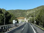
Today we headed west eventually towards the city of Salamanca. Initially our route took us south along the coast past what looked like affluent holiday destinations and an area known as Stiges and then onto the AP-2 a toll charging Motorway that links the coast to the inland city of Zaragoza. Past Zaragoza we diverted to the A-2 still a motorway quality road but now without tolls. It was a very pleasant day. Bright sunshine, exceedingly light traffic, and picturesque country side that seems to be given over almost entirely to agriculture while regularly dotted with quaint little villages.
...click/tap to read the full postVillage and churches (Salamanca, Spain)
Journal entry for Monday 3rd Apr, 2017 (day 20, miles 71,179)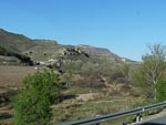
Today we decided to venture off roads of motorway quality onto national-highway standard roads, so at Calatayud we turned NW onto the N-234 towards Soria and eventually Valladolid and then back onto motorways into Salamanca. The N234 turned out to be a good choice with lots of small villages this time with the road going right through the middle rather than bypassing as was the case yesterday on the motorway. We discovered that every village has at least one church (some times more) that seems to be much larger than could be justified by the size of the village and that many of those churches (and also many electrical poles) have their own resident Stork and brood.
...click/tap to read the full postRobert's f....k up (Toledo, Spain)
Journal entry for Thursday 6th Apr, 2017 (day 23, miles 71,327)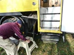
Well, we got off to a bad start this morning. Out first chore of the morning was emptying our waste water tanks at the campground sani-dump. Unfortunately I failed to notice a short concrete wall beside the dump area and as I pulled out of the dump the right hand side of the truck collided with that wall and completely destroyed the camper stairs and almost completely removed the storage box behind the stairs. That left the vehicle in an un-drivable condition so we spent the next 2-3 hours removing the damaged step assembly from the vehicle and finding a way to carry the damaged storage box on the rear carrier beside the spare tire. The real bad news of this event is that there is some significant damage to the actual camper body in the vicinity of the stair well and that will require some professional repair at some point in the nearish future. In the interim I will seal it with silicon and duct-tape in the hope of preventing water entry.
...click/tap to read the full postTo Madrid by train (Toledo, Spain)
Journal entry for Sunday 9th Apr, 2017 (day 26, miles 71,327)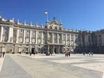
Today we took an excursion into Madrid and will find a hotel for the night and return to Toledo tomorrow. We simply did not want the hassle of trying to find a camping spot in the Madrid metroplex, and once we learned that there was a fast train available that covered the 46 miles in 30 minutes (maximum speed 270 km/h or 168 mph) and cost only Euro 12.50 per person the deal was done. So why Madrid ? For us ( or should I say Nina the culture fiend ) the big attractions were the National Palace (Palacio Real), Guernica exhibition in the Centro de Arte Reine Sofia and the Prado.
...click/tap to read the full postA pleasant drive (Cordoba, Spain)
Journal entry for Tuesday 11th Apr, 2017 (day 28, miles 71,535)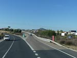
Olive day, to Granada (Granada, Spain)
Journal entry for Thursday 13th Apr, 2017 (day 30, miles 71,658)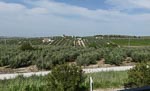
I mentioned in a previous post that the campground Carlos iii was a bit tight for us due to the mulberry trees. Well it got a lot tighter over the past couple of days as a group of Italian motor-homers arrived yesterday and have filled all the spots around ours. So when it came time to leave this morning there was no room near us for negotiating our way out. In the end I had to reverse between trees and camper vans around 3 corners with literally inches to spare on either side. We have definitely discovered that the correct dimensions for a motorhome in Europe is NOT 7.9meters L x 2.4 meters W x 4.0 meters H.
...click/tap to read the full postThe new bridge (Ronda, Spain)
Journal entry for Tuesday 18th Apr, 2017 (day 35, miles 71,781)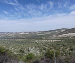
It was a shortish drive of 200km today to the pretty little town of Ronda. Another day of easy driving on lightly traffic roads through gentle and picturesque countryside. The campground we chose (Camping El Sur) is a little south of the town and there was no bus service, so after settling in we walked the 3km into town. The town is famous for its "new bridge" (newer 1751-1793 than the one built by the Romans) and we had to see it. We spent a pleasant afternoon wandering around the town with lots of tourists from all parts of the world doing the same.
...click/tap to read the full postGibraltar (La Linea, Spain)
Journal entry for Wednesday 19th Apr, 2017 (day 36, miles 71,837)
Our day started with a a slow, twisting drive through green mountains dotted with white villages hanging to the sides of, or sitting on top of, the hills. Though this section of the day was somewhat testing on the driver it was very picturesque. Eventually we dropped down onto the coast where the fierce wind we had been feeling all day had whipped up a dense haze and very large white caps on the sea. As a result the massive rock of Gibraltar which should have been easily visible during our decent to the coast was only occasionally seen.
...click/tap to read the full postWind!! (Valdevaqueros, Spain)
Journal entry for Thursday 20th Apr, 2017 (day 37, miles 71,868)This morning the wind was, if anything, stronger than yesterday which had caused a change in plans. On our original schedule we were intending to camp tonight in a campground called Valdevaqueros, which is near the port of Tarifa, from where ferries go to Morocco. And then tomorrow visit Tangiers. But due to the high winds all ferries had been cancelled indefinitely.
...click/tap to read the full postEscape from the wind (Sevilla, Spain)
Journal entry for Friday 21st Apr, 2017 (day 38, miles 71,985)
The wind was STILL strong this morning and from online weather forecasts did not seem it would lessen until at least Sunday (today being Friday), so another change of plans was required. Rather than stay at Valdevaqueros or follow the coast we decided to make for Sevilla for the night.
...click/tap to read the full postPortugal and road tolls (Cap St Vincent, Portugal)
Journal entry for Sunday 23rd Apr, 2017 (day 40, miles 72,179)
We had to drive 140km this morning before getting to the start of the Portuguese toll road, and all that we had read about it being confusing was to some degree correct. Just after the border there is a place for foreign vehicles to pull off the highway and go through a set of "gates" which accept credit cards. When we got there another motorhome was already parked there with the occupants trying to figure out what was required. While we went through the same process a number of other vehicles arrived and their passengers were also more than a little confused. However it turned out to be pretty simple. At one of the gates, the electronics read the vehicle license plate, once recognized the credit card slot flashes blue and at this point one inserts a credit card. The toll system has now linked the credit card to the vehicle license plate. Thereafter on electronic only toll roads the toll charges are applied automatically to your card. You get a printed receipt from the card machine to verify you have registered which you may have to show at some point. This registration lasts 30 days. So why was it confusing? Because there are at least 3 other options that a foreigner could use to pay tolls, there are two different sets of toll roads and some of the automatic payment mechanisms work on both sets of toll roads. And finally the official websites are hard to find, and even harder to find English versions of them.
...click/tap to read the full postGum trees (eucalyptus) (Evora, Portugal)
Journal entry for Monday 24th Apr, 2017 (day 41, miles 72,333)
Our destination today was the town of Evora (another world heritage listed town). It is inland about half was across the country (east to West) and somewhat north of where we were last night. For a bit of a change we chose a route that consisted entirely of minor highways and NO toll roads. The first 60 kms of the route was through or along the edge of a forest, and through out the day the country side varied between open farm lands and forests.
...click/tap to read the full postStorks (Nazare, Portugal)
Journal entry for Wednesday 26th Apr, 2017 (day 43, miles 72,461)
So you might be wondering abut the first photo in todays blog entry. Well we have seen many many Storks in their nests on top of electrical poles while driving in Spain and Portugal. But today we saw them for the first time in actual trees and also for the first time more than one nest in a single structure. This got us curious about why so many Storks? Google provided the answer. Traditionally White Storks have migrated across Spain and Portugal to Africa from Scandinavia. But in recent decades have discovered that the unprotected landfill trash heaps in this part of the world to be a reliable source of food and hence they have been able to spend the whole year here in this mild climate. As a result numbers have boomed. However there is a question over the future of these newly non-migrating Storks as there are plans afoot to do away with the landfills and hence deprive the Storks of their abundant food supply. So those that study Storks are awaiting developments. Will the Storks discover an alternative food supply in this part of the world, will they return to their traditional migratory pattern. I would say .. stay tuned .. but this development is likely to be a long process, one that Nina and I will not be watching closely.
...click/tap to read the full postStudents and Sanctuary (Lamego, Portugal)
Journal entry for Thursday 27th Apr, 2017 (day 44, miles 72,583)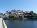
Our first stop today was the city of Coimbra and some what unusually we planned on doing some sightseeing around the town and then moving on all in the same day. A bit more energetic than my usual pace. Thus we needed a place to park within walking distance of the city center and in our Aires guide we found an area along the river near the rowing club listed. When we got to it we discovered that this was a very popular spot as there were already over 50 other motorhomes parked there. Coimbra is famous for its University, the third oldest in Europe. We were particular fortunate in the timing of our visit as the academic year was at its end and graduating students were out and about in their traditional dress. For the men black suits and cape, with accent colors to depict their course of study. For the women white shirts, black skirt, black stockings and cape. One of the traditions we read about but did not witness is the burning of the ribbons. Students traditionally tied their books together with ribbons to make them easier to carry, these ribbons are burned at graduation to signify that the students are no longer studying. Today of course the ribbons are purely symbolic and have become part of the traditional dress, we saw many student ribbons for decoration. The old city and University are built on quite a substantial hill and so during our hour long stroll through the narrow old streets we also got a change to ride the public elevator and public funicular that offer resident and students a slightly less energetic means of ascending that hill. We were blessed with a bright sunny day, and in that light the city looked really spectacular when viewed from across the river at our parking spot.
...click/tap to read the full postPilgrimage city (Santiago de Compostela, Spain)
Journal entry for Saturday 29th Apr, 2017 (day 46, miles 72,811)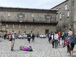
Today we made a short visit to Santiago De Compostela the end of the famous pilgrimage, Camino de Santiago, and the location of the shrine to St James the Great the reason for the pilgrimage in the first place. We arrived in Santiago mid afternoon and walked into the heart of the old city to find the place alive with people. Many were clearly "walkers" completing at least part of the Camino others just tourists like us come to look at the place and the walkers. The feeling of the place was definitely "if you are not a walker you are on the outer". But thats OK, many hiking towns and mountaineering towns have that same vibe.
...click/tap to read the full postViaducts in the rain (Colunga, Spain)
Journal entry for Sunday 30th Apr, 2017 (day 47, miles 73,046)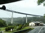
Today we started our trek along the north coast of Spain. It took a few miles out of Santiago but eventually we were traveling along the north coast on a relatively new motorway (built since the early 2000s) most of the day being spent on the A6. As it turns out much of the terrain along the coast is mountainous (or at least hilly) with valley followed by hill being a continuous pattern. The terrain was clearly a problem to the designers and builders of the new motorways as a new road that dropped down into these valleys and then climbed out again would not be the modern high speed road that was their goal. So the solution was ingenious and we presume expensive. Valleys are crossed by large, high and long bridges and often the hill on the other side is pierced by a tunnel, thereby creating a relatively level roadway out of very up and down terrain. We have not been able to find a reference to how many bridges (viaductos in Spanish) there are on this road but we did see a reference that claimed in one 16 mile section of the road there are 20 bridges and 7 tunnels. This is between Villafranca del Bierzo and Pedrafita do Cebreiro.
...click/tap to read the full postThe Guggenheim and a fantastic campsite(aires) (Bilboa, Spain)
Journal entry for Tuesday 2nd May, 2017 (day 49, miles 73,264)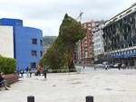
The motivation for going to the city of Bilbao was for us to visit the cities Guggenheim Museum but the campsite we chose turned out to be a bit of a feature as well, though a little more of that later.
...click/tap to read the full postA taste of Tapas (San Sebastian, Spain)
Journal entry for Wednesday 3rd May, 2017 (day 50, miles 73,337)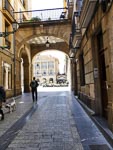
Today we made the short drive from Bilbao to San Sebastian and it became obvious quite quickly that we had entered Basque country. We no longer have any idea what the road signs are saying. After settling in to our chosen campground (this one is described as a campground - but more of that later) we ventured to the nearby bus stop and then into San Sebastian.
...click/tap to read the full postPark and Ride (Eindhoven, Netherlands)
Journal entry for Monday 8th May, 2017 (day 55, miles 74,172)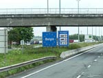
Today marked the end of the long trek from the south and while we are not yet in Zeebrugge the long driving is over and now we start concentrating on preparing the vehicle for shipping. One aspect of that preparation is the repair of an oil leak in the left rear axle hub. This started a few weeks ago and needs to be fixed before we get to the port as the shippers will not accept a vehicle with visible oil leaks. So we are back in the Eindhoven area as Erik at Adventure Trucks has arrange for the fix to be done at a local truck repair. However we arrived in the area a day early and decided to stay in another aires for two nights and spend some of that time repacking the junk that has accumulated over the 4 years since the truck was last at our house.
...click/tap to read the full postTruck fixed (Eindhoven, Netherlands)
Journal entry for Thursday 11th May, 2017 (day 58, miles 74,263)
You would be excused for being a bit perplexed by the strange mixture of photographs in todays posting. The image of a painting with all the folks seeming to have a good (but not virtuous) time is included because a print of this painting was on the wall of our hotel near the elevator on our floor. It happens to be The Garden of Earthly Delights, by Jheronimus Bosch. You might be interested to know (or maybe you already do know) that this is part of 3 painting fold-out called a triptych. This particular painting was the middle image of the triptych. The left panel depicts Adam and Eve (before their sins) and the right panel depicts the tortures of damnation. As a complete change of pace the photos of the truck show the left hub with wheel and brakes removed and oil leaking from the offending seal.
...click/tap to read the full postOn the road again (Richibucto, Canada)
Journal entry for Saturday 3rd Jun, 2017 (day 81, miles 74,581)We had planned on traveling along the Fundy coast after leaving Halifax. The Fundy is famous for its large tides with daily swings of 40 feet being common. But the weather was poor, cold, wet and gray. So we changed our minds and after leaving Nova Scotia we headed generally North along the coast of New Brunswick.
...click/tap to read the full postBackroads and a Moose (Grand Falls, Canada)
Journal entry for Sunday 4th Jun, 2017 (day 82, miles 74,756)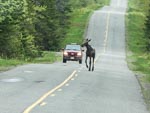
Our route today took us a little farther north (to Miramichi) and then west to Grand Falls along a series of minor and sometimes bumpy roads. It was nice to be back in "the wilderness" after Europe and we were rewarded with a brief glimpse of a young moose.
...click/tap to read the full postBack in the US (Massena, New York)
Journal entry for Tuesday 6th Jun, 2017 (day 84, miles 75,234)The weather was still wet this morning and got worse as the day progressed. The poor weather has diminished our enthusiasm for exploration and now we are thinking of increasing our pace and getting back to Gig Harbor a little earlier.
...click/tap to read the full postNice weather (Fair Haven SP, New York)
Journal entry for Wednesday 7th Jun, 2017 (day 85, miles 75,430)
Today we followed minor highways generally paralleling the St Lawrence river in up-state New York. Lots of quaint little towns and small farms. Finally the weather has improved and there is a sense of summer in the air. We saw lots of evidence today of recent flooding with the water still quite high whenever we got near the waters edge.
...click/tap to read the full postNiagara! (Angola Hwy 90, New York)
Journal entry for Thursday 8th Jun, 2017 (day 86, miles 75,613)
Another fine day, so we celebrated the sun by taking a long walk around the campground and the nearby break-water before getting underway for the day. More minor highways, more quaint little towns as we followed the southern shore of Lake Ontario. But the highpoint of the day was Niagara Falls. On that subject I will let the photos do the talking.
...click/tap to read the full postHeat, horse and buggy (Findlay Walmart, Ohio)
Journal entry for Friday 9th Jun, 2017 (day 87, miles 75,929)
Today the nice weather turned into "hot and windy" and decidedly less pleasant. We spent the day pushing West into a strong wind with temperatures into the 90's. The disadvantage of the Mog's large windscreen is evident on days like today. On a totally different front we got a couple of photos of Armish horse and buggies. We have been seeing these sporadically for the last couple of days but this was our fist successful effort at capturing a photo. Interestingly we have seen road signs warning of such vehicles and even dedicated parking places at shopping plazas for them.
...click/tap to read the full postPeoria (Peoria, USA)
Journal entry for Saturday 10th Jun, 2017 (day 88, miles 76,272)No much to report about today. It is still hot and windy as we pushed through the farm lands of Illinois.
...click/tap to read the full postPushing on (Omaha Hwy 680, Iowa)
Journal entry for Sunday 11th Jun, 2017 (day 88, miles 76,662)
You will see we took a few photos of the campground before leaving this morning. The weather was a little bit gentler today. It is still windy but the temperature is a bit more moderate because of a cloud cover that also makes for a bit of a "gray-day" but also a somewhat better day for traveling. So we pushed on a bit harder than usual making use of I80 into Iowa. You will notice that this route brought us in contact with the "famous" truck stop Iowa 80 the self claimed "largest truck stop in the world".
...click/tap to read the full postMachines (Atkinson Mill Race Park, Nebraska)
Journal entry for Monday 12th Jun, 2017 (day 89, miles 76,889)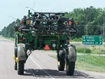
A more pleasant day still some wind but not so hot, and sunny rather than gray. This generally put us in a better mood and a nice campground early in the afternoon gave me the opportunity to work on a problem with the truck.
...click/tap to read the full postGrassland and Museum (Angostura Reservoir, USA)
Journal entry for Tuesday 13th Jun, 2017 (day 90, miles 77,177)
More nice weather and a change of scenery today. We are now in the grasslands. The change in scenery happened quite quickly as all of a sudden we noticed that we were traveling amidst rolling grass covered hills that stretch as far as the eye can see in every direction.
...click/tap to read the full postYellowstone (Avon, USA)
Journal entry for Friday 16th Jun, 2017 (day 93, miles 77,956)
Yellowstone National Park really is a scenic treasures. Even on a grey wet day like today the animals, the mountains and the rivers make it a feast for the soul. This morning we crossed the Northern part of the park from the junction with 212 to the Northern Entrance and while we were really only transiting on our way to Bozeman we could not help but want to stop and take photos. As you can see the animals conspired to feed our temptation.
...click/tap to read the full postNot entirely solo (Nanaimo, Canada)
Journal entry for Saturday 23rd Jun, 2018 (day 1, miles 175)
For the first two days of this adventure I am accompanied by a friend named Todd, so I have to admit that the journey is not entirely solo. But only a small cheat.
...click/tap to read the full postSea to Sky (Lillooet, Canada)
Journal entry for Sunday 24th Jun, 2018 (day 2, miles 323)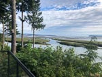
We were pleasantly surprised this morning to find that the campground had a cafe that opened at 8:00 so morning coffee was pretty easy to organize. So once fortified we packed and headed to the ferry terminal to await the loading of the vessel to Horse Shoe Bay. By the time loading started there were a large pack of bikes of all kinds most laden down with gear for an extended journey.
...click/tap to read the full postStorms shorten the day (100 Mile House, Canada)
Journal entry for Monday 25th Jun, 2018 (day 3, miles 446)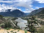
Highway 99 continued past Lillooet this morning and continued to be great riding and spectacular scenery; the weather even continued acceptable. At the intersection with Highway 12 is the town of Cache Creek and here I had breakfast before continuing north on 12. Soon the weather deteriorated with torrential rain, high wind and even hail.
...click/tap to read the full postRoadhouse philosophy (Prince George, Canada)
Journal entry for Tuesday 26th Jun, 2018 (day 4, miles 659)
Yesterdays storm was gone this morning to be replaced by crystal clear sky and bright sun which displayed the countryside wonderfully. However without the usual expedition photographer along on this journey the job of capturing the scenery and recording events fell to me. I just hope I am up to the task.
...click/tap to read the full postForest (Smithers, Canada)
Journal entry for Wednesday 27th Jun, 2018 (day 5, miles 893)
Today my route took me West along Highway 16 a somewhat less busy road than Highway 97 of the previous couple of days. The weather continued generally fine but with a strong buffeting wind that made riding a little less pleasant than normal.
...click/tap to read the full postLeaving civilization - sort of (Bell 2, Canada)
Journal entry for Thursday 28th Jun, 2018 (day 6, miles 1,118)
The Yukon (Boya Lake Provincial Park, Canada)
Journal entry for Friday 29th Jun, 2018 (day 7, miles 1,358)
Heading North this morning from Bell 2 was more of the mountains, forests, good lonely road of yesterday. Though a little spice was added by patchy rain showers that sometimes were quite heavy. The rain slowed me down some what as I am still a bit of a novice to this motorcycle stuff and I don't want to misjudge a corner in the wet. Late morning, some what before Dease Lake I called into Tatogga Lake Resort a campground and restaurant housed in a quaint log building where I had breakfast (or as it is becoming the days main meal).
...click/tap to read the full postThe Alaska Highway (Alcan) (Squanga Lake Territorial Park, Canada)
Journal entry for Saturday 30th Jun, 2018 (day 8, miles 1,627)
The first phase of todays journey was to complete the crossing of British Columbia and arrive at the border with the Yukon Territory. The effort required to cross BC from South to North never ceases to amaze me, and this trip is no exception. At the Yukon border sign the odometer on the bike is showing 30584 miles or 1300 miles since the ferry from port Angeles first dropped me on BC soil. A few more miles and the Cassiar Highway was done and I have arrived at the Alaska Highway.
...click/tap to read the full postYukon Rivers (Moose Creek, Canada)
Journal entry for Tuesday 3rd Jul, 2018 (day 11, miles 1,932)
I dithered about in Whitehorse a bit this morning before getting underway. I had to buy one of those red plastic fuel containers and then figure out how to attach it to the bike. I had expected to get a 2 gallon container but of course I should have realized all containers here would be metric so the choice was 5 liters (1.25 gals) or 10 liters (2.5 gals). After way too much deliberation I went with the 10 liter variety. Strapping it to the bike required a set of 4 lime green tie-down straps 3 of which were surplus to requirements; thus my load of unnecessary items is increased.
...click/tap to read the full postGlorious Day (Eagle Plains, Canada)
Journal entry for Wednesday 4th Jul, 2018 (day 12, miles 2,278)
I could not get out of the campground fast enough this morning, I don't really like mosquitoes. Rather than hit the road I headed back towards Whitehorse about half a mile to Moose Creek Lodge for todays installment on the Traditional Yukon Breakfast; it also was good and too big. Thereafter I hit the road to Dawson City. The weather was glorious. Bright sun with temperatures sometimes in the high 70s. So I was keen to get to Dawson City to gas up and then head up the Dempster Highway with the hope of getting to Eagle Plains; the first fuel stop on the Dempster and about half way to Inuvik.
...click/tap to read the full postNot so Glorious (Eagle Plains, Canada)
Journal entry for Thursday 5th Jul, 2018 (day 13, miles 2,372)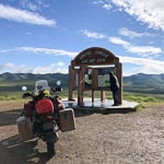
It was raining gently this morning as I pulled up to the gas pump to fill up for what I hoped would be a long day to Inuvik. I did not know it at the time but the guy that pumped the gas was prophetic as he said "you should not be going north in this weather". Yesterday was my introduction to gravel, today it was an introduction to mud. The first few miles were very tentative but within an hour the rain eased a bit and by the time I got to the rest area and monument for the Arctic Circle (25 miles from Eagle Plains) I was beginning to get hopeful.
...click/tap to read the full postRetreat (Dawson City, Canada)
Journal entry for Friday 6th Jul, 2018 (day 14, miles 2,621)
Today my retreat from Eagle Plains was mostly uneventful. There was a dense cloud cover with some mist in the valleys but fortunately no rain. The road was mostly dry so my gravel experience of two days ago was helpful. The cloud and consequence poor light rendered the scenery less of a post card and more of a bland grey mush. But as I have learned to do from other adventures I took the time to stop regularly to take a mental picture my surroundings. There is a good chance I will never be back to this place.
...click/tap to read the full postTop of the world (Tok, USA)
Journal entry for Saturday 7th Jul, 2018 (day 15, miles 2,807)
I spent a little time in the downtown area of Dawson City this morning, noting the touristification that has taken place since we were last here. Main Street is now looking pretty cute and up market but the "behind" streets are still pretty basic and unpaved.
...click/tap to read the full postWind (Fairbanks, USA)
Journal entry for Sunday 8th Jul, 2018 (day 16, miles 3,040)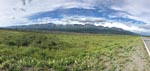
I thought today would be an easy 200 mile ride into Fairbanks. It started out warm though a bit windy and initially I spent time stopping to get some photos of The Alaskan Range. But as the day progressed the wind picked up and by late morning a howling wind (mostly a cross wind that demanded careful attention while riding), lots of dust turned the ride into a survival event.
...click/tap to read the full postThe Dalton (Coldfoot, USA)
Journal entry for Tuesday 10th Jul, 2018 (day 18, miles 3,290)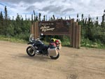
To get started on the Dalton Highway one has to drive (or in my case ride) about 80 miles along the Elliot Highway north from Fairbanks. The Elliot is reasonable quality paved country road so that 80 miles is no big deal, just a bit tedious, because one is keen to "get started" on the great adventure to Deadhorse.
...click/tap to read the full postTesing my limits (Deadhorse, USA)
Journal entry for Wednesday 11th Jul, 2018 (day 19, miles 3,525)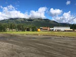
I felt very lucky this morning when I looked out on a bright sunny day. Maybe, I thought, I would have good weather all the way to Deadhorse. Yeh, right. But I was not to know the truth for a while. North from Coldfoot the road is paved for about 35 miles and one starts to get views of the Brooks Range even before the pavement ends. So note to future travelers. Go North of Coldfoot a bit as the road is paved for a while and the views are good (provided the weather is OK).
...click/tap to read the full postA relief, or good luck (Coldfoot, USA)
Journal entry for Thursday 12th Jul, 2018 (day 20, miles 3,770)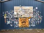
Last night at dinner I met a German guy who had flown in to Deadhorse with a bicycle in an airline box ready to start a bicycle expedition to Panama. I say ready but that is a qualified term as he did not have any food and planned on buying supplies in Deadhorse. The hotel staff did not quite laugh at him but close. I waved him on his way this morning as he was up and ready to start riding much earlier than I was ready to depart. Before getting underway I needed to get fuel and I wanted to have a look around the town. This is another one of those take a note of where you are and what you are seeing as you will probably never be back here again. I noticed a number of motorcycles around the town and took a few photos as reminders, as well as bought some "stickers" for the bike at the General Store. Then it was hit the road time.
...click/tap to read the full postDone the Dalton (Fairbanks, USA)
Journal entry for Friday 13th Jul, 2018 (day 21, miles 4,050)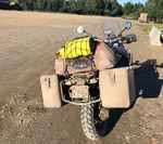
There is not much to say about today. The weather was good, the roads mostly dry and riding easy. The only record of the trials of the struggle to Deadhorse was the mud covering my motorcycle. For the first few hours this morning there were noticeably large numbers of rabbits and prairie dogs on, and beside, the road. I don't know why. But that's why the rabbit photo.
...click/tap to read the full postBack in Canada (Haines Junction, Canada)
Journal entry for Monday 16th Jul, 2018 (day 24, miles 4,559)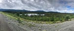
It was still somewhat wet this morning as I set off towards the Canadian Border. I was expecting to have breakfast at a place called Border City that my maps told me was just the US side of the border. I found it, but it turned out to be closed and that looked permanent. The Canadian entry station is at the town of Beaver Creek about 20 km after the actual geographic border and this town though small was definitely not closed. Three gas stations and at least two restaurants. So I chose Buckshot Betty's for one of those breakfasts I will not be allowed to have one I get home.
...click/tap to read the full postMaybe a Grizzly (Teslin, Canada)
Journal entry for Tuesday 17th Jul, 2018 (day 25, miles 4,769)
It was wet and cold pulling out of Haines Junction this morning and so the miles into Whitehorse were not about photos and sightseeing. In Whitehorse I stopped for the mandatory coffee at Starbucks, bought a few groceries and then was on my way towards Teslin.
...click/tap to read the full postBears and Bison (Laird Hot Springs, Canada)
Journal entry for Wednesday 18th Jul, 2018 (day 26, miles 3,770)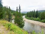
It was raining this morning so packing up my gear was a bit of a chore, trying to do everything inside the tent so as not to get all my gear wet. The rain also meant that this mornings ride was about "getting there" rather than taking in my surroundings. However after a couple of hours the rain intervals lessened and I became a little more observant of my surroundings.
...click/tap to read the full postMuncho and Stone Mountain (Fort Nelson, Canada)
Journal entry for Thursday 19th Jul, 2018 (day 27, miles 5,025)
This morning as I passed Laird Hot Springs I saw that the parking lot was crammed with motorhomes and tents. Apparently a lot of people, like me, discovered the campground and lodge full last evening. However they apparently are more creative than me and simply occupied the parking lot. The crowded nature of the parking lot confirmed my decision to give the hot springs a miss. Later in the day Nina informed me that, according to the Milepost, the Laird Hot Springs is one of the most popular attractions on the ALCAN.
...click/tap to read the full postNo services for .. (Fort St John, Canada)
Journal entry for Friday 20th Jul, 2018 (day 28, miles 5,485)
Before setting out this morning I had a conversation with a bicycle rider who had also overnighted in the campground. Turns out the guy was French and like me was headed towards Fort St John. However he expressed to me that he had a problem. Seems there is no camping ground along that route for well over 100 kilometers and that he did not want to just camp in the forest beside the road, we was nervous of bears. Well once I got under way I was immediately confronted by a sign that encapsulated the Frenchman's concern; it read Check your fuel. No services for 144 kms (thats over 110 miles). And it turned out that the sign was correct, the first fuel stop, indeed maybe even the first occupied building, was a lodge at Buckinghorse River. For me the lodge provided a welcome stop for a traditional breakfast and a place to get fuel for the next leg of the journey.
...click/tap to read the full postThe Peace (Prince George, Canada)
Journal entry for Saturday 21st Jul, 2018 (day 29, miles 5,780)
From St John this morning I back tracked a little to the start of BC Highway 29 that heads south along the Peace River to Hudson's Hope. There is obviously a political dispute surrounding the Peace River as I saw many signs arguing against the idea of a hydro power scheme on the Peace. After Hudson's Hope the route left the Peace and eventually caught up with the Pine River and followed that for miles. Today was another day of no services for ... so my French friend from Fort Nelson would have had (will have?) further camping dilemmas.
...click/tap to read the full postMt Robson (Lucerne Provincial Park, Canada)
Journal entry for Sunday 22nd Jul, 2018 (day 30, miles 6,004)
There is no doubt that today is Mount Robson day, though there were many miles between the start of day and that mountain, many miles of good road and forest (did I say forest!). Before getting to the mountain itself one drops into a valley that the locals call and signpost as Robson Valley, but which is geographically a valley of the Fraser River. In this valley I came upon the small (microscopic ?) town of McBride and stopped in at the old railway station that has been converted to a cafe and art/curio shop. Here I had a lunch of soup and toast. The cook promised me that the soup was 17 bean soup, but I could only identify two variety of beans. Never the less the soup and conversation was pleasant.
...click/tap to read the full postWaiting for weather (Jasper, Canada)
Journal entry for Monday 23rd Jul, 2018 (day 31, miles 6,041)
I followed Nina's advice and decided to stay in Jasper for tonight, thus making today a bit of a rest day. The hope (and forecast) is that tomorrows weather along the Icefield Parkway will be better than today. Spent the day relaxing around Jasper and the campground.
...click/tap to read the full postIcefield Parkway (Radium Hot Springs, Canada)
Journal entry for Tuesday 24th Jul, 2018 (day 32, miles 6,288)
For a little while this morning the rest day gamble seemed like it might not pay off, as the mountains were all covered in cloud as I started out this morning. But by the time I got to the Columbia Icefield the cloud was broken and sun was showing through. I tried to capture a smattering of the sights along this really picturesque route. I have travelled this road a number of times but never failed to be awed by just how much spectacular mountain and lake scenery is packed into this single road.
...click/tap to read the full postRogers Pass and other things (Castlegar, Canada)
Journal entry for Wednesday 25th Jul, 2018 (day 33, miles 6,606)
Today I was very much in the mood of "heading for home" which was remiss of me for there was a lot of great scenery along the way and I did not give it the photographic attention it deserved. From Radium this morning I made an early start and followed the Columbia River (and highway 95) north to the town of Golden a major rail head town and a watering hole on the Trans-Canada Highway (or Highway 1 as it is also called). For me it was also breakfast.
...click/tap to read the full postBack in the USA (Winthrop, USA)
Journal entry for Thursday 26th Jul, 2018 (day 34, miles 6,825)
The first town on my route out of Castlegar this morning was Trail, BC. It was clearly an old mining town built in and on the sides of a steep valley with small or narrow houses. Fortunately for the town some mining and or metallurgical facilities still operates; though also clearly tourism is now a substantial income source for the area. I was intrigued by the sign at the exit to the town I did not know Italian was one of the Canadian languages.
...click/tap to read the full postMount Rainier (Crow Lake Way Trailhead Hwy 12, USA)
Journal entry for Friday 28th Sep, 2018 (day 1, miles 143)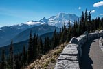
Todays goal was to try for some good photos of Mount Rainier, we were optomistic as the weather was great so we decided that Sunrie Visitor Center would be the best spot as we would not be in position until afternoon. That proved to be a less than ideal choice as by the time we got there the sun was over the top of the mountain making for poor light. Still the drive along Hwy 410 and along the Sunrise entrance road was enjoyable.
...click/tap to read the full postAn easy day on Hwy 12 (Benton City, USA)
Journal entry for Saturday 29th Sep, 2018 (day 2, miles 267)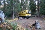
The outside temperature this morning was 37°F emphasisiing the fact that we spent the night in the mountains and at altitude. Stopped in Yakima for a while to get some supplies and communicate with family and a bit of exercise on the Yakima Green Way, a very extensive walking and bicycle trail system.
...click/tap to read the full postFarm country (Alpowa Summit Rest Area, USA)
Journal entry for Sunday 30th Sep, 2018 (day 3, miles 402)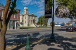
Today we got a good dose of Washington farm country. Lots of fields of straw colored growth, some just stuble having been recently harvested, some tall and swaying and about to be harvested (we assume). Quaint little towns some of which seem to be caught in a bit of a time warp, except for all the modern pickup trucks. Really a pleasant day and a salutory reminder of the scope of farming.
...click/tap to read the full postThe Clearwater (Five Mile Creek Hwy 12, USA)
Journal entry for Monday 1st Oct, 2018 (day 4, miles 482)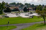
We stopped for a long while in Lewiston this morning. The town has a nice skate park and walking trail beside the river. We took advantage of this facility, and the fine sunny weather, to undertake our daily exercises. I am on a regime of strengthening and stretching from my physical therapist and Nina is aiming to achieve her Apple Watch goal of 10,000 steps every day.
...click/tap to read the full postExploring around Orofino (Knife Edge River Access Hwy 12, USA)
Journal entry for Tuesday 2nd Oct, 2018 (day 5, miles 596)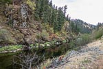
We spent the day exploring the area south of Orofino along Idaho Highways 13 and 14 before starting the trek along Highway 12 towards Lolo Pass. The day was wet with light rain and this discouraged photos and encouraged an early stop.
...click/tap to read the full postLolo Pass (KOA Missoula, USA)
Journal entry for Wednesday 3rd Oct, 2018 (day 6, miles 708)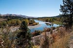
We had some business to take care of so we set off early towards Lolo pass with the goal of getting to Missoula, a campground, wifi and enough time to "take care of business". The day turned out to be sunny which made the drive up Hwy 12 to Lolo Pass quite picturesque. There were long sections of new pavement which made driving very pleasant. But this was offset by a number of delays due to single lane sections where road crews were at work.
...click/tap to read the full postA rude awakening (Suba, USA)
Journal entry for Thursday 4th Oct, 2018 (day 7, miles 799)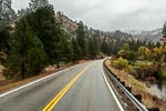
As the reader will deduce from the photos, today brought grey skies and rain. After dithering around in Missoula for a long time we eventually got a late start heading south along Hwy 93. Fall colors were out in force but the lack of nice light and water on the lens reduced the opportunity for nice photos to zero.
...click/tap to read the full postFirst snows (Near Ennis, USA)
Journal entry for Friday 5th Oct, 2018 (day 8, miles 972)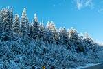
This morning was a real treat. From our overnight spot we climbed steeply to Lost Trail Pass and were delighted to find ourselves amongst fresh snow, quite a few inches of the nice fluffy white stuff. Despite having lived in the US (a place where snow is not uncommon) for 20 years we still have the typical Australian reaction to this "exotic" stuff. After Lost Trail the road towards Wisdom, MT climbed a little higher to Chief Joseph Pass before dropping out of the mountains and eventually the Big Hole Battlefield Memorial, and the cafe in Wisdom.
...click/tap to read the full postA little vehicle trouble (Suga City, USA)
Journal entry for Saturday 6th Oct, 2018 (day 9, miles 1,153)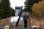
This morning our Webasto diesel heater would not start so we had to rely on the generator and a small electric heater to get our little house up to a comfortable temperature. To my surprise we also had difficulty getting the truck engine to start. Both these small problems were more than a little surprising as we were not at a particularly high altitude (only about 6,500 ft) and it was not particularly cold (33°F). Throughout the mornings travel both these problems persisted in a minor form. Both the heater and engine would start but would generate blue smoke for a while until full warmed up. Eventually in West Yellowstone I added some diesel anti-gel treatment to both tanks and we decided to bypass Yellowstone and the Tetons and head south towards Idaho Falls looking for lower altitude and slightly warmer temperatures until we were convinced the anti-gel treatment had done its job.
...click/tap to read the full postFarms, Fog and Mountains (Grand Tetons, USA)
Journal entry for Sunday 7th Oct, 2018 (day 10, miles 1,249)
We got off to a good start this morning. The heater, generator and truck all started as they should, and the sun was out providing very good light as we drove east through farm country. Near the town of Driggs we ran into a very dense and extended patch of fog which had largely dissipated by the time we stopped for some exercise on the walking/cycle trail at Victor. Then over Teton Pass to Jackson Hole, Wyoming.
...click/tap to read the full postPerfect photo weather (East Entrance Yellowstone, USA)
Journal entry for Monday 8th Oct, 2018 (day 11, miles 1,449)
The day started bright and sunny, with no clouds, so we were up somewhat earlier than usual to take advantage of the great photo opportunities. This theme continued throughout the day and we spent more time on the road than would be usual for us as we wanted to cover our targeted areas of both the Tetons and Yellowstone while the good weather lasted.
...click/tap to read the full postShoshone Canyon (KOA Billings, USA)
Journal entry for Tuesday 9th Oct, 2018 (day 12, miles 1,619)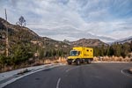
It was cold outside this morning, 24°F at 8:00 when we finally decided to get out of bed. But the diesel heater worked all night so we were comfortable inside our yellow box. And thanks to that same diesel heater I was able to warm the engine and get it started first try. I am now quite confused about the cause of the isses we have had with the truck engine and diesel heater.
...click/tap to read the full postBig Horn Canyon (Fort Smith, USA)
Journal entry for Thursday 11th Oct, 2018 (day 14, miles 1,766)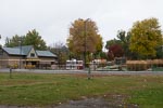
As the title says, today we visited the northern end of Big Horn Canyon. Our route took us through miles of grass lands and Crow Indian Reservation before finishing in the small town of Fort Smith. At this time of year the town is gearing up for for fishing. There are many fishing lodges around the town and drift boats on trails were very common.
...click/tap to read the full postMore grass lands (Devils Tower, USA)
Journal entry for Friday 12th Oct, 2018 (day 15, miles 2,021)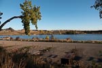
Today turned out to be a long distance day by our standards, over 200 miles. But bad weather is forecast for the next few days and we wanted to be at a campground while it (the weather) descended on us. Also the roads today were good, travel easy and the grass lands scenery interesting without being spectacular. Thus we made it to Devils Tower late in the day to find, fortunately that the KOA was open for a few more days. We also arrived just in time to get a few photos of the Tower before the sun was gone.
...click/tap to read the full postA snowy day in camp (Devils Tower, USA)
Journal entry for Saturday 13th Oct, 2018 (day 16, miles 2,021)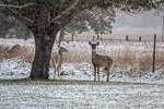
The forecast bad weather arrived over night and by mid morning the temperature was below freezing an snow was falling. That's how the day continued.
...click/tap to read the full postMail pickup (Rapid City, USA)
Journal entry for Sunday 14th Oct, 2018 (day 17, miles 2,140)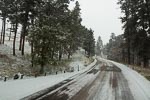
It was cold this morning, 20°F, and still snowing lightly. Overnight our diesel heater had (again) stopped working and this time I could not get it restarted. Fortunately we are in a campground with electricty so we can still heat the camper and truck engine or maybe we would be here another day. Putting aside the vehicle troubles the morning was really pretty. About an inch of snow covering most everything yet clouds high enough that we could see the Devil's Tower also with a light snow cover. We quite enjoyed our stay at Devil's Tower KOA.
...click/tap to read the full postPrairie dogs (Badlands NP, USA)
Journal entry for Monday 15th Oct, 2018 (day 18, miles 2,227)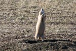
In order to give the mail service time to deliver the parcel we are waiting for, we decided to pay a visit to the Badlands National Park, spend a night there and try again for the mail tomorrow. So, after the usual round of grocery shopping chores, we headed east towards the famous town of Wall, SD and the Northern Entrance to The Badlands National Park.
...click/tap to read the full postSuccessful mail pickup (Rapid City, USA)
Journal entry for Tuesday 16th Oct, 2018 (day 19, miles 2,351)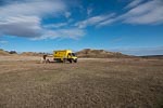
We spent this morning completing our exploration of the Badlands finally exiting the park through the town of Interior, SD before heading back to Americas Mailbox and that long awaited parcel. In case your curiousity is aroused the parcel contained a supply of mint flavoured chocolates that Nina and I use as an after dinner treat.
...click/tap to read the full postBlackhills (Hot Springs, USA)
Journal entry for Wednesday 17th Oct, 2018 (day 20, miles 2,446)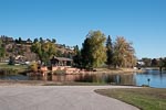
Our excursion to the Badlands a couple of days ago had the unfortunate side effect of getting our truck very muddy as the road to Sage Creek is gravel, or in our case mud, as a result of the recent snow. So this morning we had intended to visit a local Rapid City Truck Wash to cleanup. However when we pulled into the entrance we noted 3 or 4 animal carrier tractor trailers ahead of us, and in short order one of the truck attendants informed us that our wait would be at least 4 hours. So much for cleaning the truck.
...click/tap to read the full postBlackhills (Hot Springs, USA)
Journal entry for Thursday 18th Oct, 2018 (day 21, miles 2,468)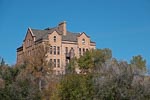
We decided to spend an extra day in the Hot Springs area. We are a little ahead of schedule for our visit next week with Rob Pickering and I am not feeling well, I have a cold. And the town of Hot Springs seems to deserve a little more attention than we have so far given it. So after a relaxed morning we spent a few hours in the town enjoying the walking paths beside the river.
...click/tap to read the full postCow country (Hawk Springs SRA, USA)
Journal entry for Friday 19th Oct, 2018 (day 22, miles 2,656)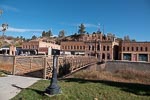
We made another visit to Hot Springs this morning before getting on our way. Nina wanted a few more photos and the town offered a good trail for her daily walk. Thereafter we spent a pleasant day driving through miles and miles of open grass lands.
...click/tap to read the full postInto Colorado (Strasburg KOA, Colombia)
Journal entry for Saturday 20th Oct, 2018 (day 23, miles 2,862)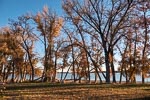
Before getting underway this morning we could not resist a few more photos of our pleasant camping spot. Then it was "onward" with the plan of getting to the Denver area so that we would be within easy driving distance of La Junta for tomorrow. Along the way we made an extended stop at the Wyoming Visitor Center just before the Colorado border. Quite an impressive building and facilities.
...click/tap to read the full postReady for a week of truck work (La Junta, Colombia)
Journal entry for Sunday 21st Oct, 2018 (day 24, miles 3,014)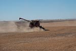
We spent the day making our way to La Junta, a long run east along I70 and then at the town of Limon south on state route 71. The run south along 71 was notable for the dryness of the country side. We would later hear that moisture (rain or snow) has been scarce in this part of the country for over a year. AS you can see from the photos we are in grain growing country.
...click/tap to read the full postA little hiccup and feed lots (Garden City, USA)
Journal entry for Saturday 27th Oct, 2018 (day 30, miles 3,346)We had a bit of a hiccup this morning. We stayed in the parking lot at Terry Lee Ent. last night and headed east this morning. But a little way into our drive we discovered that our new exhaust system needed a bit of adjustment. So back to La Junta where Rob was waiting to spend a couple of hours of his Saturday getting us ship-shape.
...click/tap to read the full postFarm country and fall colors (Elk City SRA, USA)
Journal entry for Sunday 28th Oct, 2018 (day 31, miles 3,698)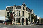
We had a little McDonalds fiasco this morning. We rarely eat at the "Golden Arches" but this morning as we approached Dodge City we decided we would take breakfast at one of those eastablishments. Thus once in Dodge we found a place to park, ordered our desired nourishmet at the new fangled electronic boards that McDonalds now have, and sat down waiting for the delivery of our food and drink. Within a few minutes a young lady came to our table to inform us that "the expresso machine was not working would standard coffee be OK rather than the expresso I had ordered". yeh, sure. A few minutes later she came back with "oh, and by the way the iceream machine is also not working so we cannot make the chocolate shake you ordered". At that point we cancelled the entire order and left. On the way out I noticed that the store advertised "mobile ordering" using your smart phone. I wondered how the McDonalds app would have handled this situation, certainly their fancy electrtonic order board was not aware that expresso coffee and icecream while on the menu were not available.
...click/tap to read the full postA visit with GXV (Springfield, USA)
Journal entry for Monday 29th Oct, 2018 (day 32, miles 3,860)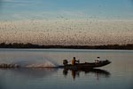
As you can see this morning we were still obsessed by the lake and the birds. Why ? We could not work out an answer to that question.
...click/tap to read the full postTyler Bend (Buffalo River NP, USA)
Journal entry for Tuesday 30th Oct, 2018 (day 33, miles 3,979)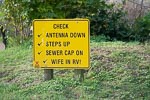
After running down the KOA checklist for departing campers we took a few "last" photos of Springfield KOA and then hit the road south. For those that have not been to this part of the world, south of Springfield there are a series of popular lakes and the town of Branson. Branson is like a small Las Vegas with a varierty of entertainment and shows and to ensure that visitors get to know the choices available to them the highway is lined with large billboards advertising the various artists that are performing in the town. However, we have been to Branson on previous visits so this time we just continued on through the town.
...click/tap to read the full postClinton Presidential Center (Village Creek SP, USA)
Journal entry for Friday 2nd Nov, 2018 (day 36, miles 4,196)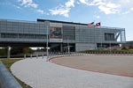
We spent the morning at the Clinton Presidential Center in downtown Little Rock. The approach was easy for our not-so nimble vehicle and parking was easy as the Center has a large lot adjacent to the entrance. We also noticed that there is an RV park on the northern side of the river right opposite the Center. Had we stayed there we would have been able to visit the Center via a pedestrian bridge. Something to keep in mind for next time.
...click/tap to read the full postI40 Tennessee (Natches Trace SP, USA)
Journal entry for Saturday 3rd Nov, 2018 (day 37, miles 4,382)Not long after getting underway this morning we came upon a police officer who had closed the road we wanted to take; seems there was a marathon underway and we needed to detour around the town of Wynne to avoid it. This caused us a bit of navigational confusion for a while, but eventually we found our way on to AR64 as required. By midday we were racing along the I40 northern bypass of Memphis surrounded by trucks and Saturday shopping traffic. Not our favourite style of travel.
...click/tap to read the full postOverland Expo Prep I (Crossville, USA)
Journal entry for Sunday 4th Nov, 2018 (day 38, miles 4,619)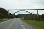
The next few days are going to be a bit boring for you readers as it is time I started preparing for the sessions I am presenting at Overland Expo. That means we are looking for campgrounds with wifi so that we can spend a couple of days stationary while I work.
...click/tap to read the full postTourist heaven and autumn colors (Cherokee, USA)
Journal entry for Wednesday 7th Nov, 2018 (day 40, miles 4,781)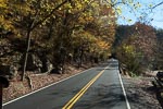
Overnight we looked a little more carefully at the map and the location of the Overland venue and decided that we were a bit too far away from the venue and in any case we needed to collect some groceries before the event. Thus a we changed our plans and decided to move.
...click/tap to read the full postDay One (Herron Point, Western Australia, Australia)
Journal entry for Wednesday 27th Feb, 2019 (day 1, kms 92)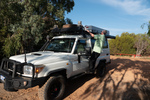
As arranged we were collected from out hotel at 9:00 am by a representative from WaExperts and delivered to their depot where we had a couple of hours training on the systems of the vehicle and then we were on our own.
...click/tap to read the full postOld lace (Coolgardie Western Australia, Australia)
Journal entry for Thursday 7th Mar, 2019 (day 9, kms 339)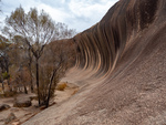
We started the day with the obligatory walk around and over Wave Rock, which was after all the point of coming to this place. I can see why some people described it to us as "under whelming" as it is not very high nor very long. But is interesting to discover how such a rock formation comes about. Its a result of differential erosion - different levels of soil moisture erodes the buried granite at different rates and soil moisture is at its highest somehwat below the surface (as surface moisture is evaporated by the sun). You will be pleased to know that there ends the days science lesson.
...click/tap to read the full postCoolgardie (Kalgoorlie, Western Australia, Australia)
Journal entry for Friday 8th Mar, 2019 (day 10, kms 63)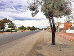
We did some historical research on the town of Coolgardie this morning. It was not difficult to do because the town has conveniently placed plaques at strategic locations that give visitors like us a glimpse into the hey-day of this now sleepy town. Coolgardie was the site of the original gold discovery that eventually gave rise to the mining operation at Kalgoorlie (25 miles away) which today is the largest open cut gold mine in the world. But initially the gold rush was sited in Coolgardie. At its peak the town sported two stock exchanges, 25 stock brokers, 26 hotels, 3 breweries, 7 news papers and 14 churches. Today Coolgardie is a sleepy town of 1200.
...click/tap to read the full postBeach driving (Esperance, Western Australia, Australia)
Journal entry for Sunday 10th Mar, 2019 (day 12, kms 334)
At the Tourist Information Center in Esperance this morning we discovered that Cape Arid National Park is closed indefinitely, and that all the camping grounds at Cape Le Grand are full and are booked out into the future. This disrupted our plans a bit as we had expected to spend the next couple of days exploring Cape Arid and to camp at Cape Le Grand. So after some replanning we spent the day touring the sights of the area, which are mostly beaches (hence the photos) and doing a little beach driving. This latter activity I saw as a good opportunity to get a sense of how our troopie will behave on the soft sand that we expect to find on some of the inland roads we plan to drive.
...click/tap to read the full postThe Eyre Bird Observatory (Eyre Highway, Western Australia)
Journal entry for Thursday 14th Mar, 2019 (day 16, kms 232)
Our day started with a retracing of the Baxter Cliffs route back to Caiguna Roadhouse; no navigation issues this time. A bit less than an hour East of Caiguna we found Cocklebiddy Road house and got some details of the route to the Eyre Bird Observatory (see below for a few details).
...click/tap to read the full postYour next golfing holiday (Eucla, Western Austrtlia)
Journal entry for Friday 15th Mar, 2019 (day 17, kms 255)
Try the Nullarbor Golf Links for your next golfing holiday. The course stretches the 1365 kms of the Eyre Highway between Kalgoorlie Western Australia and Ceduna South Australia. Each hole is located at one of the towns or road houses along the way. We decided to provide a few photos of the course so that our friends who are keen golfers can accurately assess the course conditions before buying plane tickets to Kalgoorlie.
...click/tap to read the full postThe Nullarbor (West of Yalata, South Australia)
Journal entry for Saturday 16th Mar, 2019 (day 18, kms 313)
Before hitting the road today we drove a rough track from Eucla Roadhouse to the nearby coast to get a look at the remains of one of the early Eucla telegraph stations which is now partly devoured by the shifting dunes. Thereafter as we traveled east we visited a number of lookouts perched on the edge of the Bunda Cliffs (the sea cliffs that mark the eastern end of the Greast Australian Bight). At one of these lookouts we happened upon the same group of cyclists we passed yesterday and spent sometime chatting with them while they fueled up on some (high energy ?) food.
...click/tap to read the full postA Day of Bays (Venus Bay, South Australia)
Journal entry for Monday 18th Mar, 2019 (day 20, kms 283)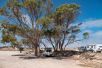
Smokey Bay, Streaky Bay (Hotel), a few rugged coastal cliffs, Venus Bay and throw in the sea lions of Point Labatt and in brief that captures today. What's missing from that brief narrative is just how beautiful todays stretch of coast is and how sparcely populated. The country side is mostly grain or sheep farming country with farm land abutting the coast, with scattered small communities every 60 miles or so. Smokey Bay was one of the smaller communities we passed through today (photo 4), it consists of maybe 2 dozen buildings only.
...click/tap to read the full postOut fishing early (Port Lincoln, South Australia)
Journal entry for Tuesday 19th Mar, 2019 (day 21, kms 360)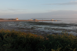
The Eyre Peninsula is at the western end of South Australias time zone so sunrise is around 8:00am at this time of year. However for the guests at the Venus Bay Caravan Park darkness did not prevent an early start on the important business of the days fishing. So by the time there was enough light for a photograph many of those tinnies had alrerady been launched at the local natural sand boat ramp and we only got photos of the late comers.
...click/tap to read the full postAnimal Farm (Cleve, South Australia)
Journal entry for Thursday 21st Mar, 2019 (day 23, kms 116)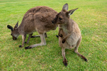
Regular readers of this blog will probably have already deduced that Nina and I like photographing animals/birds, so this morning we could not resist the opportunity to visit Glen Forest Animal Park a short drive from Port Lincoln. It is a bit corny going to such a place but on the other hand if did give us a chance to capture a number of iconic Australian animals.
...click/tap to read the full postIron Knob (Whyalla, South Australia)
Journal entry for Friday 22nd Mar, 2019 (day 24, kms 245)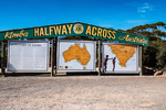
The goal for today was to make it to Whyalla, a largish town almost at the head of Spensers Gulf. Along the way we visited the town of Kimba whose claim to fame, is that it is half way across Australia (from east to west), and that it is the home of the Big Galah. On a nearby hill we also found metal statues of John Eyre (the first European to cross the continent of Australia from Sydney to "Perth") and his aboriginal companion Wylie.
...click/tap to read the full postFuel Filter (Lawrie Park, South Australia)
Journal entry for Saturday 23rd Mar, 2019 (day 25, kms 168)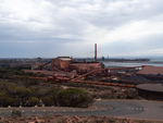
We did a driving tour of Whyalla this morning before hitting the road. From the Lookout on Hummock Hill the scope of the various industrial areas was apparent. This must have been quite an operation in its day.
...click/tap to read the full postNostalgia (Wallaroo, South Australia)
Journal entry for Sunday 24th Mar, 2019 (day 26, kms 149)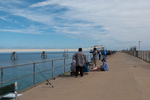
Today was to be a nostalgic day for me as our destination was the small beach town of Wallaroo. This was my mothers home town and the place I spent my first 10-11 years. Wallaroo's original reason for existence was as a copper mining and copper smelting town and in my childhood the old smelter works and the piles of cinders from the defunct smelting operation were great play grounds. After the copper era ended the Adelaide and Wallaroo Fertilizer Company produced agricultural fertilizer from imported fertilizer rock. The piles of ferilizer and rock were also a playground for us kids.
...click/tap to read the full postYorke Peninsula (Minlaton, South Australia)
Journal entry for Monday 25th Mar, 2019 (day 27, kms 187)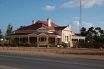
Today started with a visit to Wallaroo Museum and a walk around the town to see if my memory could match the geography and I could find my old elementary school. The museum visit was particularly satisfying because I found a series of photos that allowed me to match up my memories of the beach front area with that areas current arrangement. And I found an old building that is still part of an active elementary school that I recognized as my old class room. So I counted the morning a success.
...click/tap to read the full postStump Jump (Wallaroo, South Australia)
Journal entry for Tuesday 26th Mar, 2019 (day 28, kms 145)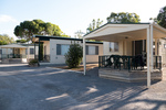
We continued our shortened exploration of the Yorke Peninsula today with a visit to a few of the small seaside towns on the eastern shore of the peninsula and saw more great beaches, jetties and well maintained small towns. If one wanted a beachfront lifestyle, largely devoid of other people the Yorke (and Eyre) peninsulas would be good places to consider. At the town of Ardrossan we came across a Museum that featured the Stump Jump Plough, ... a what you might ask (see below).
...click/tap to read the full postAnother Toyota Dealer (Port Wakefield, South Australia)
Journal entry for Wednesday 27th Mar, 2019 (day 27, kms 81)
We spent the morning walking part of Wallaroo's Tourist Drive and capturing a few more photos of my "home town"; I now surely have enough to satisfy my nostalgia.
...click/tap to read the full postVictor Harbor (Victor Harbor, South Australia)
Journal entry for Thursday 28th Mar, 2019 (day 28, kms 195)
Victor Harbor is South along the coast from Adelaide, it is the major town in a large wetland area that constitutes the mouth of the Murray River (Australia's longest river), and that's where we ended today, a base for a couple of days exploring the area.
...click/tap to read the full postWet and windy (Cape Jervis, South Australia)
Journal entry for Friday 29th Mar, 2019 (day 29, kms 77)
We put a bit of effort into doing some sightseeing around Victor Harbor today but really the weather was against us. So around midday we headed for Cape Jervis (about 50 km away) where we decided to spend the night so that we would be close to the ferry to Kangaroo Island which we have to catch tomorrow morning at 8:30.
...click/tap to read the full postKI and interesting facts (Cape Jervis, South Australia)
Journal entry for Saturday 30th Mar, 2019 (day 30, kms 0)
As I mentioned in yesterdays post, this morning we were off to Kangaroo Island on the 8:30 ferry. What I did not mention was that we had booked to pick up a day long bus tour once off the ferry. The hope was that the bus tour would give us an overview of Kangaroo Island since we did not have the time in our schedule to spend days touring by ourselves.
...click/tap to read the full postThe Coorong (Goolwa, South Australia)
Journal entry for Sunday 31st Mar, 2019 (day 31, kms 86)
The reason we came to this part of the country was to see an area called the The Coorong. For us (particularly Nina) the Coorong has a couple of attractions or at least points of interest. Firstly it is the setting for a famous Australian story and film called Storm Boy and secondly it is the point at which Australia's biggest river system (The Murray Darling) empties into the ocean. The Coorong is an extensive tidal estuarial region that encompasses the mouth of the Murray River.
...click/tap to read the full postBusiness and Catchup (Adelaide, South Australia)
Journal entry for Wednesday 3rd Apr, 2019 (day 36, kms 47)
We spent the nights of April 1st, 2nd, 3rd in Adelaide primariliy for the purpose of "business" (more vehicle work and completing US tax returns) rather than sight seeing. Never the less we took the opportunity to renew our aquaintence with Adelaide city/downtown and the area around the Torrens River. The Adelaide metro area has grown dramatically since our last visit over 20 years ago and is quite a sprawl. The city and Torrens area have undergone some major upgrades but has retained the charm of the city we knew.
...click/tap to read the full postBurra Burra (Hallett, South Australia)
Journal entry for Thursday 4th Apr, 2019 (day 37, kms 209)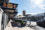
We spent the morning navigating our way through the northern sprawl of the Adelaide metro area, passing through the township of Elizabeth, which was once a major car manufacturing center for GM when it was still building the Australian car the Holden.
...click/tap to read the full postGorges of the Flinders (Flinders Rangers, South Australia)
Journal entry for Saturday 6th Apr, 2019 (day 39, kms 177)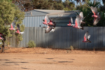
The cockatoos were out and about while we were fueling up in Hawker this morning and Nina managed to capture a flock of them in flight. There after, as you can see from the rest of the photos, we spent the day sightseeing by following a series of rough unpaved scenic roads or tracks through gorges or steep sided creek valleys. Morolana Road, Brachina Gorge and Bunyeroo Gorge. We found these gorges quite fascinating. In this incedibly dry country where most of the vegetation is low scrub, the creeks are an avenue of very large River Gum trees.These trees survive in this place by driving their roots down hundreds of feet to find the creeks water that is often still flowing underground.
...click/tap to read the full postChambers Gorge (Chambers Gorge, South Australia)
Journal entry for Sunday 7th Apr, 2019 (day 40, kms 192)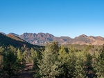
Today was intended to be a bit of nostalgia, we planned on camping the night in a place named Chambers Gorge, it is an informal camping area on private property that is somewhat off the beaten track and being "informal" has no facilities at all. The nostalgia relates to the fact that we camped in this place in 1997 when on an outback trip with our then young children and we remember this place with some fondness.
...click/tap to read the full postFlies (Arkaroola, South Australia)
Journal entry for Monday 8th Apr, 2019 (day 41, kms 112)
As you can see the flies were back this morning as soon as the sun appeared; this prompted us to get moving and keep moving. The second photograph are the signs at the junction of two gravel roads; the view was the same in every direction. It is amazing even to us how empty this place can sometimes feel; in todays driving we passed 3 other vehicles and one of those was a road grader.
...click/tap to read the full postSome 4LOW (Leigh Creek, South Australia)
Journal entry for Tuesday 9th Apr, 2019 (day 42, kms 191)
This morning we retraced yesterday afternoons route to the Bolla Bollana Smelter ruins and there after a series of 4wd tracks south through part of the Gammon Ranges National Park. Again this was a nostalga exercise reliving past adventures. It was also the first time on this journey where there was any substantial need for 4wd low range as there were some steep rock climbs and descents. The descent to the abandoned Idninha out station building was probably the most demanding.
...click/tap to read the full postFirst flat and Aussie Icon (Marree, South Australia)
Journal entry for Wednesday 10th Apr, 2019 (day 43, kms 133)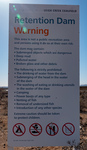
We got going early this morning wanting to be at the Leigh Creek gas station at 8:00 (its opening time) to get the flat tire fixed. However Leigh Creek does not fix tires, I was directed 5 km up the road to Copley where the task was completed promptly. More evidence for me that Copley will eventually win out as the tourist stop on this part of the trek.
...click/tap to read the full postA Technological History (Roxby Downs, South Australia)
Journal entry for Thursday 11th Apr, 2019 (day 45, kms 275)
Yesterday while planning our current little side trip I wondered about the name of the Borefield Road but this mornings drive south towards Roxby Downs answered at least part of my question. The road was lined with capped bores (spear point wells down to the artesian water table) with periodic larger structures including filling stations for water tankers.
...click/tap to read the full postLake Eyre (Haligan Bay, South Australia)
Journal entry for Friday 12th Apr, 2019 (day 46, kms 313)
We spent the morning retracing our route of yesterday along the Bore Field Road and then rejoined the Oodnadatta Track. Along the track we stopped at a few points of interest, either old railway sidings (with ruins of railway buildings, broken bore machinery and in one case an old cast iron water tank) or natural springs. This part of inland Australia sits on top of the Great Artisian Basin, a large underground water deposit that covers 22% of Australias area and is estimated to hold 15,600 cubic miles of water. Along the Oodnadatta Track this water comes to the surface in natural springs in mound formations and provided natural staging places for early settlers and the early railways.
...click/tap to read the full postCadibarrawirracanna (Coober Pedy, South Australia)
Journal entry for Saturday 13th Apr, 2019 (day 47, kms 222)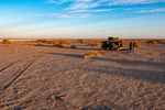
The first stop after leaving Lake Eyre this morning was the village/roadhouse of William Creek which consists of a pub, a scenic flight business in a single building, a bush campground and a gas station attached to the pub. One of our guide books described it as an iconic outback pub, it certainly is an interesting building. Seems to be mostly built from railway sleepers. Perhaps the most interesting thing about William Creek is that it is located on Anna Creek Station the largest cattle station (ranch) in the world. At 9142 sq miles it is just a little bit bigger than the country of Israel. The station was originally established by Sidney Kidman who realized that the only way to run cattle successfully in the Australian outback was to have a very low ratio of cattle to land. ß
...click/tap to read the full postNight on a cattle station (Arckaringa, South Australia)
Journal entry for Sunday 14th Apr, 2019 (day 48, kms 159)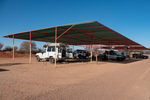
It took us a little while to get ourselves out of Coober Pedy this morning. What with queuing up to buy fresh drinking water, buying a new gas stove, Nina's 10,000 steps and my mandatory cafe visit for a coffee we did not even get to the underground museum and mine until 10:00am. The museum was pretty good and of course depicted the story of opal discovery and the development of mining in this region. Like a lot of pioneer stories the beginning of opal mining at the Coober Pedy location is a tale of determination bordering on crazyness. After the initial discovery two men arrived at the site with 100 gallons of water on a bullock dray and stayed mining until their water ran out. To extend their water they collected all used waste water in a drum and skimmed the "clean" water off the top. When that finally ran out they had to walk 90 miles to a nearby rail head. All this in a region that is recognized as the driest part of Australia, the driest continent on earth.
...click/tap to read the full postAlgebuckina Bridge (Oodnadatta, South Australia)
Journal entry for Monday 15th Apr, 2019 (day 49, kms 211)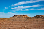
We discovered this morning that the family that manages Arckaringa are on vacation and the young man that arrived last night works for the company that owns the station (the same company owns an adjacent property). Our route this morning, as planned yesterday, took us through what is called the Painted Desert, an area of small mesas with multi-colored soil and rock layers from the variation of mineral content.
...click/tap to read the full postDalhousie Springs (3O'Clock Creek, South Australia)
Journal entry for Tuesday 16th Apr, 2019 (day 50, kms 190)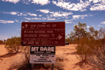
I have used the word "iconic" a number of times in recent posts and I am now regreting that as I want to use it again, to describe our destination for today. The place is called Dalhousie Springs and it is well known in Australia for a number of different reasons, perhaps the most common being the complex of hot thermal pools that make it a little oasis in the desert but also because it is the western entrance to the 4wd track across the Simpson Desert to Birdsville, one of the most famous outback 4wd trails. As you can see from the photo of the sign that track was now (or recently) closed due to of all things flood waters coming down from northern Australia.
...click/tap to read the full postFinke and the Ghan Heritage Trail (Chambers Pillars, Northern Territory)
Journal entry for Wednesday 17th Apr, 2019 (day 51, kms 339)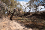
Today is my (Robert's) 70th birthday, but there were no birthday celebrations this morning, but instead an early start in order to have an excuse to be in the fly proof air conditioned interior of our vehicle. About 75km from last nights camp over more rough sandy/rocky tracks we came to Mt Dare Homestead which is now a hotel and restaurant/cafe as well as a station homestead. We cooled our heals at Mt Dare for a few hours having coffee, lunch and talking to the couple from Zimbabwe who were managing the place for a few weeks.
...click/tap to read the full postThe Alice (Alice Springs, Northern Territory)
Journal entry for Thursday 18th Apr, 2019 (day 52, kms 199)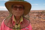
It took us until just after lunch today to retrace the Chambers Pillar track, complete the Ghan Hertiage Trail, and arrive in Alice Springs - often called The Alice by Australians. The Chambers Pillar Track had a spectacular example of a bull dust hole. This is an area on a road or track where the soil has turned to dust about the consistency of talcum powder and the powder or dust fills one or more large holes in the roadway making the hole very difficult to see. The last three photos are of our vehicle driving through that bull dust hole.
...click/tap to read the full postGorges, Gaps and Chasms (Serpentine Chalet, Northern Territory)
Journal entry for Wednesday 24th Apr, 2019 (day 58, kms 217)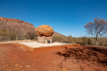
Today we commenced the very popular tourist route of the Western MacDonnell Ranges, a route that will eventually take us to the rock, "Uluru". The MacDonnell Range is really a small remnant of a much larger mountain range that has been weathered away to its current modest size. Many of the tourist attractions on this route are gorges, cut by creeks, through the MacDonnells or adjacent ranges, and often such a gorge has an almost permanent water hole at its heart. The water remains in the narrow chasms because of the lack of direct sunlight and the much cooler environment. In a number of cases, such as Serpentine Gorge, the water is also fed by a natural spring with water either from the mountain's own rock which acts as a sponge or the Great Artesian Basin.
...click/tap to read the full postDingo sighting (Glen Helen, Northern Territory)
Journal entry for Thursday 25th Apr, 2019 (day 59, kms 47)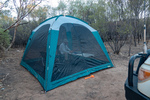
We start todays post with a couple of photos of last nights camp. Thereafter a few photos of an aboriginal ochre mine or pit. Aboriginal people collect minerals of various colors from this river bank (and other ochre pits like this one) and use them for body paint and making art. In other parts of Central Australia such colored minerals were traded between tribes and regular trade routes existed.
...click/tap to read the full postLutherans and Palm Trees (Palm Valley, Northern Territory)
Journal entry for Friday 26th Apr, 2019 (day 60, kms 153)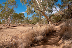
Today was packed full of interesting sights, but the one that stands out was Palm Valley; but that comes a little later in this post. First off was another gorge, this one called Red Bluff Gorge and as you by now can guess there was a wide dry sandy riverbed with lots of Ghost and River Gums that led to a narrow cleft in a wall of red sandstone and in that cleft there was a waterhole. This particular waterhole had its own supply of floatation toys to entertain the children of those families that neglected to bring their own "floaties".
...click/tap to read the full postA hitch hiker (Kings Canyon, Northern Territory)
Journal entry for Saturday 27th Apr, 2019 (day 61, kms 207)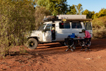
Today started with a photo of last nights camp. Then today was just a travel day, retraced our route over the rough gravel track to Hermannsburg, a quick picture of the house of Albert Namatjira (famous Australian Aboriginal artist) then 200+km of more rough road to Kings Canyon Resort.
...click/tap to read the full postKings Canyon Walk (Kings Creek, Northern Territory)
Journal entry for Sunday 28th Apr, 2019 (day 62, kms 67)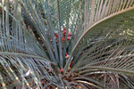
The Kings Canyon Rim Walk starts about 10 km east of the Resort so we had to pack up for the day in order to drive to the start of the walk. The start of the walk could be a bit intimidating, with all kinds of safety warnings. For example if the days max temperature is going to be over 36°C (approx 100°F) then it is manditory to start the walk before 9:30 am (there is a gate to enforce this). Along the walk there are periodic emergency beacon stations where walkers can signal for help (like one of those personal safety satellite devices), there are periodic helicopter landing zones and large outdoor medical chests. One can only conclude that lots of people have been injured and/or rescued on this walk; or maybe the parks management are a little overly cautious.
...click/tap to read the full postTourist central (Yalara, Northern Territory)
Journal entry for Monday 29th Apr, 2019 (day 63, kms 260)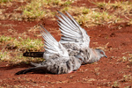
Todays post starts with some images from King Creek last night and this morning. The first image is of an ancient plant called a cycad, this one is female. The birds fluffing up their wings are Spinifex Pigeons, they started this behavior when one of the King Creek workmen turned on a water sprinkler. A number of these birds landed in the area being watered and essentially started taking a shower in the spray. There is an interesting story associated with the donkey pictured in image 6. When the camel in image 5 was young it was abandoned by its mother and the donkey took over nursing the then small baby camel. Now the two are inseparable. The images of the tents are examples of the range of accomodation that was available at King Creek.
...click/tap to read the full postMixed fortunes (Curtin Springs, Northern Territory)
Journal entry for Tuesday 30th Apr, 2019 (day 64, kms 149)
As planned the three of us arrived at the Sunrise Viewing Area at 6:50 (20 minutes to spare). The place was crawling with people, at least a couple of thousand, cameras, smart phones, and selfies everywhere. To everyones disappointment there was cloud in the east at sunrise so while the sun on the cloud was spectacular the morning rays did not illuminate and color the face of Uluru.
...click/tap to read the full postUluru and Olgas in the sun (Curtin Springs, Northern Territory)
Journal entry for Wednesday 1st May, 2019 (day 65, kms 307)
Today was sunny and warm so we were keen to get back to Uluru and capture some of the more typical photos of the big rock in sunshine. No walking around it this time just drive around it and look for some good images, because today we wanted to do a hike at another nearby bunch of rocks called either The Olgas or Kata Tjuta.
...click/tap to read the full postGaps (Conners Well, Northern Territory)
Journal entry for Sunday 5th May, 2019 (day 69, kms 245)
Today we started the long trek to Darwin, but first we had to take a short trip into the East MacDonnell Ranges and look at a few of the closer attractions. As I have mentioned previously the MacDonnell Ranges are the remnant of an acient much larger mountian range that has been weathered down to what is the MacDonnells today. The present day MacDonnels are relatively low (a few hundred feet to maybe 1200ft), consist of a long jagged ridge of exposed strata with gorges and gaps breaking through from south to north where rivers have carved their way through. So today we were off to see a few of these "gaps" which typically are dry sandy stream beds with jagged side walls and picturesque stands of ghost gums. Along the way we happened to find the largest Ghost Gum in Australia (and hence the world).
...click/tap to read the full postUFOs and an EMU (Wycliffe Well, Northern Territory)
Journal entry for Monday 6th May, 2019 (day 70, kms 275)
Today was a pretty tedious day. The road was mostly straight, the scenery low scrub, towns non-existent, and flies in swarms anytime we stopped and opened the car door. The only break from the monotony of driving were the occassional Road Houses. These are basically a gas station, restaurant and pub, maybe some basic motel rooms, maybe a caravan park and a few dwellings for locals (population usually well under 100).
...click/tap to read the full postMarbles (Renners Spring, Northern Territory)
Journal entry for Tuesday 7th May, 2019 (day 71, kms 287)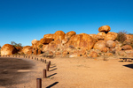
A little north of Wycliffe Wells is a collection of granite boulders known as The Devils Marbles. We made a point of getting an early start so we would get to the marbles while the morning light was still shining on the boulders. It's quite an impressive collection of boulders in various states of erosion, including a few that have been split down the middle like they were cut with a knife.
...click/tap to read the full postWhat a crowd (Daly Waters, Northern Territory)
Journal entry for Wednesday 8th May, 2019 (day 72, kms 239)
We got a visit from some birds of prey this morning while packing up. They looked particularly spectacular against the bright blue sky so we spent a while trying to "get some pics". The remainder of the day was not note worthy until we reached Daly Waters, our next camping spot.
...click/tap to read the full postThe Tropics (Mataranka, Northern Territory)
Journal entry for Thursday 9th May, 2019 (day 73, kms 224)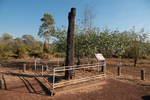
I neglected to mention in yesterdays post that Daly Waters was also an important base during World War II. The old airfield and related buildings can still be seen. Indeed some sources claim that Daly Waters was the first international airport in Australia as planes from Asia set down here on their way into Australia.
...click/tap to read the full postMore Never Never (Pine Creek, Northern Territory)
Journal entry for Friday 10th May, 2019 (day 74, kms 256)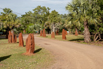
Back in 1984 when the movie was made from the novel "We of the Never Never", a replica of the Elsey homestead building was constructed as a set for many of the scenes in the movie. This morning we visited that replica.
...click/tap to read the full postA Sojourn in Darwin (Darwin, Northern Territory)
Journal entry for Wednesday 15th May, 2019 (day 79, kms 186)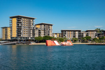
Arrived in Darwin on Saturday 11th May, a day earlier than we had originally planned. Our early arrival was deliberate as we wanted to be in Darwin, and settled in, by Sunday in order that we could go to the Mindil Beach Market which operates Sundays and Thursdays from about 4:00pm until 9:00pm.
...click/tap to read the full postLitchfield (Florence Falls Litchfield NP, Northern Territory)
Journal entry for Thursday 16th May, 2019 (day 80, kms 133)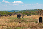
Today we are at Litchfield National Park, about 130 km SSW from Darwin. One of the early "photo ops" in Litchfield is a (or some) very large Cathedral Termite Mound, and they are impressive but mounds of a more modest size are everywhere in this country so they are only of passing interest. What Litchfield is really about is water and the ability to swim in it. During the wet season the entire country side floods to a depth of meters and areas like Litchfield (large raised plateaus of rock) act like a sponge and absorb vast quantities of the wet season water. Once the dry season starts the sponge starts to disgorge that water and many rivers are created. Litchfield is one such outcroppings and the outflowing water has created a number of nice waterfalls with large pools at the bottom of the base. These pools, the falls, and the rivers/streams that feed the falls make great swimming holes. Of course only after the rangers have checked them to ensure there are no crocodiles hanging about.
...click/tap to read the full postMore swimming holes (Wangi Falls Litchfield NP, Northern Territory)
Journal entry for Friday 17th May, 2019 (day 81, kms 40)
We had planned to spend three nights in Litchfield and tonight was surposed to be spent at Surprise Creek Falls along the Litchfield-Daly Road, but that plan got changed as the Litchfield-Daly Road has not re-opened after the wet season. So we simply jumped to the day 3 plan and headed for Wangi Falls. This is probably the main draw card within Litchfield. It has a kiosk, an office of one of the helicopter tour companies, wifi, and a most spectacular pool and water falls. We spent a nice lazy day there taking advantage of the cooling effect of the water.
...click/tap to read the full postA sunset cruise (Corroboree Road House, Northern Territory)
Journal entry for Saturday 18th May, 2019 (day 82, kms 216)
So we are a day ahead of schedule thus the sunset cruise on Corroboree Bilabong we have booked for tomorrow night would, ideally, be more convenient if it could be tonight. So as we leave Litchfield and start the trek towards Kakadu that is our plan, to see if we can rescehdule. Thus we head for Corroboree Roadhouse on the Arnhem Highway (the road to Kakadu) where we are supposed to meet the shuttle to the cruise tomorrow night in the hope we can reschedule.
...click/tap to read the full postKakadu (Jabiru, Northern Territory)
Journal entry for Sunday 19th May, 2019 (day 83, kms 256)
Today was our first experience of Kakadu National Park, the largest national Park in Australia at 20,000 square km (about 1/2 the size of Switzerland). Over half the land that comprises the park is actually owned by Aboriginals and the entire park is jointly managed by the Parks Australia . A quick look at a map of the park will reveal two main access roads, The Arnhem Highway and the Kakadu Highway that meet at the town of Jabiru. Interestingly Jabiru's primary purpose is as a "company town" for the nearby Ranger Uranium Mine. Although tourism is also a major activity within the town.
...click/tap to read the full postGunlom Falls (Gunlom Falls Kakadu, Northern Territory)
Journal entry for Monday 20th May, 2019 (day 84, kms 202)
This morning we noticed that we were not the only refugees from last nights rain storm. There were a number of 4x4 vehicles in the parking lot that looked set up for camping, and there was a lot of wet gear hanging on the clothes line or laying on the concrete building porch.
...click/tap to read the full postDarwin Again (Darwin, Northern Territory)
Journal entry for Thursday 23rd May, 2019 (day 87, kms 0)So we came back to Darwin after Gunlom because I noticed that the solar panel on top of the tent was not doing anything and we anticipate that over the next 6 weeks we will have many camps without electricty to recharge the battery that runs the refrigerator. So the folks at WAExperts.com.au had organized for a sparky (auto electrician) to drop by our campground and fix the problem. Turned out to be a corroded connection which was fixed by replacing a bunch of wires and some connectors. We also took the opportunity to update what we think of as the banner photos, the photos at the top of the home page. click this link and watch the slide show.
...click/tap to read the full postMoving again (Pine Creek, Northern Territory)
Journal entry for Friday 24th May, 2019 (day 88, kms 235)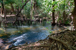
The solar panel is fixed, we are stocked up on supplies and are on the road again. So south to Pine Creek (again) to spend another night at the Lazy Lizard campground.
...click/tap to read the full postHouston We have A .... (Katherine, Northern Territory)
Journal entry for Saturday 25th May, 2019 (day 89, kms 164)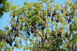
Last evening we noticed that the trees at the entrance to the Lazy Lizard had a good size population of fruit bats. They were quite noisy, sqwarking away for much of the night. This morning with some better light Nina caught a few photos of these surprisingly large creatures, as well as a few scenes from the town of Pine Creek, the railway museum and a local cricket match.
...click/tap to read the full postBoab Trees (Limestone Gorge Gregory NP, Northern Territory)
Journal entry for Tuesday 28th May, 2019 (day 92, kms 295)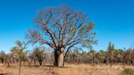
The vehicle problem put a bit of a dent in our schedule as we have a booking for a lake cruise on Thursday as well as reservations for a camping site for Wednesday and Thursday at Lake Argyle and we had planned to spend 3-4 days covering the distance to Lake Argyle. Now we have only 2 days thus this morning we were up before sunrise getting ready for an early start.
...click/tap to read the full postLake Argyle - A birds eye view (Lake Argyle, Western Australia)
Journal entry for Wednesday 29th May, 2019 (day 93, kms 283)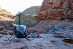
We took an early morning hike before leaving Limestone Gorge and captured a few more pictures of Boab trees (which we learned from a nearby plaque probably arrived in Australia from Madagascar on ocean currents). Then retraced our route over the rough entry track.
...click/tap to read the full postReturn to NT (Keep River NP, Northern Territory)
Journal entry for Saturday 1st Jun, 2019 (day 96, kms 82)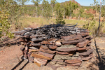
Today we ducked back into the Northern Territory a few kilometers to visit, and camp at, Keep River National Park. On paper the attractions of this park are a couple of nice campgrounds and a couple of interesting walks amongst some sandstone cliffs. The first of the days hikes introduced us to the small stone and twig structure in the first picture, which was explained by the info-plaques in pictures 2 and 3.
...click/tap to read the full postAn early morning hike (Kununurra, Western Australia)
Journal entry for Sunday 2nd Jun, 2019 (day 97, kms 78)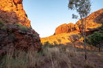
We were up well before sunrise this morning as we had decided to undertake the Jarnem Loop hike and all the advice we had read suggested getting to the lookout for the sunrise. Well we did not quite manage a sunrise at the lookout but we did get some photos of the rising suns rays on the sandstone cliffs. Towards the end of the loop we came to Nigli Gap; a series of cliffs which show signs of aboriginal habitation.
...click/tap to read the full postEl Questro (El Questro, Western Australia)
Journal entry for Monday 3rd Jun, 2019 (day 98, kms 112)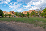
Before getting underway this morning we took a few photos around our campground, and around the town of Kununurra. In particular we wanted to demonstrate the relative lushness of the area as the Ord River Valley around Kununurra is the region that is irrigated by the water released from Lake Argyle.
...click/tap to read the full postStarting the Gibb (Ellenbrae Station, Western Australia)
Journal entry for Wednesday 5th Jun, 2019 (day 100, kms 174)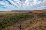
We started the day with a little bit of a 4x4 adventure on an El Questro track called Saddle Back Ridge. A long steep climb with lots of "steps" and a few off camber hairpins before arriving at a lookout that gave a good 360 degree view of the property. That seemed like a good note on which to take our leave from El Questro and start the "famous" Gibb River road.
...click/tap to read the full postCorrect handling of a cane toad (Drysdale Station, Western Australia)
Journal entry for Thursday 6th Jun, 2019 (day 101, kms 132)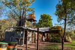
Before leaving Ellenbrae this morning we drove back to the homestead to try their coffee and scones. This seems to be a feature they are trying to cultivate as a "differentiator" for their tourist business. While sitting in the quirky but attractive cafe devouring said coffee and scones we started reading an information sheet that is provided at each table. From it we learned some interesting facts.
...click/tap to read the full postKimberley Plateau (Mitchell Falls, Western Australia)
Journal entry for Friday 7th Jun, 2019 (day 102, kms 186)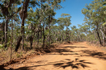
It's a bit hard to put into words the contradictions that today brings. On the one hand we are in an incredibly remote place and on the other hand tonights campground will have quite a population (maybe 100 people), we will see a number of offroad tourist buses at the campground, and there will be a helicopter base at the campground. Our starting point for today is already 500km (310miles) from the last town we passed through (Kununurra), it is the only fuel stop we have seen since that town, and today we are going to drive another 185 km (110miles) north and west from Drysdale.
...click/tap to read the full postReturn to the Gibb (Manning Gorge, Western Australia)
Journal entry for Monday 10th Jun, 2019 (day 105, kms 171)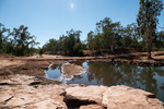
With our Mitchell excursion done today we returned to the Gibb River Road and continued our westward journey. The first leg of the days journey was 60km south from Drysdale to the Gibb River Rest area and then 110 west to Mount Barnett Road House and the nearby Manning Gorge Campground. There was not much of note on todays drive, lots of road corrugations, a surprising number of fellow travellers, maybe 50 other cars most towing a camper of some form and two notable river crossings where we took a few photos. We crossed the Gibb River just before rejoining the Gibb River Road and the Barnett River just before the similarly named road house.
...click/tap to read the full postFreshies (Windjana NP, Western Australia)
Journal entry for Tuesday 11th Jun, 2019 (day 106, kms 205)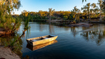
We made a start before sunrise this morning and walked from the campground to Manning Gorge. The start of the walk is quite interesting as one has to cross a large waterhole, and a small aluminium boat with rope tow is provided for the purpose. By the time we returned from the walk the kids staying in the campground were up and playing in the waterhole and a couple of them offered to be our ferrymen. The walk to the Gorge was hot and a bit tedious but the gorge provided some nice photos of cliffs reflected in the clear water.
...click/tap to read the full postCompleting the Gibb (Broome, Western Australia)
Journal entry for Thursday 13th Jun, 2019 (day 108, kms 367)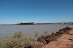
Today turned into a long day, at least by our standards. We got an early start from Windjana, eventually the paved road arrived and we made good time into the coastal town of Derby on King Sound at the mouth of the Fitzroy River. We found the place a little crowded (with tourists), and the single campground seemed packed so we decided to push on to Broome.
...click/tap to read the full postCape Leveque (Gumbanan, Western Australia)
Journal entry for Sunday 16th Jun, 2019 (day 111, kms 279)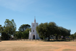
We have a few things planned in Broome next week but the thought of hanging around in one place for over a week was more than Nina could tolerate so we decided to take a little excursion to Cape Leveque about 200km north of Broome. The peninsula that is tipped by Cape Leveque is all aboriginal land and hence is very lightly inhabited but non the less is a very popular tourist destination.
...click/tap to read the full postReturn to Broome (Broome, Western Australia)
Journal entry for Monday 17th Jun, 2019 (day 112, kms 228)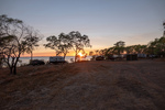
Before returning to Broome this morning we wanted to visit Kooljaman, an aboriginal owned tourist resort that provides accommodation ranging from luxury cabins through to unpowered campsites. They were fully booked so we could not camp there last night. Also this property is the only place where one can access the beach front at Cape Leveque. Photo 2 is the access road to Kooljaman. We spent a couple of hours at Kooljaman exploring their beaches and facilities before starting the return trip to Broome.
...click/tap to read the full postStairway to the Moon (Broome, Western Australia)
Journal entry for Tuesday 18th Jun, 2019 (day 113, kms 0)
One of the big events in Broome is called Stairway to the Moon. This takes place whenever a low tide and new moon coincide. Since the downtown beach area of Broome face East one can watch the new full moon rise over the sea, and when the tide is low the moon light reflects off the sand/mud to give the impression of stairs leading to the rising moon. This is now a big event and attracts thousands of spectators. So this evening about 6:17pm we were at the Town Beach to buy dinner from one of the many food stalls and watch the moon rise. Photos were difficult.
...click/tap to read the full postRAAF Boab Quarry (RAAF Boab Quarry, Western Australia)
Journal entry for Thursday 20th Jun, 2019 (day 115, kms 363)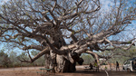
Today we leave the coast heading towards Fitzroy Crossing and then Halls Creek eventually. Todays route retraces part of the route we followed from Derby to Broome and then branches onto the Great Northern Highway. When researching this leg of our journey we noted that camping places were few and so todays leg is a longer one than usual and ended at the unusually named RAAF Boab Quarry. For non Australian readers RAAF is an acronym for the Royal Australian Air Force. There were few scenic attractions on todays route, the Boab Rest Area (photo 1) being an exception, otherwise the day was an easy drive on good paved roads with light traffic.
...click/tap to read the full postGeike Gorge (Fitzroy Crossing, Western Australia)
Journal entry for Friday 21st Jun, 2019 (day 116, kms 98)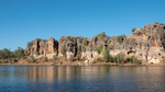
In contrast to yesterday today was a very short drive, less than 100 km, into Fitzroy Crossing and then north about 20km to a small National Park containing Geike Gorge. The gorge is formed by the Fitzroy River cutting through the Napier Range. You might recall we visited another part of the Napier Range at Windjana where we saw lots of "freshies" and observed fruit bats trying to avoid those same crocs while taking a drink. At Geike we took a boat tour of the Gorge. The photos tell that story well.
...click/tap to read the full postTo Halls Creek (Caroline Pool, Western Australia)
Journal entry for Saturday 22nd Jun, 2019 (day 117, kms 312)
The main accommodation building at Fitzroy Crossing Lodge (photo 1) was quite interesting as the entire structure seems to be corrugated metal, and surrounds the swimming pool.
...click/tap to read the full postBungle Bungle (Bungle Bungle, Western Australia)
Journal entry for Sunday 23rd Jun, 2019 (day 118, kms 224)
The access road to Purnululu National Park and the Bungle Bungle range is about 100km north of Halls Creek and it was an easy drive on paved road to that access road. From there to the Park Visitors Center is another 56km and we had heard all kinds of horror stories about how bad this twisty gravel road was. But to our surprise the road generally was in ok shape and had some very interesting scenery though we did not get any views of the Bungle Bungle Range at this time.
...click/tap to read the full postThe Bungles II (Bungle Bungle, Western Australia)
Journal entry for Monday 24th Jun, 2019 (day 119, kms 0)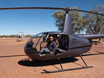
The main activity today was our 30 minute helicopter tour of the Bungle Range, and as with our previous heli tours we both were well satisfied with the experience. The ariel view gives an entirely different perspective. I won't make any other comment about the flight but rather let the photos tell the story.
...click/tap to read the full postThe Bungles III and Halls Creek (Halls Creek, Western Australia)
Journal entry for Tuesday 25th Jun, 2019 (day 120, kms 245)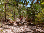
In her inimitable style Nina had another hike on the agenda this morning as a last taste of the Bungles before we made the trek back to Halls Creek. This one was called Echidna. We had no idea why that name was chosen, nor what we would see. The guide to the hike suggested there might be some climbing at the end of the hike but that was all. Unlike our earlier hikes this one was in the North West of the park so we could be certain that there would be no beehive domes.
...click/tap to read the full postTanami I (Wolfe Creek Crater, Western Australia)
Journal entry for Wednesday 26th Jun, 2019 (day 121, kms 150)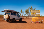
Today we started our traverse of the Tanami Road which will take us back to Alice Springs 1057 km from last nights camp at Halls Creek. Historically the Tanami Track (as it was called) was a cattle droving route along which pastoralists in the Kimberley moved their cattle to market. In the 1960s (after overland droving ceased, and there was no need to detour to find water for the cattle) the track was rerouted and shortened to approximately its current route. Today it is still a remote 80% gravel road that is almost devoid of services. At the North West end it starts 16km from Halls Creek (at a junction with the Great Northern Highway) and to the South Eastern end it joins the Stuart Highway 20km north of Alice.
...click/tap to read the full postTanami II (Tanami Road, Western Australia)
Journal entry for Thursday 27th Jun, 2019 (day 122, kms 294)
We made it to Billiluna this morning during their operating hours and bought 30.77 liters of fuel. Why such a strange amount? Well the rules for buying fuel at Billiluna are, you tell them how many liters you want, they will work out the price of that and round it to the nearest A$10, then give you a fuel card for that amount for which you must lodge a $5 deposit, you take the card out to the pump and dispense the fuel, then return the card and get your $5 deposit back. It turned out that 30.77 liters was almost too much I had to dribble the last 0.77 liters into both tanks to get it all in. But, non the less, we now definitely had enough fuel.
...click/tap to read the full postTanami III (Tanami Road, Western Australia)
Journal entry for Friday 28th Jun, 2019 (day 123, kms 392)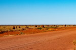
Another day, more kilometers, more red dust and surprisingly few additional creatures. We spotted the dingo at our morning tea break and the snake was crossing the road just a little later. The aeroplane needs some explanation. Roughly mid way along the Tanami Road there is a gold mine called the Granites Gold Mine run by Newmont Gold Mine. While passing this mine we spotted this passenger jet getting ready to takeoff. It was a little mind blowing. Here we are in what feels like the middle of nowhere and we see a jet plane just off to our left!
...click/tap to read the full postTanimi Fini (Alice Springs, Northern territory)
Journal entry for Saturday 29th Jun, 2019 (day 124, kms 256)This morning we knocked off the remaining 260kms into Alice Springs and thus brought our Tanami adventure to a true conclusion. When we fueled up in Alice we had travelled 1084 km since taking on fuel in Halls Creek. In addition to the 30.77L we got in Billiluna we added another 127.5L today in Alice for a total of 158.27L, so we could have made the entire distance without additional fuel. In addition to keeping track of fuel we also kept track of the other vehicles that we passed while we were driving. Over the 3 days prior to today we passed a total of 2 non-articulated trucks, 8 road trains, 34 pickups or SUVs pulling camping trailers or caravans, and 62 non towing pickups, or suvs or actual sedan cars. Since we drove for only 3-5 hours per day and did not count vehicles we saw while camped these numbers are well below the total number using the Tanami Road. The interesting thing is the mix, as well over half the non towing pickups/suvs were travelers like us with camping gear on board. The conclusion is that the vast majority of vehicles using the Tanami Road are doing so for recreational purposes. We find that interesting and entirely consistent with our less formal counts of vehicles we have encountered elsewhere on this trip.
...click/tap to read the full postAlice (Alice Springs, Northern territory)
Journal entry for Tuesday 2nd Jul, 2019 (day 124, kms 31)We stayed in Alice Springs a few days, catching up on some business and having our vehicle serviced in preparation for the next leg of this journey.
...click/tap to read the full postMadding Crowds (11km West of Curtin Springs, Northern territory)
Journal entry for Wednesday 3rd Jul, 2019 (day 128, kms 402)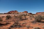
Today we headed back to Uluru where we will start our travers of the Great Central Road, which is the south western leg of Australias (The Worlds?) Longest Shortcut. However, for us, Uluru is a long drive and we plan on ending the day at Curtin Springs and along the way take a detour to Rainbow Valley. Rainbow Valley it turns out is a small but colorful rock outcropping, the track in is typical red sand and the scenery a mix of red sand, light colored spinifex, and desert oak trees. .
...click/tap to read the full postThe start of the GCR (East of Lasseters Cave, Northern territory)
Journal entry for Thursday 4th Jul, 2019 (day 129, kms 301)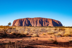
It was cold overnight, we estimated (don't have a thermometer) in the mid 30°F. So consequently we did not hang around at our bush camp but got underway towards Uluru where our observations about the tourist season was further confirmed. Just take a look at the line of people climbing Uluru and what you can't see are the 1000+ vehicles parked just near.
...click/tap to read the full postGood Sumaritan (50km East of Warburton, Western Australia)
Journal entry for Friday 5th Jul, 2019 (day 130, kms 320)
While out for her morning walk Nina found these ants nests (see photo 1) positioned in the middle of a spinifex plant and with their entrance mound covered in spinifex "leaves"; we could not work out whether it was camouflage or some other form of protection.
...click/tap to read the full postRain, but only a little (195km East of Laverton, Western Australia)
Journal entry for Saturday 6th Jul, 2019 (day 131, kms 400)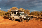
Last night in camp some dark clouds accumulated and this morning they pretty much covered the sky, and of course we thought rain, possibly. This could be a problem because outback roads are definitely NOT all-weather. With even modest amounts of rain that red sand/dirt turns to mud and the roads either become impassable or get closed by the local police. So we did not want to get caught in that situation. Hence an early start was called for and an extra effort throughout the day to get as close to the end of the dirt as possible.
...click/tap to read the full postLaverton and the end of the dirt (Leonora, Western Australia)
Journal entry for Sunday 7th Jul, 2019 (day 132, kms 314)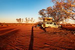
Another beautiful sunrise, more camels, lots more dirt road and dust clouds from oncoming vehicles and we are finally in Laverton; the end of the Great Central Road. Laverton turned out to be a very nice looking tidy town, which surprised us a bit as we have seen it described as "uninteresting". There was a nice new information center in the town that had the best maps and info sheets on The Great Central Road we have seen. Pity we could not have got those maps and sheets in Alice Springs or Yulara before we drove the road.
...click/tap to read the full postUnusual art (Lake Ballard, Western Australia)
Journal entry for Monday 8th Jul, 2019 (day 133, kms 160)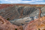
Our first stop today was only a few kilometers south of Leonora at the Sons of Gwalia Gold Mine. Anyone who was associated with share trading in Australia (like me) would have heard this name before, and maybe unlike me knew the origin and meaning of the name. The discovery of the gold deposits and starting of the original mine was undertaken by some Welsh immigrants. Gwalia is the Welsh name for Wales. Today the mine still operates, though now as an underground mine, rather than the original open cut. Next to the present day mine site is a museum and a collection of old equipment and old buildings including the mine managers house (called Hoover House). That house is now a Bed and Breakfast and a cafe. Interestingly Herbert Hoover (eventually 31st president of the USA) took over as Mine Manager in 1898 at the age of 23 and had the managers house built; hence the name.
...click/tap to read the full postA few more figures from Lake Ballard (North of Leinster, Western Australia)
Journal entry for Tuesday 9th Jul, 2019 (day 134, kms 349)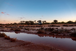
Before departing Lake Ballard this morning we could not resist a few more photos of these strange little statues by the light of the rising sun.
...click/tap to read the full postWiluna (Meekatharra, Western Australia)
Journal entry for Wednesday 10th Jul, 2019 (day 135, kms 289)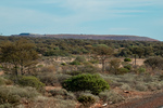
About 100km north of last nights camp we came to the town of Wiluna. This is yet another Western Australian town that was once a major gold mining town and in the 1930s had a population of around 9000. Today the population is around 700 and is probably most well know as the southern entrance to the Canning Stock Route and the Western end of the Gunbarrel Highway. It is interesting to us that one of the motivations for the Gunbarrel was to place instruments as part of rocket development at Woomera. While at Woomera earlier in this trip we heard from an Airforce Officer just how valuable the Woomera Rocket Range is because of the length of flight path over un-inhabited territory it offers.
...click/tap to read the full postSponge Bob (Kumarina Road House, Western Australia)
Journal entry for Thursday 11th Jul, 2019 (day 136, kms 252)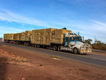
There is not much to say about today. Just another day traveling North on the Great Northern Highway with many road trains, mines and not much else. Just to illustrate the point; the app we are using to find camping places (and other places of interest) noted that near 25 Mile Well was a sight of interest called Sponge Bob mail Box. This is nothing more than the mail box for one of the local pastoral stations decorated up a bit. Other wise we just recorded some of the heavy vehicles we encoutered.
...click/tap to read the full postKarijini here we come (Jnc GNH and Karijini Drive, Western Australia)
Journal entry for Friday 12th Jul, 2019 (day 137, kms 318)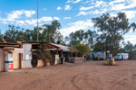
Today was really about getting to and finding a camping spot close to Karijini National Park so that tomorrow we would have an entire day to commit to exploration of the park. This is because we could only get one night in either of the campgrounds at the park. Todays photo record, starts with a few photos of Kumarin roadhouse and a few "along the way" shots as well.
...click/tap to read the full postKarijini I (Dales CG Karijini, Western Australia)
Journal entry for Saturday 13th Jul, 2019 (day 138, kms 184)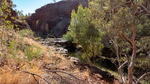
We were at Karijini and starting our first "hike" by 8:30 thereby facilitating what turned out to be a very full day.
...click/tap to read the full postKarijini II (Tom Price, Western Australia)
Journal entry for Sunday 14th Jul, 2019 (day 139, kms 112)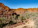
After yesterdays achievements, and in light of the fact that we could not camp at Karijini tonight, todays plan was to "do it all"; or at least our version of that. We would "do" Dales Gorge and hit all the high points. See below.
...click/tap to read the full postNameless (Rest Area Marble Bar Road, Western Australia)
Journal entry for Wednesday 17th Jul, 2019 (day 142, kms 333)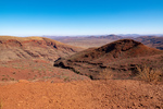
As you can see from the date of this entry we spent three nights in Tom Price dealing with some family business. This morning when we departed our plan was to head west towards Millstream-Chichester National Park. But we quickly discovered that all roads in that direction were unpaved and had a lot of mine traffic, particularly 4 trailer road trains. Now we dont mind dirt roads but in conjunction with road trains they are tedious and dangerous, and we are a bit weary of dirt roads anyway. So we changed plans late morning and returned to Tom Price with the intent of going towards the town of Marble Bar.
...click/tap to read the full postMarble Bar (Port Hedland, Western Australia)
Journal entry for Thursday 18th Jul, 2019 (day 143, kms 352)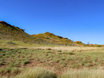
The first half of the drive into Marble Bar was on paved road with a good deal of road train traffic servicing local mines. The second half was a good quality gravel road with almost no traffic. Along both sections the scenery was interesting with striking red rock and soil covered in "buttons" of spinifex, some bright green patches presumably from recent rain and a few creek crossings with some water still present.
...click/tap to read the full postPort Hedland, a quick visit (Dampier, Western Australia)
Journal entry for Friday 19th Jul, 2019 (day 144, kms 322)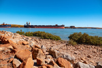
Port Hedland is a major shipping port for iron ore mined in the Pilbara Area of Western Australia as well as being a major service center for such mines and having a major salt mining operation right on the outskirts of the town. With a population of 14,000+ it feels like a small city.
...click/tap to read the full postCrowds (Yannarie Rest Area, Western Australia)
Journal entry for Saturday 20th Jul, 2019 (day 145, kms 411)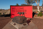
We took a little tour around the Dampier area this morning including stopping at the information display at the town entrance where we read about the Red Dog. It seems a red dog named, among other names, Tally Ho became a well known figure around the Pilbara region as it traveled the region by getting rides with and adopting as temporary owner a bus driver and other travelers. It is said that the dog was made a member of the Dampier Salts Sport and Social Club and the Transport Workers' Union.
...click/tap to read the full postExmouth (Exmouth, Western Australia)
Journal entry for Sunday 21st Jul, 2019 (day 146, kms 172)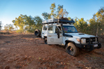
The little town of Exmouth sits towards the top east corner of North West Cape, and is surrounded by Cape Range National Park and is the gateway to Ningaloo Marine Park with its coral reefs, colourful fish and migratory whale sharks. Not surprisingly then Exmouth is definitely a tourist town and the population swells from 2200 to over 6000 during the height of the tourist season. In addition North West Cape is the sight of an RAAF base and a Naval Communications base.
...click/tap to read the full postCoral Bay (South of Minilya, Western Australia)
Journal entry for Wednesday 24th Jul, 2019 (day 149, kms 281)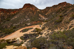
Today was mostly a travel day, we needed to take a big slice out of the distance to Carnarvon. However we did make a couple of scenic stops. The first, Shot Hole Canyon just a few kilometers south of Exmouth and around lunch time we dropped into the village of Coral Bay a very popular spot on the Ningaloo Coast.
...click/tap to read the full postQuobba (Quobba Homestead, Western Australia)
Journal entry for Thursday 25th Jul, 2019 (day 150, kms 239)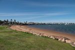
A few hundred kilometers of the coastal highway with its red soil and low scrub brought us to the town of Carnarvon. Originally a shipping port for the local wool industry, the town is now perhaps more well known for its role as a major tracking station for NASA's Gemini and Apollo Programs and of course there is an extensive museum of paraphernalia from that era. In addition to visiting the Tracking Station Museum we spent a little time exploring the towns beach front and its now closed but impressive "mile long jetty".
...click/tap to read the full postAnother station (Wooramel Homestead, Western Australia)
Journal entry for Friday 26th Jul, 2019 (day 151, kms 205)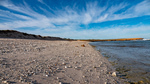
After retracing yesterdays drive from Carnarvon to Quobba our day came to an unexpectedly quick end. For some reason we were both feeling sleepy, and even took the unprecedented step of stopping at a rest area, putting up the tent and having a sleep. This convinced us that rather than continuing with the our original plan of spending the night at Hamelin Pool (a day of about 300km) we should stop early. As luck would have it we were not far from Wooramel River Retreat when this decision was made so that became our nights stopping place.
...click/tap to read the full postRed sand and white beaches (Peron National Park, Western Australia)
Journal entry for Saturday 27th Jul, 2019 (day 152, kms 275)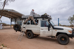
While packing up this morning I noticed that the solar panel was coming adrift from its mounting. The panel had been afixed to some aluminum L sections on the roof with pop-rivets and all the vibration from the rough roads we have travelled have worn the heads off the rivets. As a result one entire side of the panel was no longer fastened to the L section. A few kilometers after leaving Wooramel we stopped at Wooramel Roadhouse and borrowed an electric drill and got some self-tapping screws to re-fasten the panel. That first photo is yours-truly demostrating his balancing skills while installing the new self-tappers.
...click/tap to read the full postA goanna (Monkey Mia, Western Australia)
Journal entry for Sunday 28th Jul, 2019 (day 153, kms 89)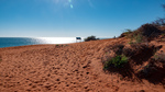
This morning we finished our exploration of Francois Peron NP by driving the remainder of the sandy track to Cape Peron where we spent some time trying to get the "perfect" photo contrasting the red soil against the white beaches and blue ocean. It was a lovely morning and in addition to the great scenery, the great luck of spotting a goanna sunning itself under a bush we enjoyed the bouncing bucking ride along the sandy tracks.
...click/tap to read the full postThe dolphin "Experience" (Nerren Nerren Rest Area, Western Australia)
Journal entry for Monday 29th Jul, 2019 (day 154, kms 243)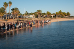
This morning we spent our time attending the Dolpin Feeding Experience, the reason we came to this place. Each morning starting at about 8:15 the rangers invite guests to stand on the beach front and watch a feeding "experience". After about 15 minutes during which one of the rangers does a monologue about the dolphins of the area a small number of members of the audience are invited to feed the dolphins with fish provided by the rangers. Each dolphin is limited to three fish at each experience. So this morning only three guests got to feed a dolpin as there was only one adult dolphin lining up for food. The "experience" is repeated 2 more times if the dolphins show interest.
...click/tap to read the full postThe Murchison River (Muchison House Station, Western Australia)
Journal entry for Tuesday 30th Jul, 2019 (day 155, kms 207)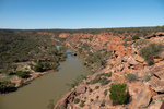
Today was spent in the Kalbarri National Park which has the Murchison River and its associated gorges as its key attraction. Somewhat to our surprise the Murchison had flowing water, we found out from talking to a park worker that this is a result of 6 inches of rain in June. In addition a lot of flowers were blooming including the red flowered flame trees in the photos.
...click/tap to read the full postPink Lake and Hutt River (Hutt River Province, Western Australia)
Journal entry for Wednesday 31st Jul, 2019 (day 156, kms 160)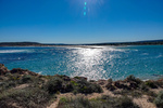
We spent a little time this morning in the town of Kalbarri. This gave Nina a chance to complete her daily walk (and achieve the necessary 10,000 steps) and allowed me to do my morning physio exercises. There after we travelled down the coast south of Kalbarri, which has some nice coastal scenery and is part of the Kalbarri National Park.
...click/tap to read the full postSheep shears (Cliff Head Campsite, Western Australia)
Journal entry for Thursday 1st Aug, 2019 (day 157, kms 230)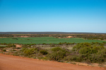
It finally dawned on us this morning that the countryside has changed over the past two days and we are now back in green country where there are wide farm fields of green and flowing water. The deserts and the dry salty coastal plains are no more. Unfortunately this change also signals that our adventure is winding down.
...click/tap to read the full postLimestone blocks (Lancelin, Western Australia)
Journal entry for Friday 2nd Aug, 2019 (day 158, kms 224)
As we left our camping spot this morning we happened to see this Sea Eagle sitting atop a post. The scenic highight of today was a visit to The Pinnacles at Nambung National Park where one can walk and/or drive amongst these strange limestone blocks poking up out of the yellow sand.
...click/tap to read the full postLast driving day (Fremantle, Western Australia)
Journal entry for Saturday 3rd Aug, 2019 (day 159, kms 151)
Today was the last driving day of this adventure. Tonight we camped in a caravan park in Fremantle just south of Perth City. We will be in this caravan park or a nearby hotel until Sunday 11th when the next short non-driving leg of this adventure starts. Our time in Fremantle will be mostly chores such as cleaning our faithful troopy and catching up on family business. But we do plan one sightseeing day while in this area and will report on that when it happens.
...click/tap to read the full postWaiting (Ushuaia, Argentina)
Journal entry for Tuesday 17th Dec, 2019 (day 5, miles 0)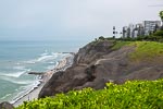
If we were mountaineers preparing for a major climb we would say that this has been an extended, and somewhat relaxed, approach march as we left Seattle almost a week ago and yet we only join our cruise boat tomorrow. This slow travel to Ushuaia is partly a realization a few months back that our bodies no longer handle long days and nights of flying without the need for a rest, and partly a result of airline pricing policy. We are going to spend 3+ weeks in Lima after this cruise and we did not want to string together a number of one-way airline tickets. Hence we settled for a SEATAC-Lima return followed by a Lima-Ushuaia return. Thus we took the opportunity to break our southward journey for a few days in Lima and catch up with our son and his wife; who you might recall from previous posts live in the seaside suburb of Miraflores. We spent a couple of pleasant warm days there staying at Hotel Antigua a nice boutique hotel a few blocks from the Miraflores escapement.
...click/tap to read the full postFirst steps on The Antarctic Continent (Cierva Cove, Antarctica)
Journal entry for Saturday 21st Dec, 2019 (day 11, miles 0)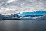
Mid morning our vessel anchored in Cierva Cove within sight of the Argentine Antarctic Base called Primavera (the last photo in the first group below). The cove is surrounded by glaciated mountains and the cove itself was crowded with floating ice of various sizes. We spent a couple of hours touring around the bay in Zodiacs getting a firsthand look at all that ice.
...click/tap to read the full postStart of another adventure (Enroute, Singapore)
Journal entry for Saturday 7th Mar, 2020 (day 2, miles 0)
The start of another adventure, this time an exploration of SE Asia followed by some time in the Gulf states; and again without a vehicle.
...click/tap to read the full postExploring the city (Raffles, Singapore)
Journal entry for Monday 9th Mar, 2020 (day 3, miles 0)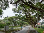
The name Singapore is derived from the local name Singapura which means Lion City in the Sanskrit language and was, according to legend, thus named by Sri Tri Buana while on a hunting trip in the area in the 13th century.
...click/tap to read the full postCloud Forest (Raffles, Singapore)
Journal entry for Tuesday 10th Mar, 2020 (day 5, miles 0)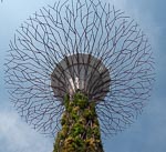
Today was deliberately a much more relaxed day inorder to recover from yesterdays long walk in the heat. After a slow start we took a taxi to Gardens By the Bay where we spent a few hours exploring The Cloud Forest and the Flower Dome. These are each large glass domes with internal conditions controlled to allow the growing of exotic plants.
...click/tap to read the full postGolden lady (Kuala Lumpur, Malaysia)
Journal entry for Thursday 12th Mar, 2020 (day 7, miles 0)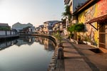
Melacca (Melaka) was a trading center from as early as 1403 when the town was founded by Parameswara (the King of Singapura) and first visited by a Chinese trade envoy. For the next 100 years or so the port of Malacca propspered as a trading hub for Asian trade. The Portuguese arrived in 1511 conquering the city, disrupting the ports central role in Asian trade and thwarting their own ambition. Over the next 100+ years the Dutch tried on a number of occassions to take the port from the Portuguese finally succeeding in Janurary 14th 1641. In 1824 the Dutch ceeded Malacca to the British in exchange for Bencoolen on Samartra.
...click/tap to read the full postBirds and butterflies (Kuala Lumpur, Malaysia)
Journal entry for Friday 13th Mar, 2020 (day 8, miles 0)
We planned today, our first full day in KL, to be a somewhat relaxed day with only a couple of sightseeing destinations. First up was a small tropical garden garden park that is completely enclosed by netting in order that its population of butterflies cannot either depart of be attacked by the local bird or monkey population. Interestingly this small facility is located in the heart of this major city. Simlarly our second destination, the KL Bird Park, is located in the heart of the city and is also partially enclosed by netting with different areas of the park connected by bird-proof double doors. Since birds and butterflies are mainly visual attractions I will let todays photo collection tell the remainder of the story.
...click/tap to read the full postMission aborted (Kuala Lumpur, Malaysia)
Journal entry for Sunday 15th Mar, 2020 (day 10, miles 0)
According to our original plan for this venture today we should have flown to Hanoi in Vietman. But a couple of days ago we were informed that Vietman has temporarily cancelled all tourist visas. This was followed by the news that Oman (a country that was also on our itinerary) had taken the same action. In the face of these developments and the likelihood that other countries would follow suit we have decided to return home and attempt this trip again when the world is no longer racked by a health crisis. We fly back to Seattle tomorrow.
...click/tap to read the full postRepurposed Railway Line (Lappa Mt Garnett Trail, Queensland Australia)
Journal entry for Thursday 20th Jul, 2023 (day 3, kms 207)
This morning we continued along the Herberton-Petford road towards the town of Irvinebank with various attractions, an old tin mining town, a very large snake with a black head, a very impressive Brahman bull, and in Irvinebank a very industrious flock of guinea fowl, and an impressive display of old ford cars and trucks in the garage of a local resident.
...click/tap to read the full post